Ancient Greek temples were deliberately placed in the landscape with relation to salient features that were considered holy. The topography of different locales was seen as the manifestation of telluric energies that revealed and reflected the nature and characteristics of the deities that inhabited them. The practice is clearly demonstrated by the contrasting natural settings of the sanctuaries of the god Apollo, corresponding to different aspects of his cult, at the sites of Delos, Delphi and Epidaurus.
Birthplace of Apollo and Artemis on Delos. (Click on photos to enlarge)
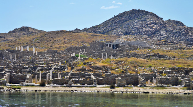
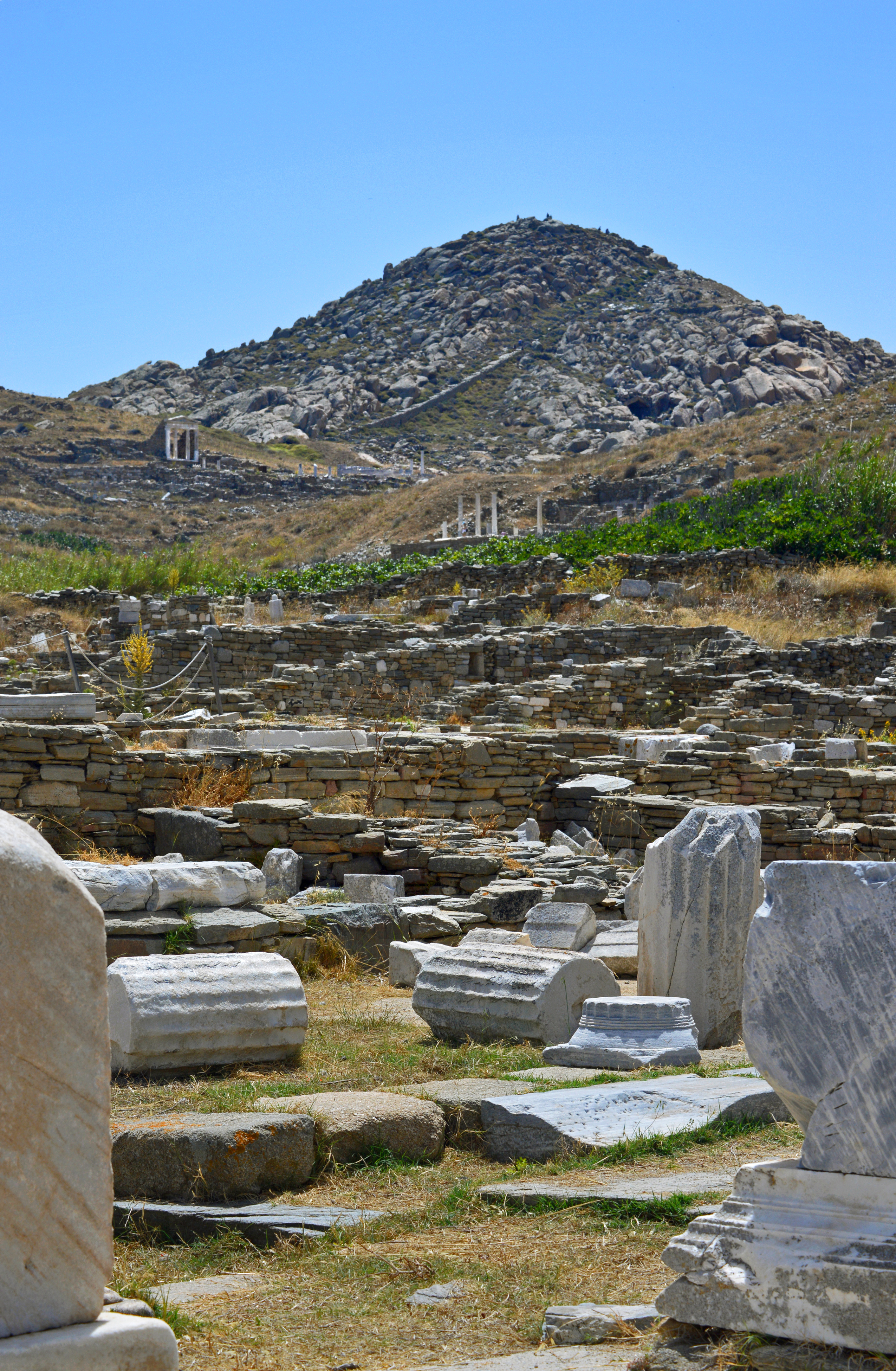
Apollo is one of the most important and complex Greek deities. He is a god of the sun and light, prophecy and healing and patron of the arts. He was the son of Zeus born, together with his twin sister the chaste huntress Artemis, on the small, barren island of Delos in the middle of the Cyclades.
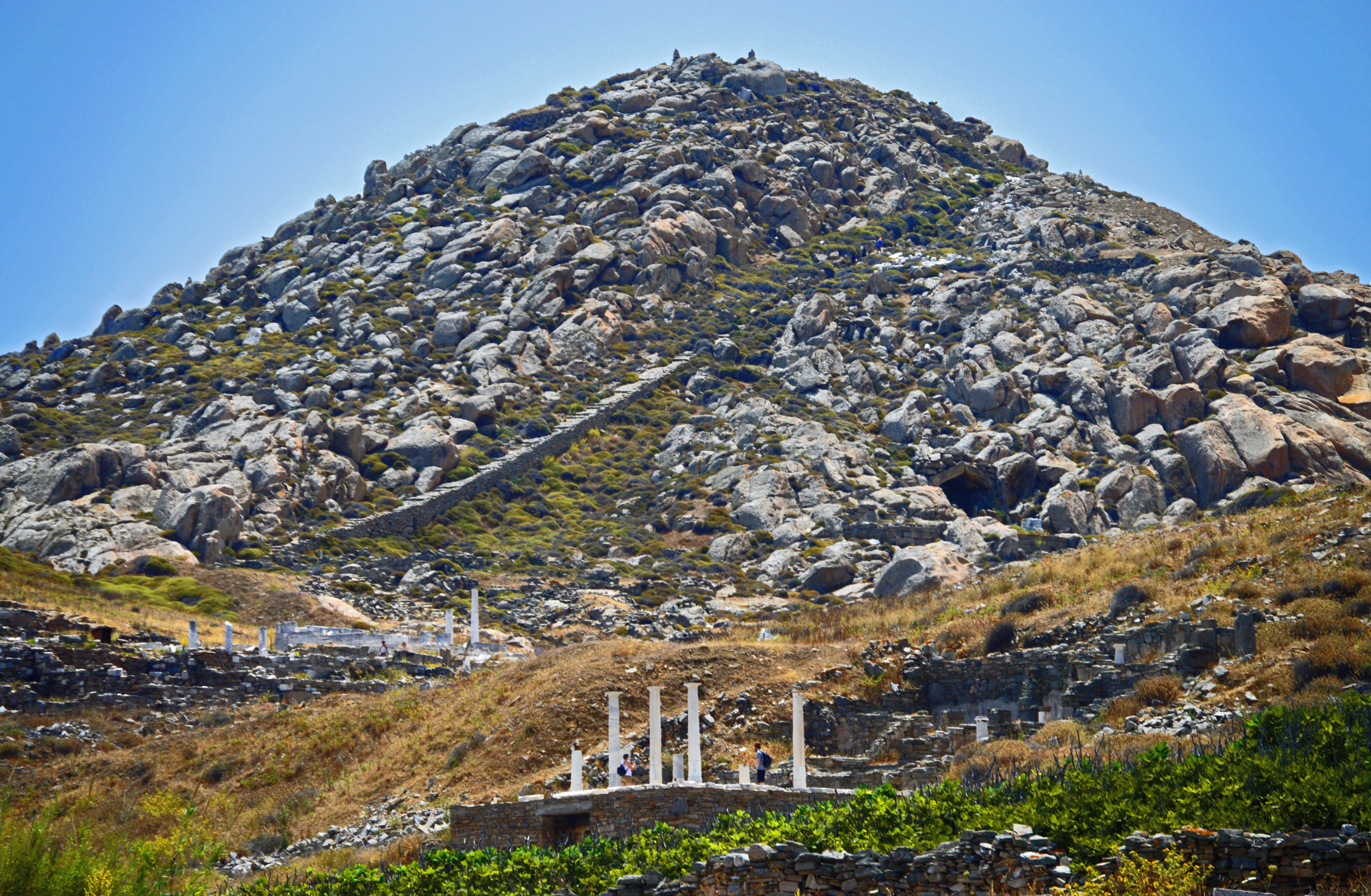
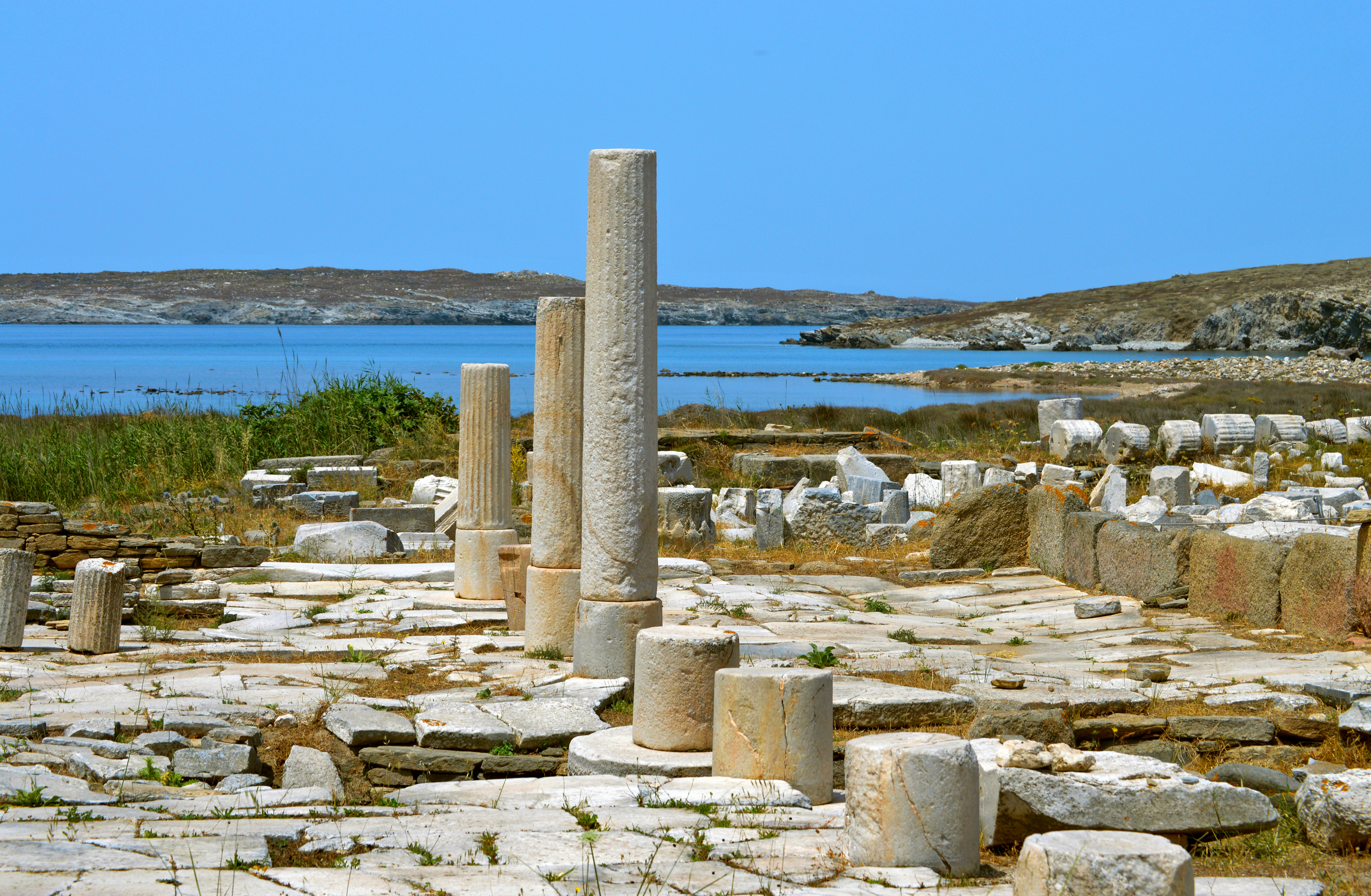
Temple Ruins on Delos
Apollo was hailed as Phoebus (‘bright’) and as Apollo Helios he became identified with the sun, (while his sister Artemis was associated with the moon) and on sun-drenched Delos the almost surreal intensity and clarity of the sunlight seems a tangible manifestation of his presence.
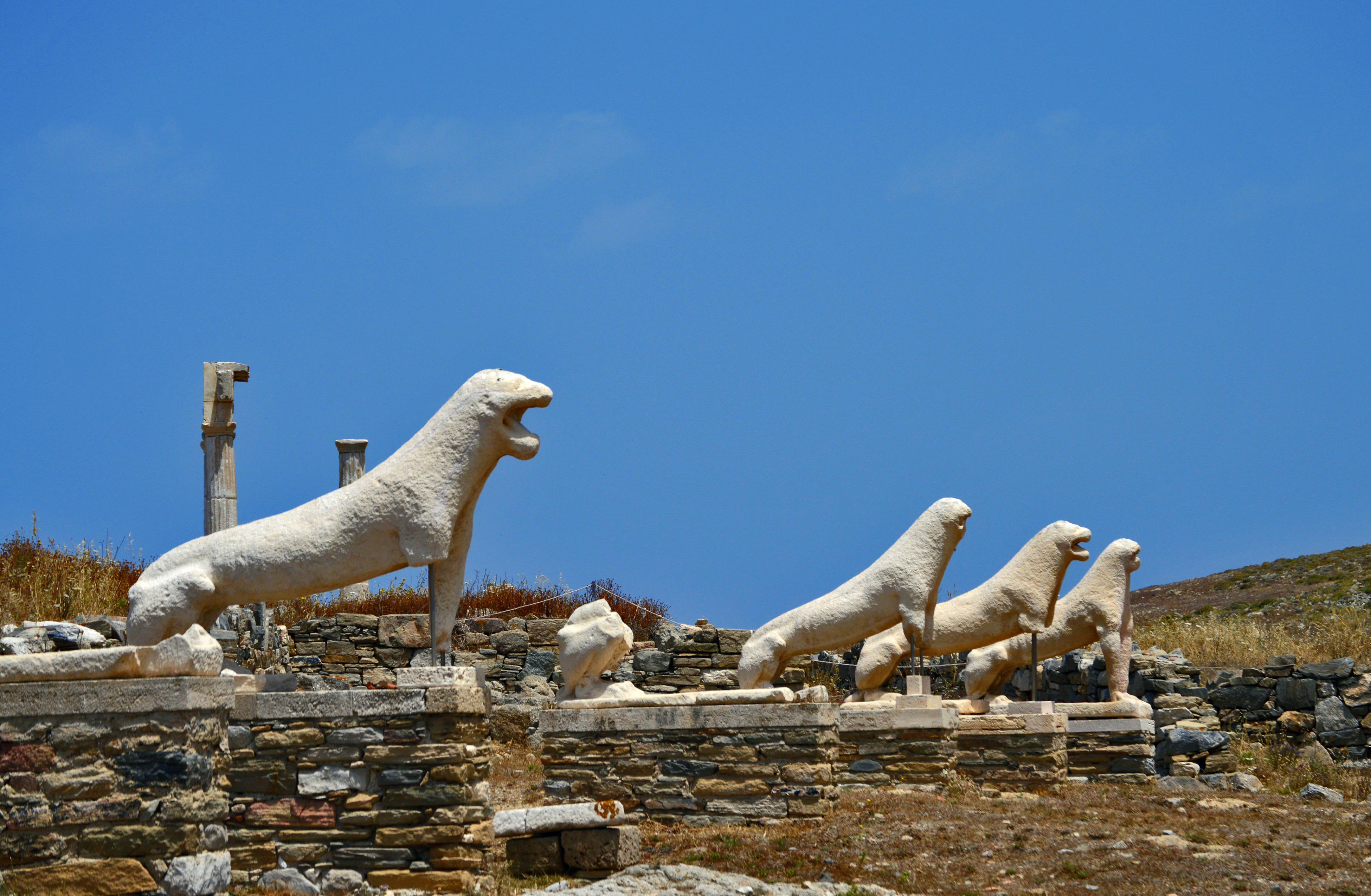
Avenue of Lions on DelosExtensive ruins of Delos
Apollo represents harmony and balance, clarity, reason, order and restraint. The term “Apollonian” contrasts with the “Dionysian” qualities of the god of wine. As his complementary opposite, Dionysus represents chaos, impulse, excess and ecstasy. He was worshiped by the frenzied maenads dancing wildly in the woods. This dichotomy was perceptively explored by the 19th century German philosopher Nietzche in “The Birth of Tragedy.” The ancient Greeks seem to have recognized the need to integrate these disparate forces, and both deities were worshiped in turn on alternate seasons at Delphi. Inscribed on Apollo’s temple there were the famous maxims: “Know Thyself” and “Nothing in Excess.”
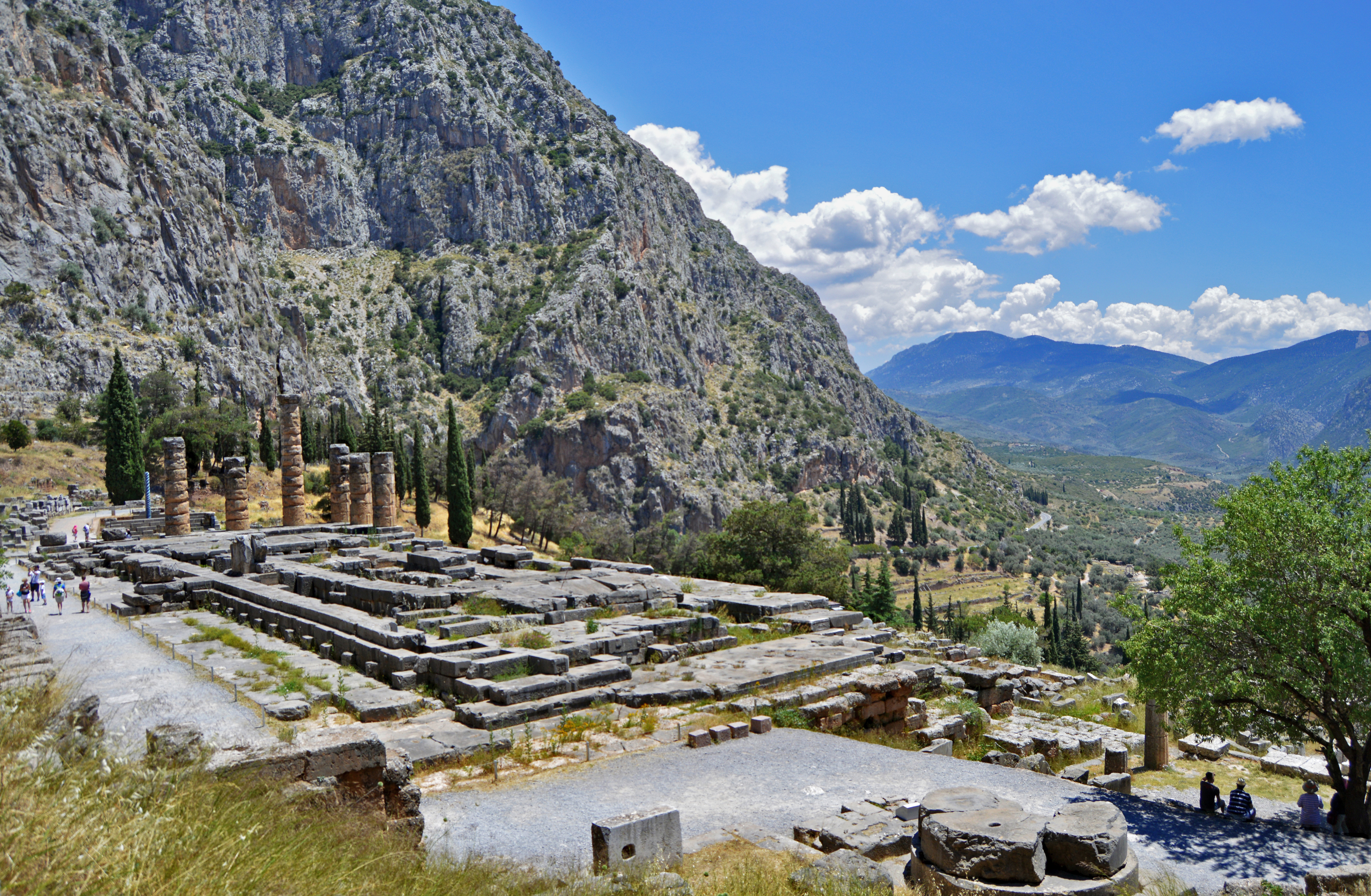
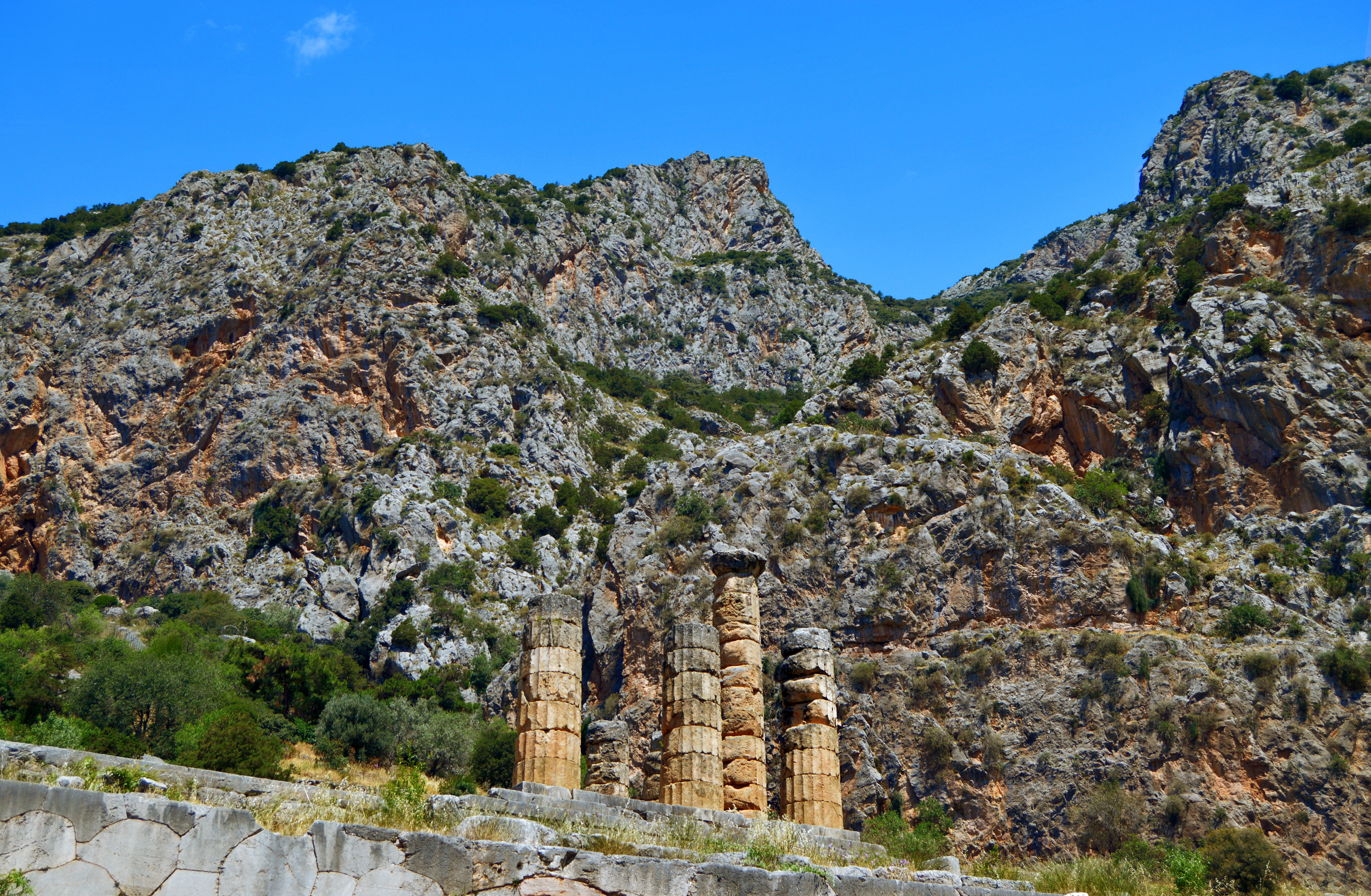
Temple of Apollo at DelphiRock of the Oracle
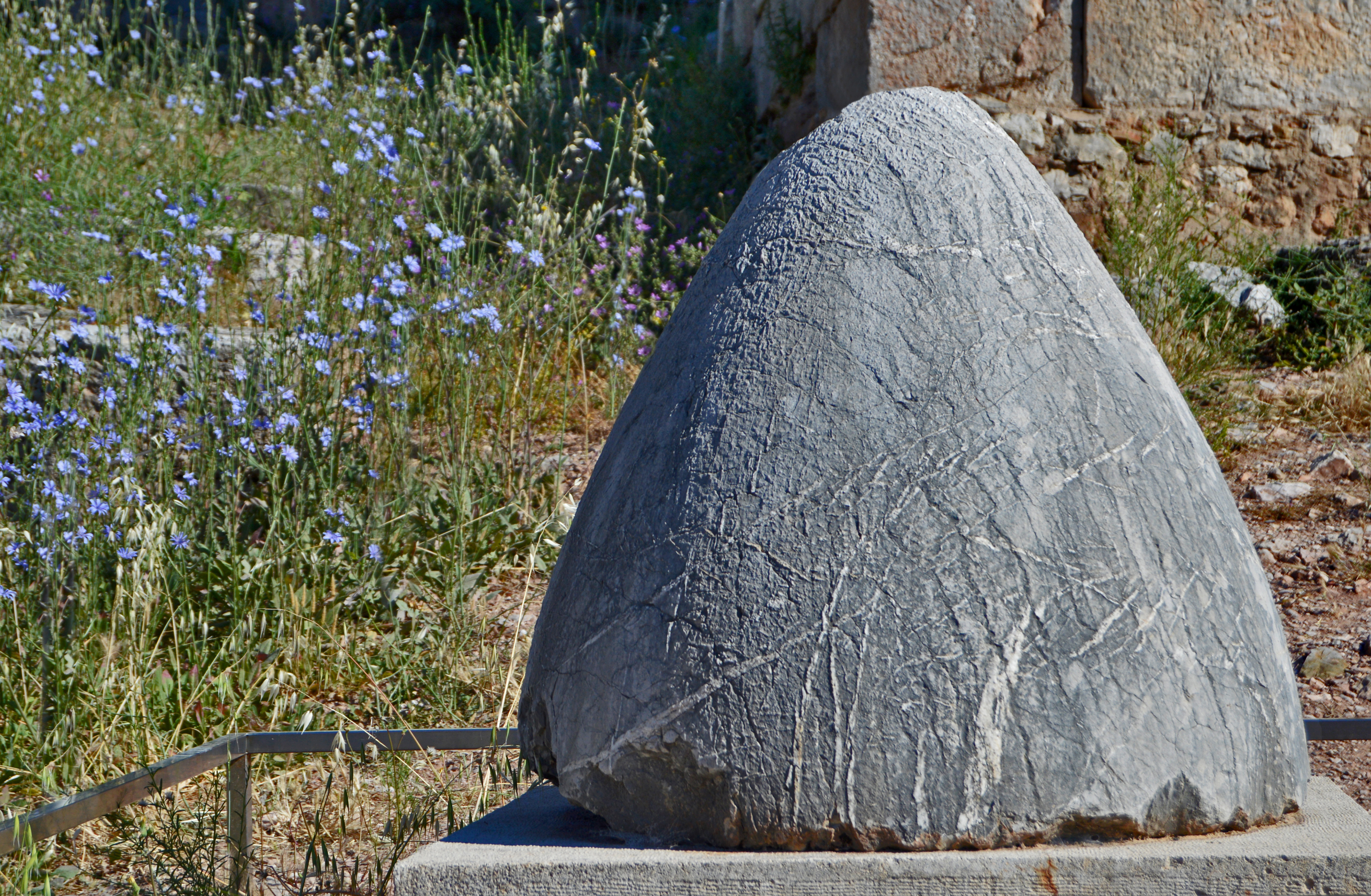
Delphi, on the slopes of Mount Parnassus, offers one of the most striking natural settings in Greece and the dramatic scenery reflects the ancient myths associated with the site. Here Apollo had fought and vanquished the giant snake Python, a powerful earth deity that may represent a primitive cult of the mother Goddess, and established his famous Oracle. A priestess called the Pythia presided at his temple and, in a trance induced by fumes or psychotropic plants, would utter prophecies believed to come from the god himself. The Oracle was consulted before major undertakings such as wars, and its influence spread even beyond Greece. Delphi was considered the cosmic center of the Greek world, symbolized by the ‘omphalus’ or navel stone dropped from the sky by Zeus’ eagles to mark the spot.
Sacred horned peaks soar above the Temple of Apollo at Delphi.Omphalos stone symbolizing Delphi as the center of the Greek world.
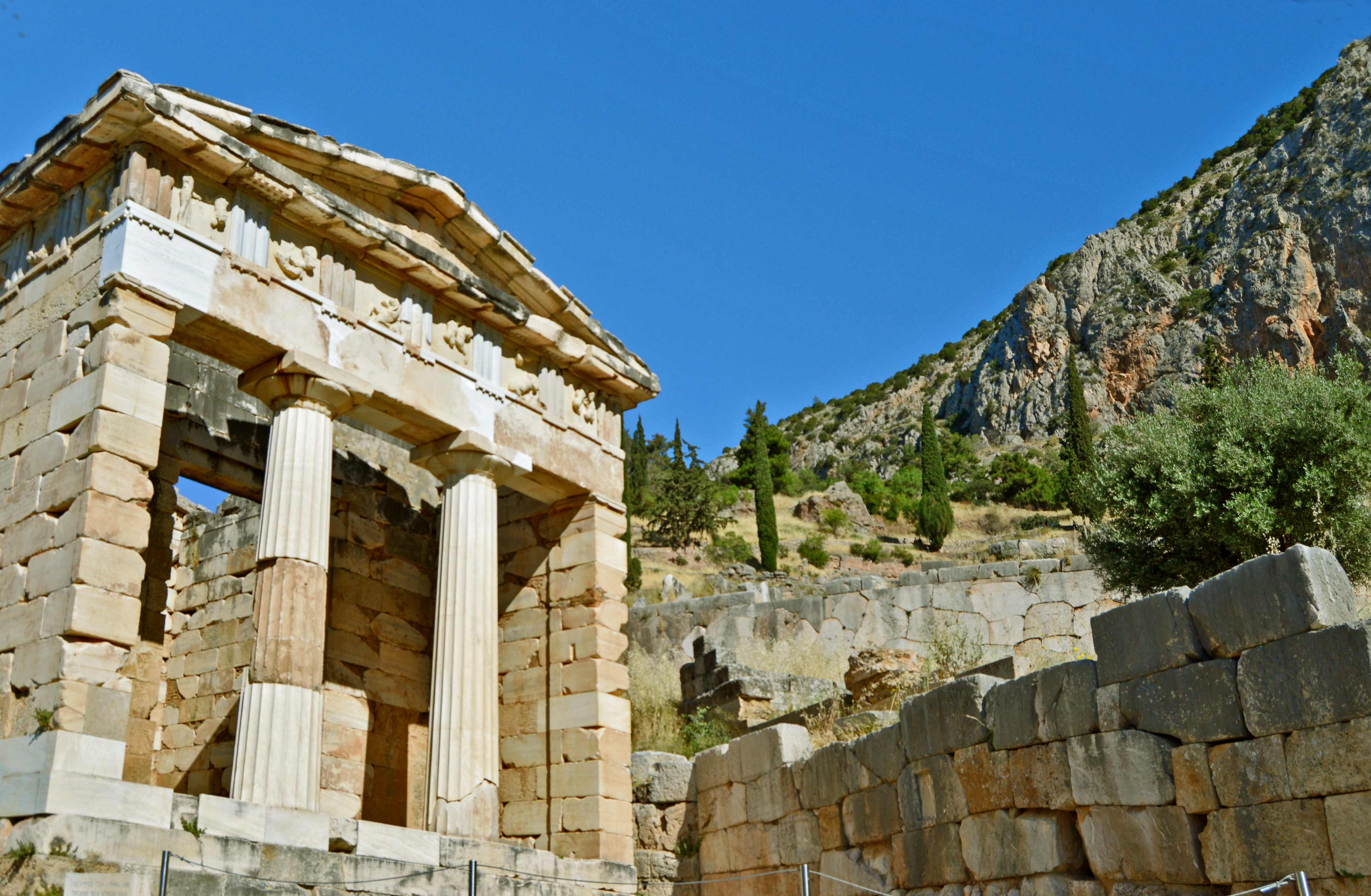
The ruins of the temple of Apollo visible today date from the 4th century BCE, superimposed on two earlier buildings. The winding route up the slope to the sanctuary, called The Sacred Way, was lined with votive statues and treasuries built by Greek city states to store the offerings made to Apollo in thanksgiving for his guidance.
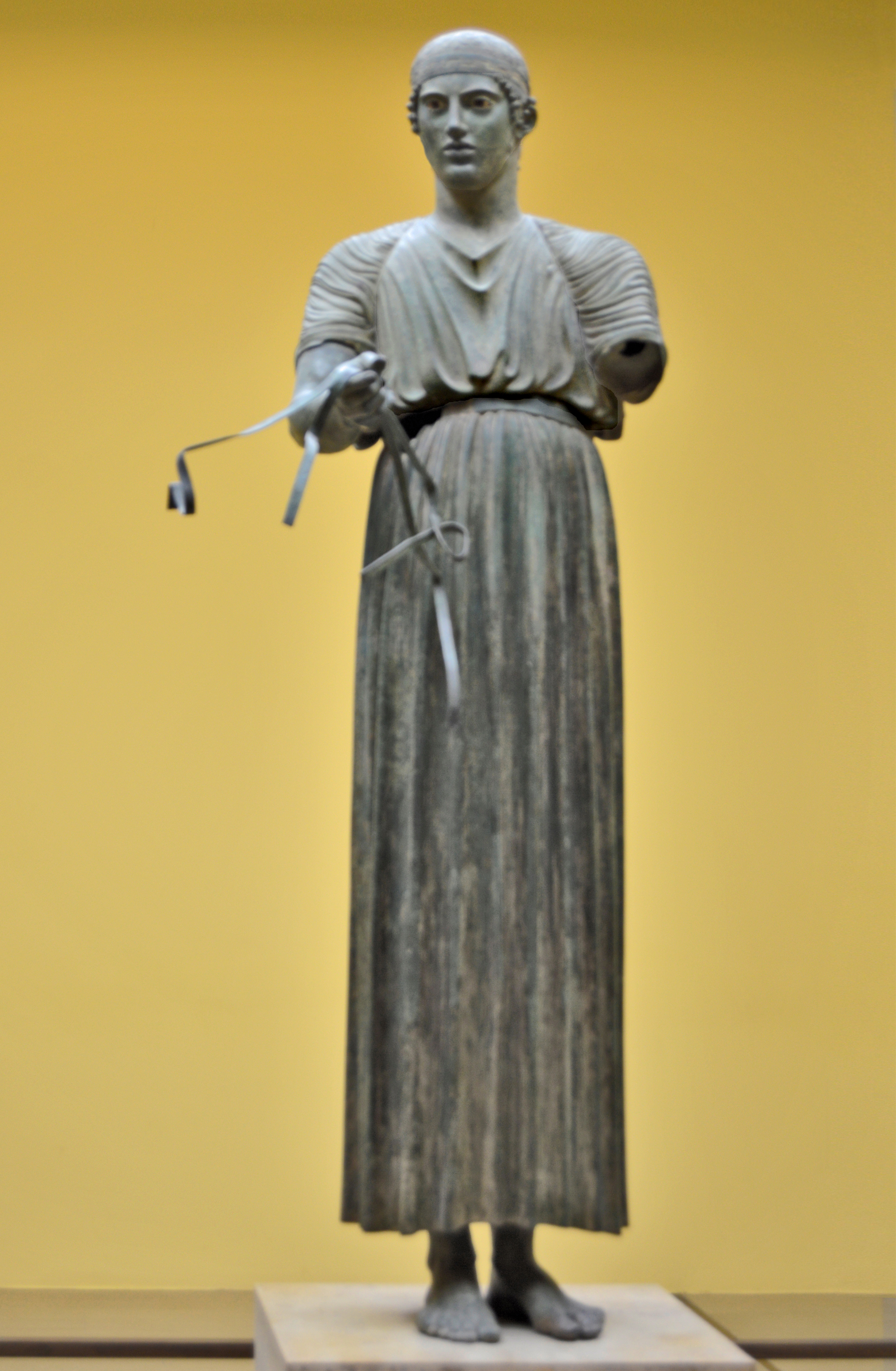
Treasury of the Athenians on the Sacred Way up to the Temple of Apollo.Bronze “Charioteer of Delphi”
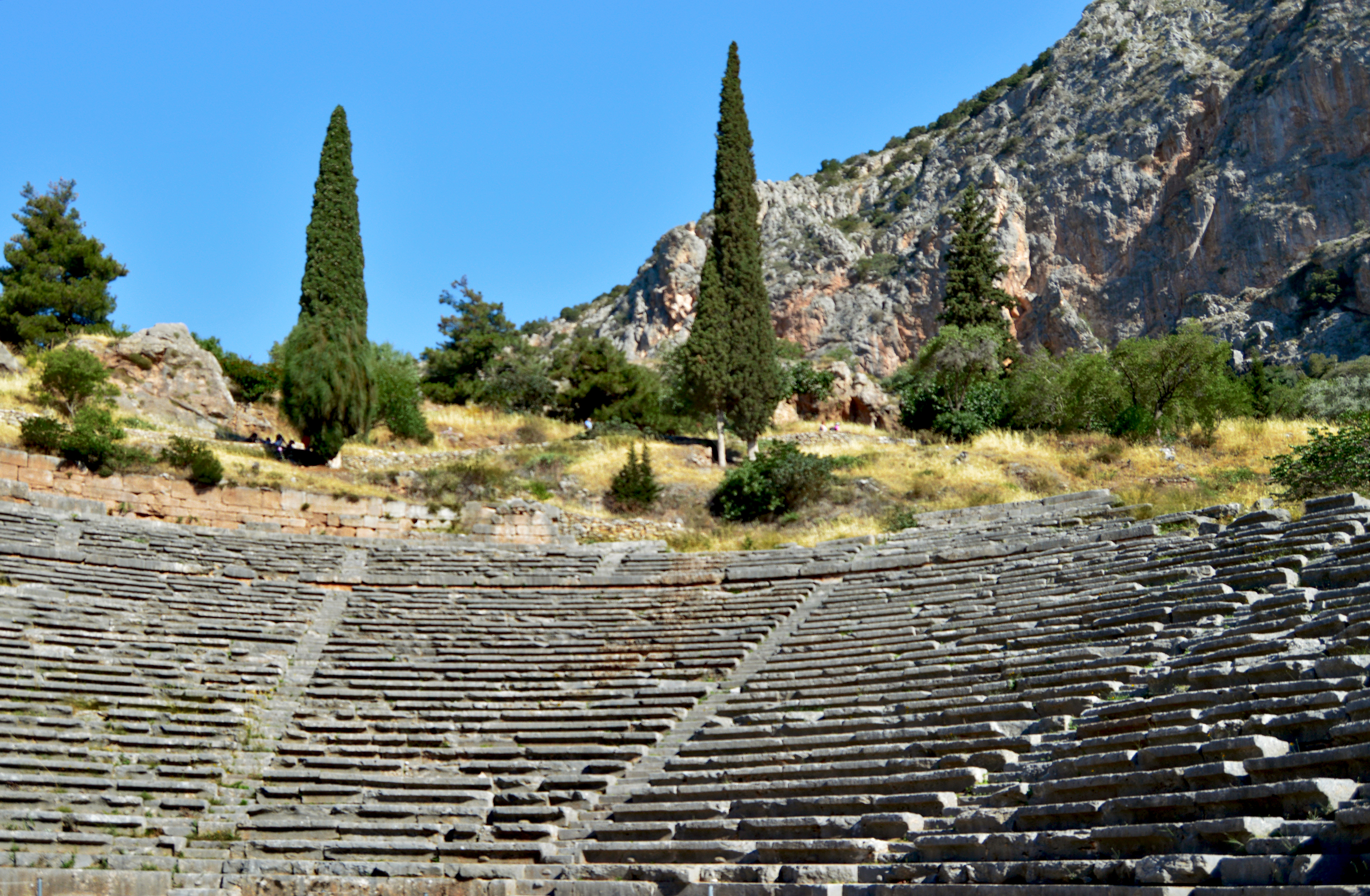
Higher up above the temple, offering a panoramic view of the site, the semi-circular bowl of a theater has been cut into the side of the mountain. This theater and a nearby stadium were locations for the Pythian Games, one of the four Pan-Hellenic Games of ancient Greece. They were held in honor of Apollo every four years and, in contrast to the Olympic Games that honored Zeus, featured art and music as well as athletic competitions.
Apollo was the patron of music and poetry, often portrayed playing a lyre surrounded by the Muses who were personifications of the arts.
Theater at Delphi
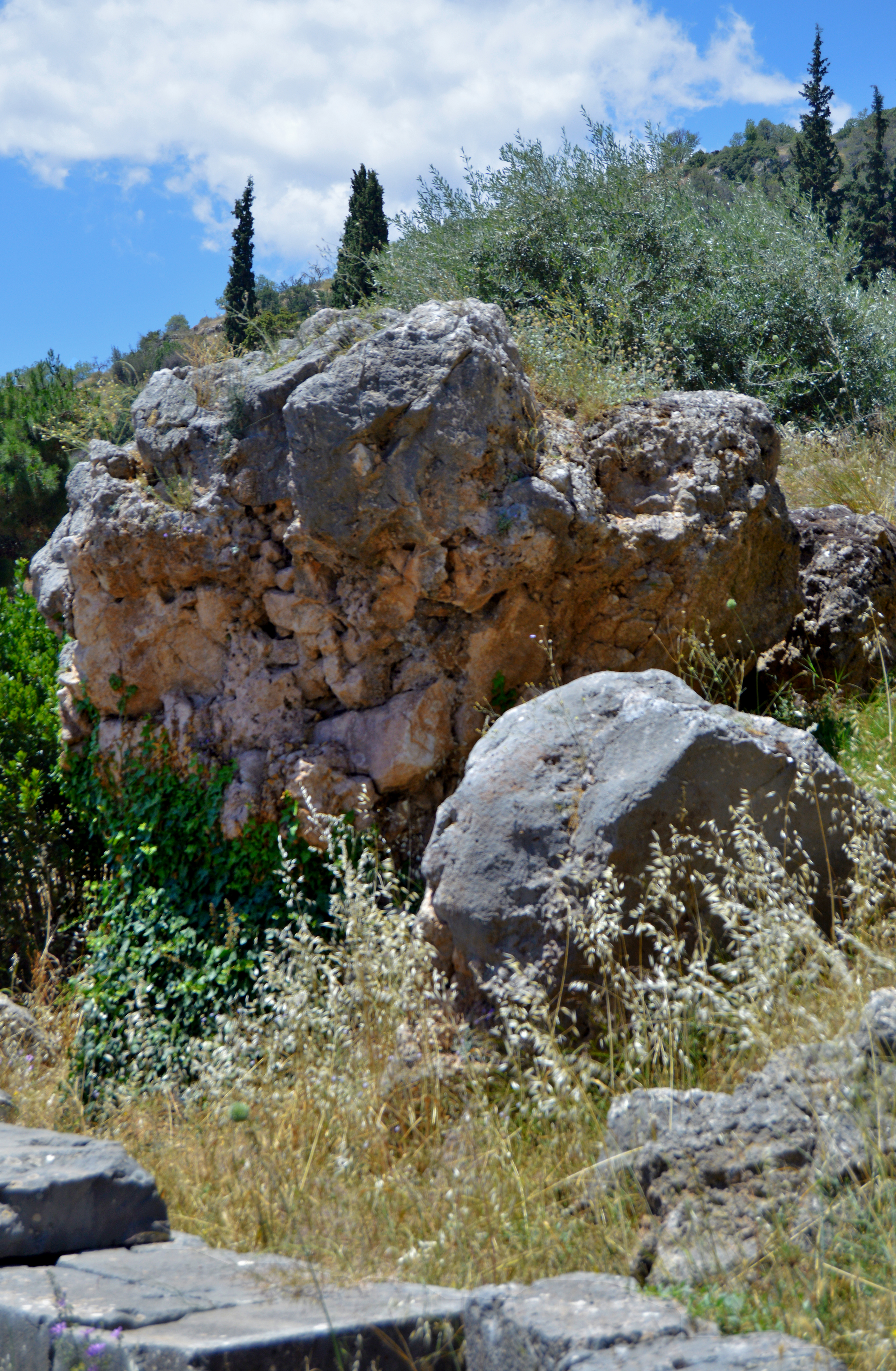
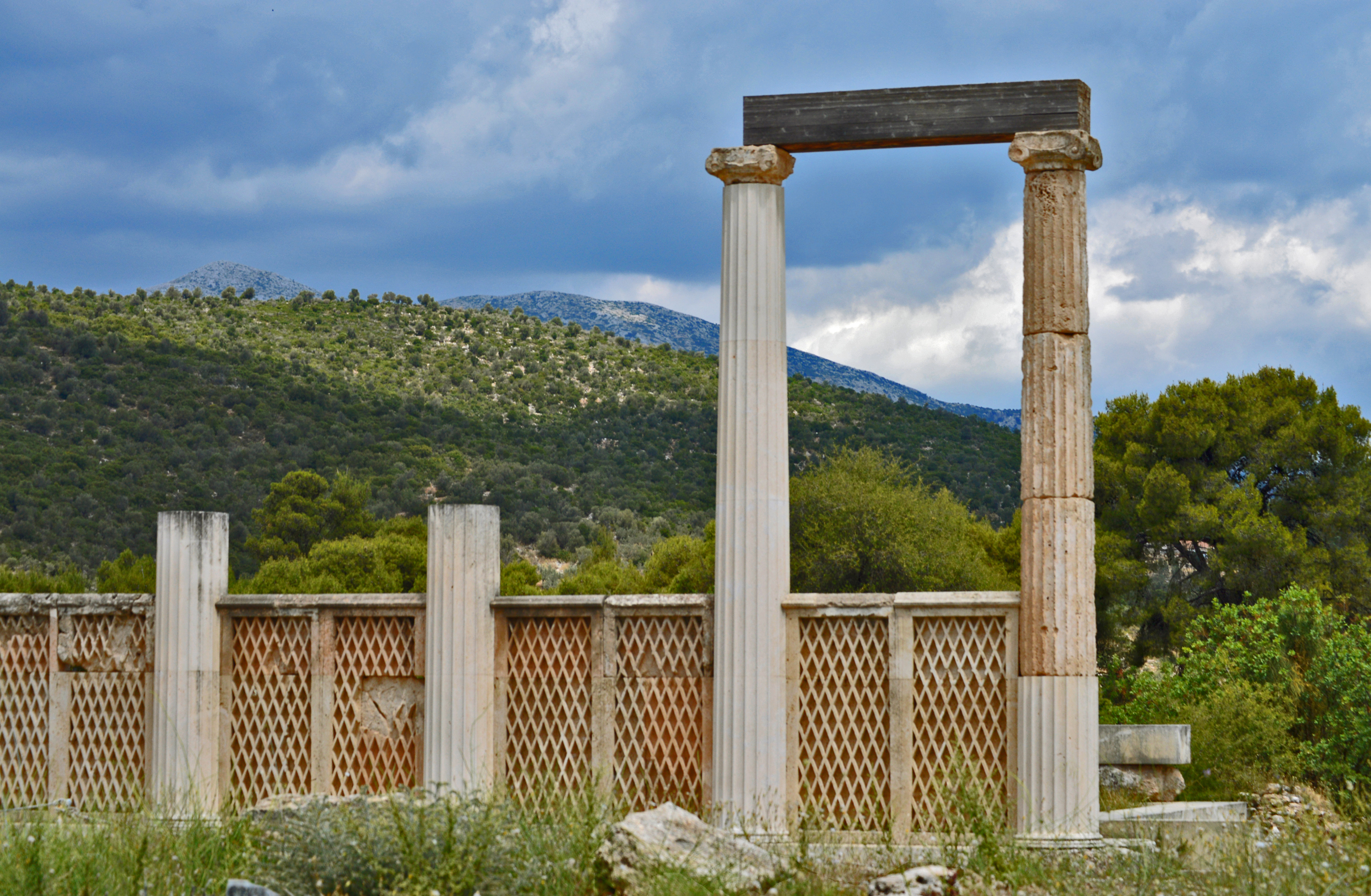
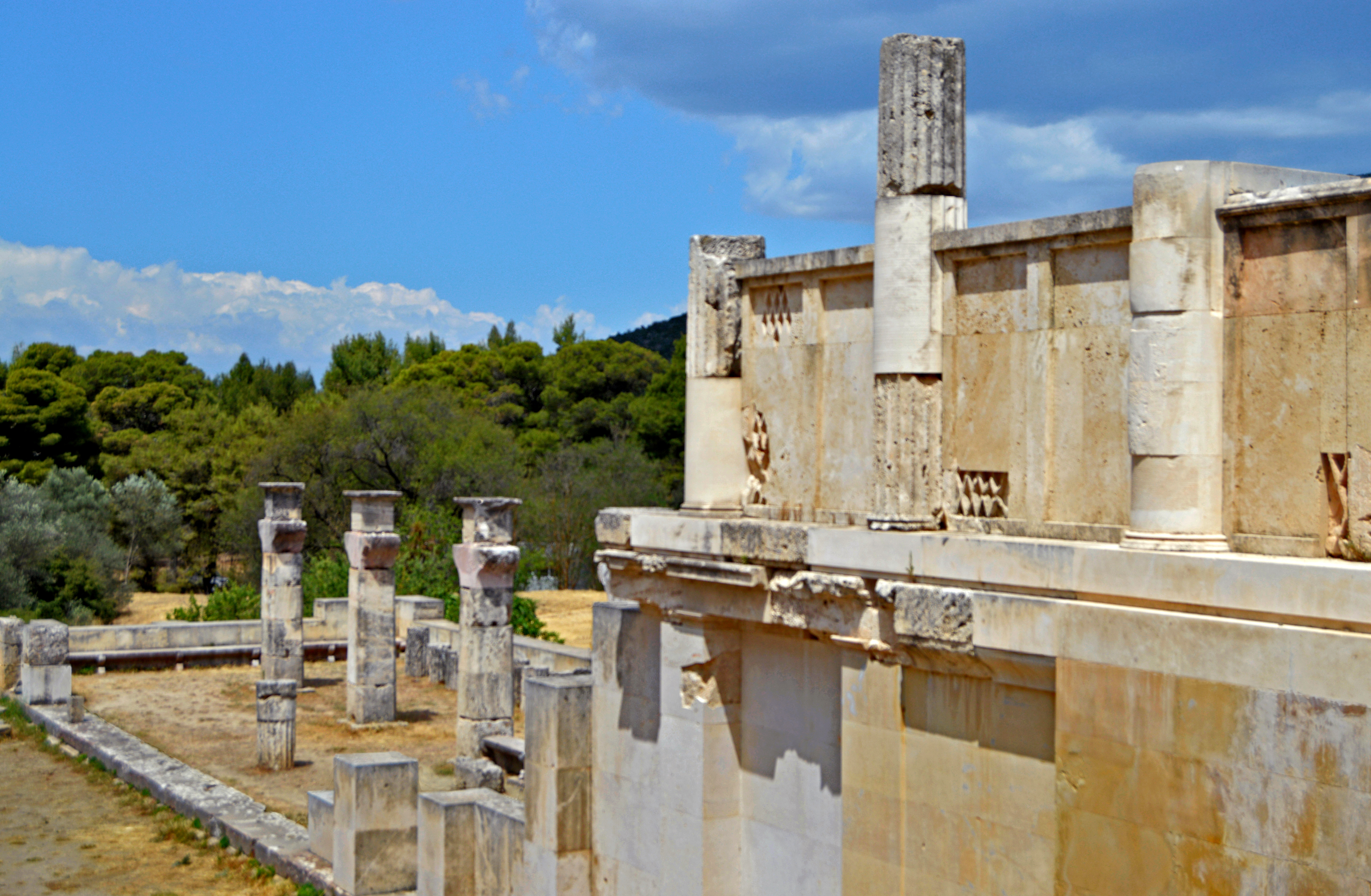
Medicine and healing were also associated with Apollo through his son, the famous healer Asclepius, whose snake-entwined staff remains a symbol of medicine to this day. The most famous sanctuary of Asclepius was located at Epidaurus, where pilgrims flocked to be cured of their illnesses. Contrasting with the towering cliffs and chasms of Delphi, Epidaurus lies in a shallow valley enclosed by gentle hills. In keeping with the healing qualities of the god manifested here, the setting is salubrious, calm and protective.
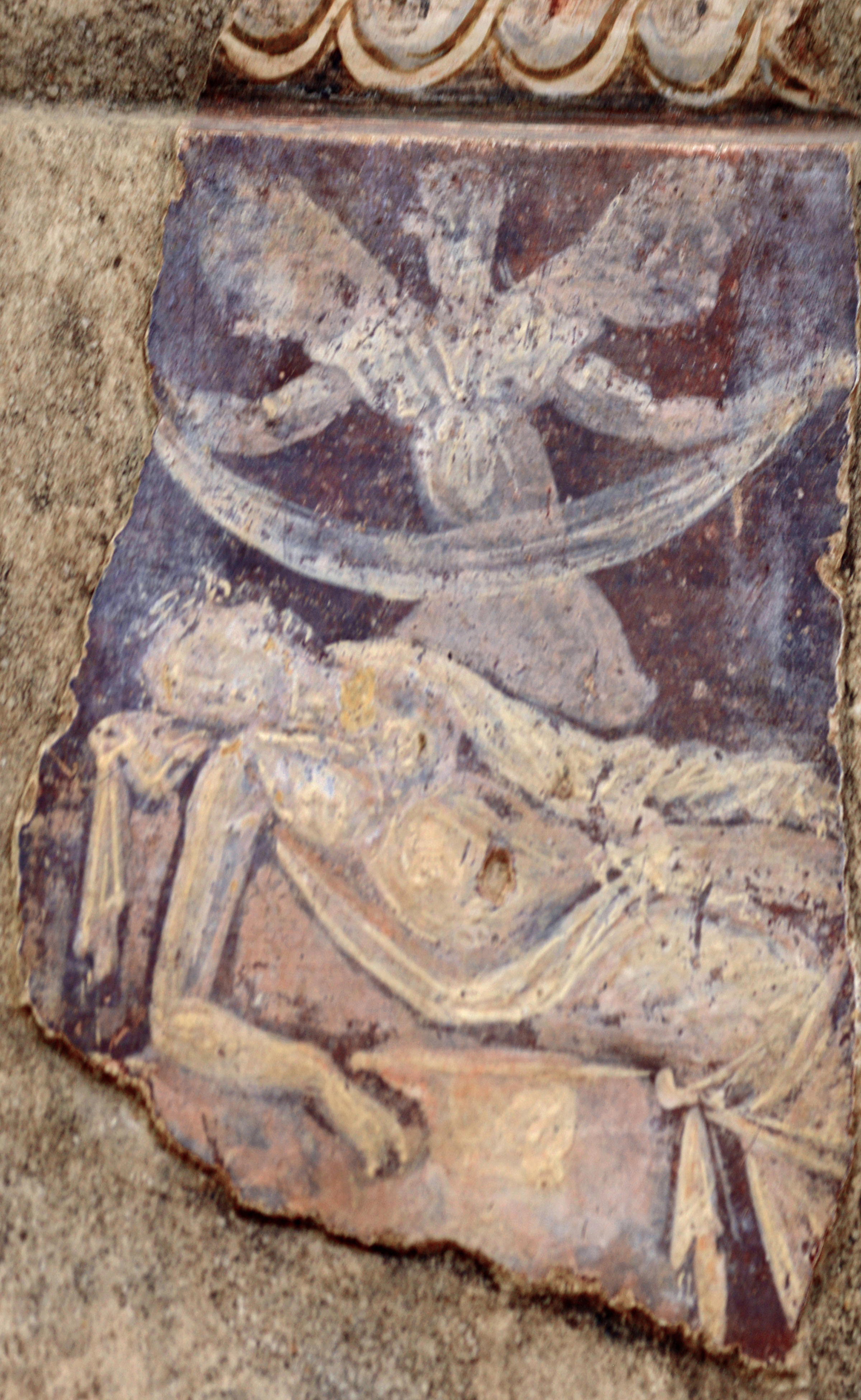
Two views of the Abaton at Epidaurus.Fresco depicts a dream scene.
Supplicants would spend the night in the holiest part of the sanctuary, the Abaton. Any dreams or visions were recounted to a priest who would interpret them and prescribe the appro-priate therapy. Surprisingly for the times, medical practices at the Asclepeion seem to recognize a psychological dimension to the treatment of illness.
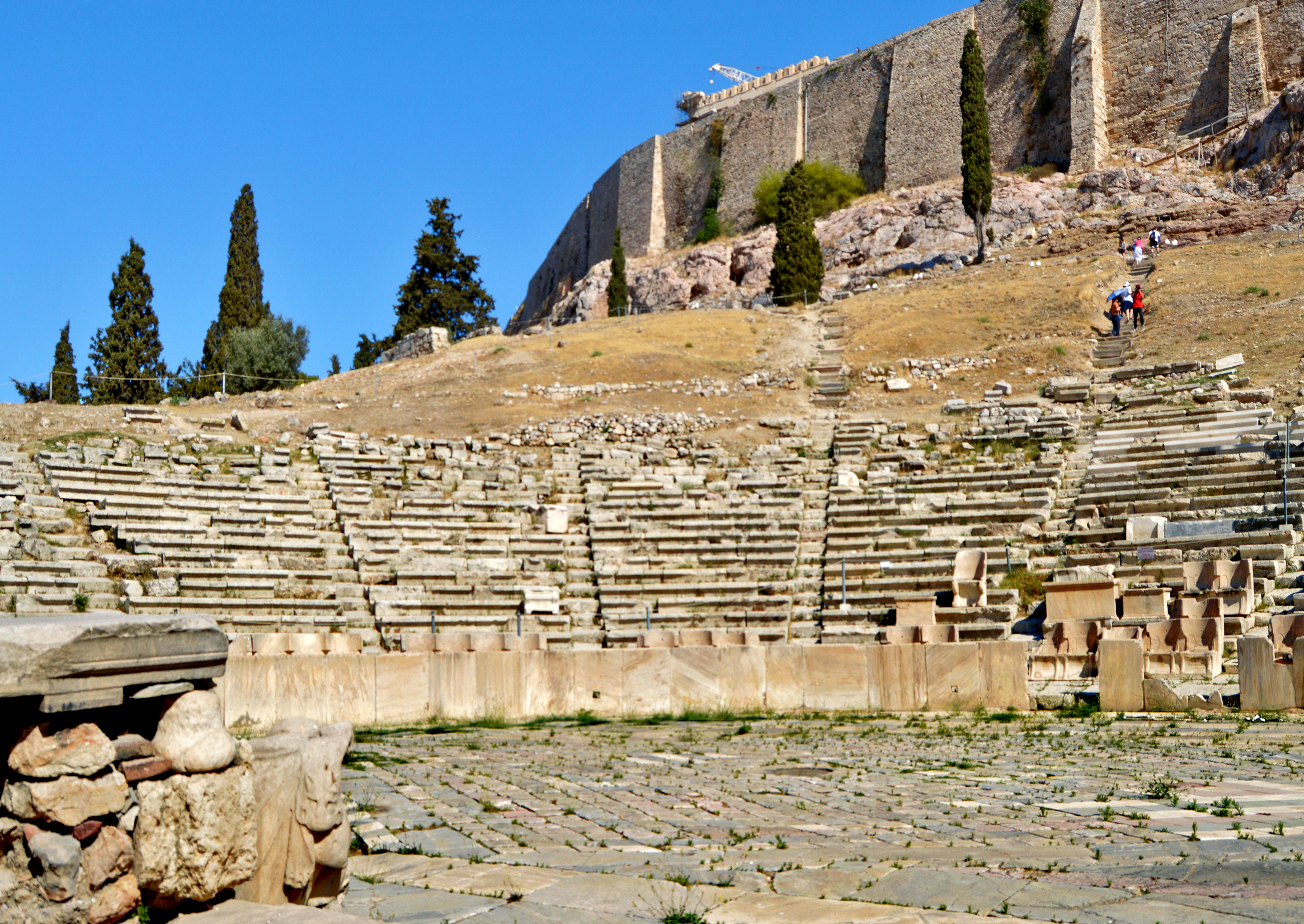
Theater of Epidaurus
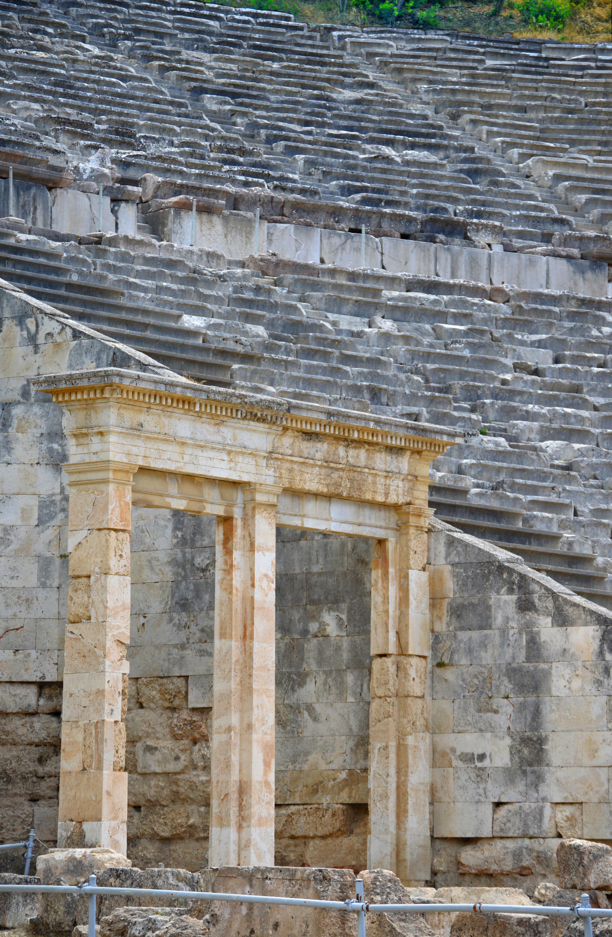
Likewise, the emotional catharsis produced by dramatic perfor-mances was thought to have therapeutic effects. Theaters are prominently incorporated in many religious sites. Epidaurus boasts a magnificent theater with world-famous acoustics built in the 4th century BCE that holds 14,000 spectators and is still used for performances today.
Religion provided the context for almost all communal activities in ancient Greece. Public spectacles like theatrical performances and athletic contests were held as part of festivals honoring the gods. The ethos that promoted excellence through competition applied to the arts as well as athletics. Plays were presented and judged over the course of five days at the annual spring festival of the Dionysia in Athens. In ancient Athens, drama developed as a public art form that explored before mass audiences ethical issues affecting the individual and the community, reaffirming common values.
Theater of Dionysus in Athens.
The Theater of Dionysus at the foot of the Acropolis was the setting for debut performances of the tragedies by Aeschylus, Sophocles and Euripides counted among the greatest classics of Western literature. They explore grand themes of pride and downfall, individual responsibility and fate that still engage us to this day.
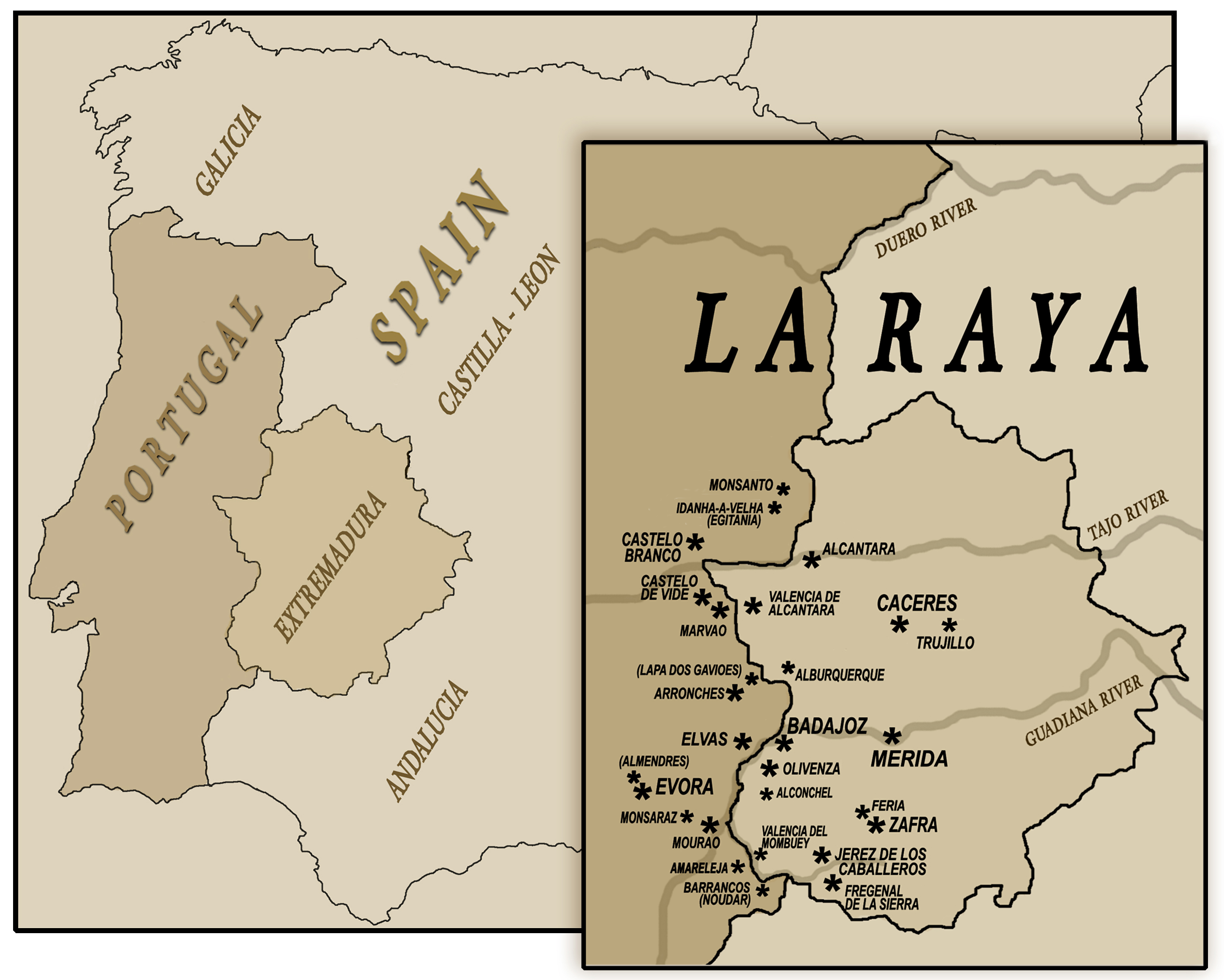
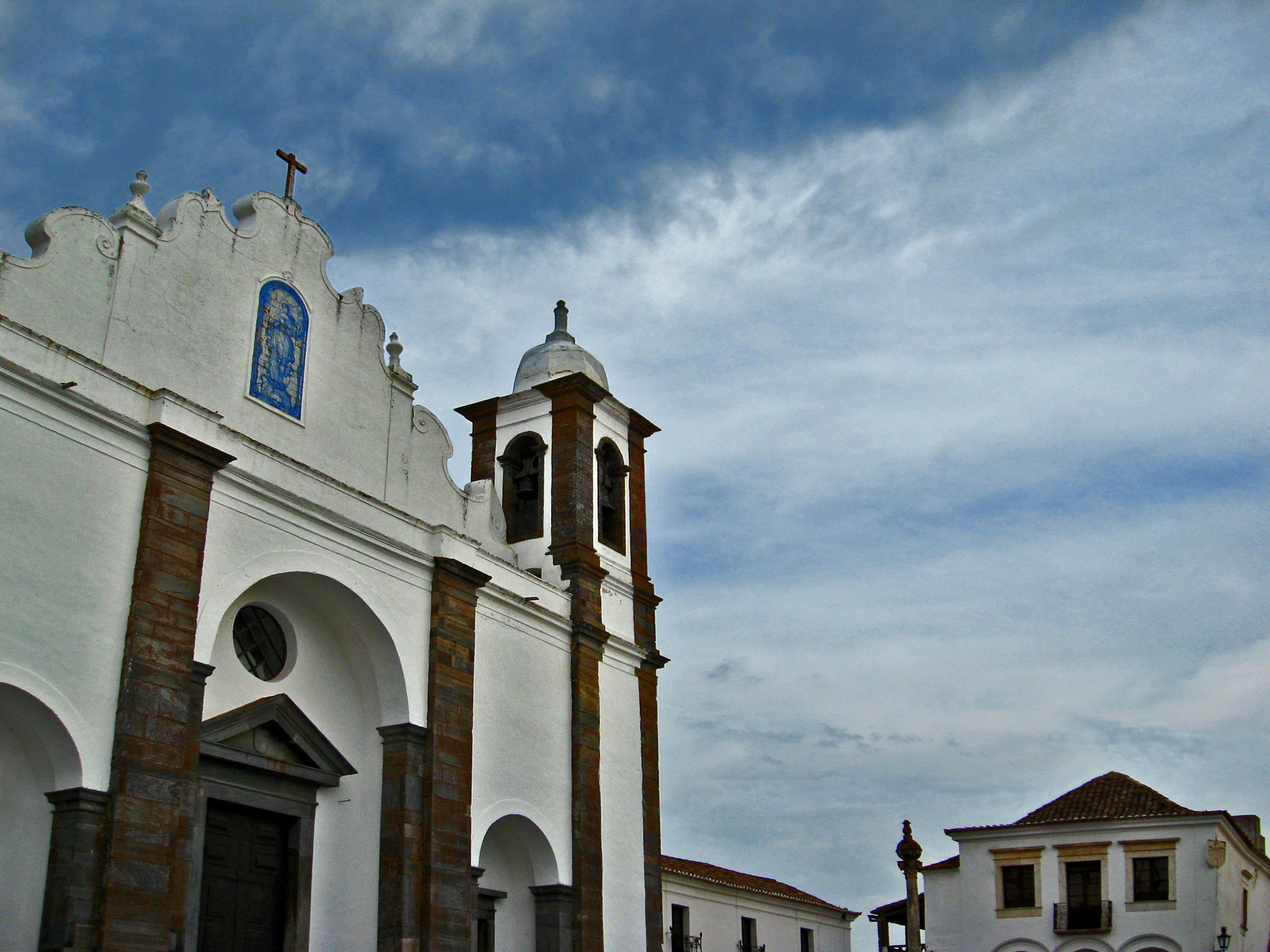
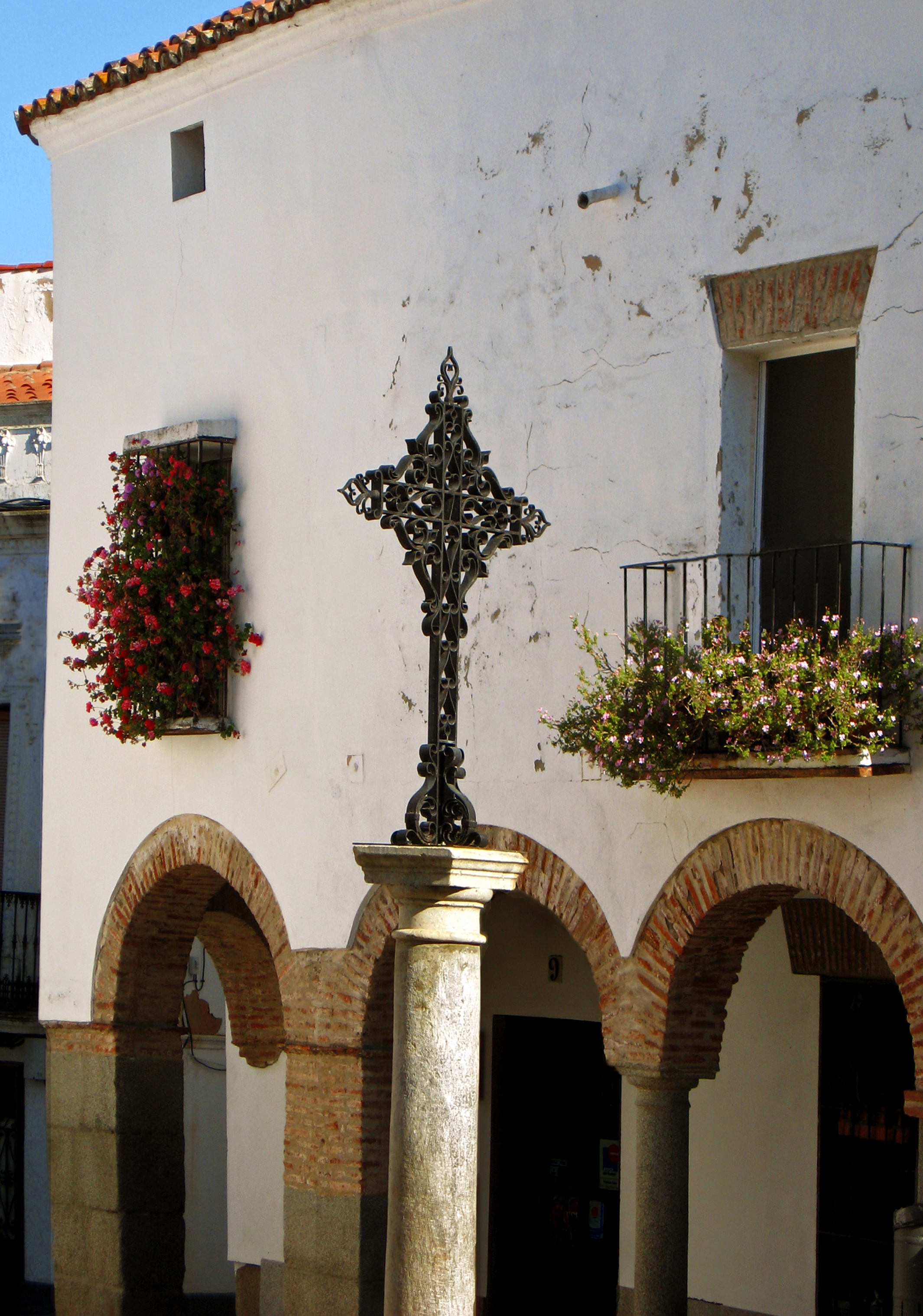
INTRODUCTION La Raya / A Raia (The Line) is the name given to the territories which lie along the borderline separating Spain and Portugal; particularly those in the Spanish province of Extremadura and the neighboring Portuguese Alentejo. Throughout history this region has been a crossroads, a perennial frontier fought over by competing peoples, empires and religions. During the centuries of warfare between the medieval Christian kingdoms of northern Spain and Muslim al-Andalus to the south, contested lands ‘beyond the Duero River’ were collectively known as Extremadura.
Click on Map and Photos to Enlarge
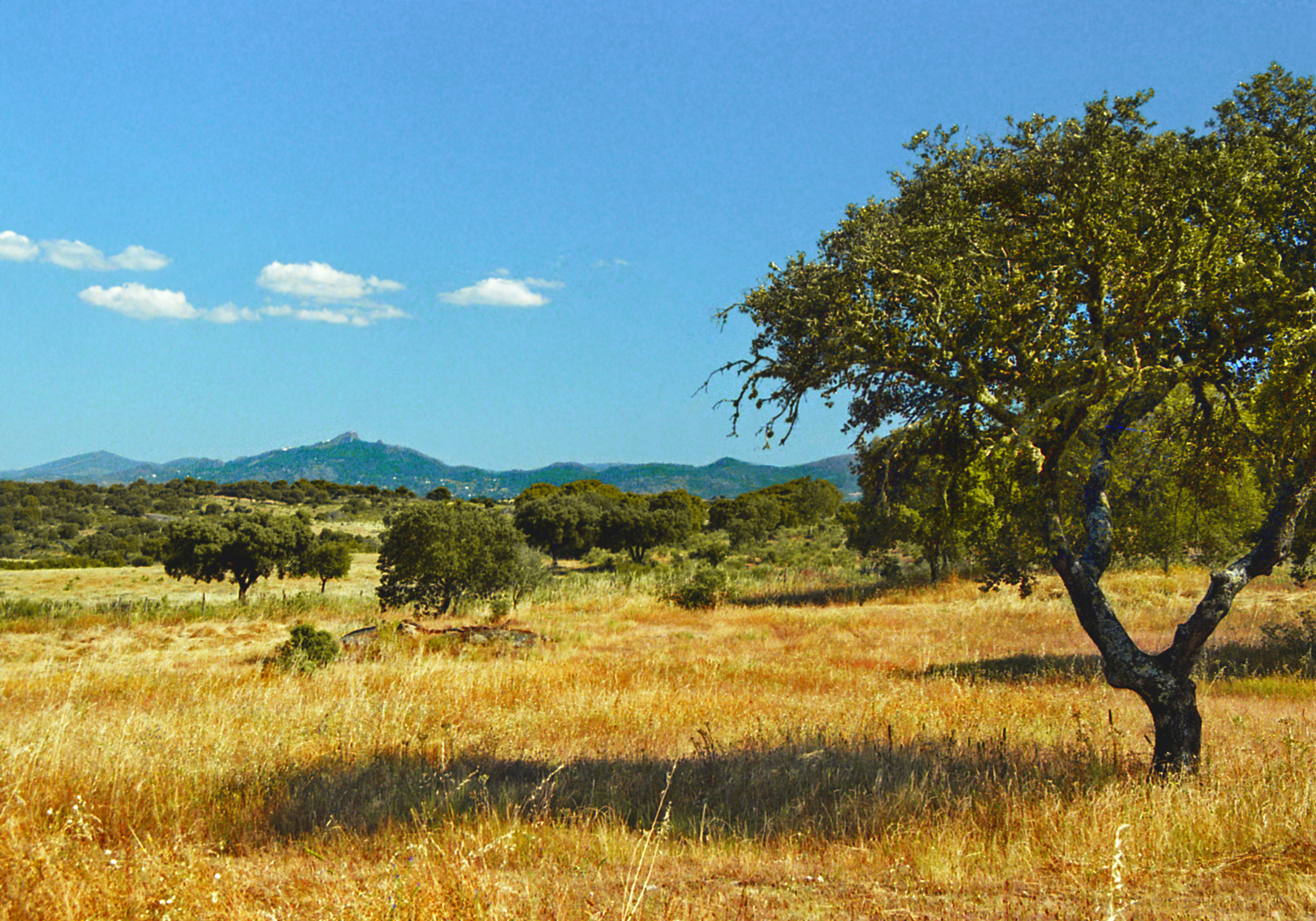
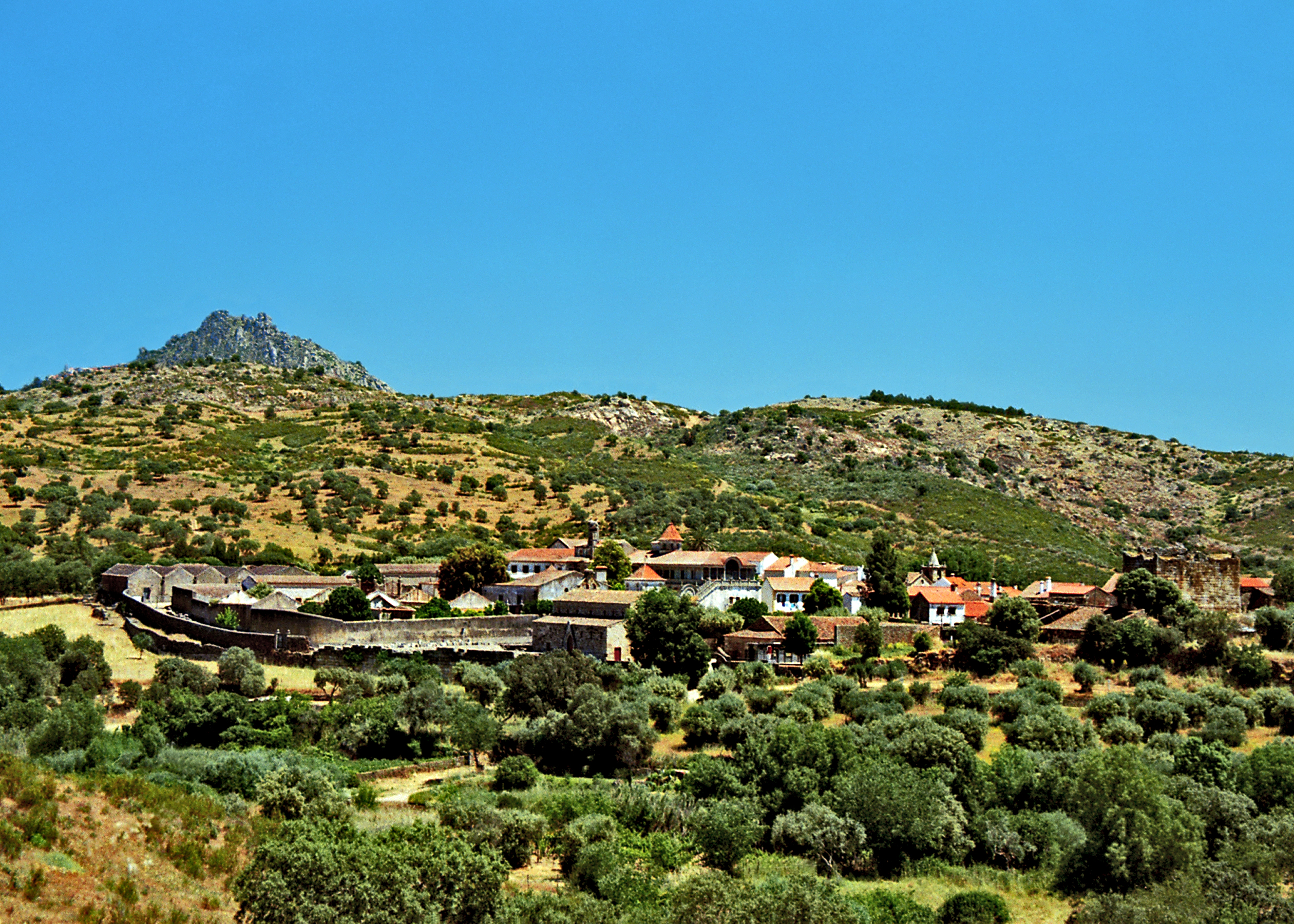
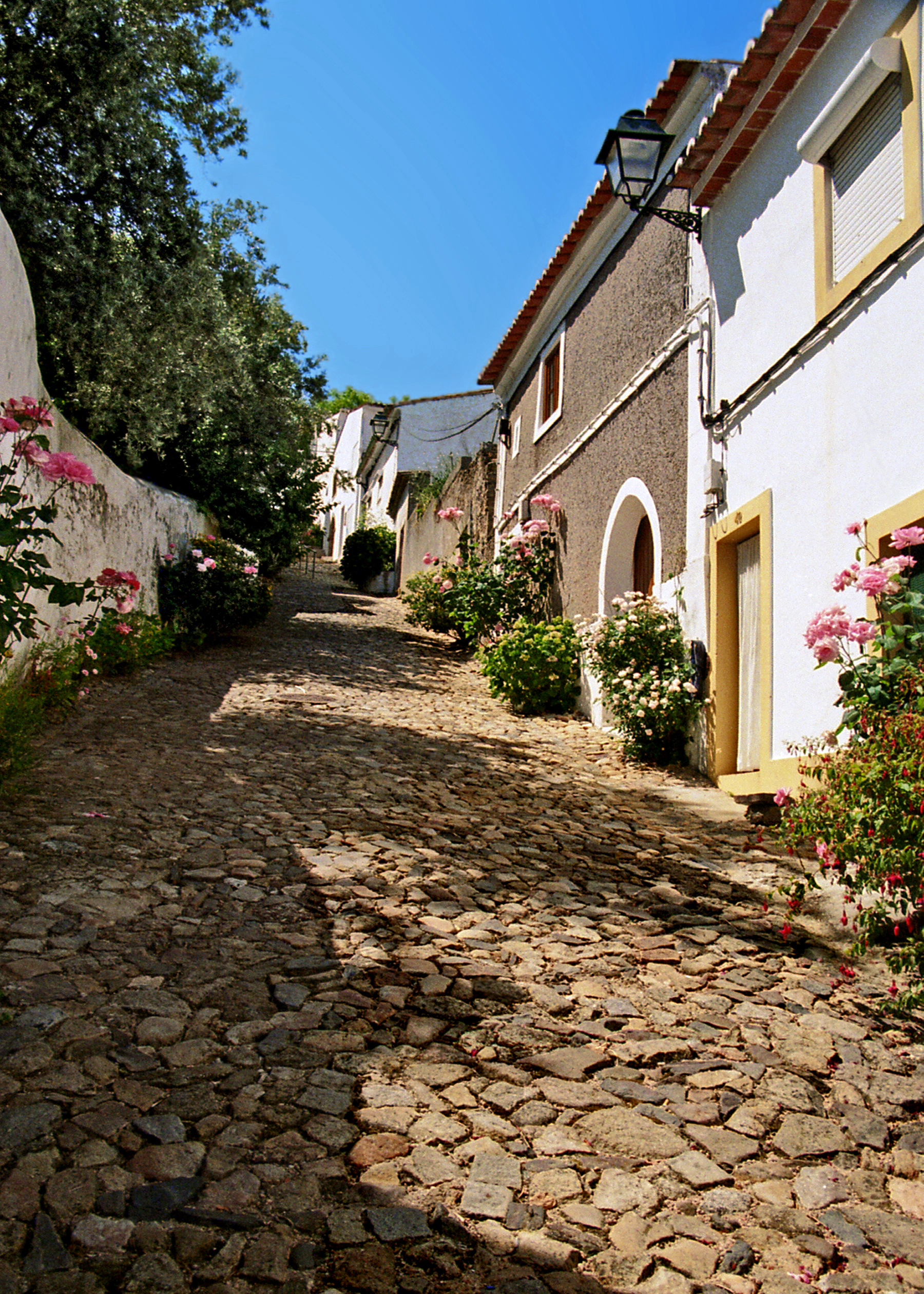
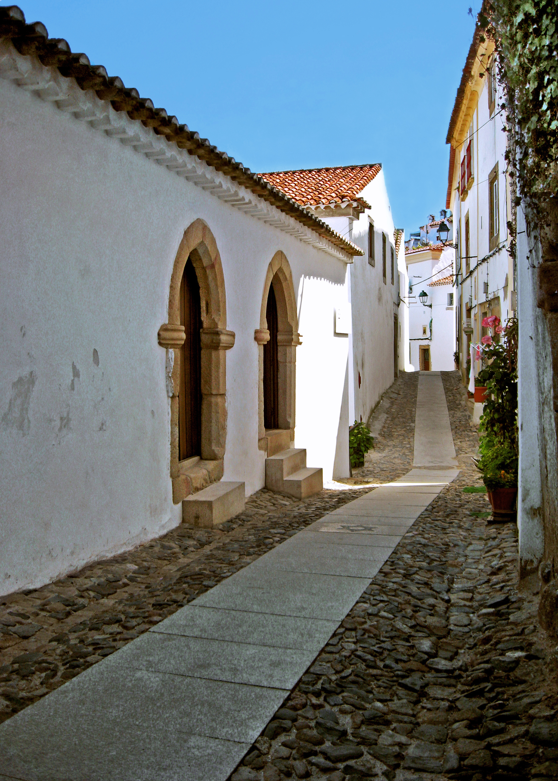
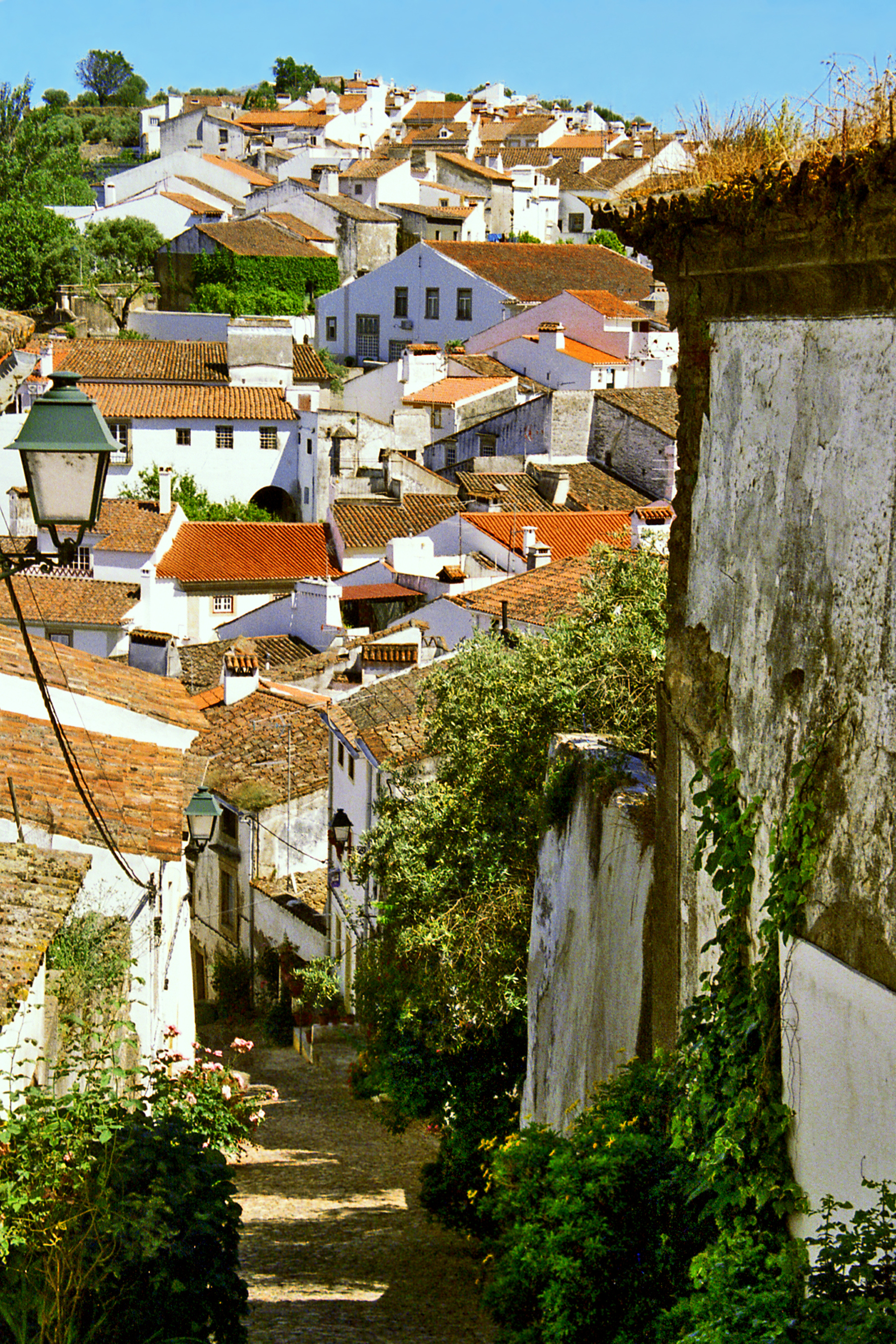
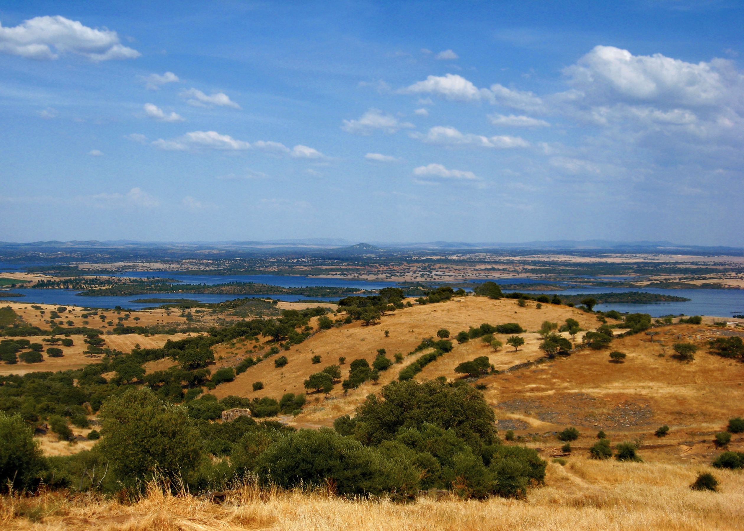
It is a sparsely populated landscape of golden grassland dotted with stands of dark green oak and silvery olive trees, where giant boulders rise abruptly like sentinels towering over the endless plains.
Landscape of Extremadura
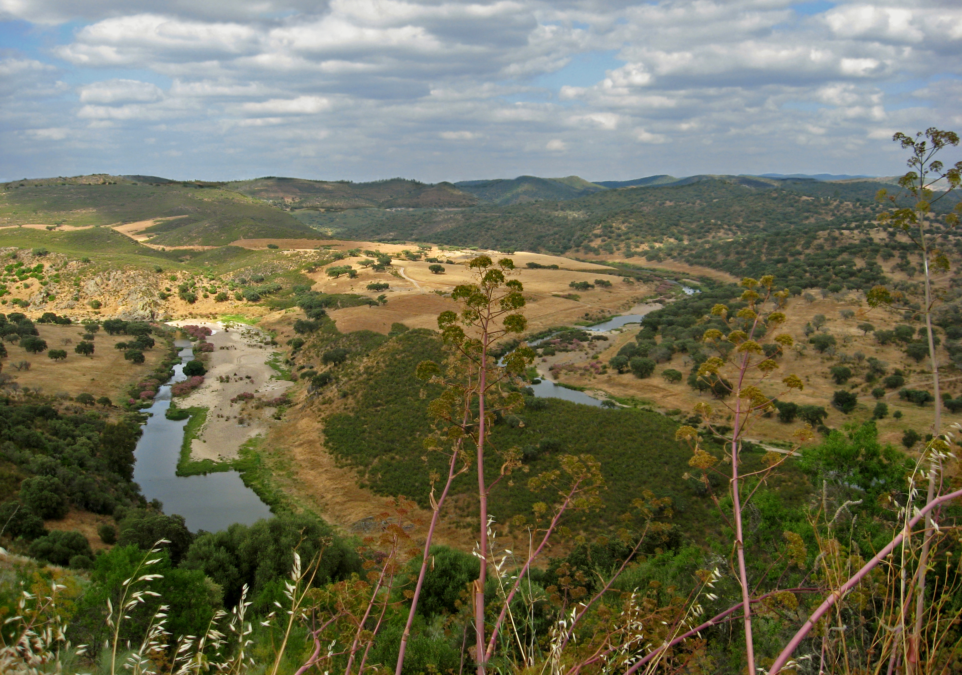
The heartland of La Raya is defined by the Tajo and Guadiana rivers and their winding tributaries which have served as territorial markers from time immemorial. But despite shifting political boundaries the region has shared a common cultural heritage since prehistoric times.
Meanders of the Ardila River in La Raya
PREHISTORY In the dawn of prehistory La Raya witnessed its first clash of cultures as early modern humans spread across Europe displacing the previous Neanderthal population. Archaeological evidence reveals that the southwestern corner of the Iberian Peninsula became the last stand of the Neanderthals, who survived there for millennia after having disappeared (by extinction or assimilation) everywhere else. Fascinating traces of prehistory abound throughout the region. The Maltravieso Cave on the outskirts of Caceres contains rock paintings dating from 23,000 years ago including depictions of animals and numerous outlined hand prints. These hands reach out to us pro-claiming “we were here” in an unbroken chain of human experience stretching across the mists of time.
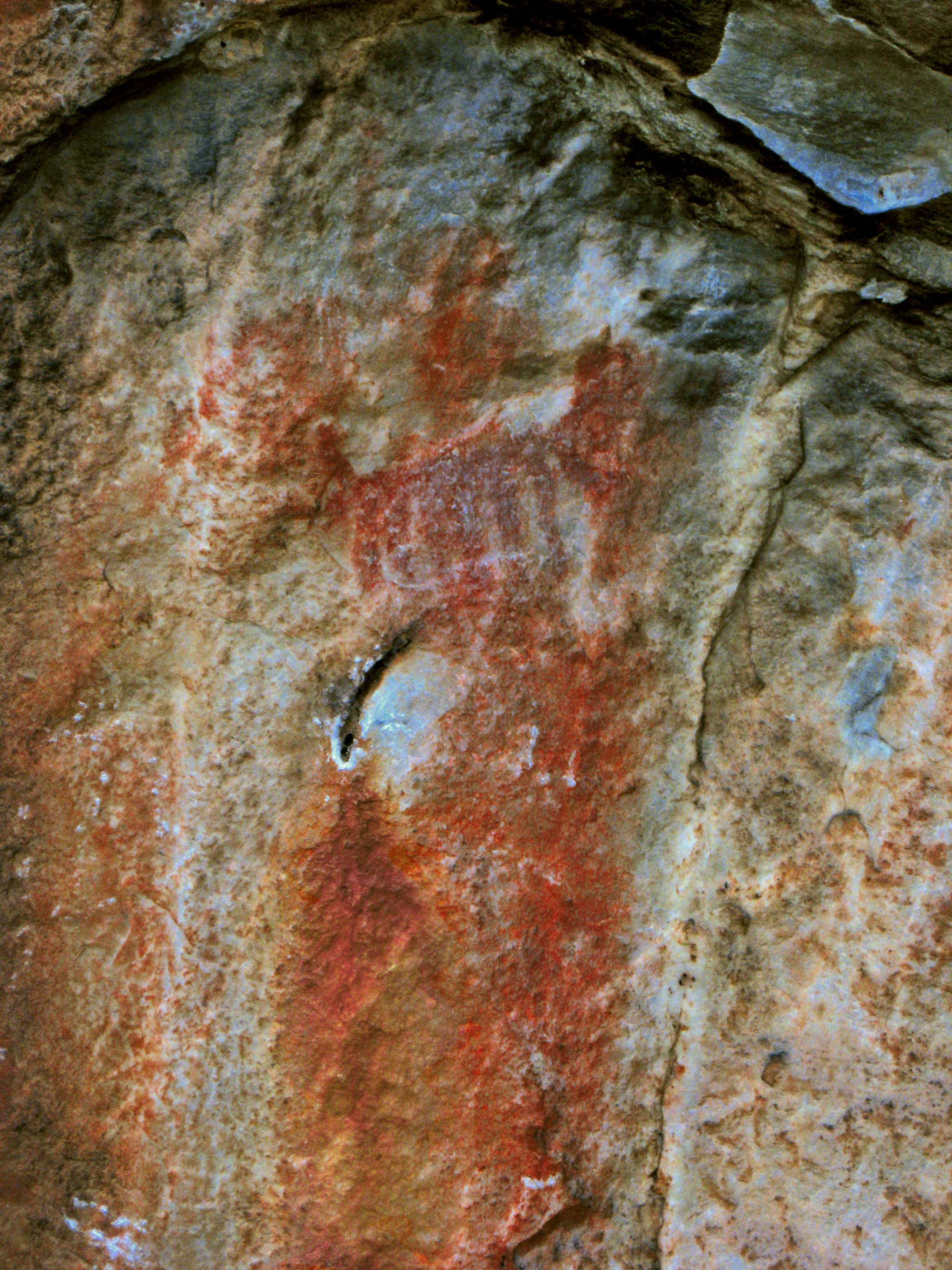
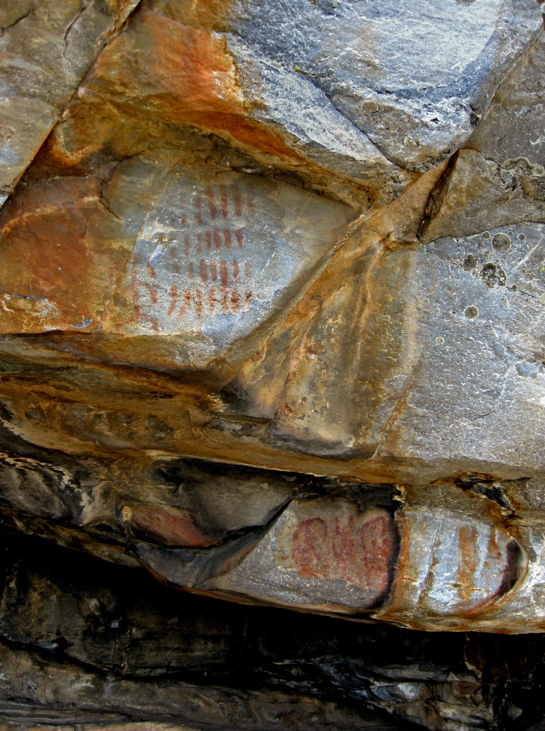
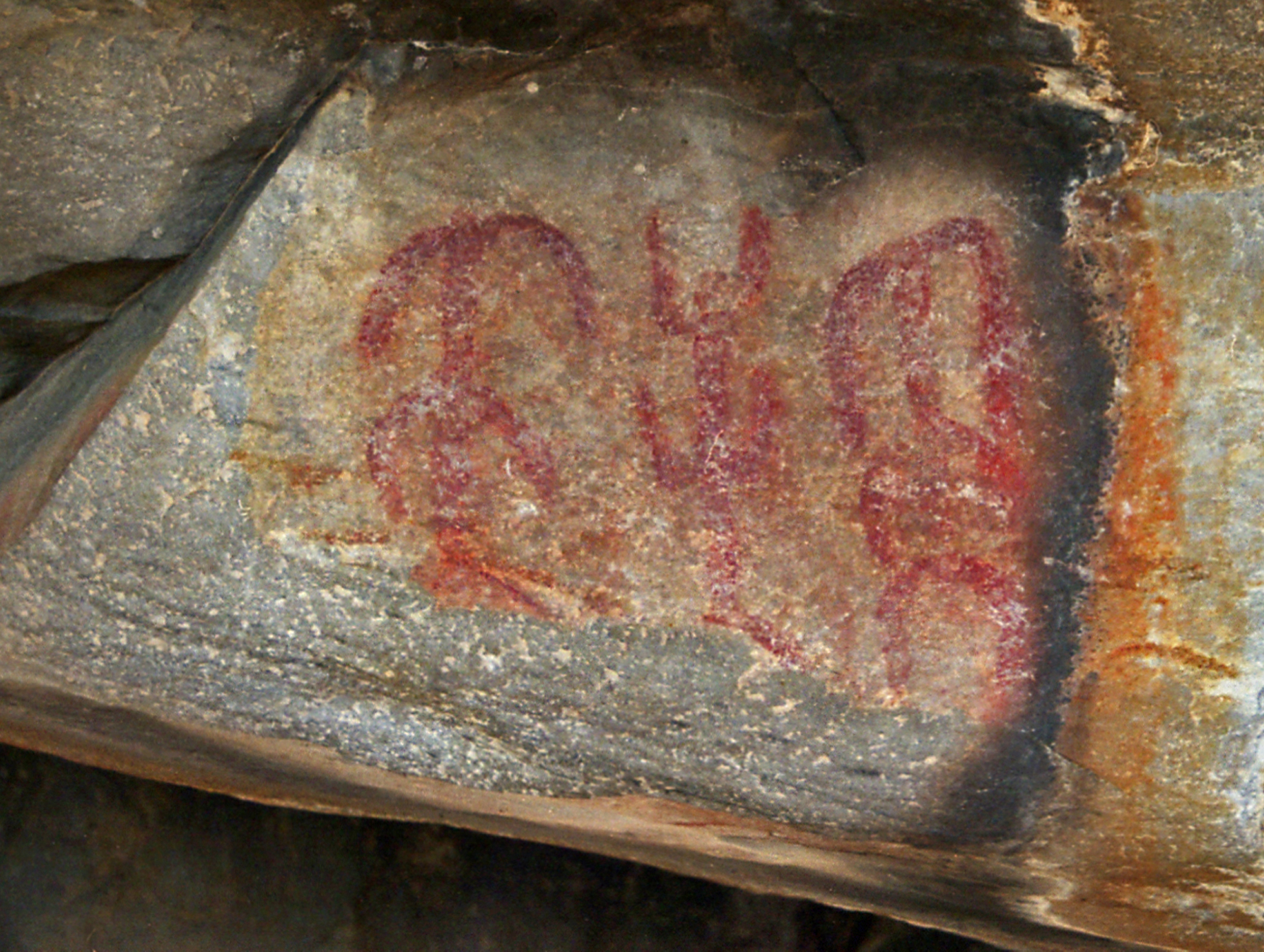
Prehistoric Rock Paintings in the Lapa dos Gavioes, Portugal
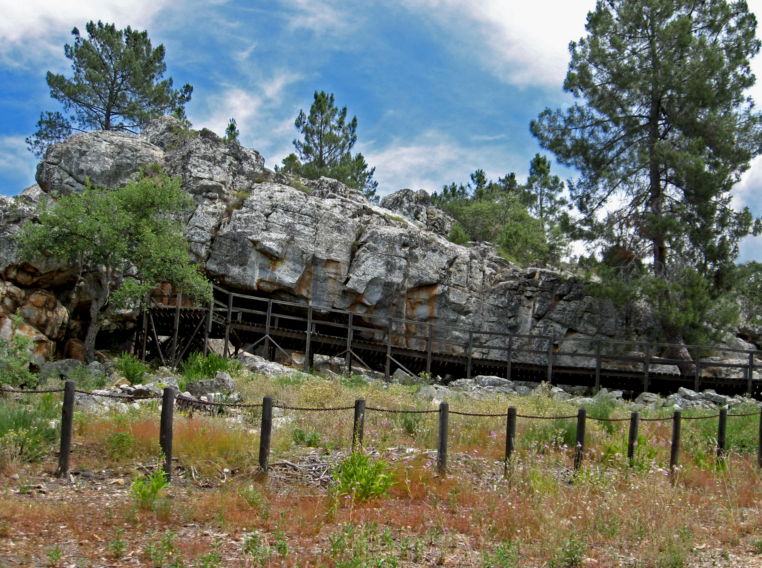
The Lapa dos Gavioes is a shallow rock shelter nestled in a pine clad hillside near the Portuguese town of Arronches that once sheltered the prehistoric hunter-gatherers of the region. It contains rare open-air rock paintings, dating from the late Paleolithic to the Neolithic periods. The well-preserved pictographs feature red ochre drawings of stylized human and animal figures and geometric patterns of lines and dots whose long-lost message still intrigues us.
View of the Rock Shelter
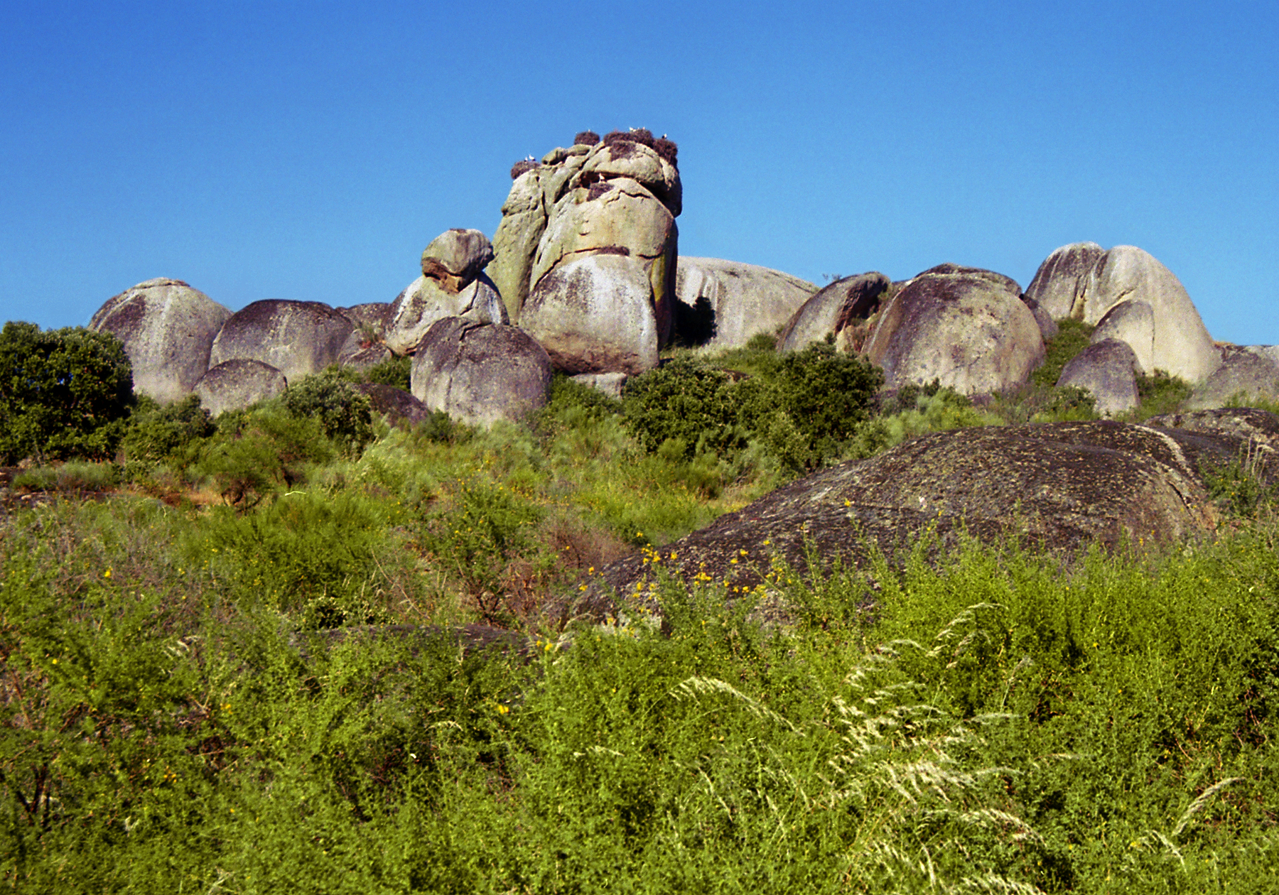
At the nature park of Los Barruecos near Caceres huge granite boulders lie strewn across the landscape, piled atop one another like gigantic sculptures, surrounded by ponds and marshes fre-quented by migratory birds and nesting storks. Archaeologists have found here evidence of the first agriculturalists in the region, dating from the sixth millennium BCE. Amidst the rocks there are petroglyphs and ancient tombs carved into freestanding boulders.
Rock Formations in Los Barruecos, Spain
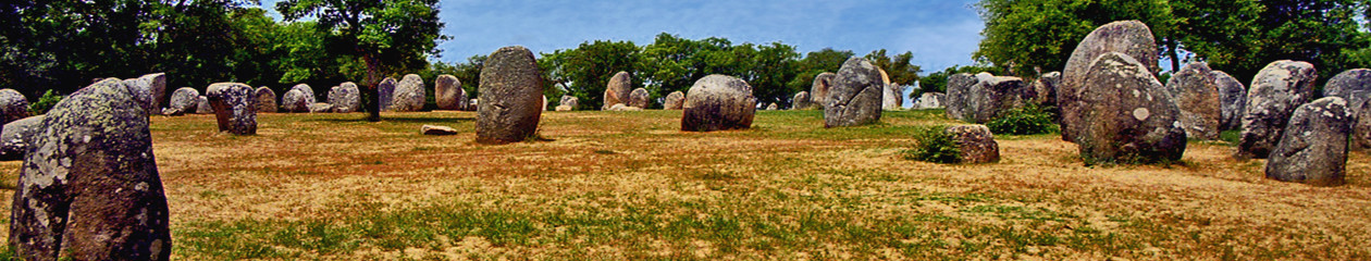
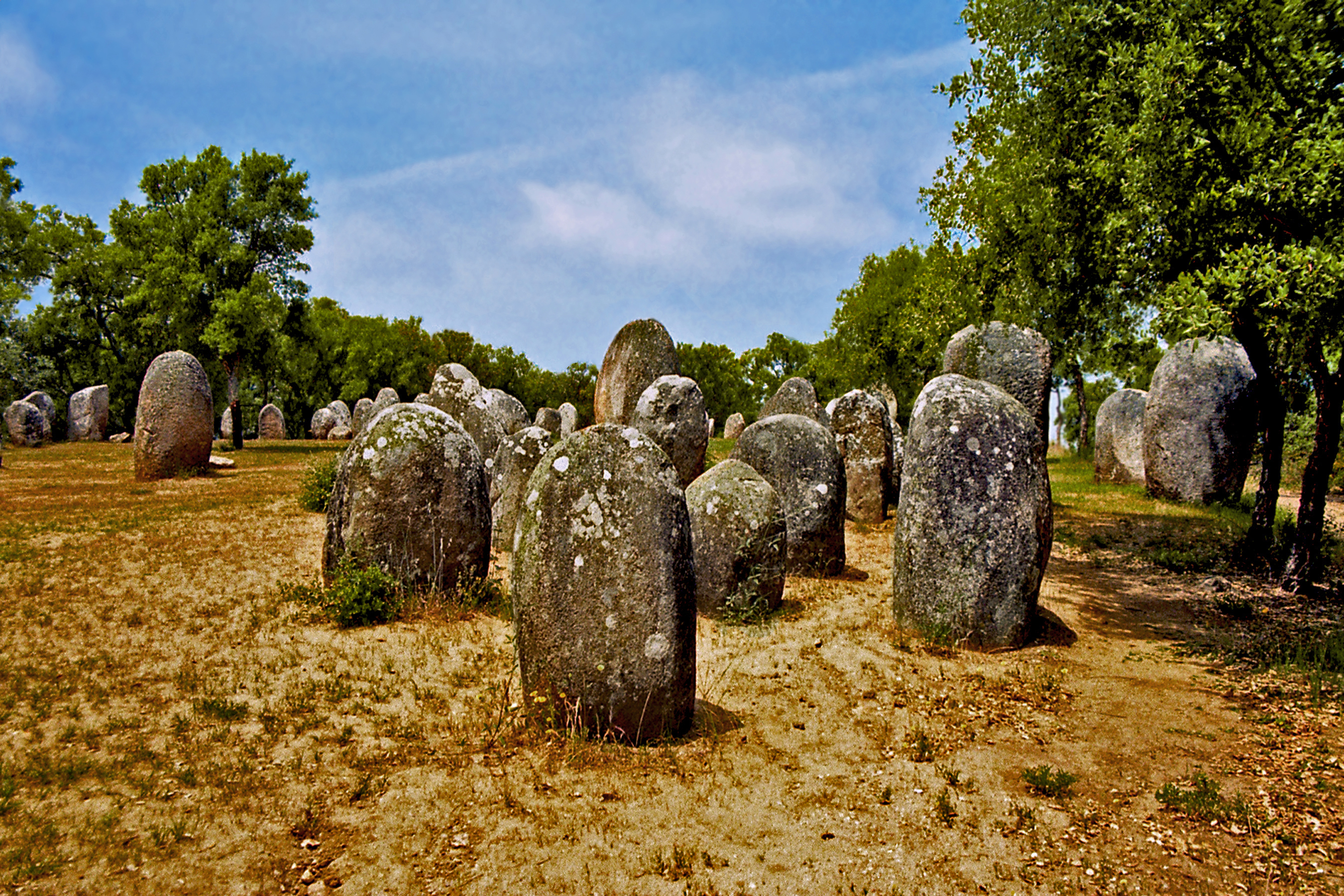
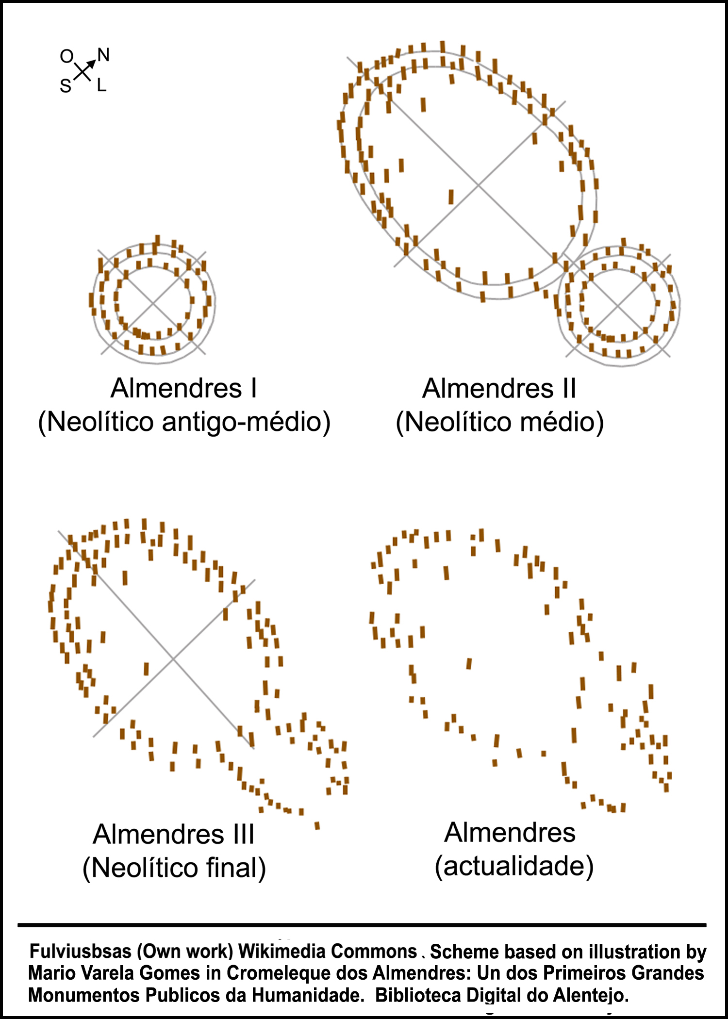
About seven thousand years ago, La Raya was part of an Atlantic megalithic culture that extended from the British Isles to northwest France and the Iberian Peninsula. The great cromlech of Almendres near Evora in Portugal is the oldest astronomically aligned stone circle in Europe, predating Stonehenge. Built from about 6,000 to 4,000 BCE, it is a concentric arrangement of 95 stones marking the changing seasons.
The Stone Circle of Almendres, Portugal
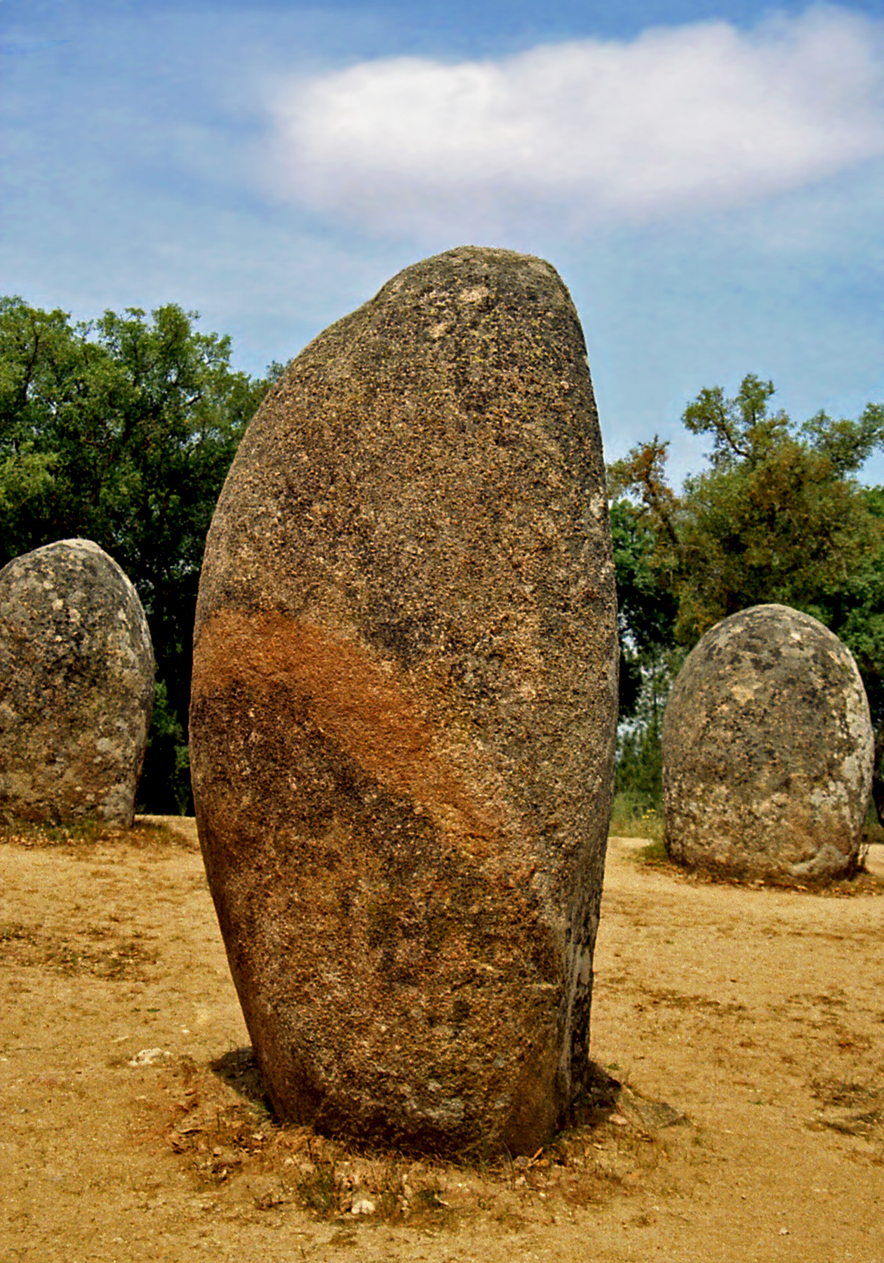
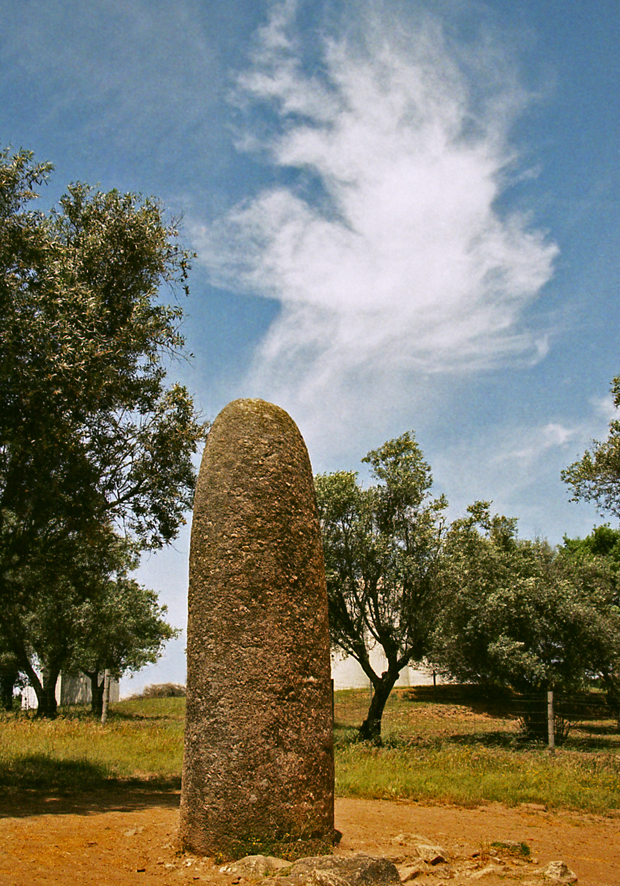
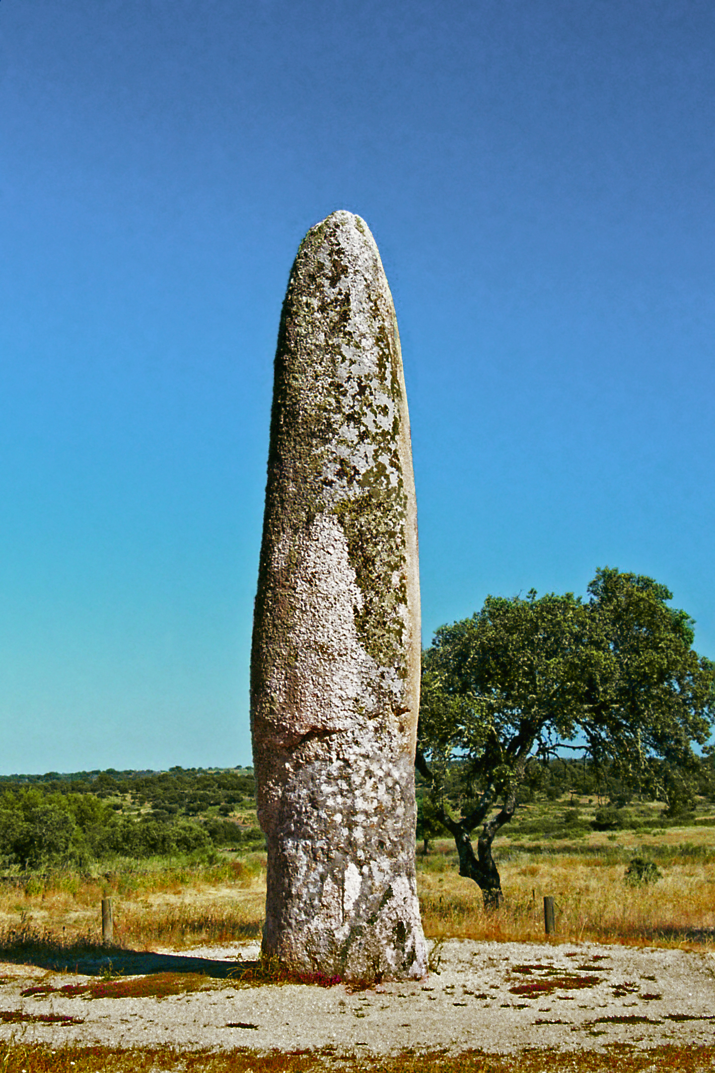
Single standing stones called menhirs are found throughout the region. At Almendres an isolated menhir located northeast of the great circle points to the direction of the sunrise during the winter solstice. La Raya appears to have been a major cultural center for the megalith builders, attested by many impressive sites, including the Menhir of Meada, the tallest standing stone in the Iberian Peninsula located near the Portuguese town of Castelo de Vide.
Menhirs of Almendres (Left) and Meada (Right)
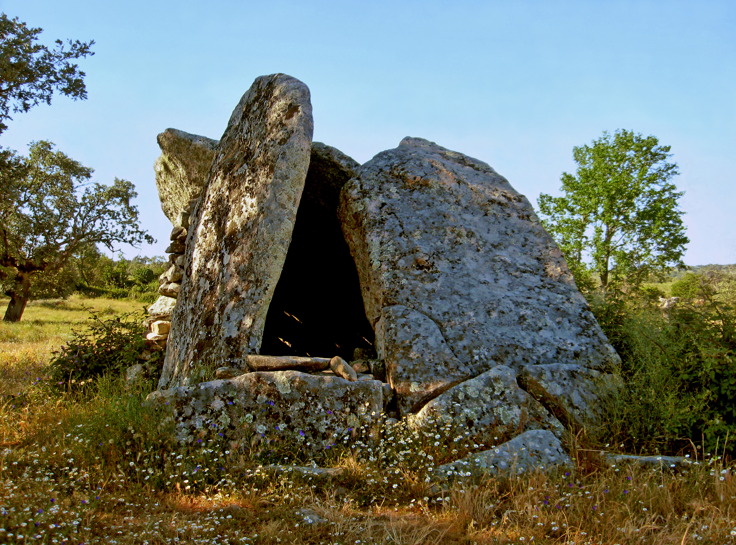
Across the Spanish border toward Valencia de Alcantara is one of the largest concentrations of dolmens, or portal tombs, in Europe. These astonishing structures built out of huge stone slabs were originally covered by earthen mounds. Termed ‘antas’ in Portugal, they have long been endowed with magical properties in folk legends that attribute their construction to giants or to magical enchantresses called mouras.
Typical Dolmen at Coureleiros, Portugal
THE LEGACY OF ROME The Roman conquest of the Iberian Peninsula (Hispania) lasted for two hundred years before it was finally consolidated. The Lusitanian Celtic peoples who inhabited the territory of La Raya were among those who resisted with fierce rebellions like the one led by Viriatus in the second century BCE. The region was finally subdued by Julius Caesar in 60 BCE and incorporated into the empire under Augustus, who reorganized the territory of Hispania into the three provinces of Tarraconensis, Baetica and Lusitania. The Guadiana River was the boundary dividing the rich olive growing lands of Baetica (mostly in present-day Andalucia) from the wilder territory of Lusitania which extended from Extremadura to the Atlantic coast of Portugal.
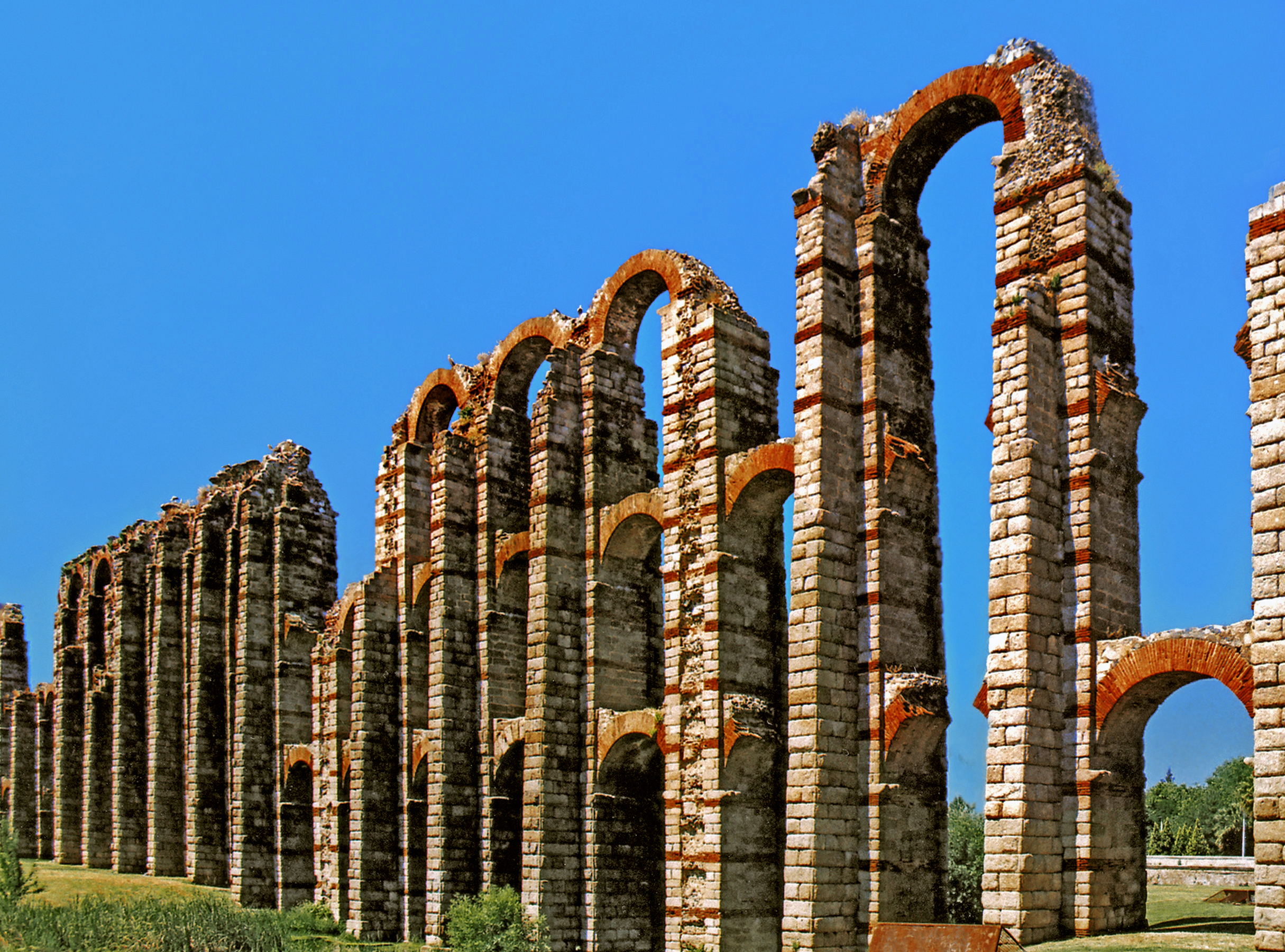
Roman Aqueduct of Merida
Large country estates were hubs of agricultural production (over twenty Roman villas have been discovered near the Spanish town of Zafra). Olive groves and vine-yards were planted and the famed Iberian pigs fed on the acorns produced by vast stands of oak in the ecologically balanced dehesa system still practiced today.
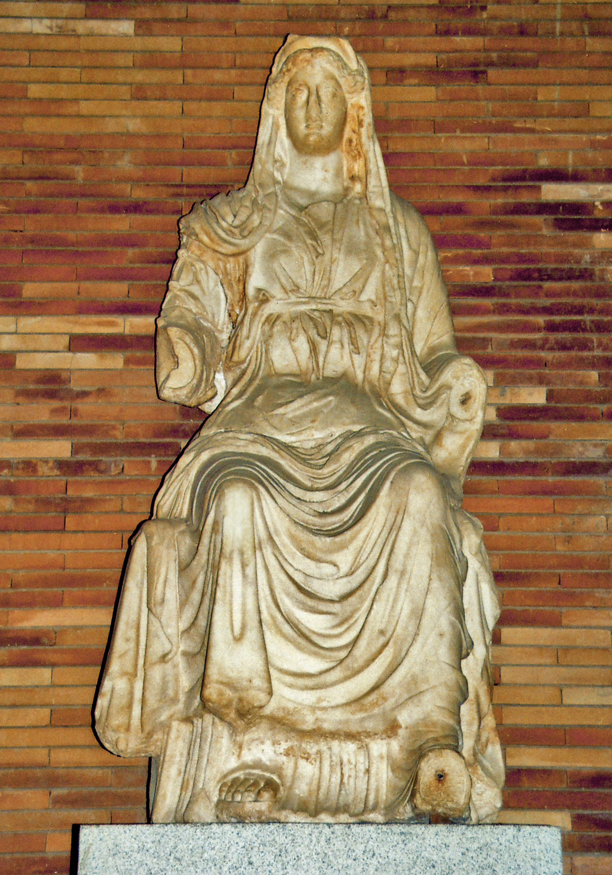
Statue of Ceres, Roman Goddess of Agriculture & Fertility, from Merida.
Under Roman rule political stability, combined with improved means of communication and trade, led to rapid urbanization throughout the region. An impressive road system built by the legionaries connected the new urban centers. The famous Via de la Plata ran north from Hispalis (Sevilla) to Emerita (Merida), past Norba Cesarina (Caceres), and on to the rich gold mines of Leon province where the VII Legion was permanently stationed.
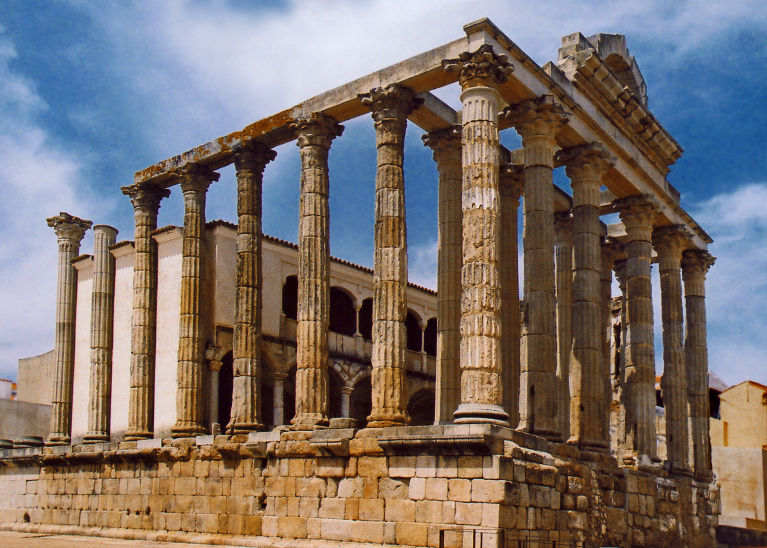
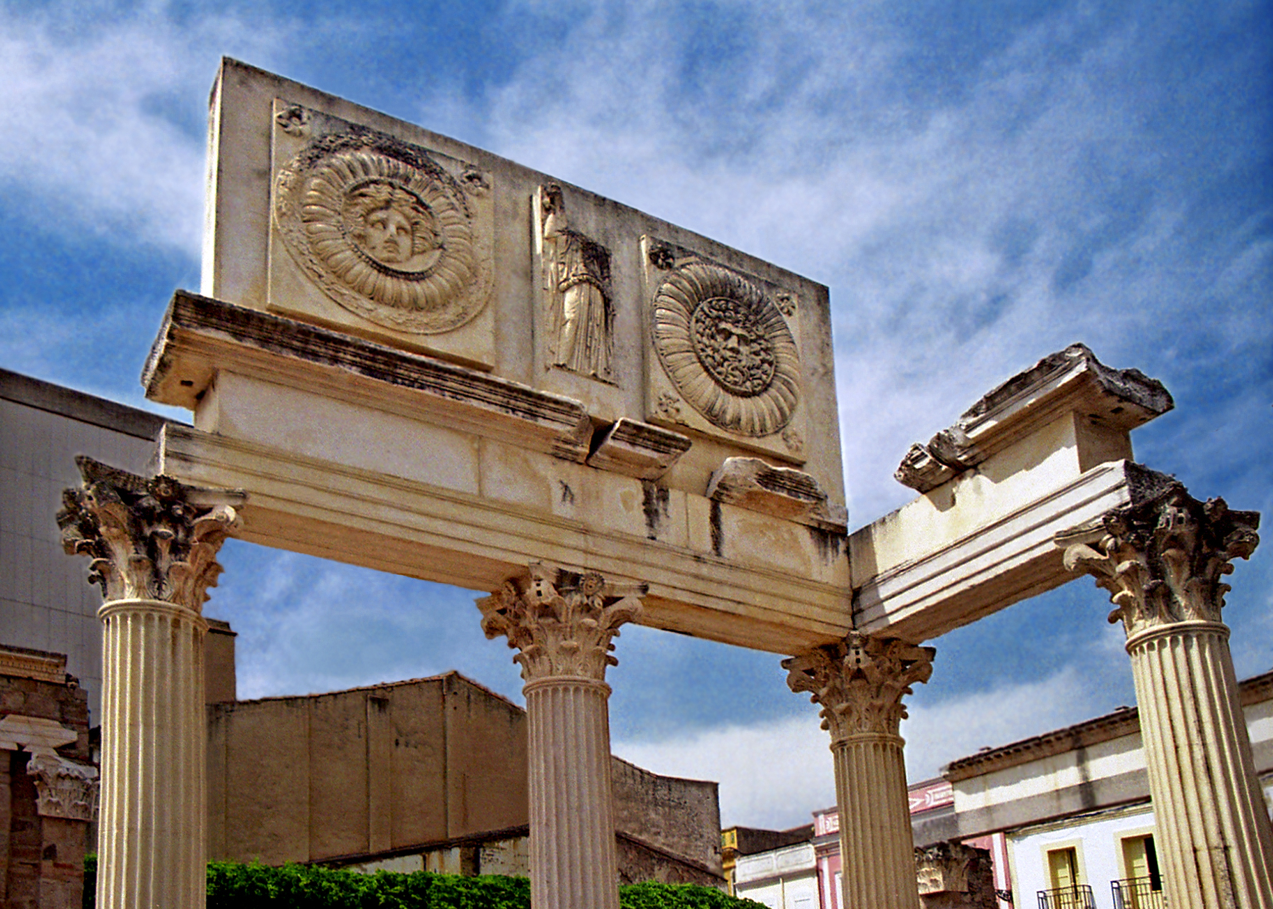
Temple to the Imperial Cult, Merida.Buildings of the Forum, Merida.
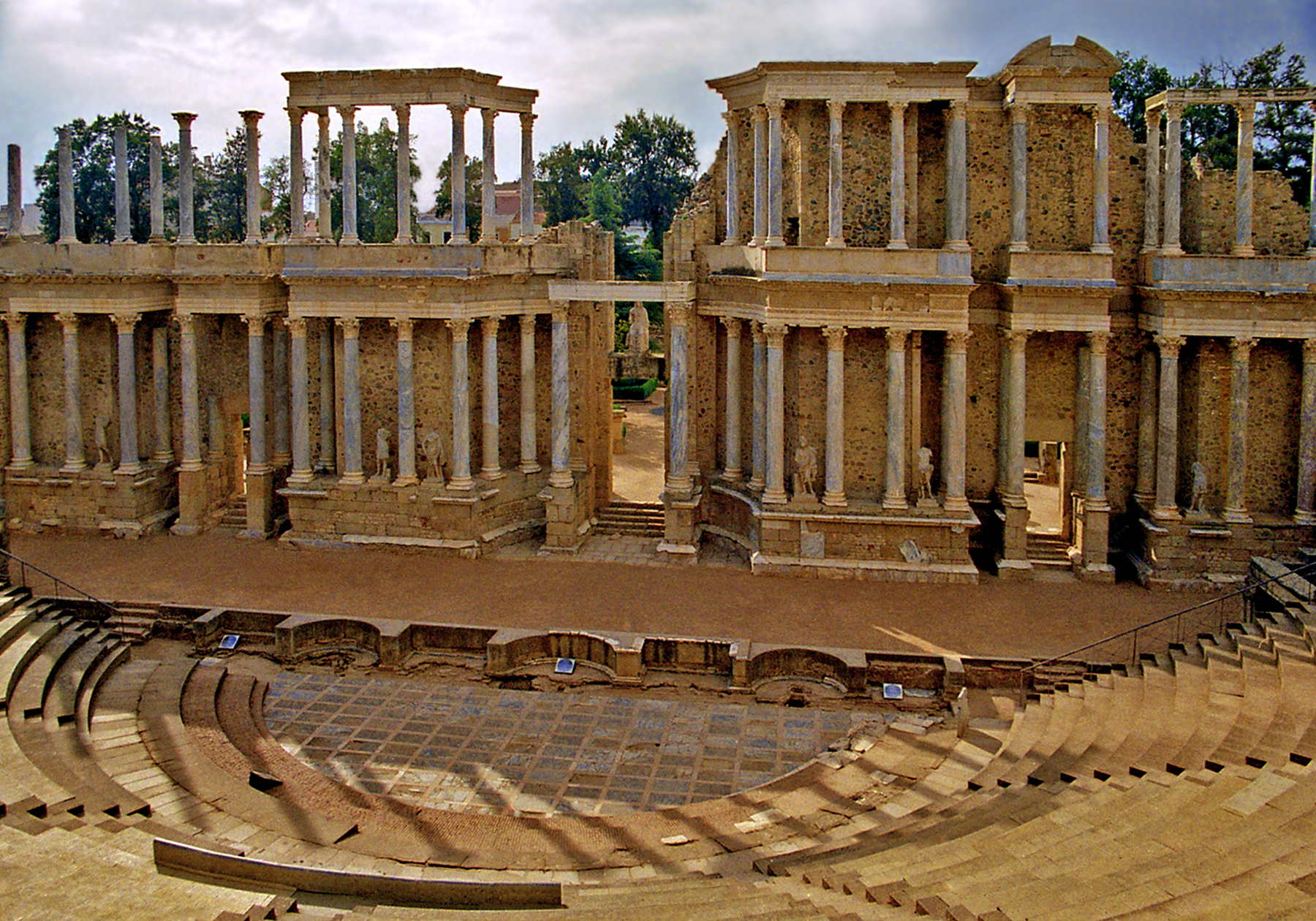
Emerita Augusta (Merida) was the capital of Lusitania, first settled in 25 BCE by the veterans of Augustus’ X and VI legions. While the roads, bridges and aqueducts bore witness to Roman engineering genius, Merida’s gleaming marble temples and theaters were designed as showcases to extol and promote Roman civilization.
Roman Theater of Merida.
The Archeological Ensemble of Merida, a UNESCO World Heritage site, has the most extensive and well preserved Roman ruins in Iberia and the outstanding National Museum of Roman Art displays hundreds of sculptures, mosaics, inscriptions and artifacts painting a fascinating picture of daily life in Roman times.
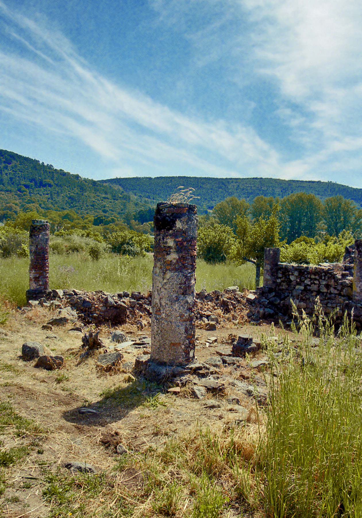
Ruins of Ammaia, Portugal
Many towns and cities of La Raya can trace their origins back to the Roman period. While some have retained their importance others have disappeared altogether, by-passed by time, leaving scant remnants of their former glory. Little remains of the once popu-lous Roman city of Ammaia, which flourished between the 1st and 4th centuries CE, along the banks of the Sever River beneath the promontory of Marvao.
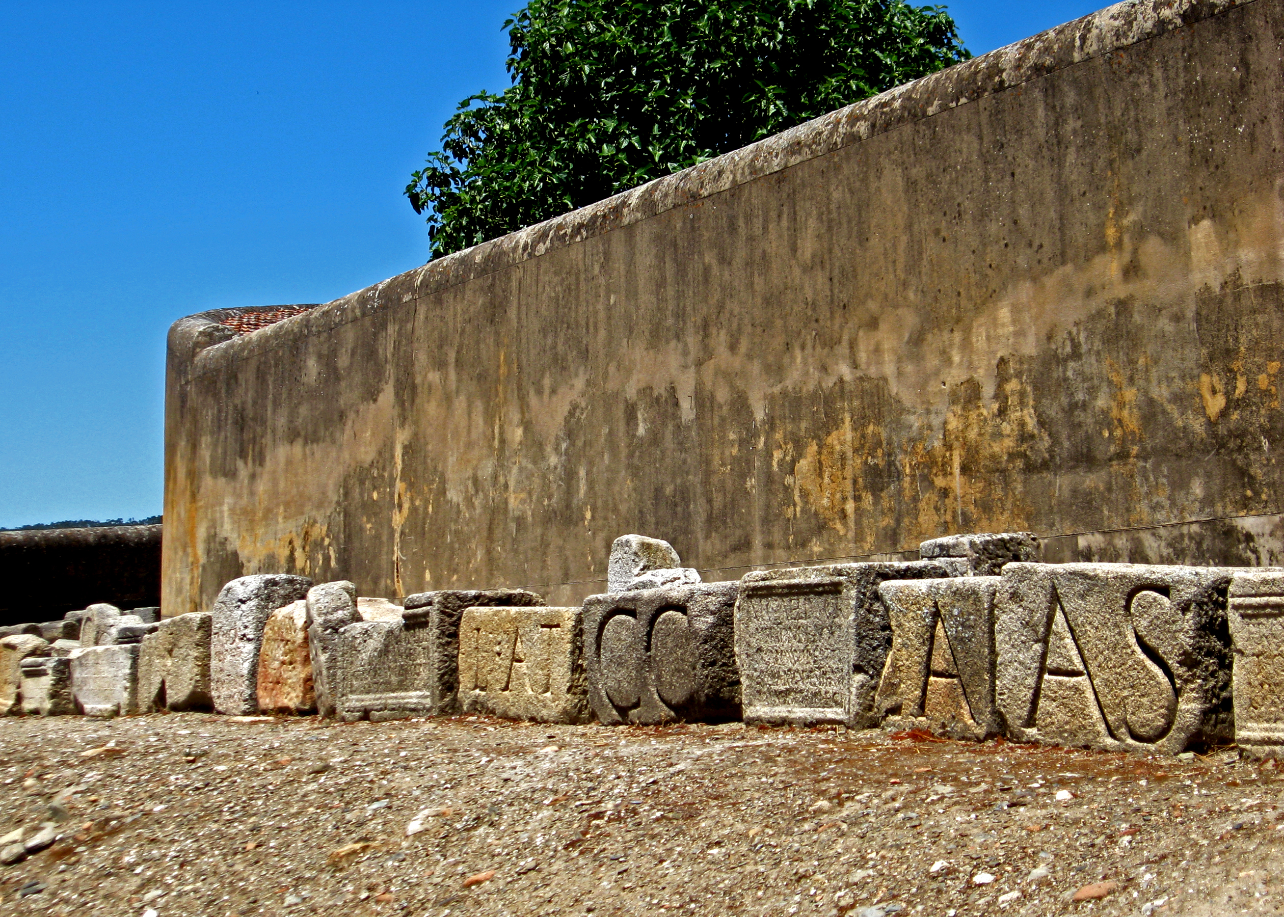
Numerous Roman Inscriptions of Ancient EgitaniaView of Idanha-a-Velha, Portugal
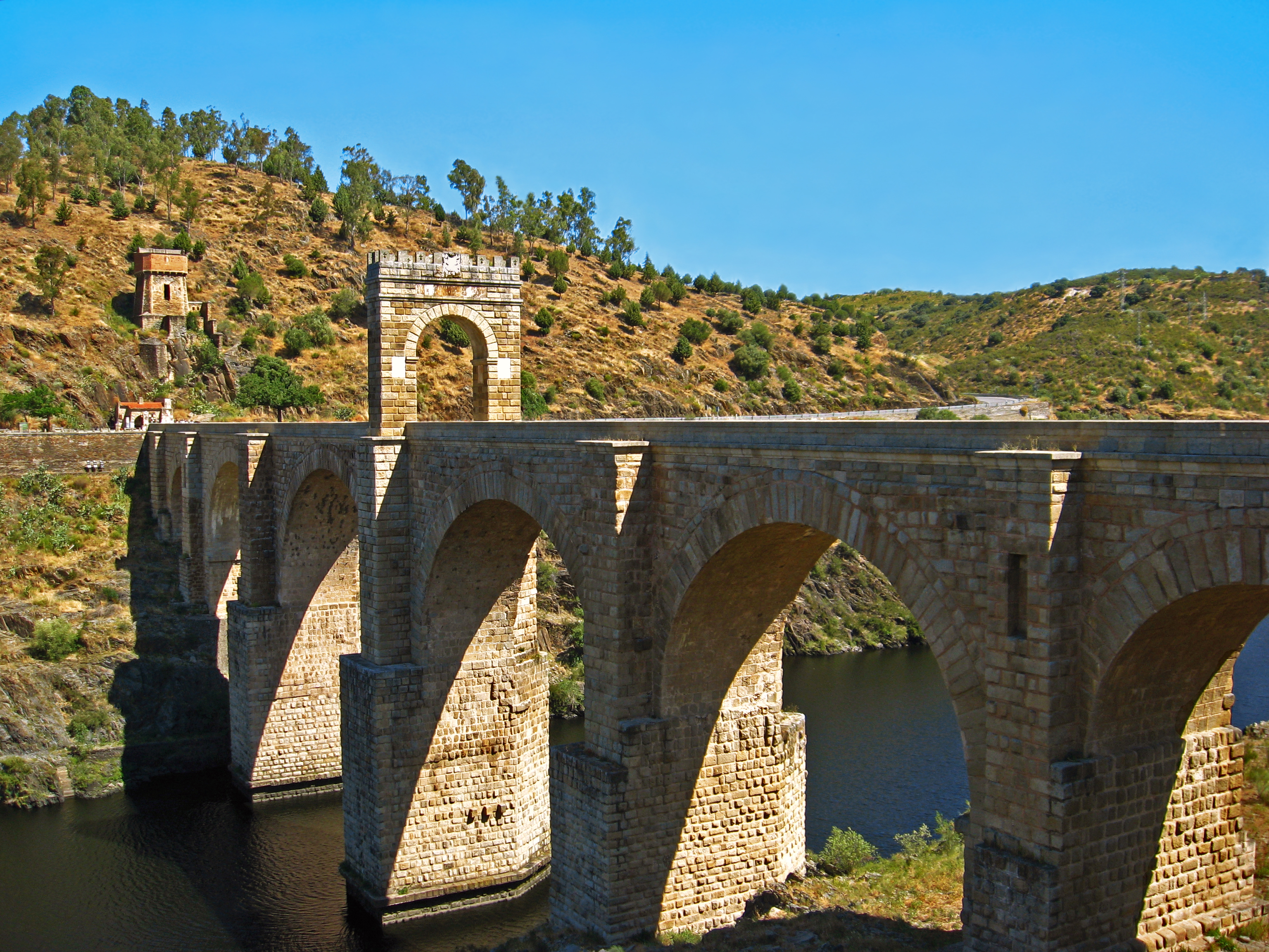
Idanha-a-Velha (the Roman Egitania) is a tiny Portuguese village encircled by ancient walls, seemingly set in the middle of nowhere and suspended in time. But this sleepy farming community was once an important early Christian bishopric, the birthplace of Visigothic kings and before that a thriving Roman city which contributed to the construction of the great Alcantara Bridge over the Tajo River.
The Roman Bridge of Alcantara, Spain..
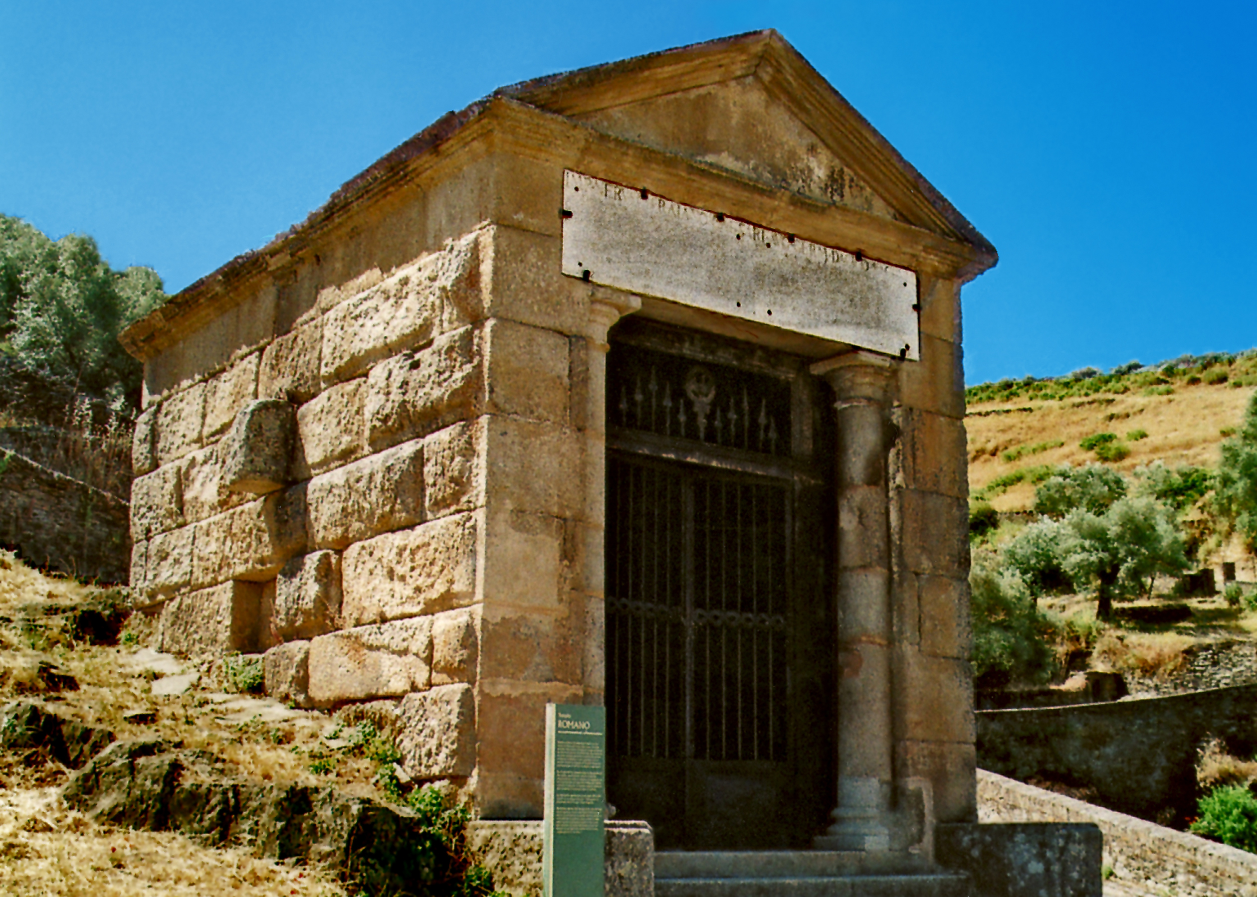
Dedicated to Emperor Trajan in 103 CE, it is a spectacular feat of engineering that has remained in constant use up to this day. A small temple to the emperor and the gods of Rome also contains the tomb of the intrepid bridge builder, Gaius Julius Lacer. It sits on a bluff above the river overlooking his enduring creation.
Temple of the Bridge Builder, Alcantara.
AL-ANDALUS The 4th and 5th centuries CE saw the gradual dissolution of Roman power in the wake of successive waves of invasion by Germanic tribes in their westward migration across Europe. From among these, the Visigoths won a tenuous hold over the Iberian Peninsula, ruling a fractious kingdom from their capital at Toledo. When the king’s rivals sought help from allies in North Africa, an army of Berbers newly converted to militant Islam found the territory of the Visigoths ripe for conquest. In 711 the Umayyad general Tariq led an expe-ditionary force across the Straits of Gibraltar (Jabal Tariq or Tariq’s Mountain) and toppled the weakened kingdom.
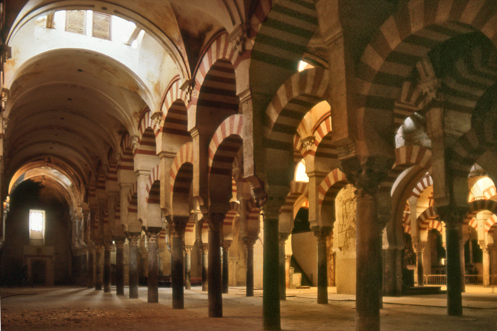
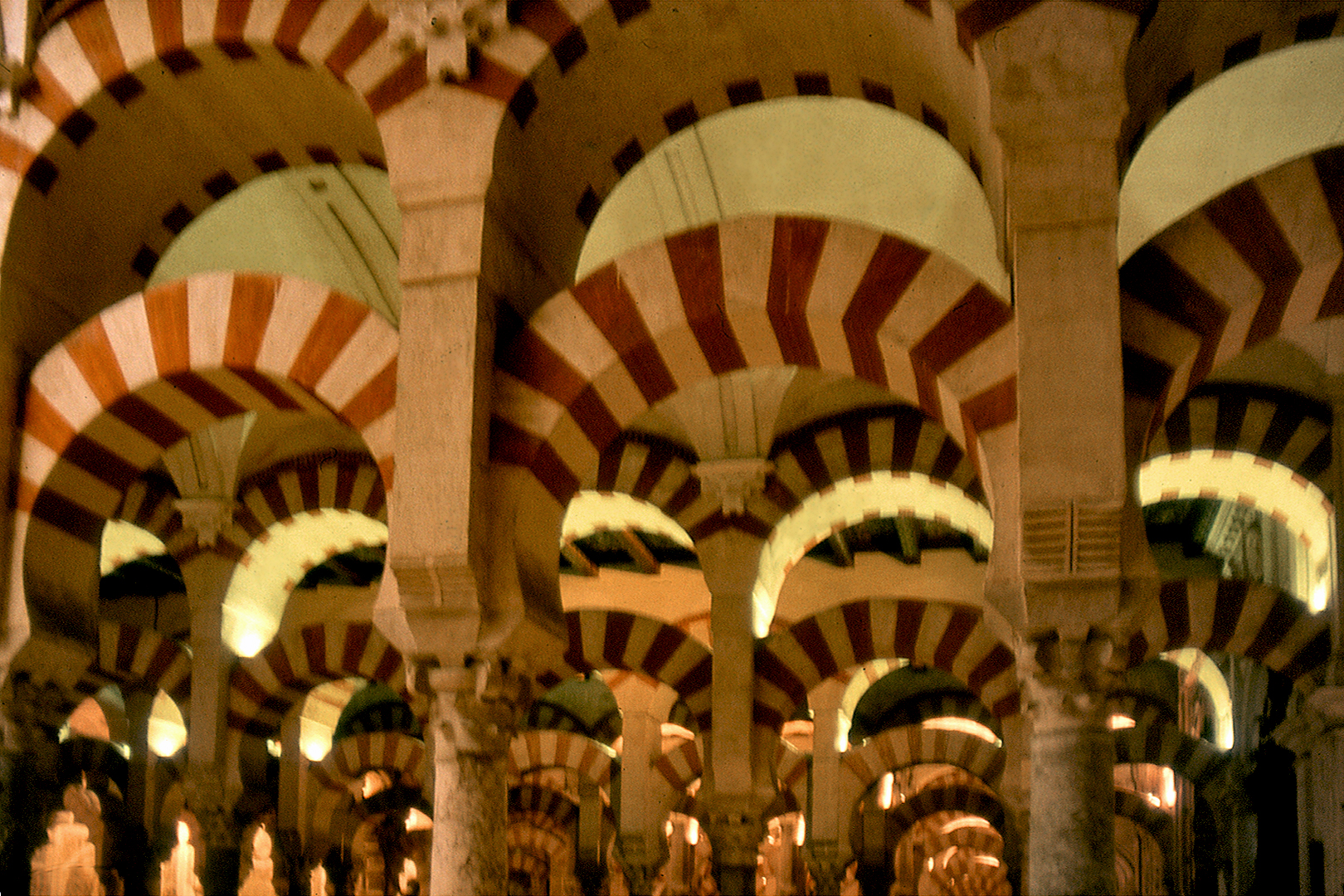
Views of the Great Mosque of Cordoba, Spain
Merida, which had retained its wealth and importance under the rule of powerful Christian bishops, fell after a protracted siege in 713. La Raya became part of al-Andalus, (the name given to the Iberian territories under Muslim rule) subject to the powerful Caliphate of Cordoba and, after its fragmentation, to the independent Taifa Kingdom of Badajoz.
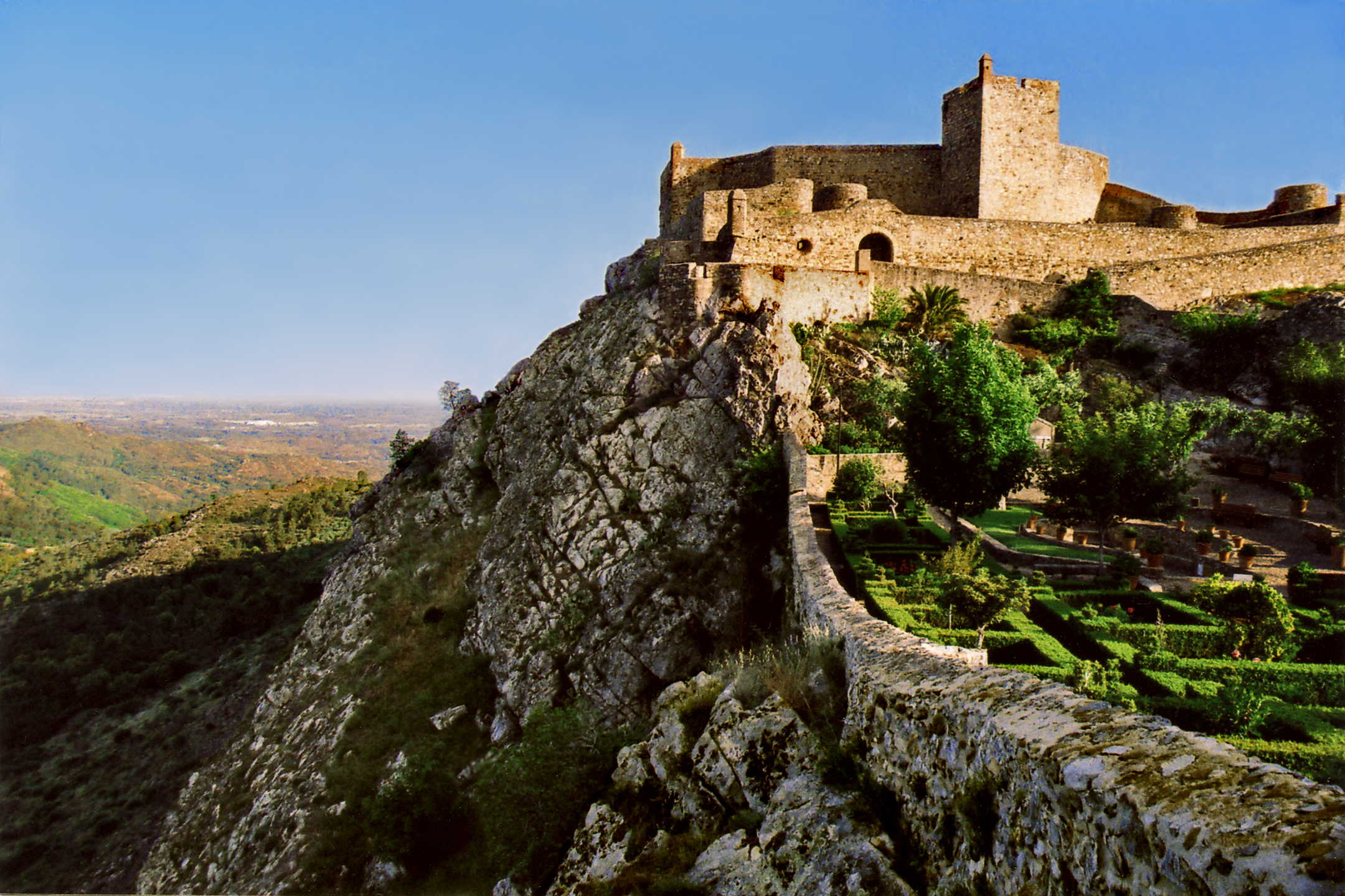
Mountaintop Town and Fortress of Marvao, Portugal (Named After Ibn Marwan)
For the most part, different cultures and religions coexisted peace-fully in al-Andalus; but ethnic divisions within Muslim society and the heavy tax burdens imposed on the Christian population led to sporadic uprisings. The 9th century rebel leader Ibn Marwan, whose Galician ancestors had converted to Islam and become governors of Merida, typifies the mixed society and fluid alliances of the times. He led a rebellion against the Caliphate, fleeing to the impregnable fastness of Marvao and allying with the Christian Kingdom of Leon. He was eventually granted his own lands by the caliph, where he founded the city of Badajoz (Batalyaws) and began construction of its magnificent Alcazaba fortress.
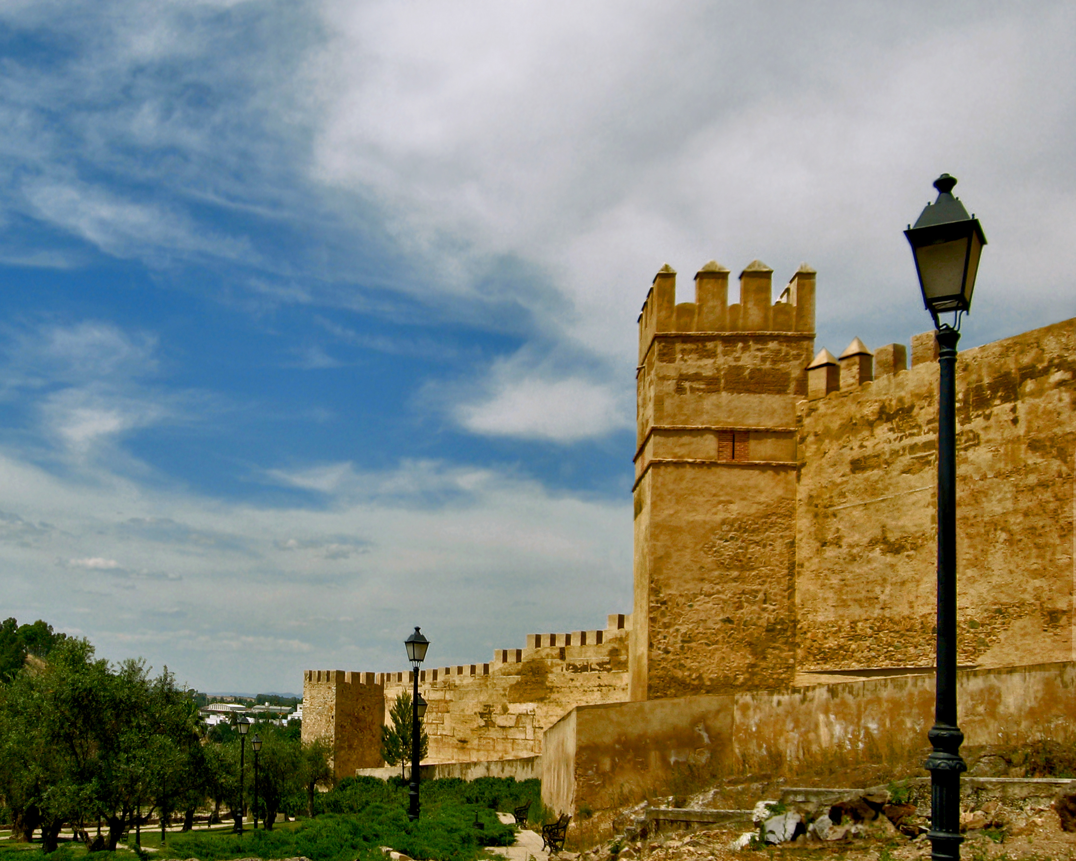
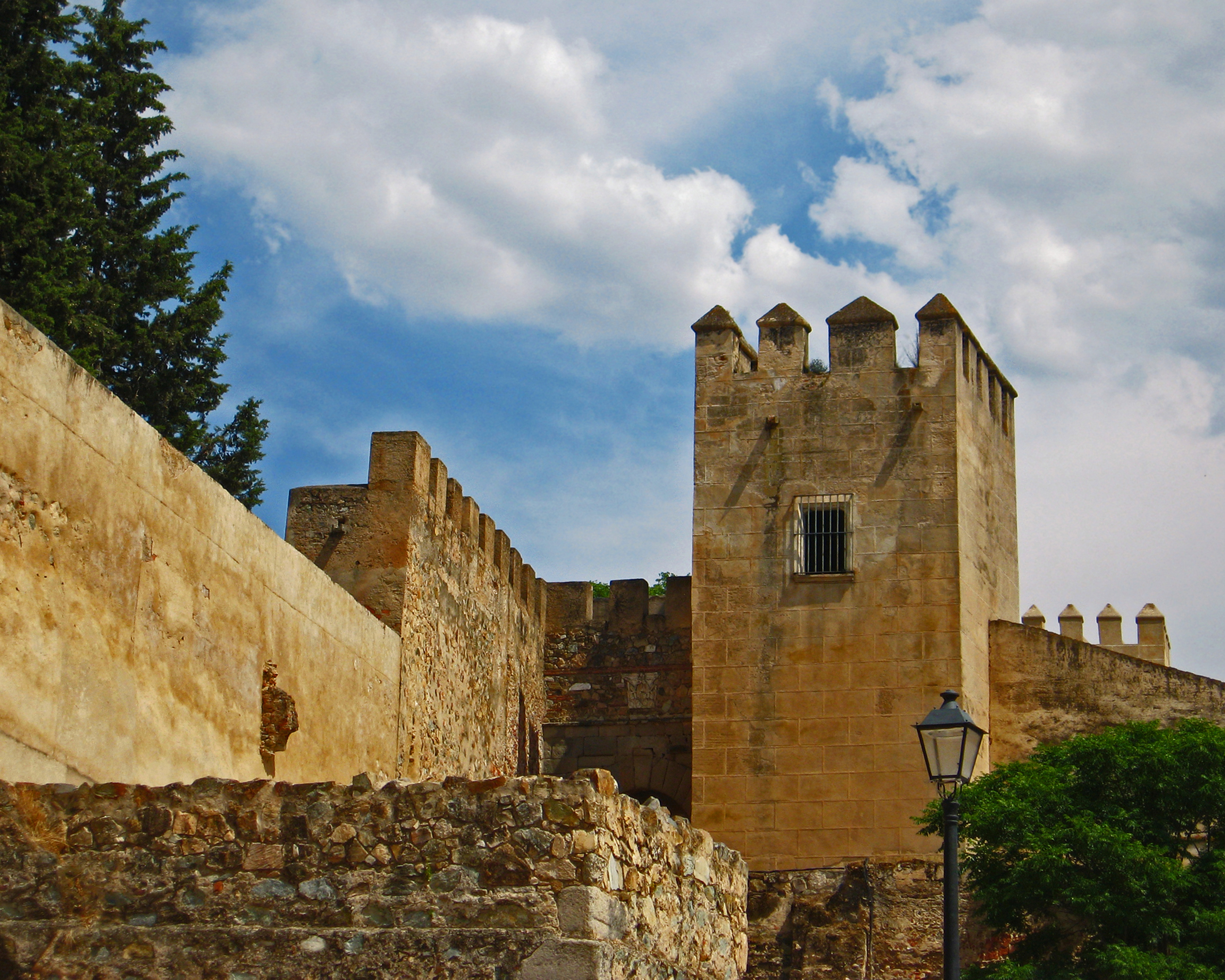
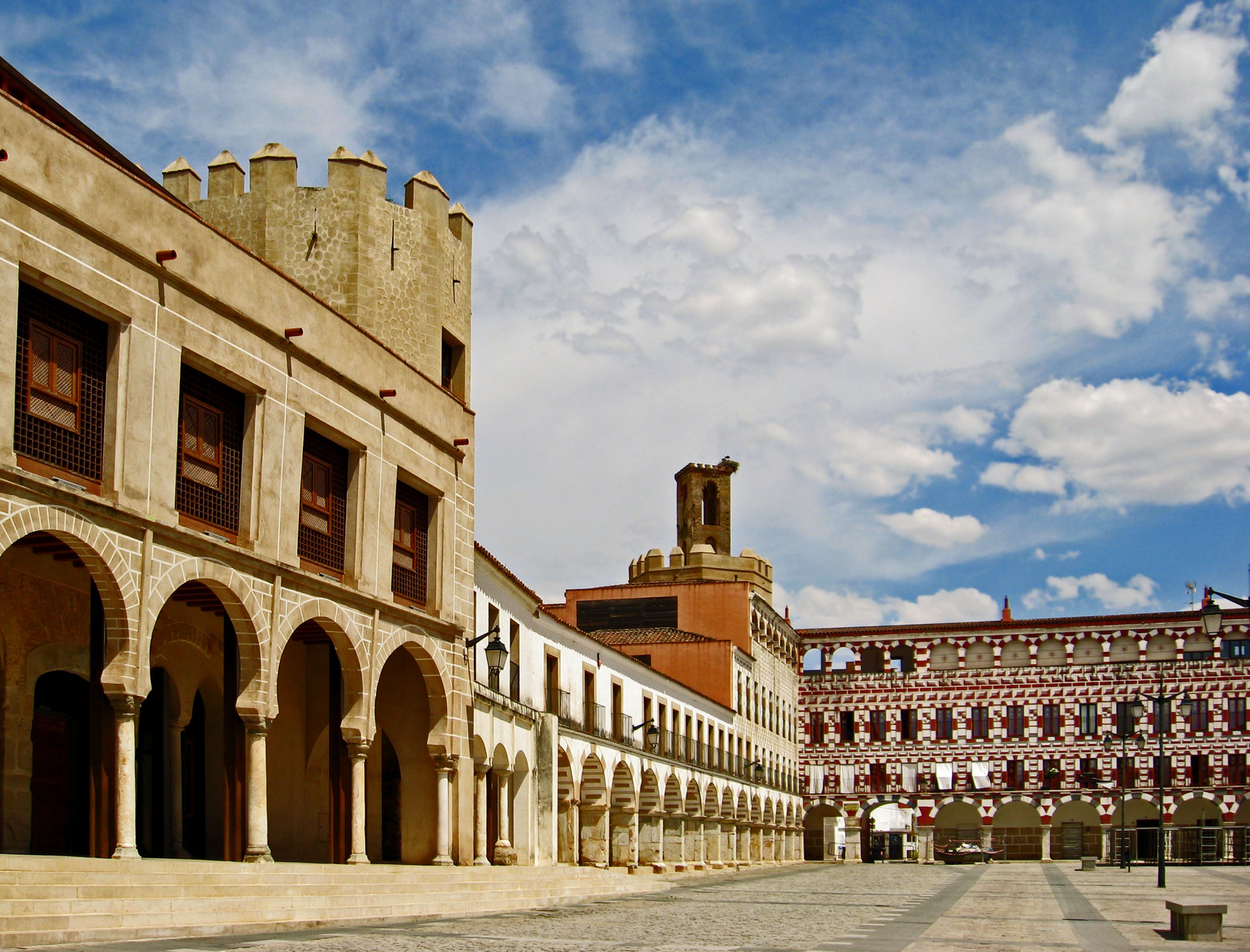
Views of the Alcazaba Fortress in Badajoz, Spain.
The historic city of Evora, an ancient megalithic center and thriving Roman town, was ruled by the Moors from the 8th to the 12th centuries. During the Reconquista it was taken by the legendary Portuguese warrior Geraldo Sem Pavor (Gerald the Fearless). Famous for his daring surprise attacks, he led a successful guerrilla war against the Moors throughout the Alentejo and Extremadura from 1162-1172, capturing numerous castles and towns. Taken prisoner during the siege of Badajoz, Gerald was forced to relinquish most of his conquests in exchange for his freedom. The wily adventurer finally met his end in Morocco where, accused of espionage, he was executed by the Almohads.
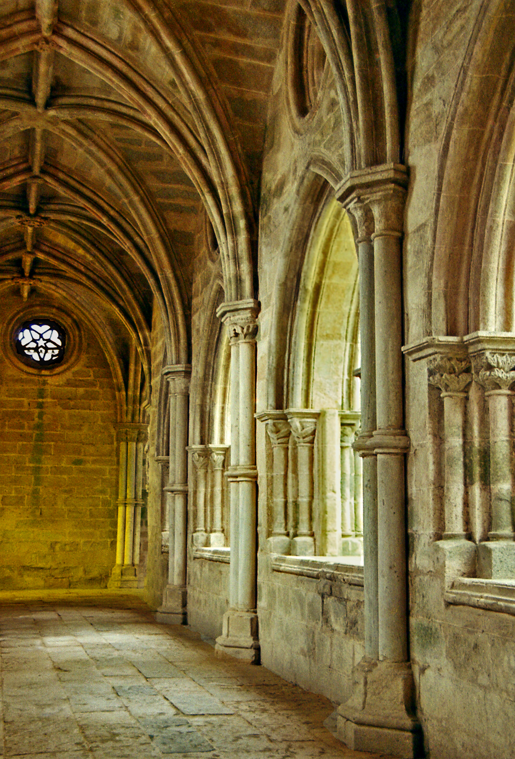
View of Evora Cathedral and Cloister, Portugal
Begun soon after Geraldo’s conquest, the Cathedral of Evora was built in a robust Romanesque style. The stone walls topped with crenellations impart an imposing military air to the structure. Battlemented square towers flank the plain façade which was em-bellished with a finely sculpted portal and rose window in the 14th century, when the beautiful Gothic cloister was also added.
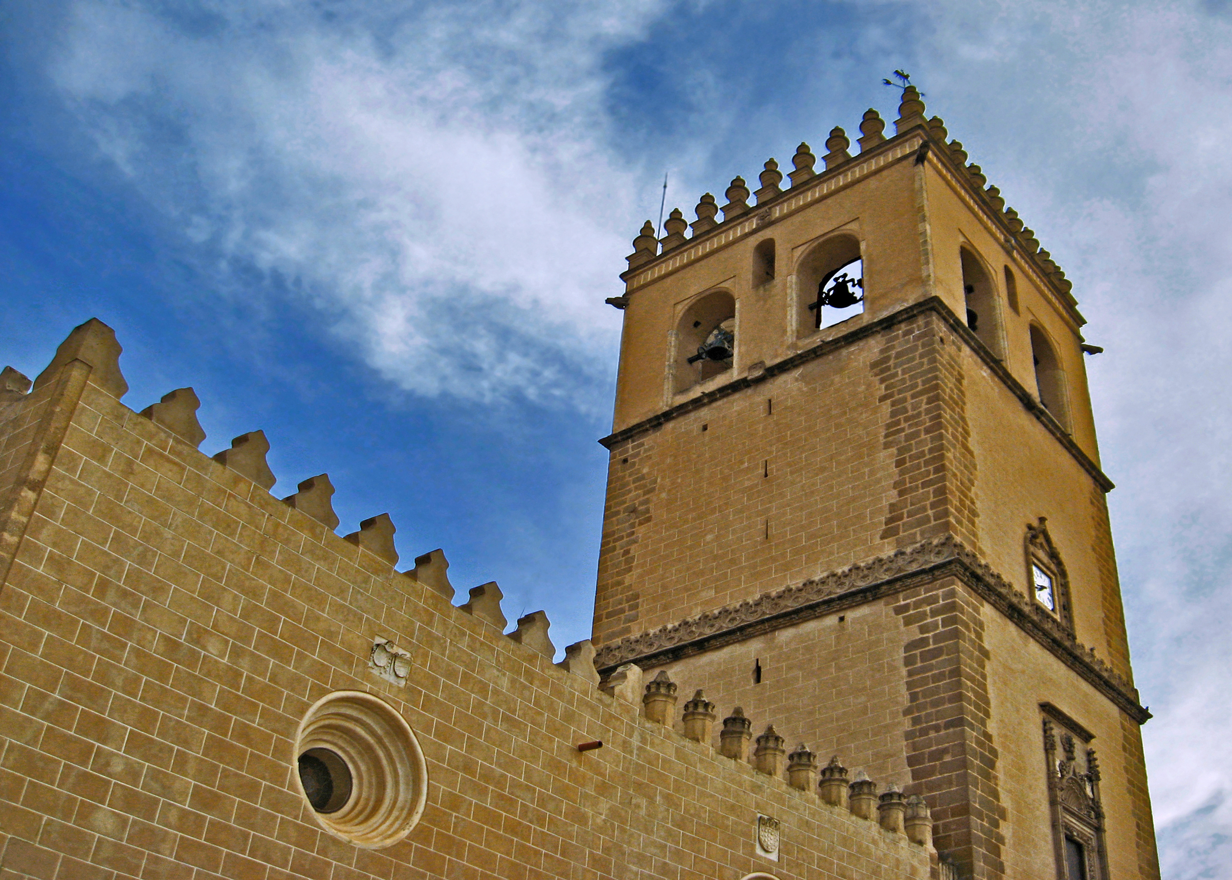
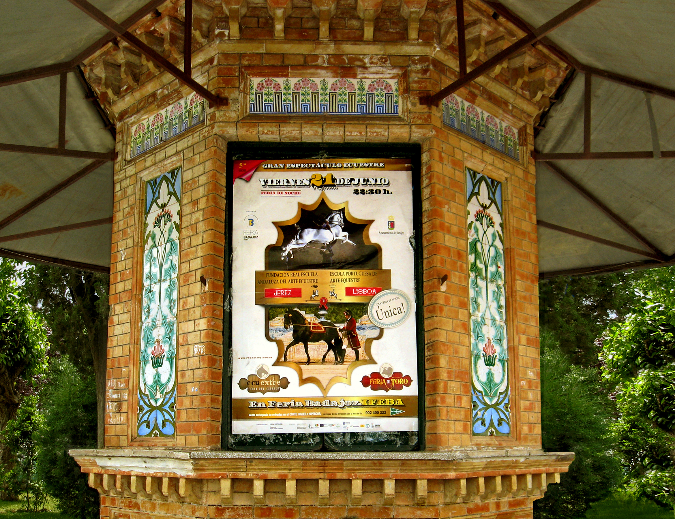
Plaza Alta in Badajoz, Spain
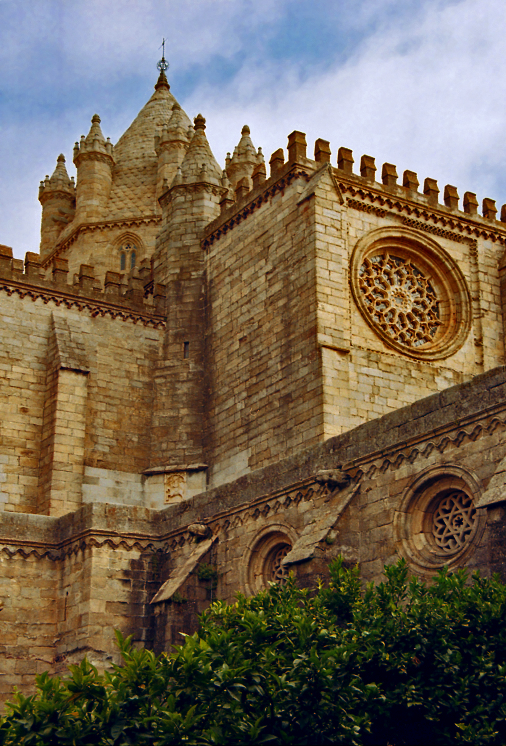
Badajoz remained an independent Muslim kingdom ruling over the territory of La Raya until 1230, when in the course of the Recon-quista it fell to the king of Leon. Construction of the cathedral of Badajoz began shortly thereafter and would continue on and off until the 16th century. Its massive plain exterior lacks the airy grace of flying buttresses and large stained glass windows typical of the prevailing Gothic style. Instead, due to scarce resources and the practicalities of defense it stands, literally, as a fortress of the faith.
Cathedral of Badajoz, Spain
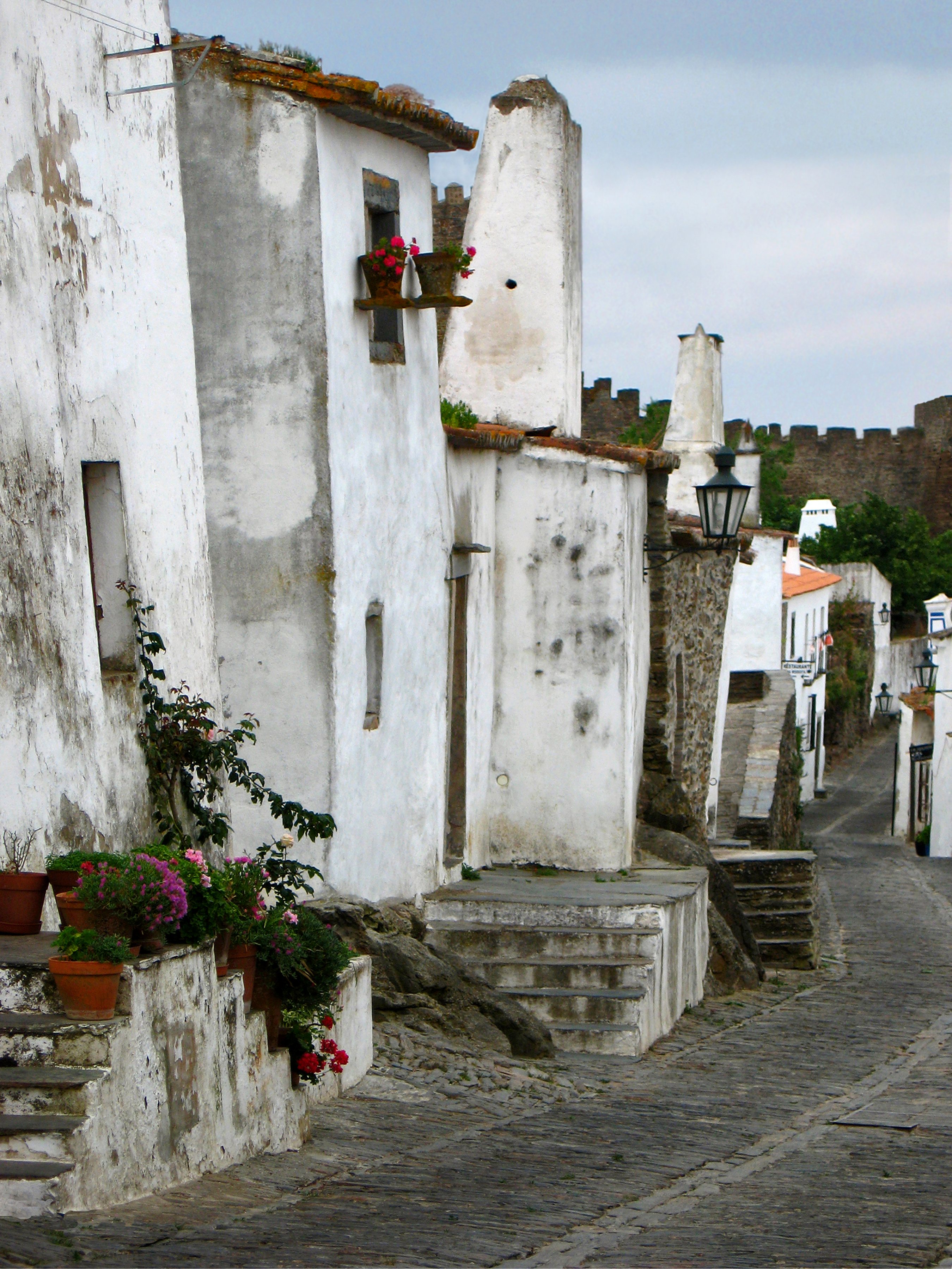
RECONQUISTA By the 9th century, only a strip of land at the northernmost edge of Spain remained in Christian hands. This small enclave would later grow into the kingdoms of Leon, Castile and Aragon and launch the Reconquista, the centuries-long struggle to wrest the peninsula from Muslim rule. For all that time La Raya was a perpetual battlefield, subject to the ebb and flow of changing boundaries; as a result large areas became depopulated. To this day, Extremadura remains the least populous region of Spain.
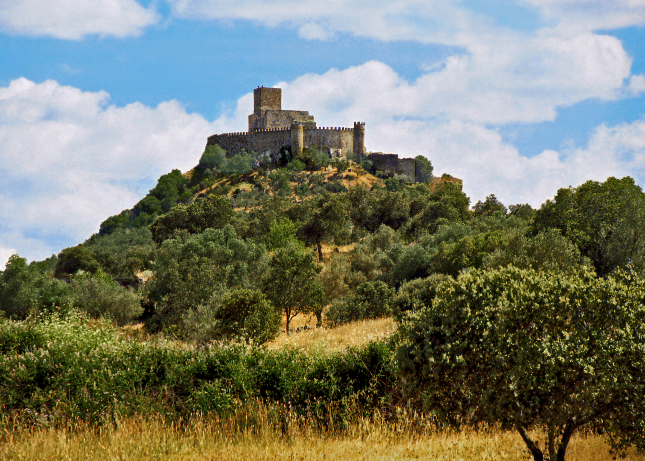
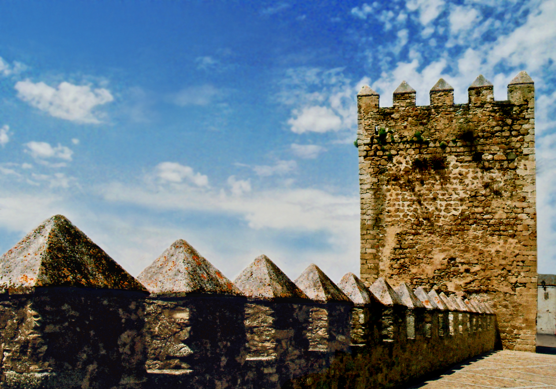
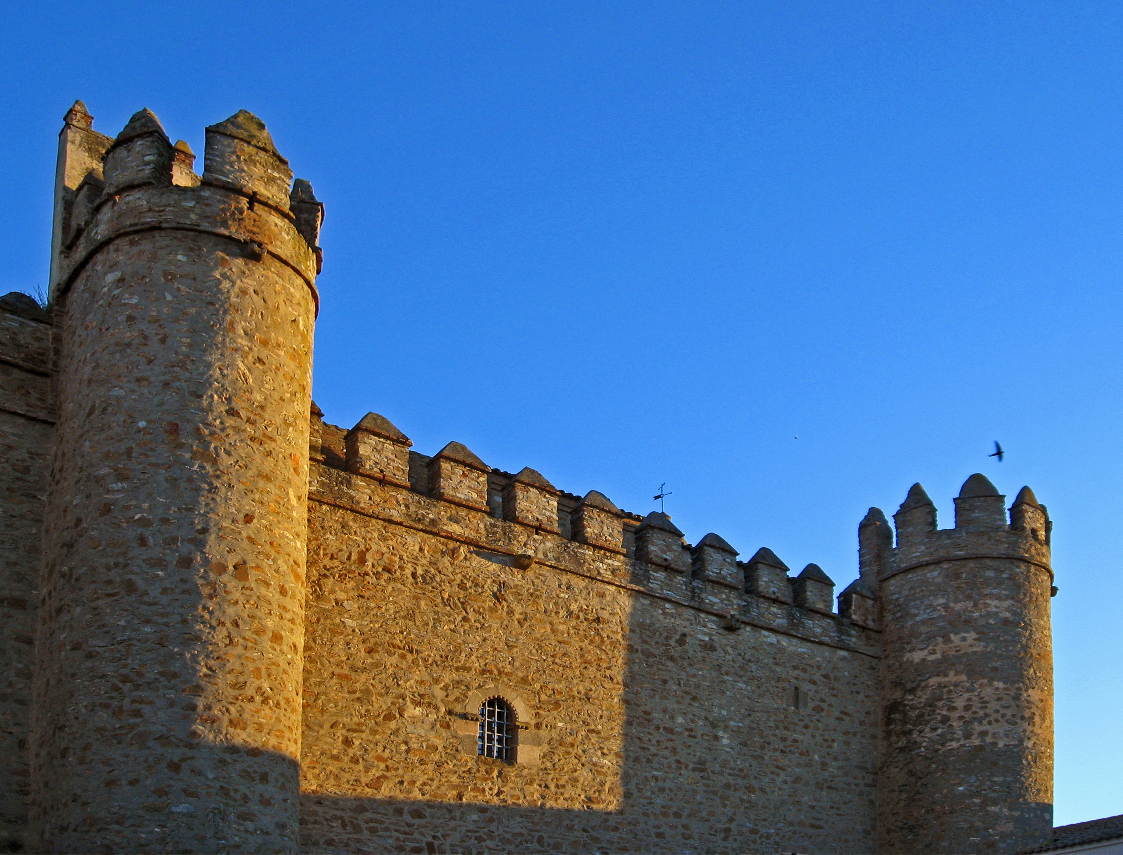
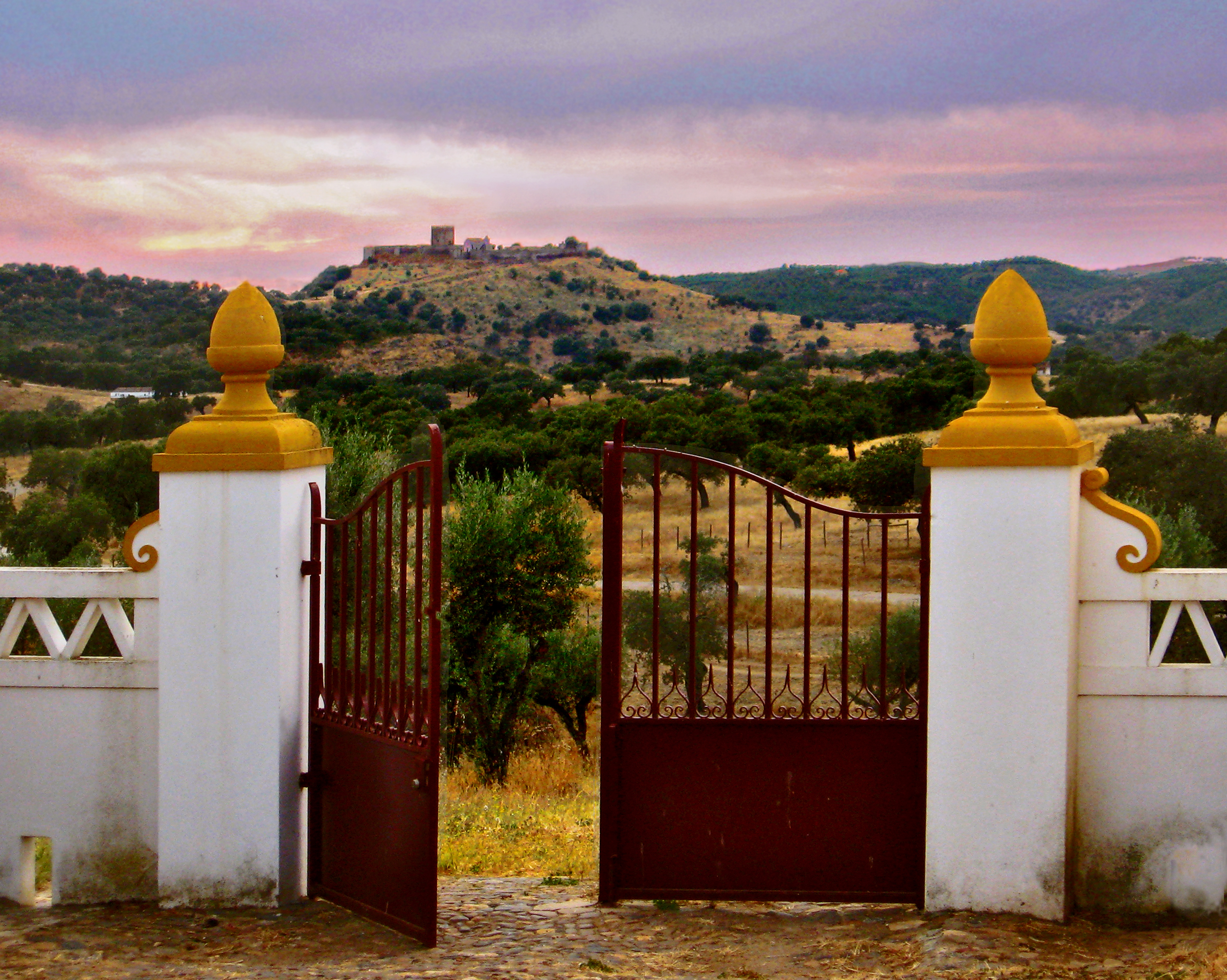
Castle of Alconchel, Spain
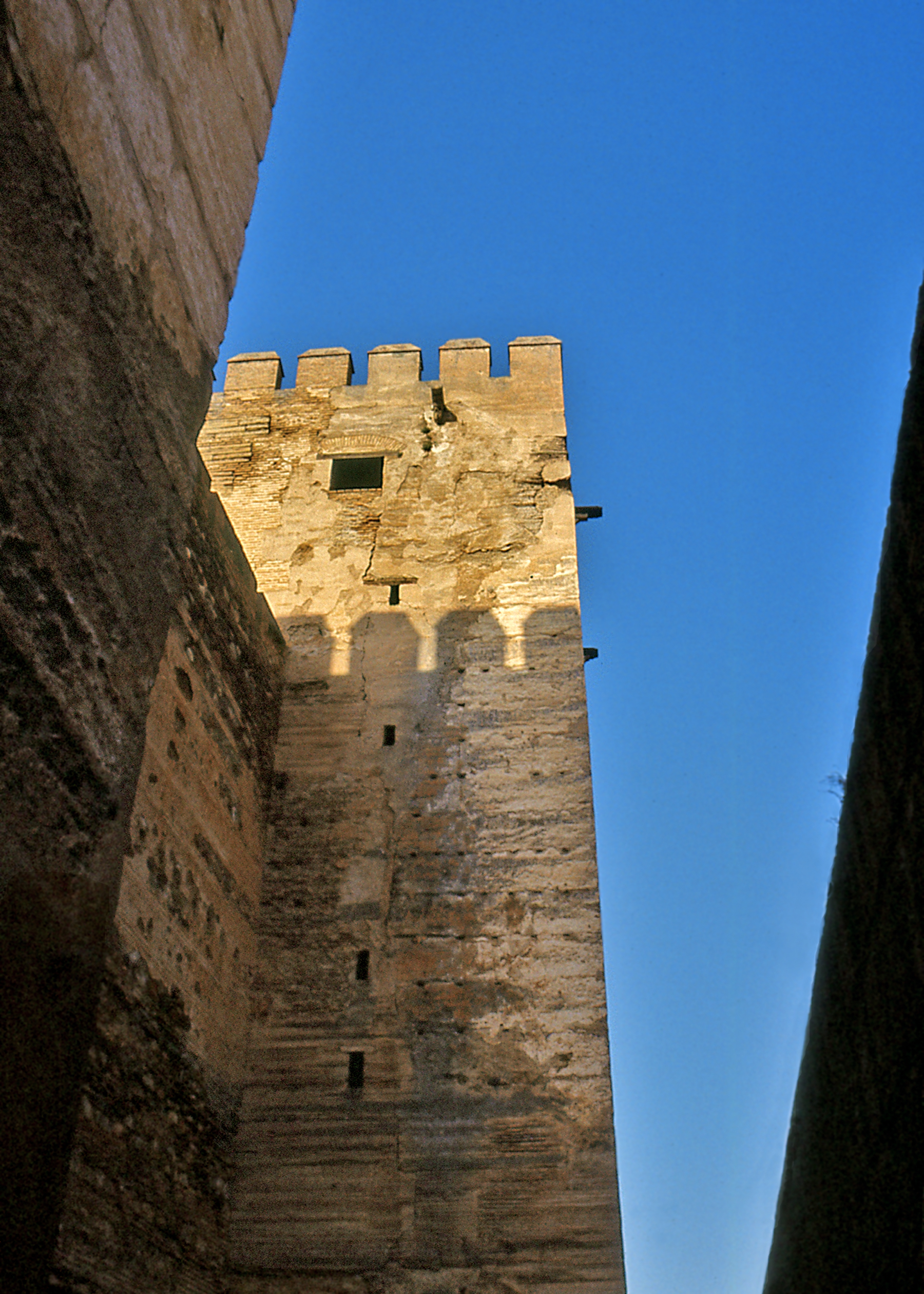
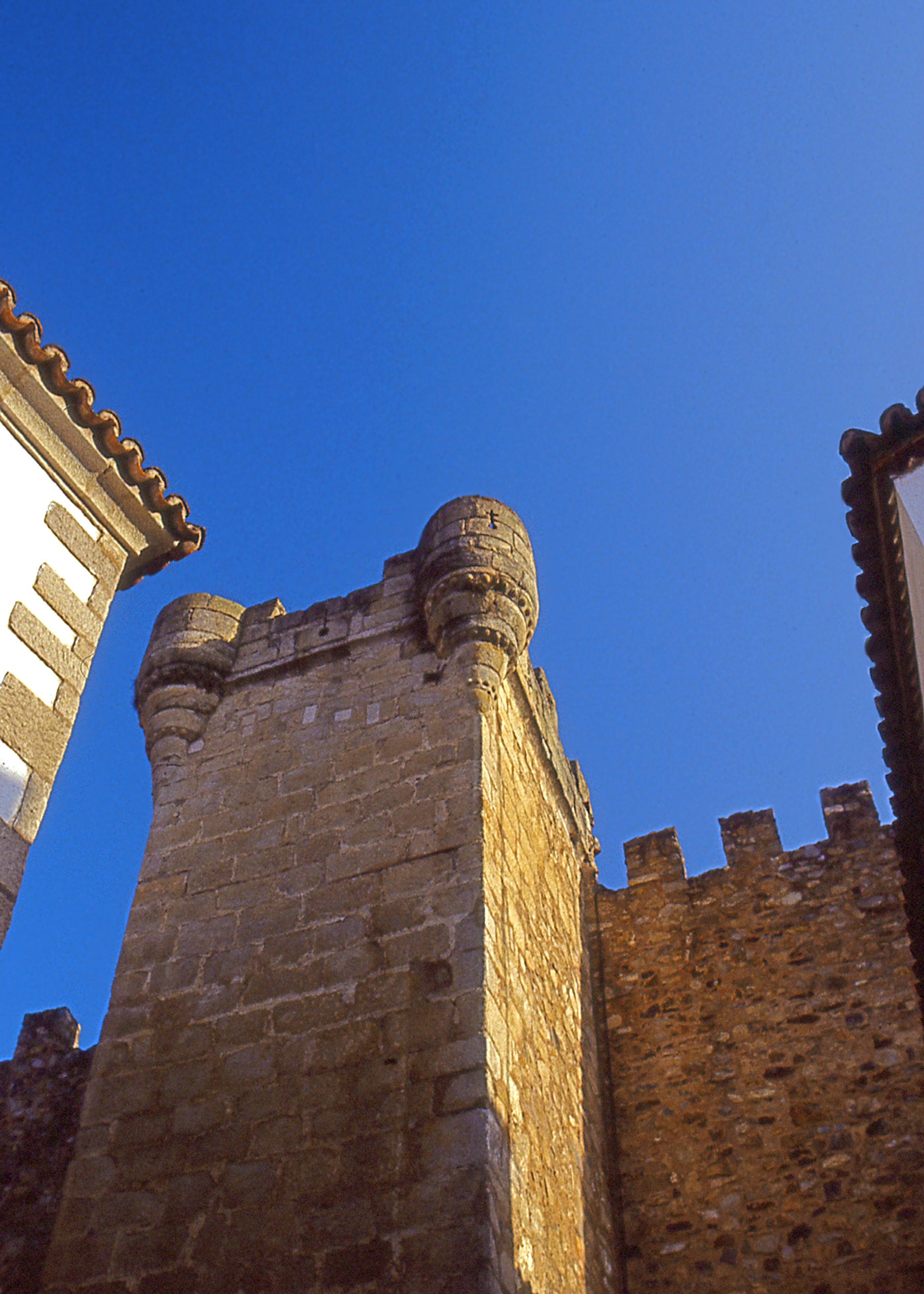
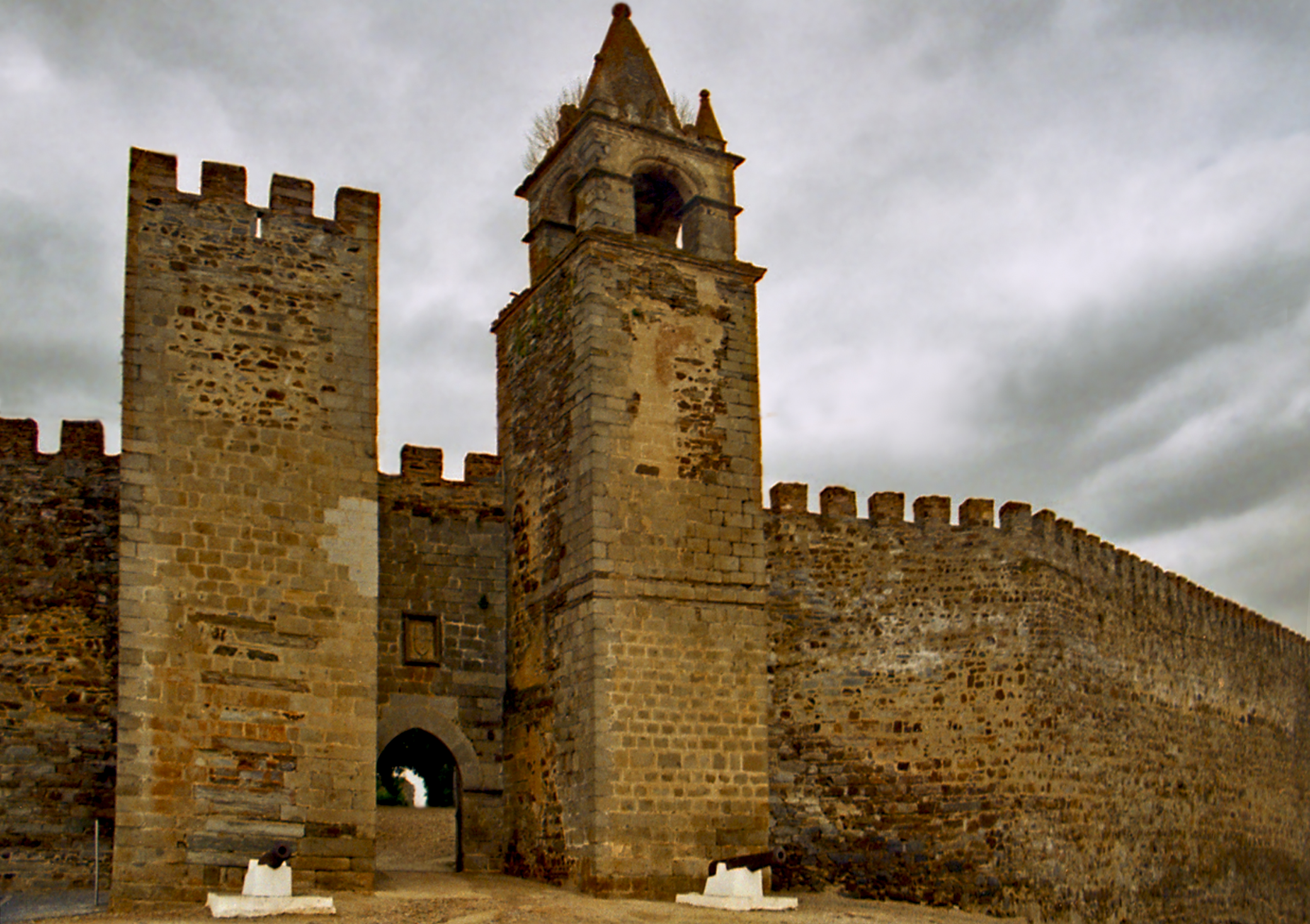
To assist with their ongoing crusade the Christian kings relied on military orders like the Templars and Hospitallers who, together with the Spanish Knights of Santiago and Alcantara and the Portuguese Knights of Christ and Avis, were granted fiefdom of re-conquered lands. To that end, the military orders and feudal nobility alike vied in building the numerous fortified castles which still dot the country-side. Throughout La Raya their remains can be found perched atop almost every natural elevation, seemingly growing out of the rocks. Their lofty towers and crenellated walls command sweeping views of the landscape guarding against the approach of enemy armies.
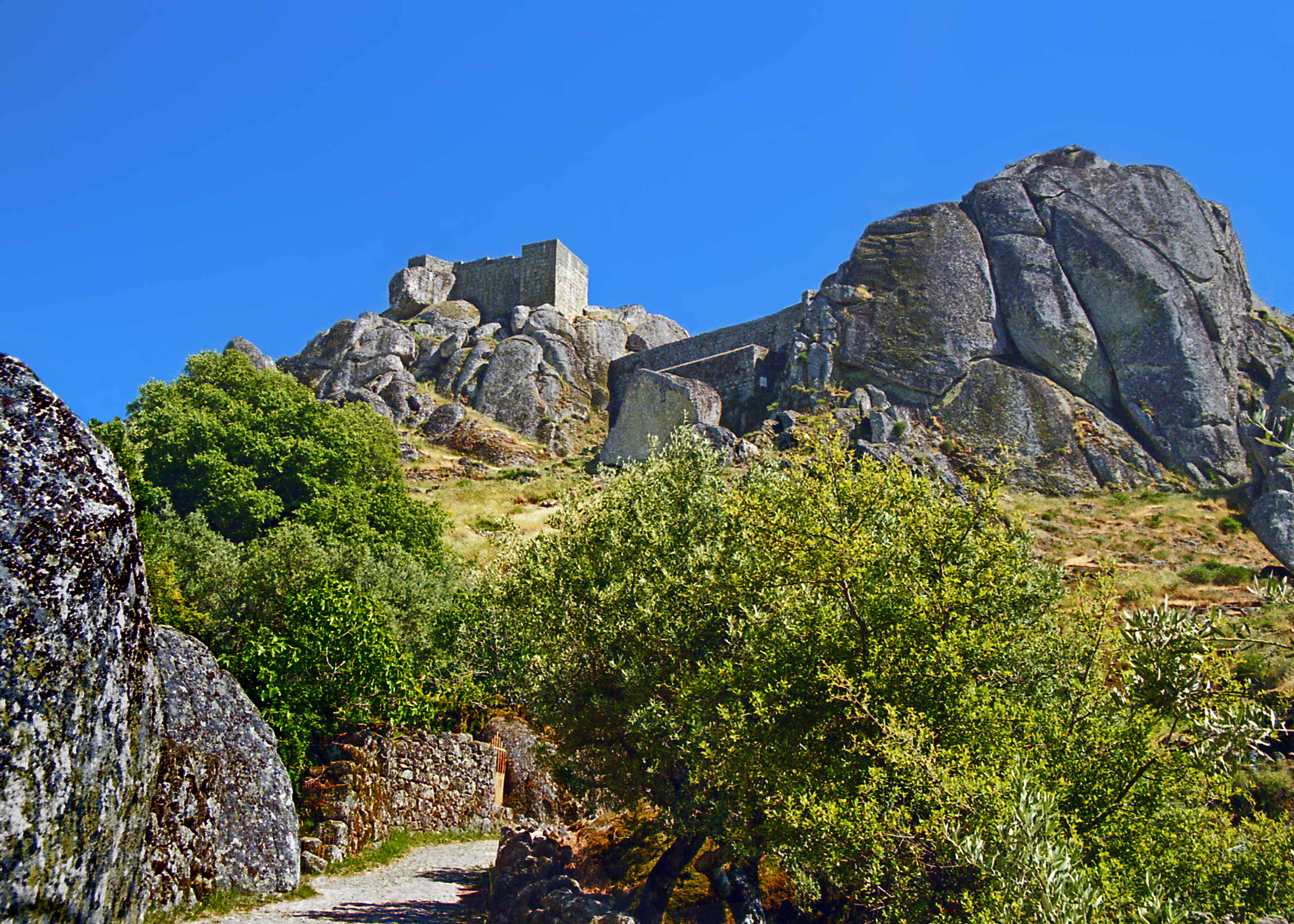
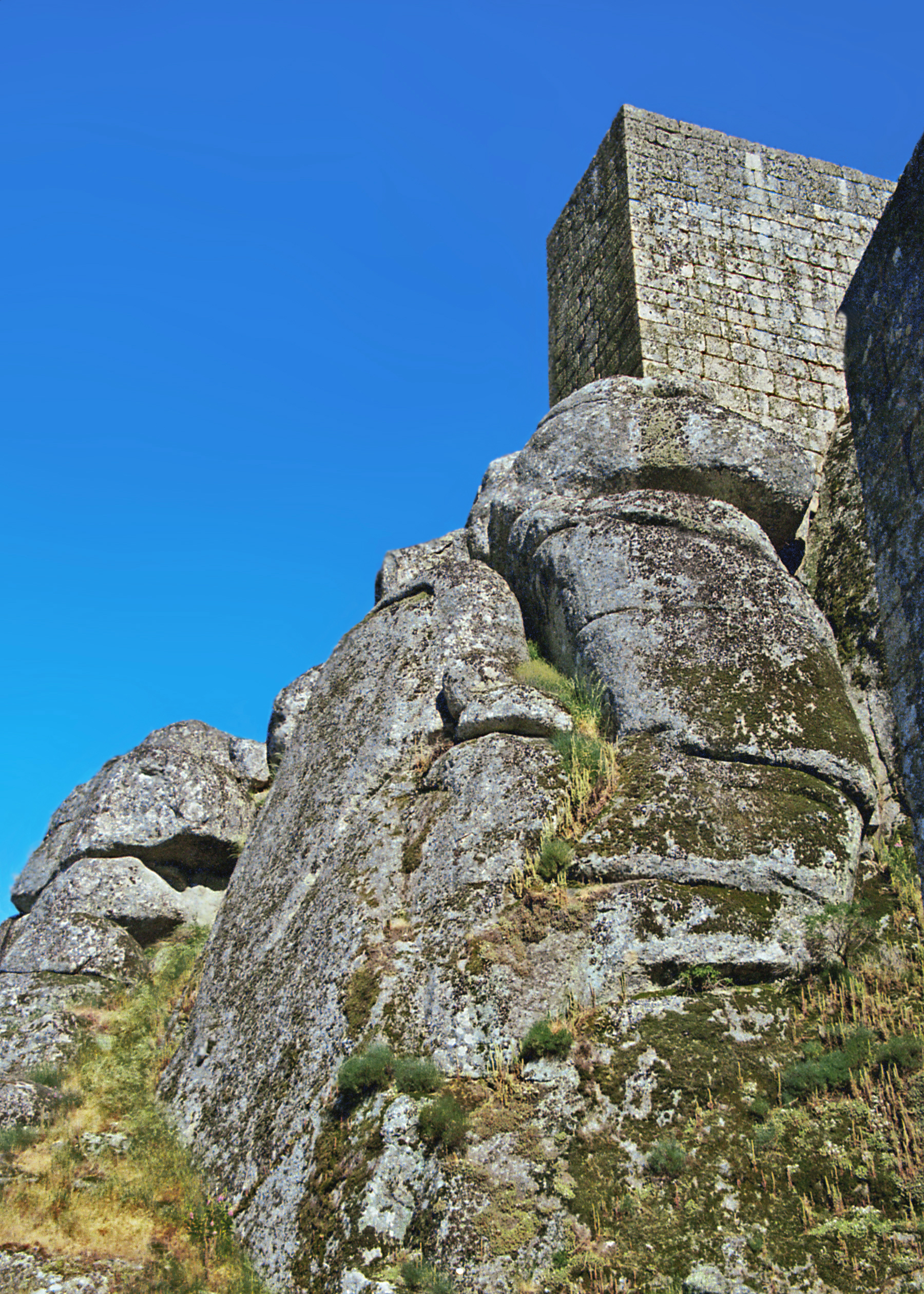
Templar Fortress of Monsanto, PortugalGranite Boulders of the Castle
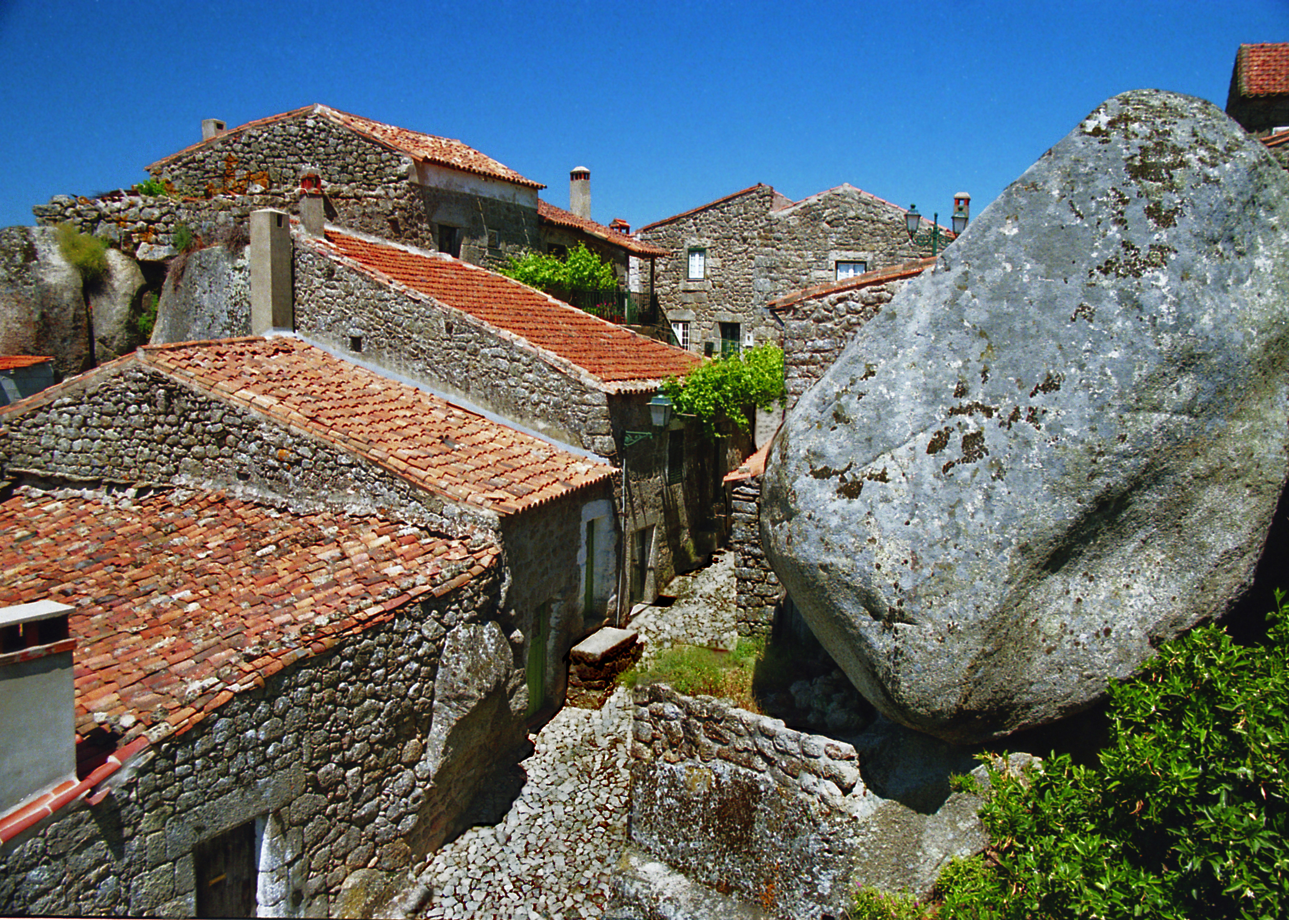
The spectacular promontory of Monsanto (the ‘mons sanctus’ cited by Roman historians) was sacred to Celtic peoples of the region. The impregnable heights resisted the Romans and Moors alike. Its powerful mystical am-biance was recognized by the Portuguese Templars who built a fortress here in the 12th century, incorporating the massive granite boulders into the structure, as do many of the old stone houses in the picturesque town that clings to the steep slopes below.
Stone Houses of Monsanto, PortugalBattlements of the Templar Fortress of Jerez de los Caballeros, Spain
Most of southern Extremadura was controlled by the Knights Templar from their headquarters at Jerez de los Caballeros and imposing castles at Alconchel, Fregenal de la Sierra and Burguillos del Cerro. In 1312 facing charges of heresy and the dissolution of their order, Templar knights staged staged a bloody last stand at their fortress in Jerez de los Caballeros choosing death over surrender. Their landholdings were forfeit to the Crown which sold or granted them to loyal families among the nobility.
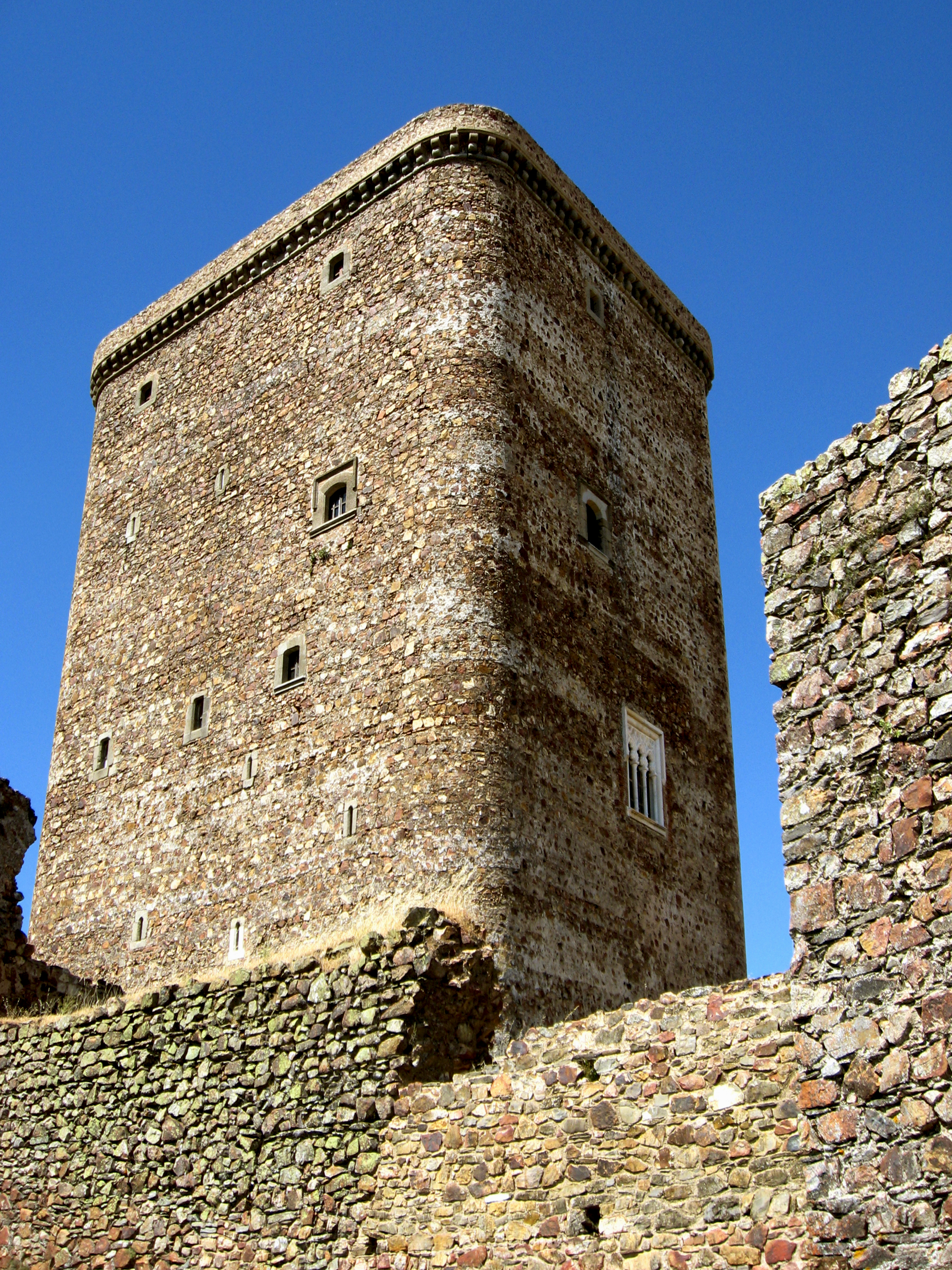
Massive Keep of the Castle High Above the Town of Feria, Spain
The Dukes of Feria, based in Zafra, thus became powerful feudal lords owning vast territories throughout the region. Landholding patterns established in response to the challenges of the Reconquista gave rise to the latifundia common in Extremadura; where huge tracts of land, neglected by absentee owners and worked by impoverished peasants, long hindered economic development.
Castle of Zafra, Spain
WORLDS WON & LOST 1492 was a momentous year for Spain. It marked not only the discovery of the New World, but the conclusion of the Reconquista with the fall of Granada, the last bastion of Islam in the peninsula. It also marked the expulsion (or forced conversion) of Muslims and Jews and the beginning of a downward spiral of religious and social intolerance exemplified by the Inquisition.
Top: Church on the Plaza of Monsaraz (Pillory Post in the Rear) Bottom: Plaza Vieja in Zafra, Spain. Folk Architecture in Monsaraz, Portugal.
After five centuries as part of al-Andalus, there were large Muslim populations and Jewish communities throughout the region. The loss of so many farmers, skilled artisans and traders would disrupt and impoverish the economy of La Raya.
Top: Former Synagogue (Converted into a Church) in Caceres, Spain Bottom: Jewish Quarter and the Old Synagogue Museum of Castelo de Vide, Portugal
The beautiful Portuguese hilltop town of Castelo de Vide boasts a well preserved medieval Jewish quarter. Walking along the steep cobblestone streets visitors can still find ancient stone doorways indented to hold a mezuzah. The former synagogue, restored as a museum, displays the names of victims of the Inquisition (established in Portugal in 1536 ) as a reminder of what was lost.
View of the Town and Ancient Doorway, Castelo de Vide
But the exploration and conquest of the Americas opened up new horizons for ambitious adventurers and warriors hardened by centuries of the Reconquista. Most of the explorers and conquis-tadors of the Americas hailed from Extremadura, including Cortez and Pizarro, the conquerors of the Aztec and Inca empires.
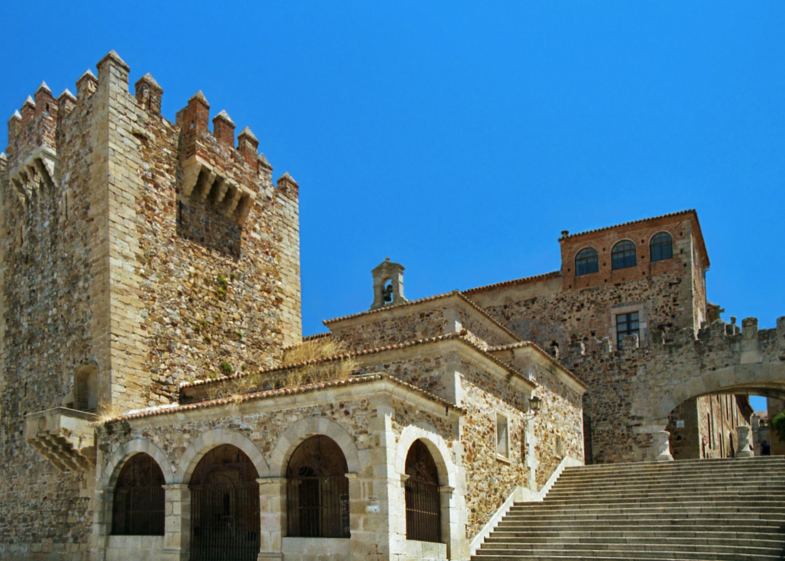
Statue of Pizarro and City Walls of Trujillo, Spain
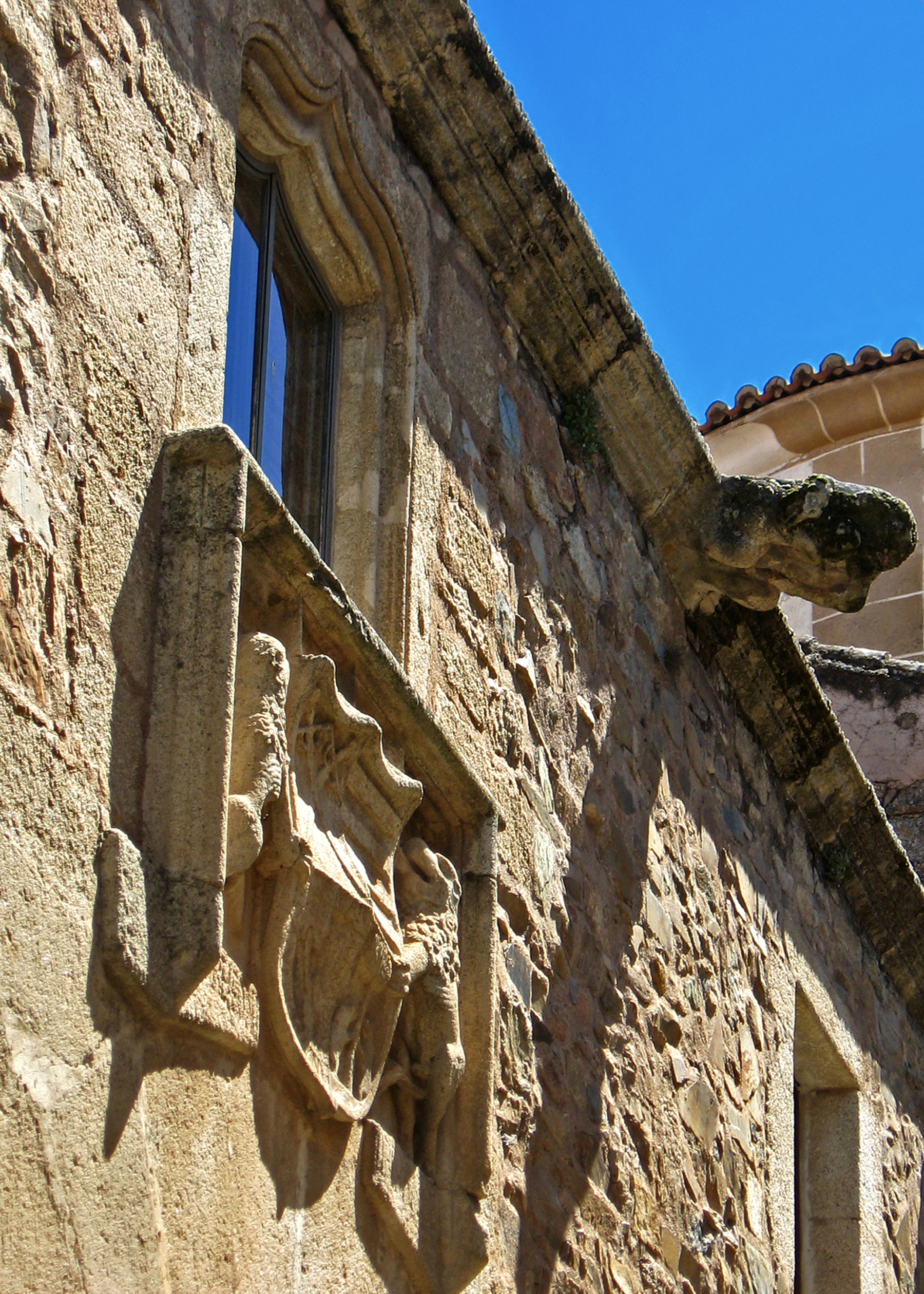
When Indianos (those who had made their fortune in the Americas) returned to their hometowns they built mansions to proclaim their new-found wealth and status. The spectacular walled historical quarter of Caceres (a UNESCO World Heritage Site) reflects this construction boom with its magnificent panoply of Spanish Renaissance buildings. Rivalries played out architecturally as prominent families competed to build the grandest houses and the tallest towers.
Views of the Historic Quarter of Caceres
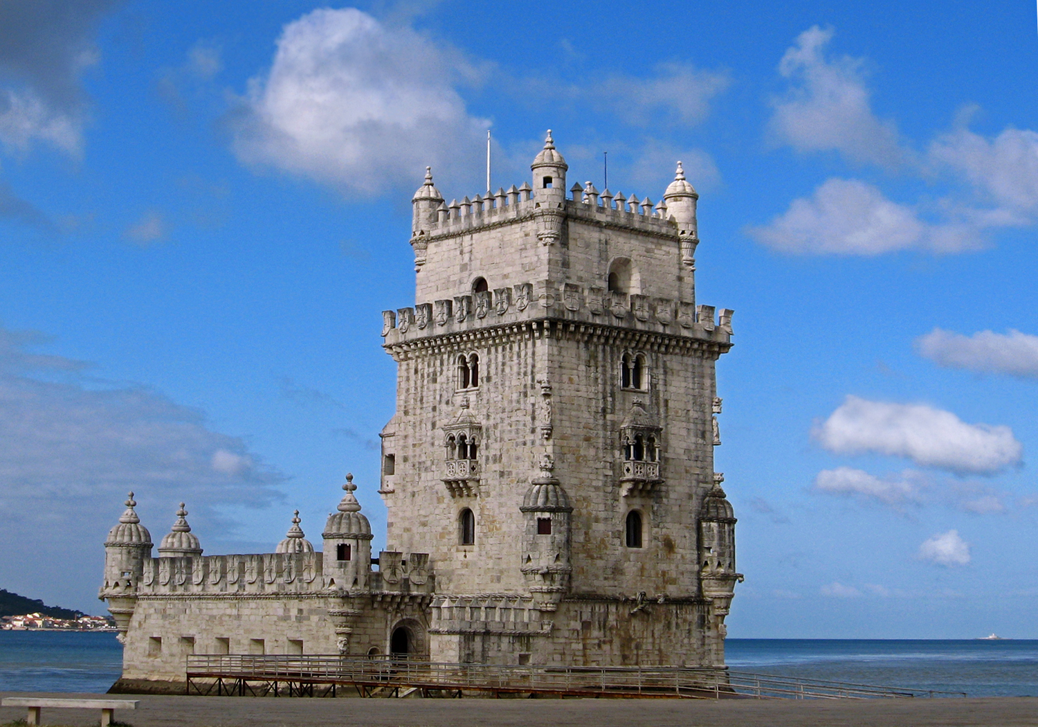
The Portuguese were great navigators who led the Age of Discovery from the 15th to the 17th centuries, acquiring a vast overseas empire and controlling the lucrative trade between Asia and Europe. Portuguese territories extended eastward from the African coasts to India, Southeast Asia and China, and west across the Atlantic to Brazil. Belem Tower, built in 1514 to guard the mouth of the Tagus River as part of the coastal fortifications of Lisbon, is emblematic of Portugal’s maritime achievements.
Belem Tower in Lisbon, Portugal
The discovery of gold and diamonds in the Brazilian state of Minas Gerais, made Portugal the wealthiest country in Europe in the 18th century. This era of prosperity was reflected architecturally in beautiful buildings of a distinctively Portuguese Baroque style that incorporates azulejos, blue and white decorative tiles, inspired by imported Chinese porcelains and Dutch imitations from Delft.
Baroque Staircase with Azulejo Decoration in Castelo Branco
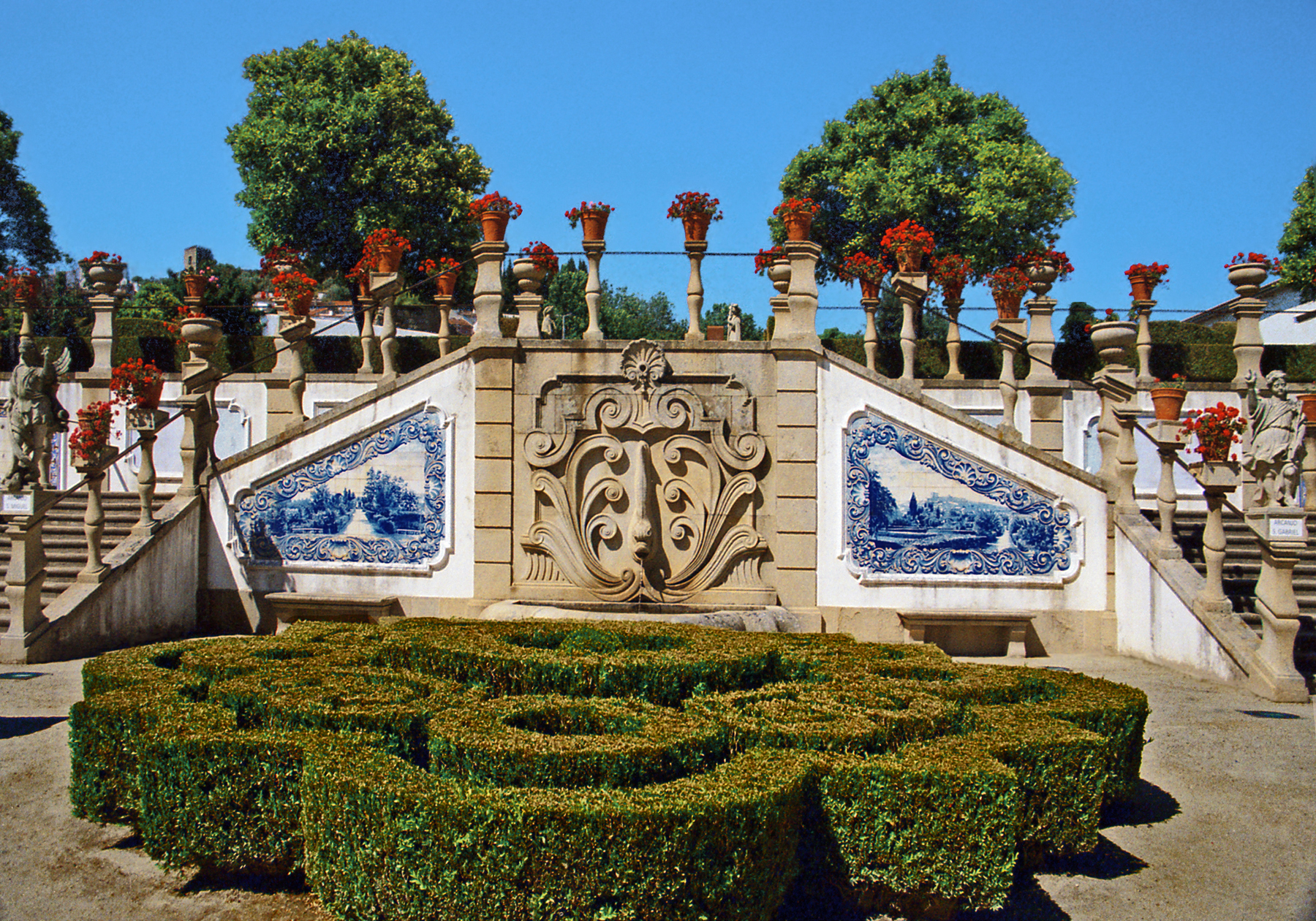
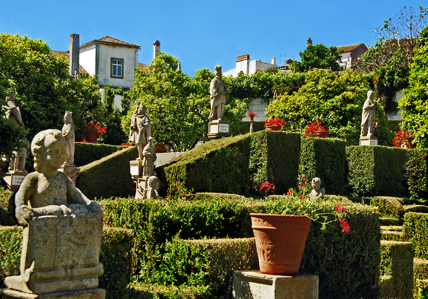
The gardens of the Episcopal Palace in Castelo Branco, created in 1725, are among the most beautiful Baroque gardens in Portugal. Its clipped hedges, fountains and statuary featuring Portuguese monarchs, Christian saints and allegories of the zodiac, the seasons and the continents represent a cultural compendium of the age.
Gardens of the Episcopal Palace in Castelo Branco, Portugal
THE DISASTERS OF WAR In the 16th century, under Charles V and Phillip II, Spain had reached the height of its power, reflected in the literary and artistic achieve-ments of the Golden Age. But Spain’s rulers squandered the vast wealth of the Americas in a series of ruinous religious and territorial wars. Not least of these, the Portuguese Restoration War (1640-1668) that devastated La Raya.
Fortress of Mourao, Portugal
The kingdom of Portugal had become independent from Spain in the 12th century, but had briefly reverted to Spanish rule under the Hapsburgs.Marriage alliances between Portuguese and Spanish nobility resulted in shifting boundaries and competing territorial claims (sovereignty over the town of Olivenza is still disputed). The Spanish town of Valencia del Mombuey, sacked and twice burnt to the ground by Portuguese troops, is emblematic of the period.
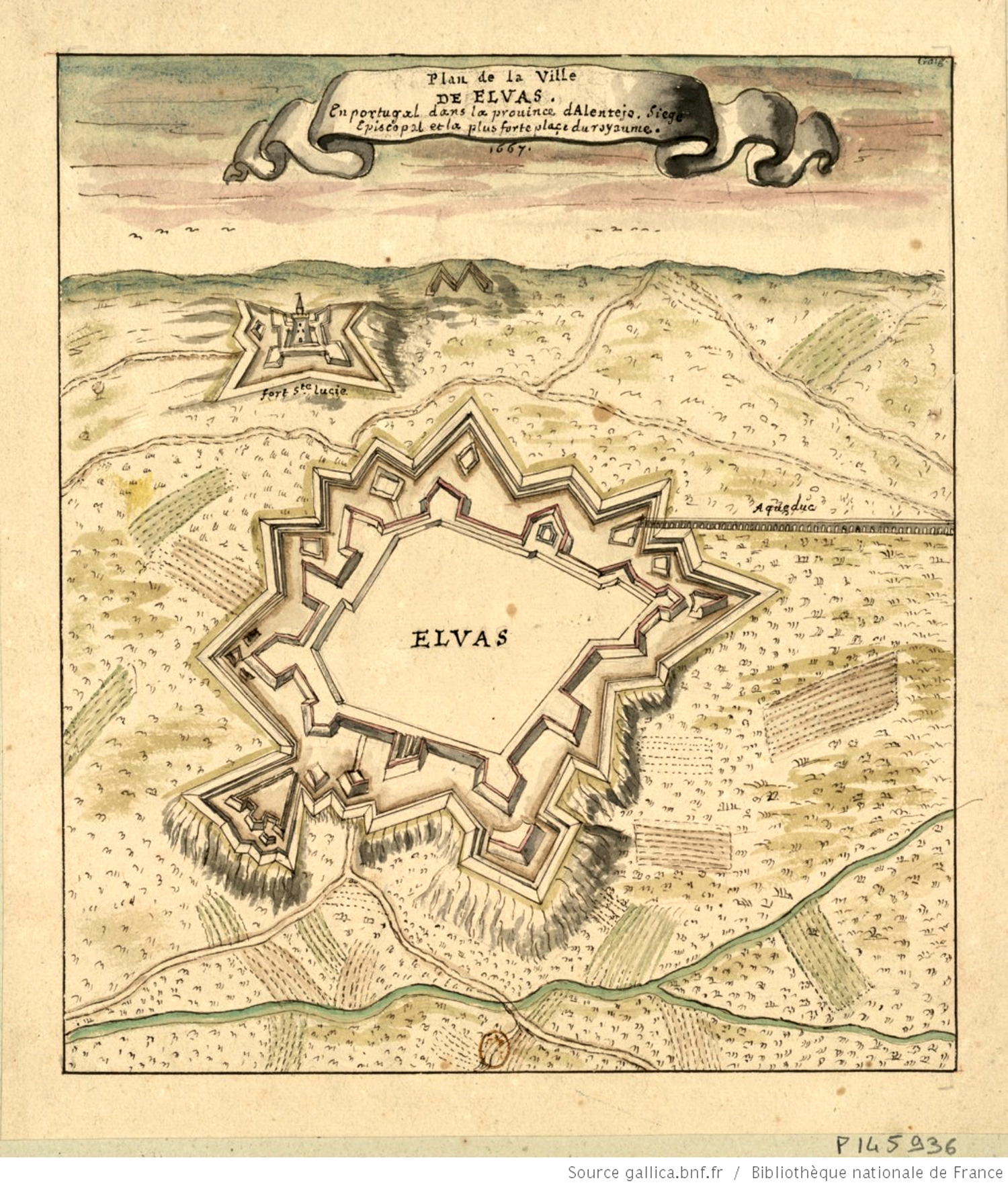
At this time, warfare was being dramatically transformed by the widespread adoption of gunpowder and cannons. Ancient walls that had withstood assault for centuries were now suddenly vulnerable to artillery fire. In response, a new style of fortification arose; star-shaped forts were designed in complex shapes with projecting triangular bastions and massive sloping earthworks.
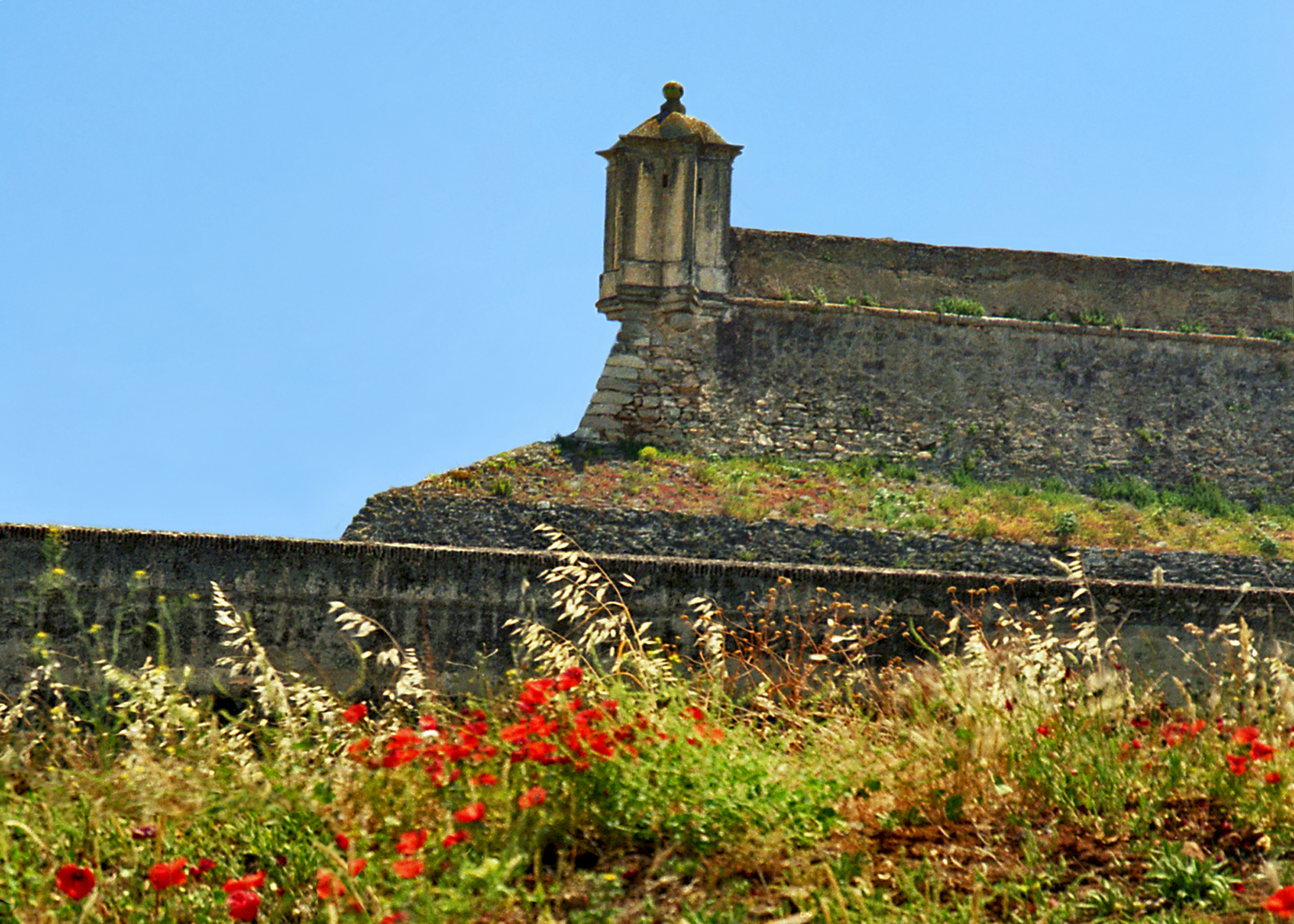
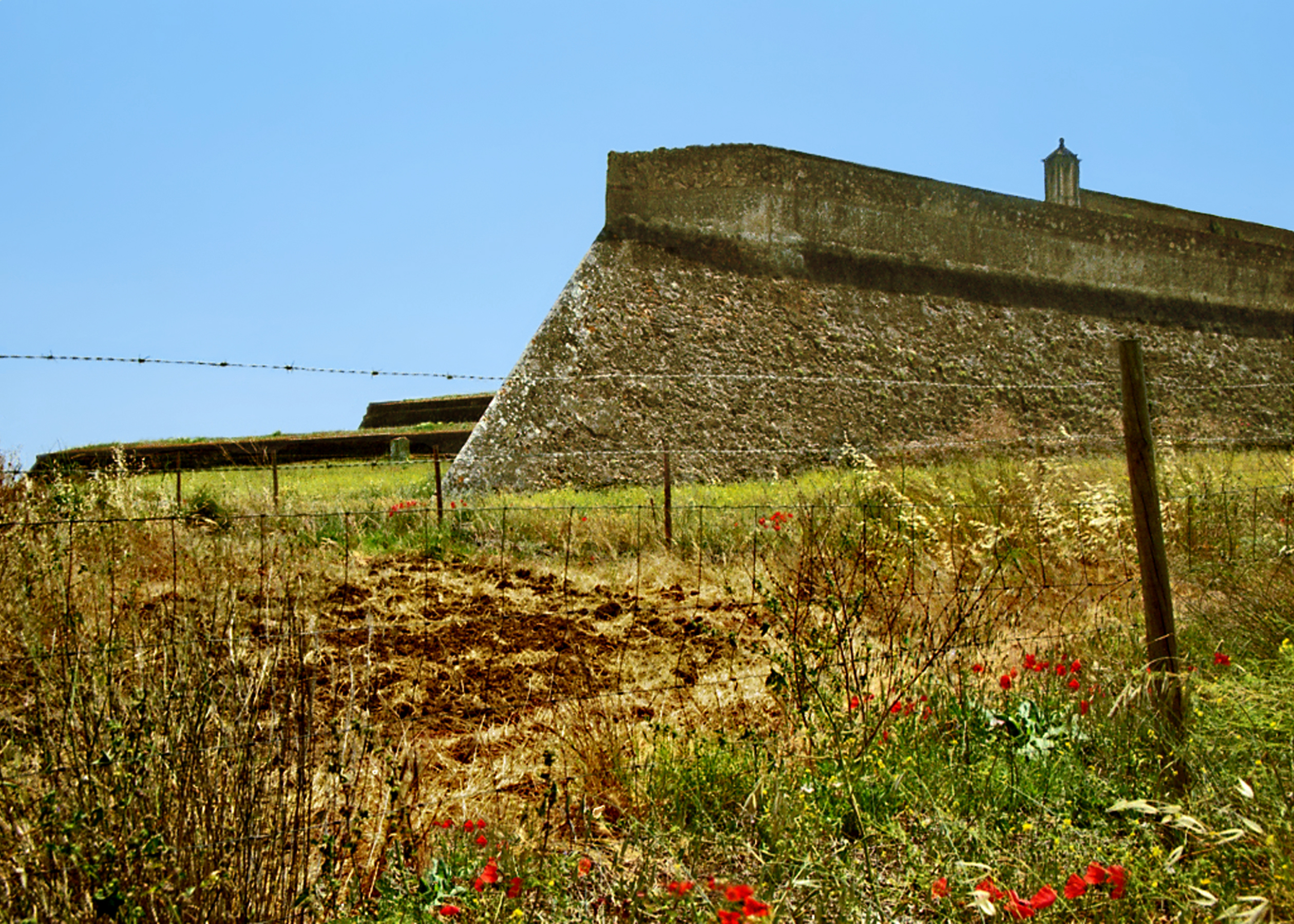
Ramparts of the Fortress of Santa Luzia, Elvas.
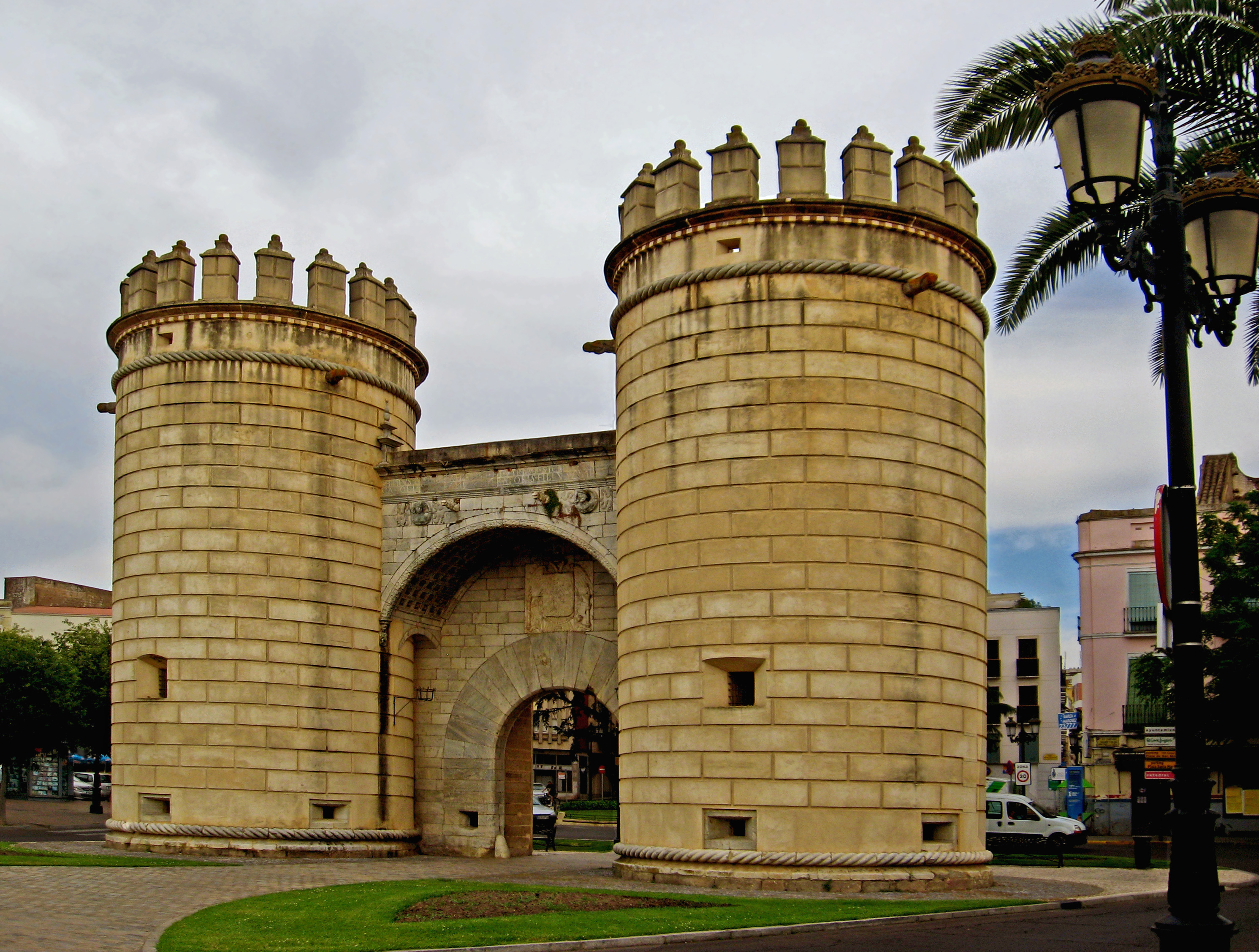
Star forts originated in Italy in the mid 16th century and quickly spread to the rest of Europe, reaching their apogee with the designs of Dutch and French military architects in the 17th century. The extensive fortifications of the Portuguese town of Elvas (a UNESCO World Heritage Site) are among the best-preserved in Europe, and are mirrored across the frontier by the bastions of Badajoz.
Puerta de las Palmas, Badajoz
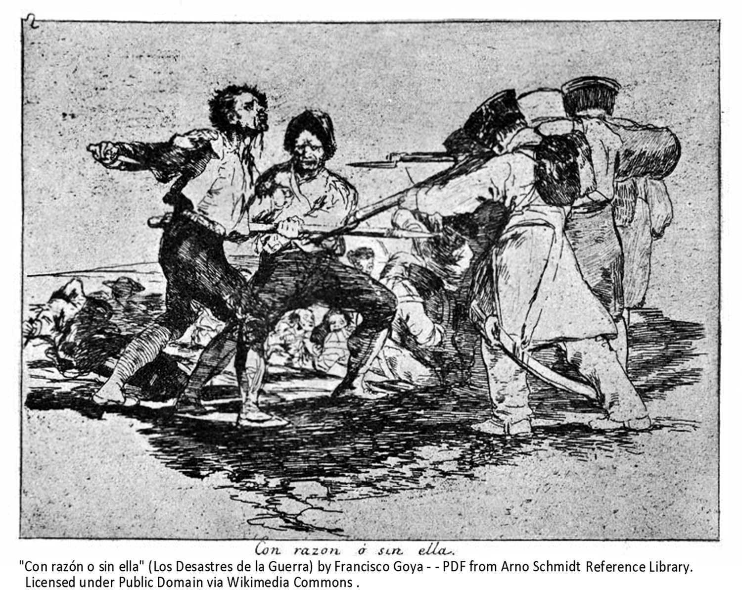
In the early 19th century, Napoleon’s territorial ambitions would have dire consequences for Spain and Portugal. The forts of La Raya were the scene of major battles between the British-led Alliance and French forces in the Spanish War of Independence against Napoleon (1807-1814) as the region was again subjected to the violent depredations so vividly portrayed in the contemporary paintings and prints of Goya.
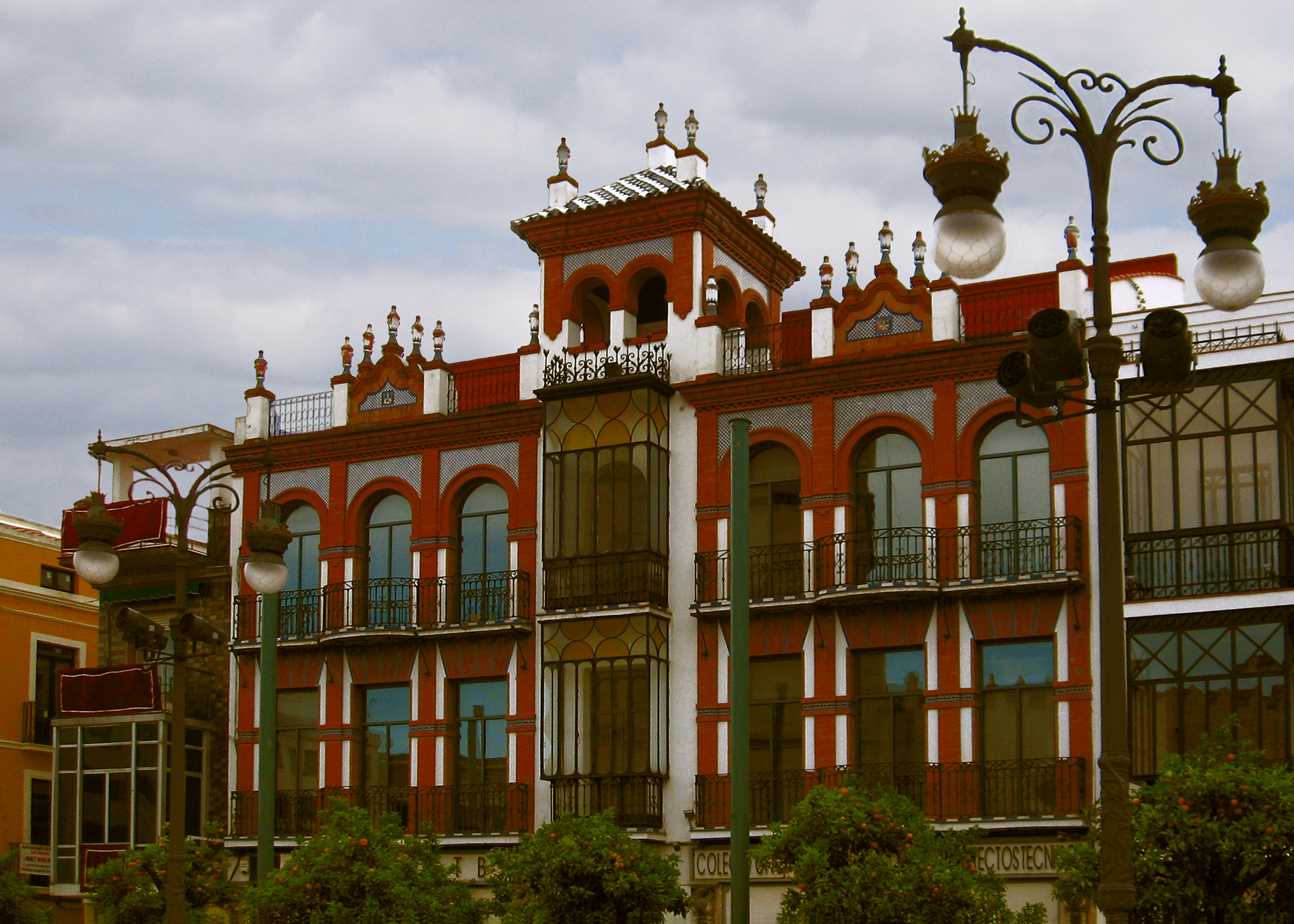
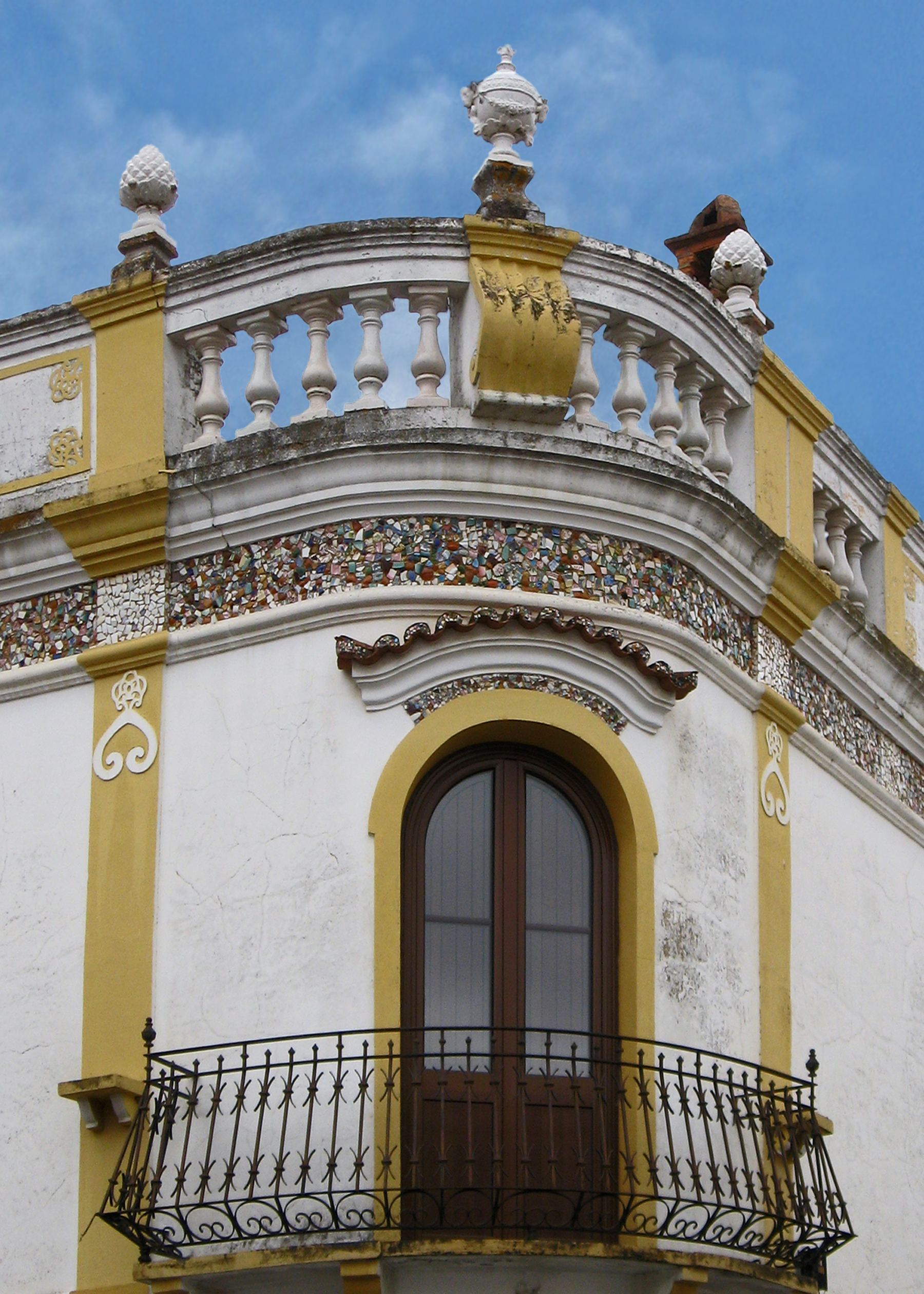
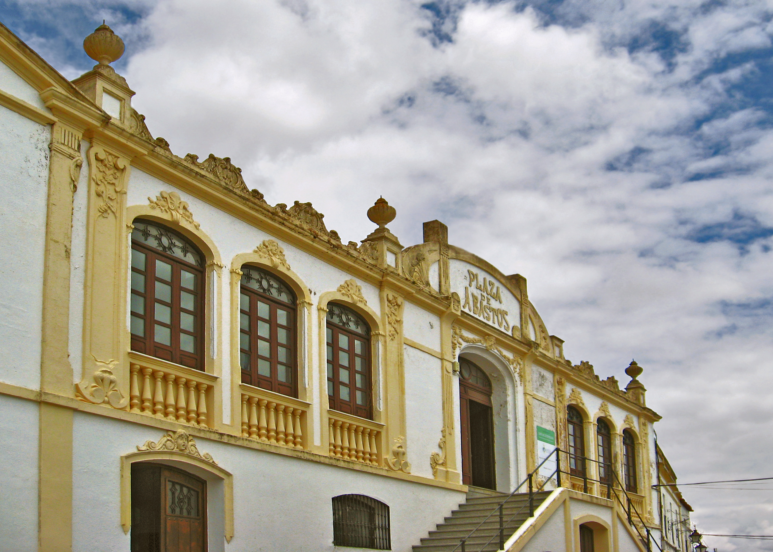
INTO THE MODERN AGE At the turn of the 20th century, Extremadura enjoyed a period of prosperity and commercial expansion fueled by new technologies and improved means of communication. Newly built railroad lines spurred the growth of regional urban centers like Merida and Badajoz, where wealthy merchants built grand storefronts and mansions in fashionable styles like Andalusian Regionalism and the Modernista architecture of Gaudí.
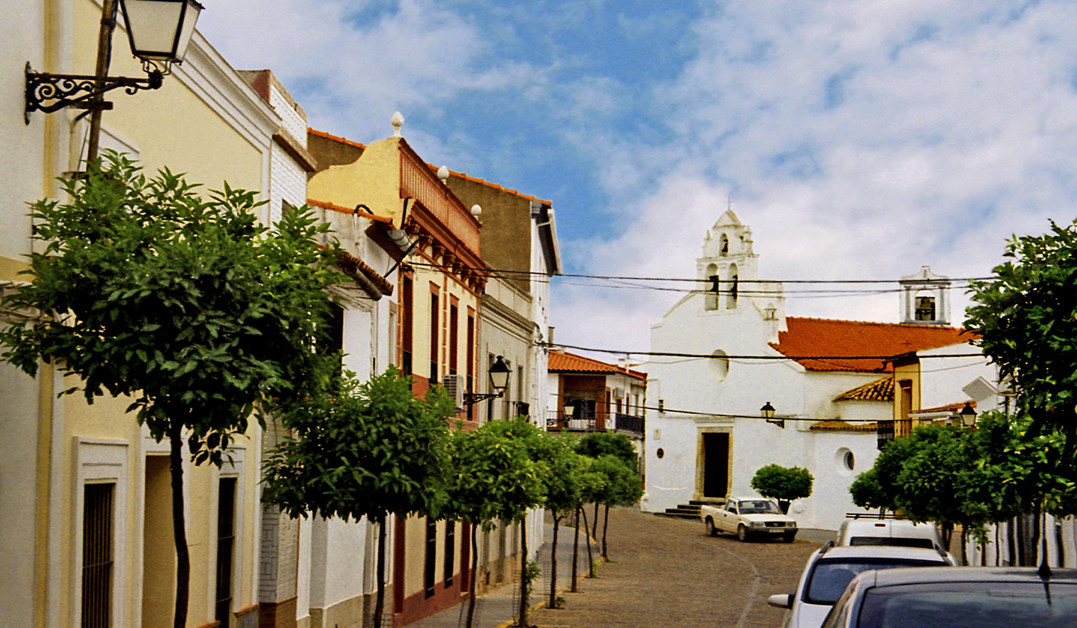
Top: Turn of the Century Elegance in Badajoz, Spain and Amaraleja, Portugal. Bottom: Market Building in Fregenal de la Sierra, Spain.
The Spanish and Portuguese empires had crumbled in the course of the 19th century as their former colonies gained independence; an economic reversal that would have far reaching social and political consequences.The progressive ideas of the ’98 Generation and the Spanish Second Republic now spread to towns like Fregenal de la Sierra, where a liberal newspaper was published, agrarian reform was promoted and civic improvements carried out. But persistent socioeconomic problems led to protests and upheavals and ultimately to the bloody Civil War (1936-1939) bitterly fought in Extremadura. For centuries families in La Raya had intermarried across the border. During the Civil War many Spaniards fleeing persecution found refuge with relatives and friends in Portugal.
Newspaper Kiosk in Fregenal de la Sierra, Spain
In the following decades, the region experienced massive emigration in search of economic opportunities. While cities like Badajoz grew rapidly, their historic centers ringed by blocks of modern buildings, many small towns saw their populations age and decline. But tech-nology can now connect the smallest town to worldwide networks.
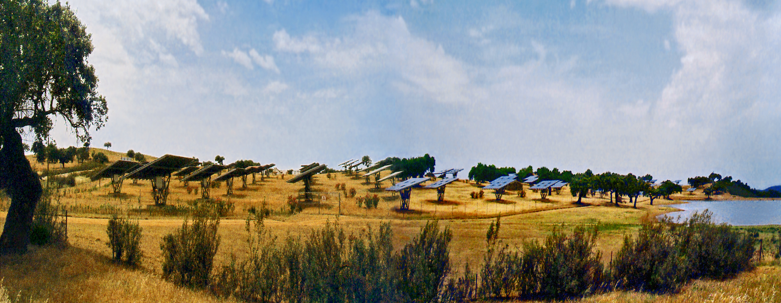
Small Town of Valencia del Mombuey, Spain (above). Solar Array on the Outskirts.
The region could also benefit from the development of renewable energy resources like its abundant intense sunshine. In 2007 the tiny Portuguese town of Amaraleja became home to the largest solar power plant in Europe and a smaller plant operates across the border in nearby Valencia del Mombuey.
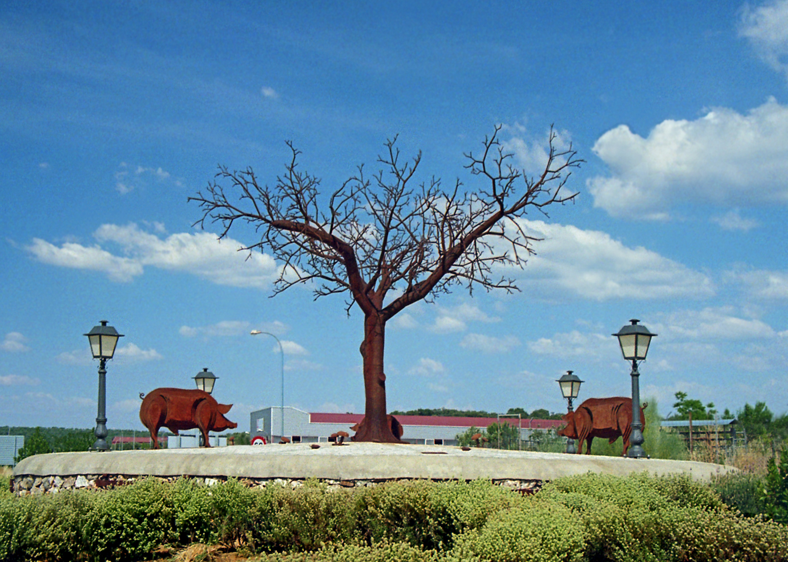
Homage to the Dehesa: Outdoor Sulpture in Villanueva del Fresno, Spain.
There is renewed interest in the sustainable ecological practices of the ancient dehesa system, and traditional agricultural industries (like the famed Iberian ham) continue to be economic mainstays. The Portuguese Alentejo region is the world’s largest producer of natural cork, and is enjoying a burgeoning wine industry.
View of the Alqueva Reservoir
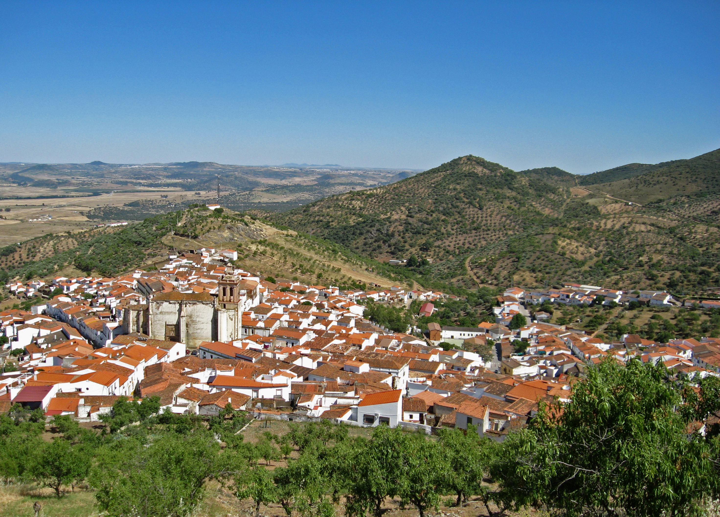
The Alqueva reservoir of the Guadiana River created the largest artificial lake in Europe and is being developed for agricultural and recreational uses. A growing number of tourists are, at long last, discovering the region’s fascinating historical monuments and un-spoiled picturesque countryside. For the soul of La Raya resides in its small towns; the ancestral roots families return to, where cherished traditions are preserved.
Nature Park and Castle of Noudar Near Barrancos, Portugal
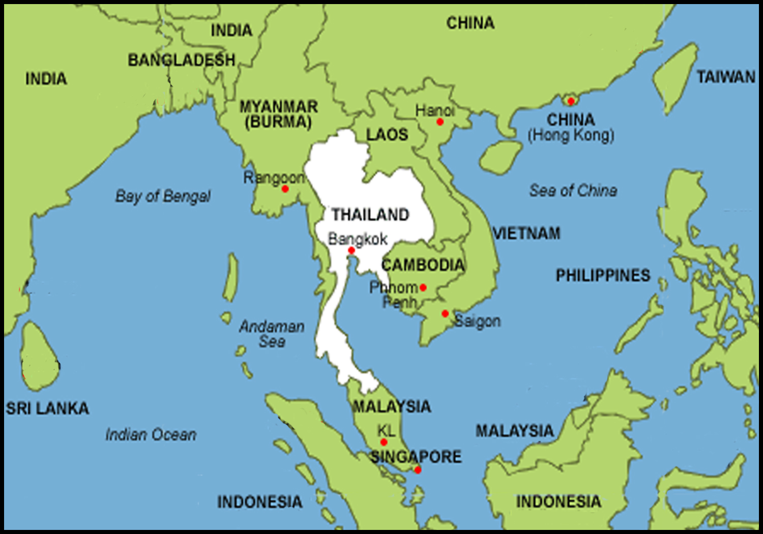
As the historical term Indochina implies, Mainland Southeast Asia was a crucible of cultural influences originating from both India and China. As early as the 1st century CE, an ancient kingdom known as Funan controlled the trade routes of southern Indochina. By the 6th century Funan had split into two successor states: the Cambodian Khmers in the south and the Mon-Dvaravati in the northern region that would eventually become Thailand.
These ancestors of the Thai came to rule a large area of north-western Indochina situated between the Burmese and Khmer empires. Over the centuries, numerous wars were waged by these three rival states, whose territorial boundaries fluctuated as each one gained temporary ascendancy. Monuments were built, perio-dically destroyed by warfare, and rebuilt, resulting in the inter-mingling of regional styles that characterizes Thai architecture.
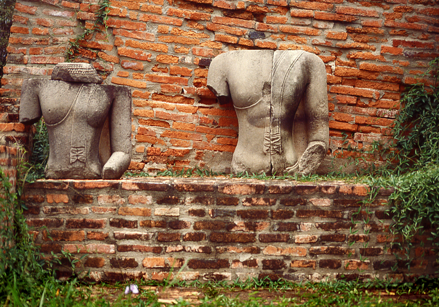
Remains of Past Glories at Ayutthaya
By the 12th century, the Thai people had established the kingdoms of Sukhotai in the south and Chiang Mai in the north and had developed a distinctive national culture, including the adoption of Theravada Buddhism spread by missionaries from Sri Lanka.
Theravada is one of three branches or schools of Buddhism which claims to be the oldest and most authentic, transmitted from India to Sri Lanka in the 3rd century BCE. Theravada Buddhism is practiced throughout Southeast Asia; in contrast, Mahayana sects predominate in East Asia and the Tibetan-Himalayan region follows the Vajrayana tradition.
Buddha Images are Often Clothed in the Saffron Color Worn by Thai Monks
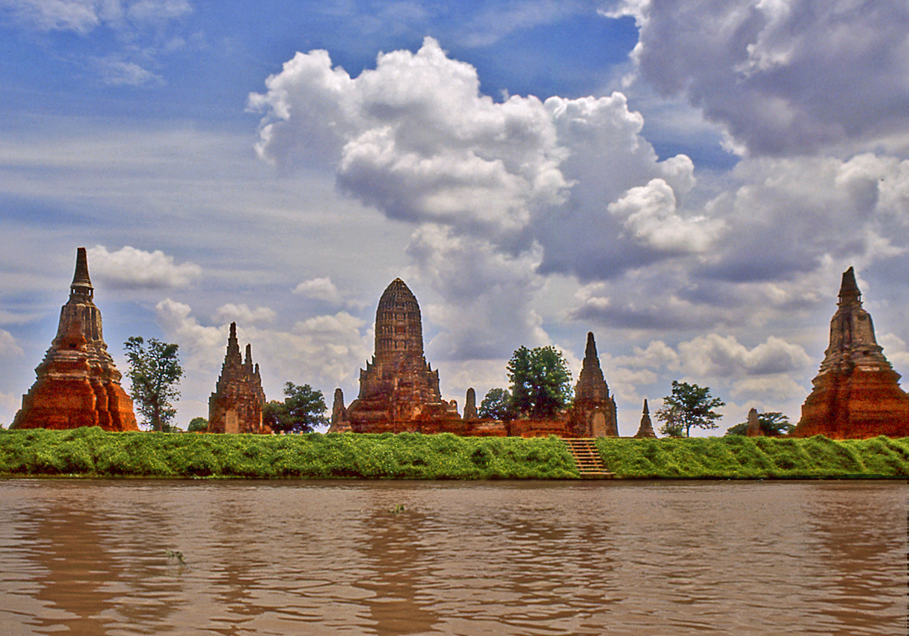
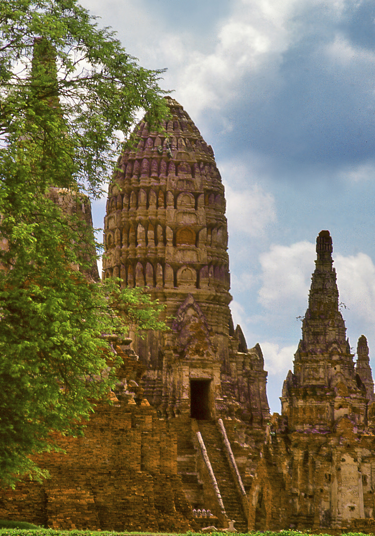
In the 14th century a third powerful Thai kingdom arose in the Chao Phraya River basin. For 400 years the empire of Ayutthaya was the leading political and cultural force in the region, absorbing the neighboring kingdom of Sukhotai, defeating the Khmers of Angkor and extending its conquests as far as Burma. Ayutthaya was eventually destroyed in the Burmese Wars of the late 18th century and the Thai capital was moved south to the site of present-day Bangkok.
View of Ayutthaya from the River (Wat Chaiwatthanaram)
The ruins of Ayutthaya lie some 80 km. north of Bangkok along the banks of the Chao Phraya, and a journey by boat offers fascina-ting views of daily life along the river. Approaching Ayutthaya, an impressive panorama suddenly unfolds as the tall spires of the old capital come into view. The monuments display the syncretism of Thai architecture that incorporates influences from the Khmers (corncob shaped prang towers), the Shan (elongated spires) and the Burmese (bell-shaped stupa domes). As a result of this cultural mix, Thailand displays the greatest variety of Buddhist stupa styles of any country in Asia.
Former Monastic Hall at Ayutthaya
Stupas (called chedi in Thai) originated in India, where the rounded shape of ancient funerary mounds was adopted for Buddhist reli-quary monuments. These mounds were often set atop platforms and topped by elaborate umbrellas. Over time each component part of the stupa was given a symbolic meaning and evolved distinctive regional variations as Buddhism spread acrossAsia.
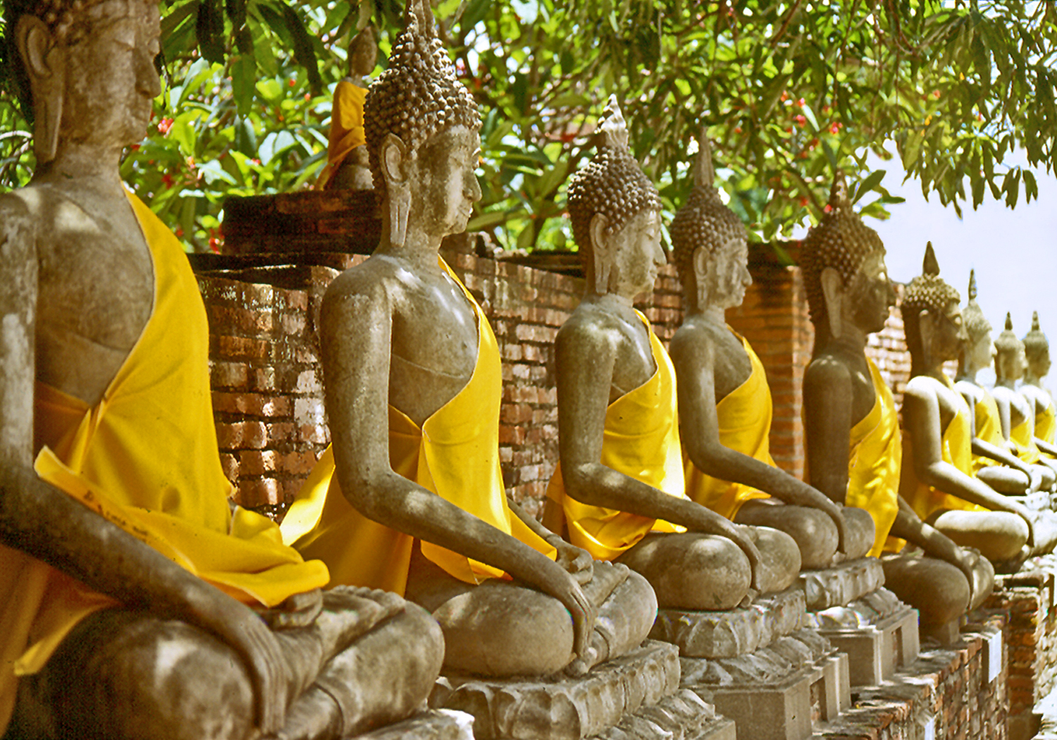
Temples of Ayutthaya
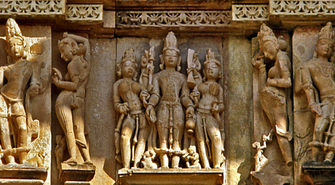
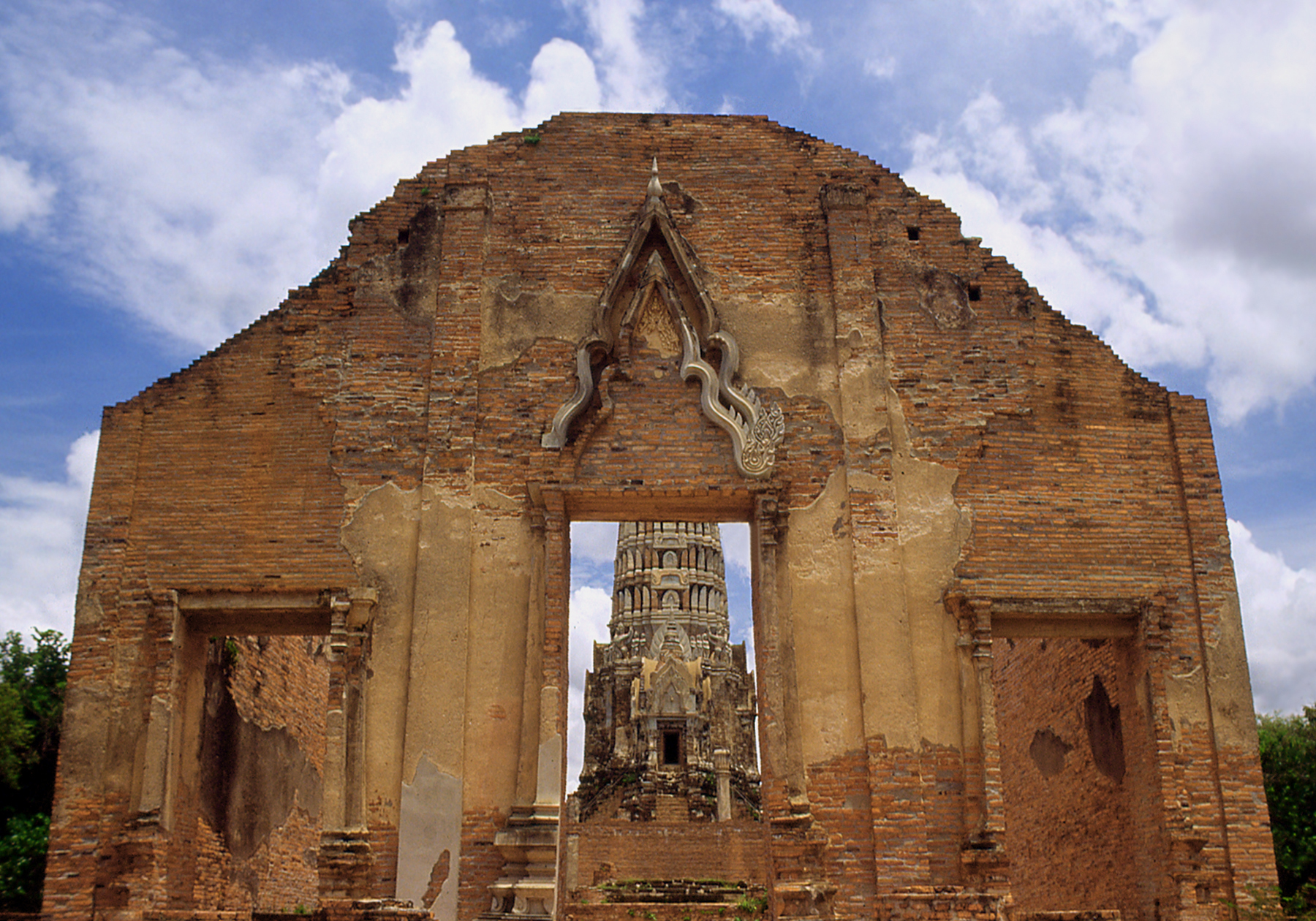
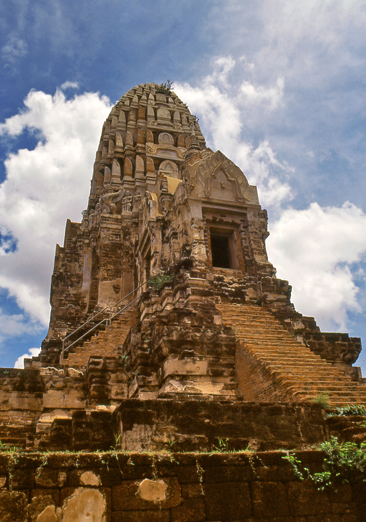
Wat is the Thai word for temple. Wat Ratchaburana was built in the mid 15th century by the seventh king of Ayutthaya. It features a tall Khmer-style prang tower over the sanctuary, which is covered with stucco decoration, and three porticoes facing east, north and south, set atop a high platform accessed by steep stairs. The silhouette is reminiscent of the medieval Hindu temples of north-central India.
View of Wat Ratchaburana
The Thai rulers of Ayutthaya may have also adopted aspects of the royal funerary cult of the Khmers of Angkor and began to erect commemorative stupas to serve as their tombs.
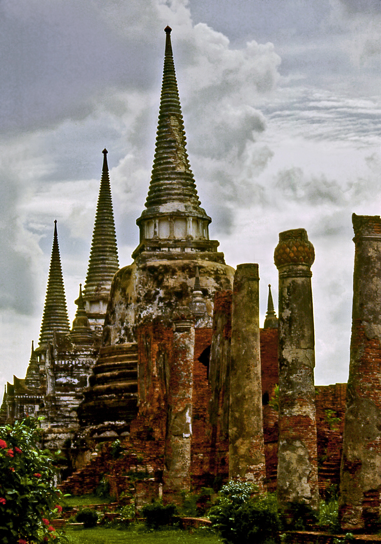
Wat Phra Si Sanphet
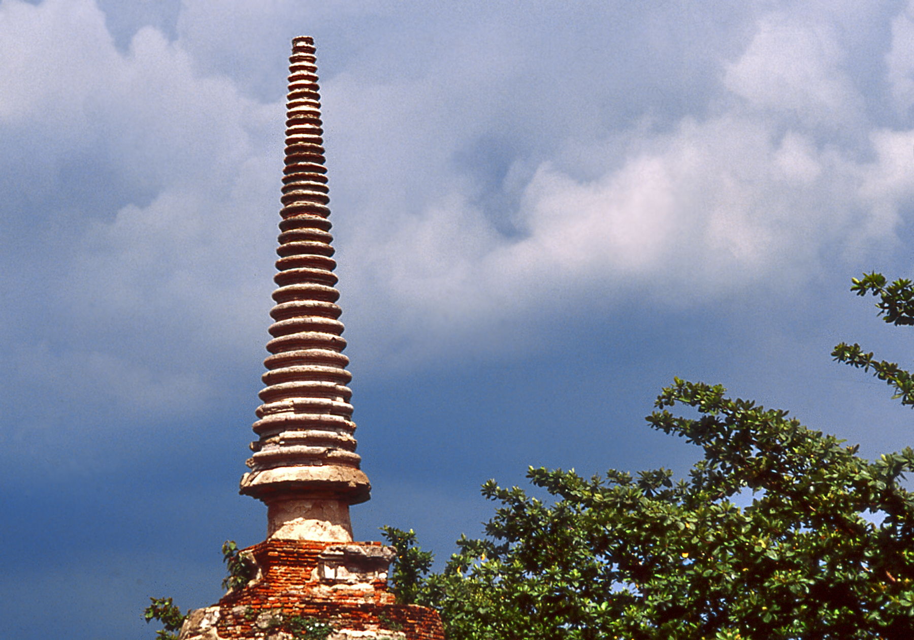
Wat Phra Si Sanphet, built in 1448, is a large temple complex located within the ancient royal palace precinct. Its three graceful bell shaped stupas were built as memorials to encase the ashes of former kings. They typify the Ayutthaya style, where elongated spires of superimposed rings take up almost half the height of the monument. They correspond to the ceremonial umbrellas that top Indian and Sinhalese stupas.
Ayutthaya Stupa Spire
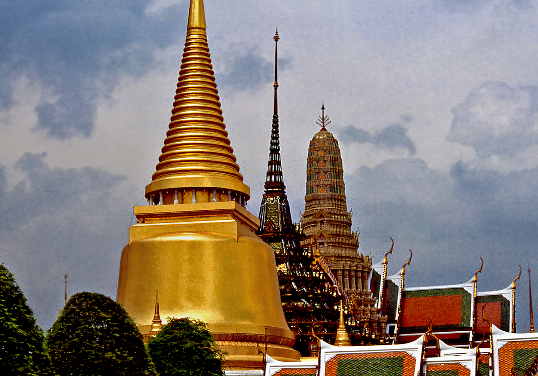
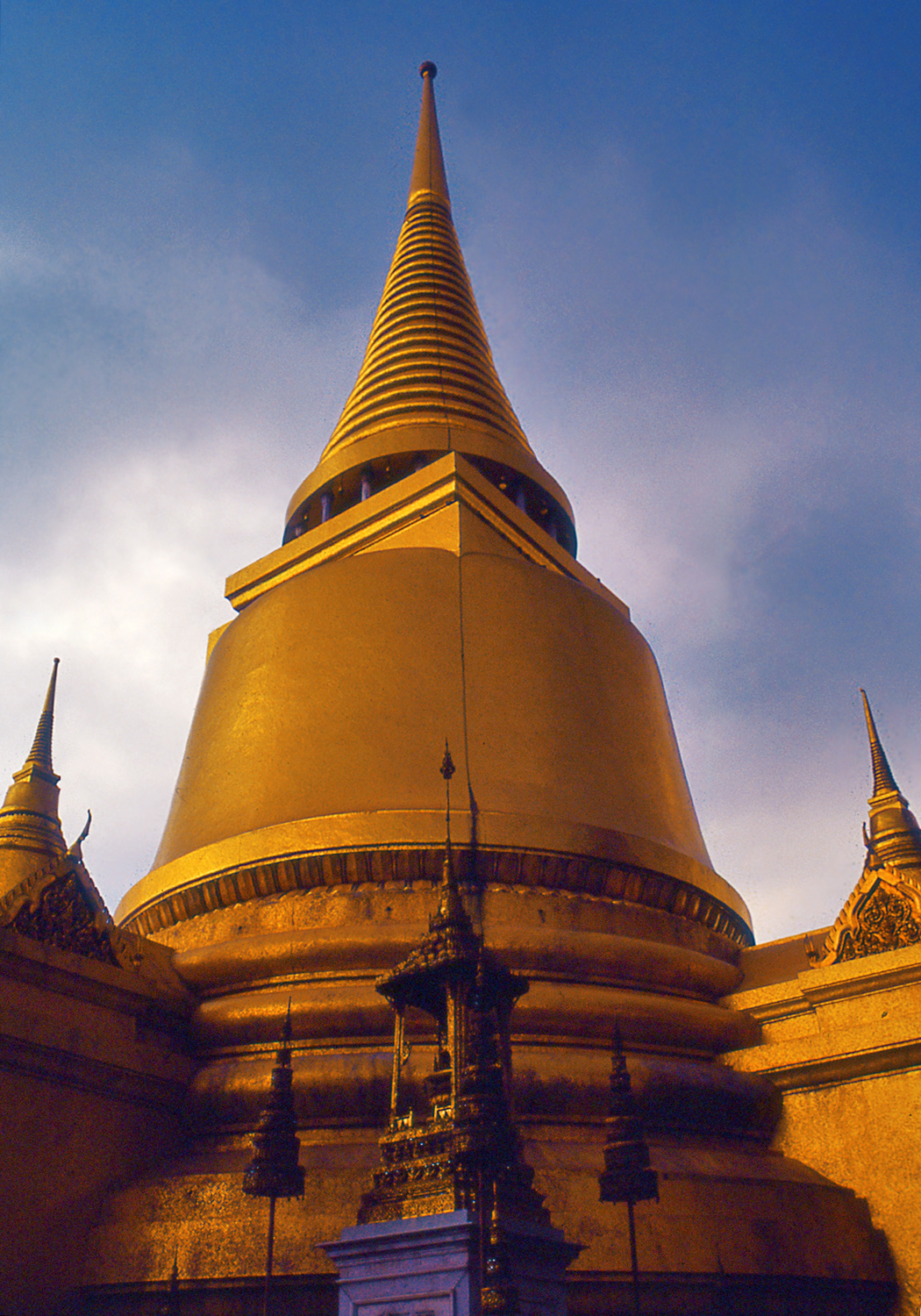
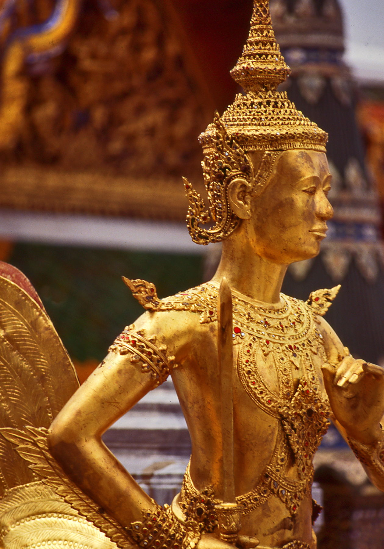
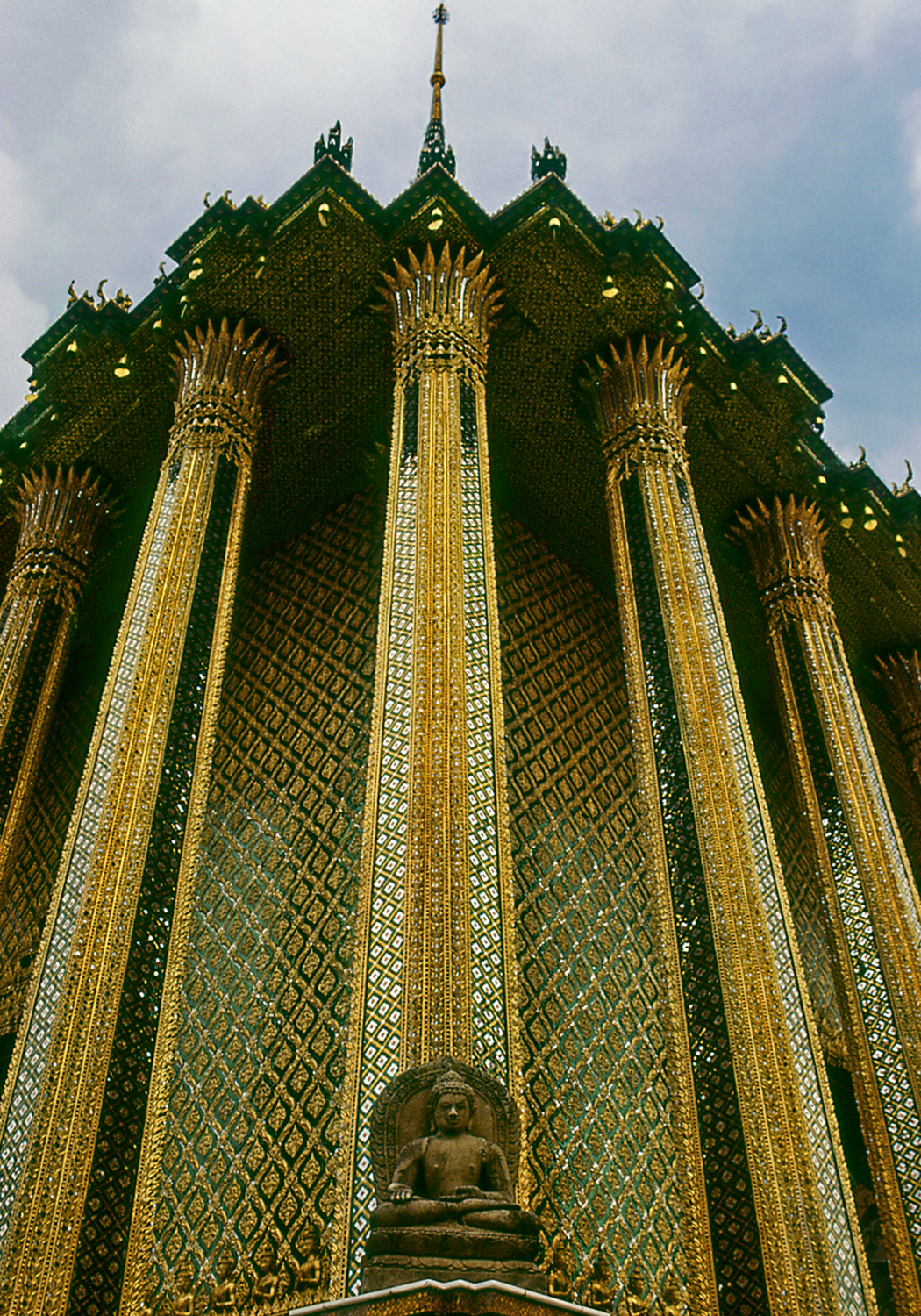
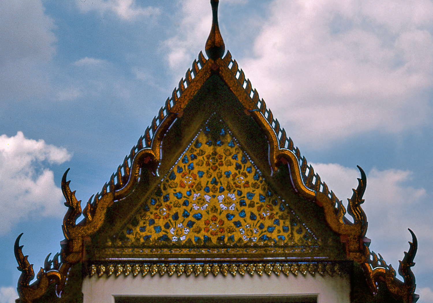
Thailand’s ruling Chakri dynasty traces its lineage to the founding of Bangkok in 1782. Wat Phra Kaew (also called the Temple of the Emerald Buddha) was built inside the royal palace compound by King Rama I to enshrine a precious image of the Buddha which is considered the protector of the country. The temple complex contains many exquisitely ornamented buildings, including three adjacent structures, each one built in a markedly different style: Phra Siratana Chedi, a golden Sinhalese bell-shaped stupa housing Buddhist relics, the Royal Pantheon featuring a Khmer-style prang tower and, between them, the Thai-style Phra Mondop, a library containing sacred Buddhist texts.
Distinctive Architectural StylesGolden Chedi
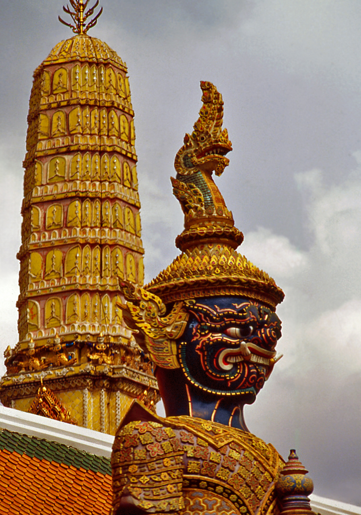
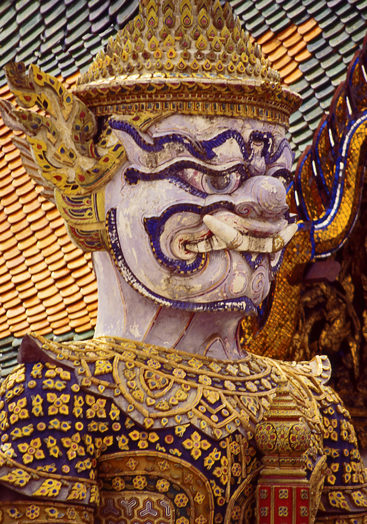
The temple complex is enclosed by a wall with a covered gallery painted with scenes of the Ramakien, Thailand’s national epic, de- rived from the Indian Ramayana. Entrances are protected by fero-cious guardian figures in battle attire similar to the masks, head-dresses and elaborate costumes of classical Thai dance drama. Temple guardian images are found throughout Asia, and depict the demonic spirits of ancient nature cults tamed and converted into defenders of Buddhism.
Fierce Guardian FigureDetail of a Guardian
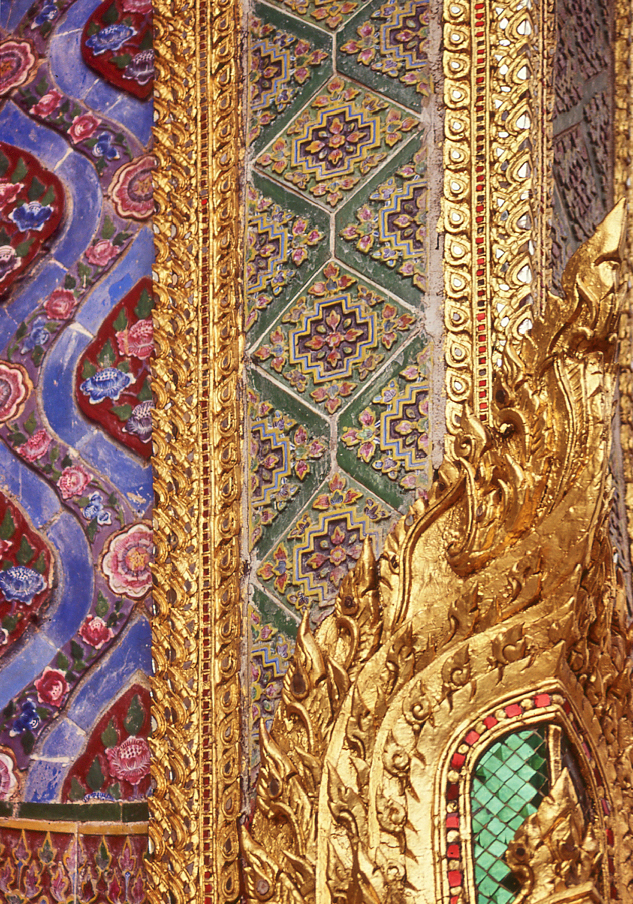
Under the Chakri dynasty the Thai kingdom (known in the West as Siam) prospered, avoiding colonization by the European powers and laying the foundations of a modern nation state. During this period, in the late 18th and early 19th centuries, older architectural models were reinterpreted with the addition of elaborate surface decoration in glittering gold leaf and mosaics of shell, ceramic and colored glass.
Graceful Dance PoseElaborate Decoration
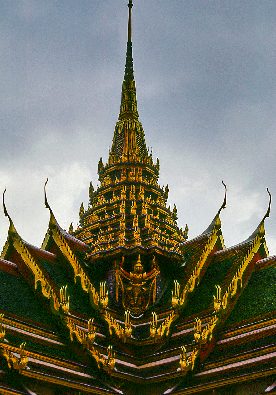
The characteristic Thai roof profile also emerged at this time, featuring sloping tiled surfaces with high gables and overhanging eaves enhanced by long pointed finials marking the ends of the ridge poles. The exaggerated effect is reminiscent of southern Chinese architecture which may have inspired it.
Overlapping Roof EavesGlittering Surfaces
Phra Mondop, the sumptuous library building within the Grand Palace’s Wat Phra Kaew temple complex, was built by king Rama I in the late 18th century. It epitomizes the Thai style, with its super-imposed roof structures and overlapping eaves, dramatic upturned finials and richly decorated surfaces.
Typical Thai Roof Profile
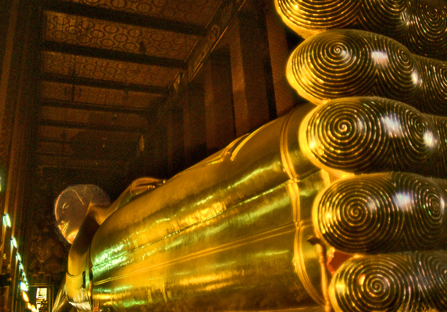
Wat Pho is one of the oldest and largest wats in Bangkok and contains many historic Buddha images, including a huge gilded reclining Buddha. The 46 m. long statue depicts Buddha’s entry into Nirvana at the end of his earthly incarnations. The soles of his feet show auspicious symbols and chakras, or energy points. Interestingly, Wat Pho is a center for the study of traditional medicine and Thai massage which, like acupuncture, focuses on pressure points affecting the flow of energy in the body.
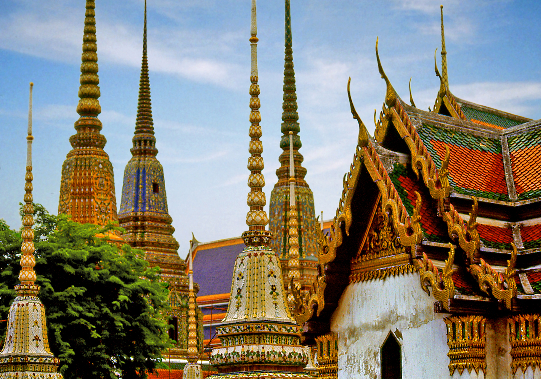
Chedis of Wat Pho
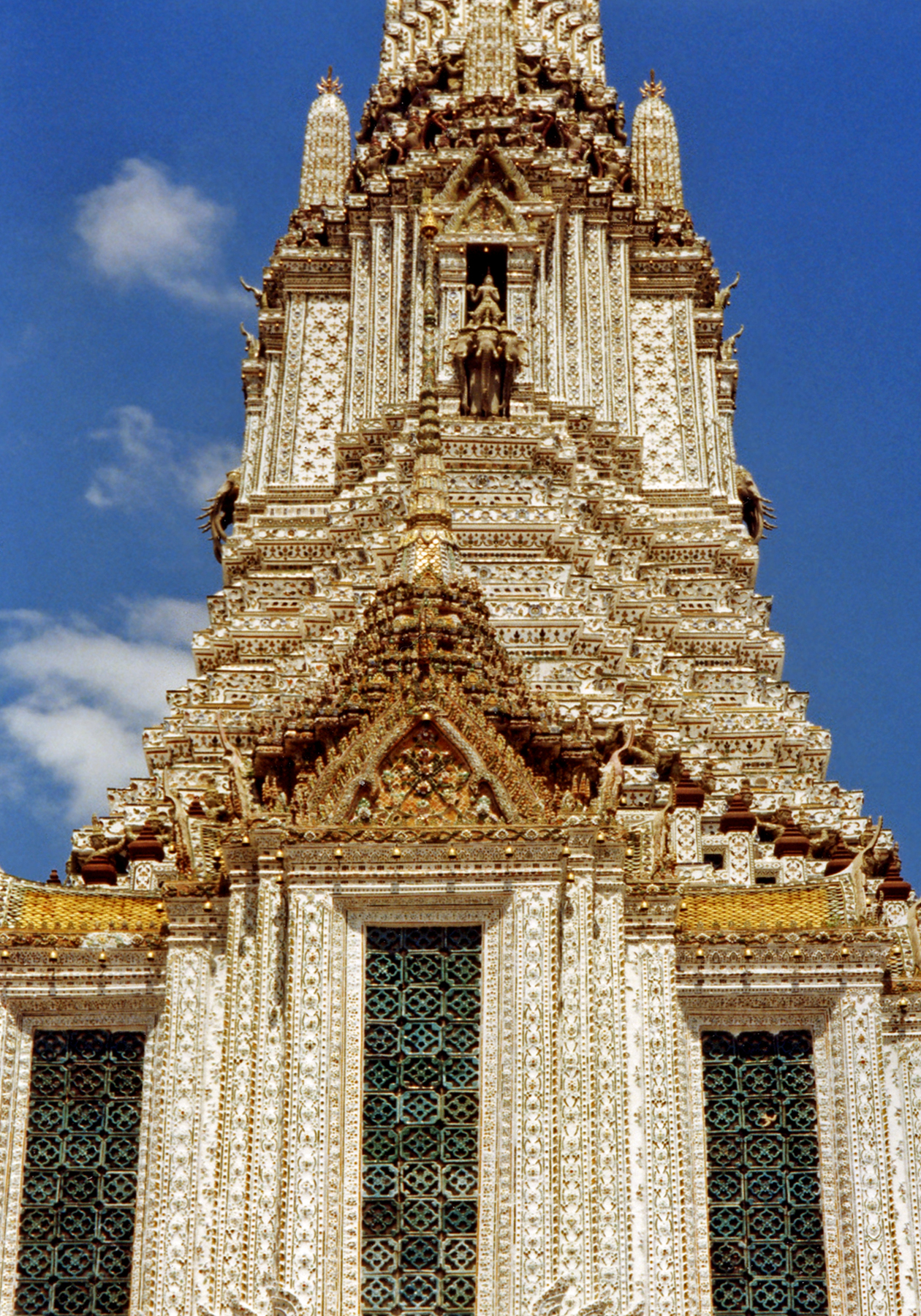
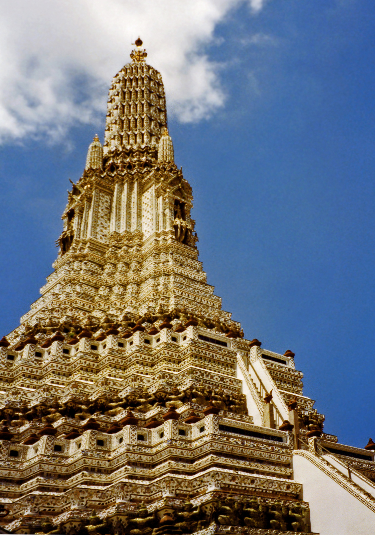
Chinese influence is more explicit in the use of porcelain mosaics to decorate the surface of chedis at Wat Pho and at Wat Arun, the famous “Temple of the Dawn.” Construction of this magnificent structure was begun by king Rama II over an existing foundation and completed by his successor, Rama III, in the 1840’s. The Khmer-style prang tower is the tallest in the country.
Front View of Wat Arun
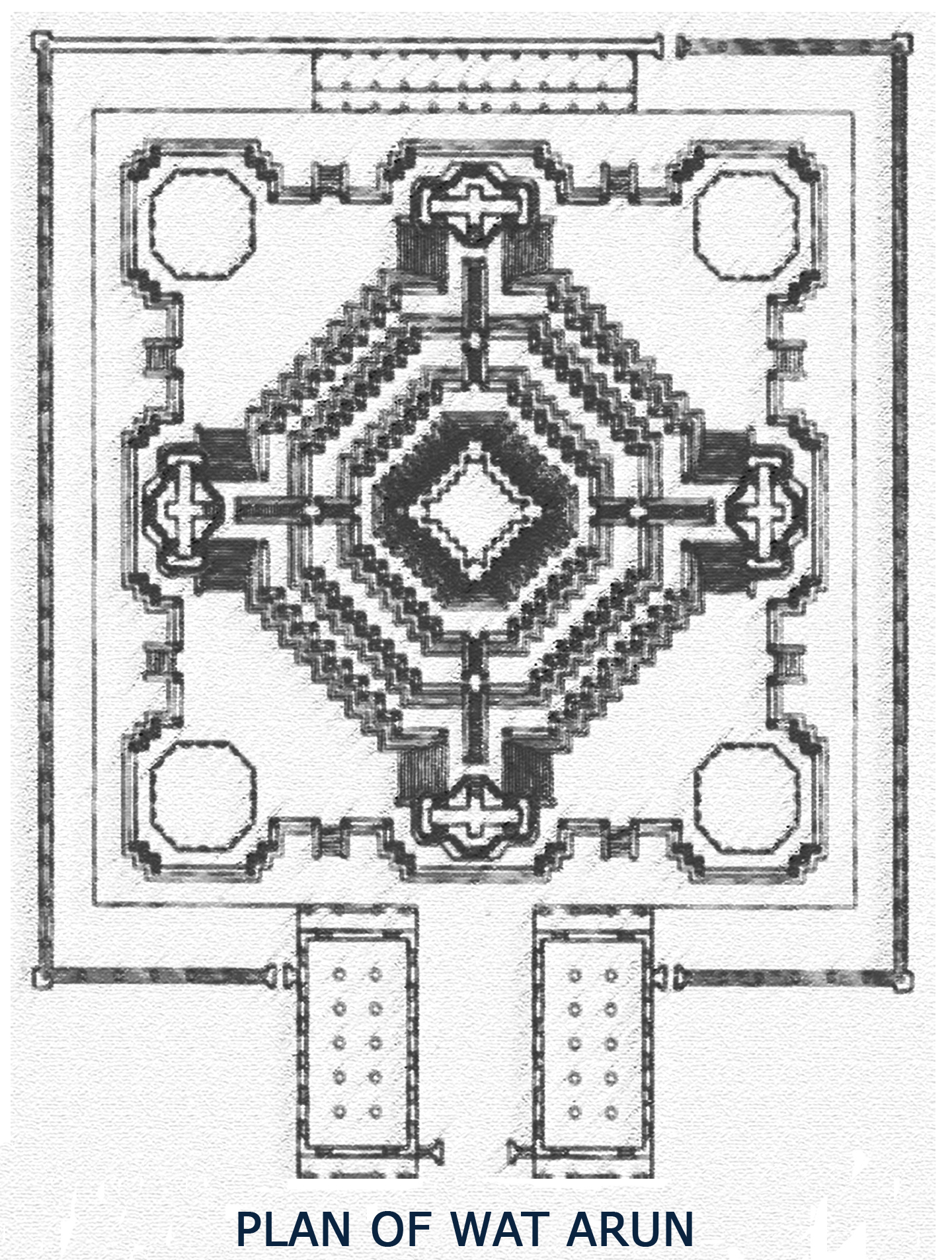
The brick core is covered with plaster and embedded with multi-colored porcelain shards from the ballast carried by Chinese trading ships. The zig-zagging glistening surfaces impart a sense of rhythmic movement to the structure which follows a complex mandala plan. The grouping of five towers represents Mount Meru, the central mountain of Buddhist cosmology, encircled by the guardians of the four directions.
Set in a prominent riverside location, Wat Arun is a distin-ctive beloved Bangkok land-mark. Many of Bangkok’s most famous temples and historical monuments lie on the banks of the Chao Phraya River which winds through the city and the best way to visit them is by a long-tailed motor boat. These water taxis offer a refreshing alternative to the modern city’s notoriously congested traffic.
Bangkok’s fascinating temples are a welcome respite from frenetic modernity; places of quiet meditation where history comes alive and time seems to stand still.
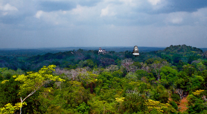
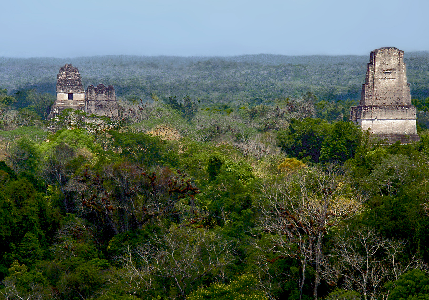
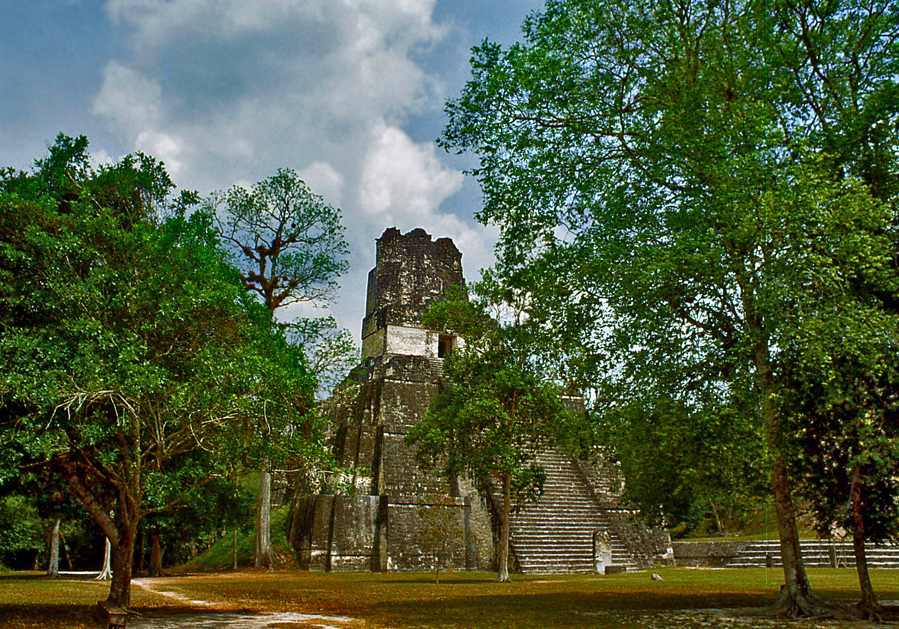
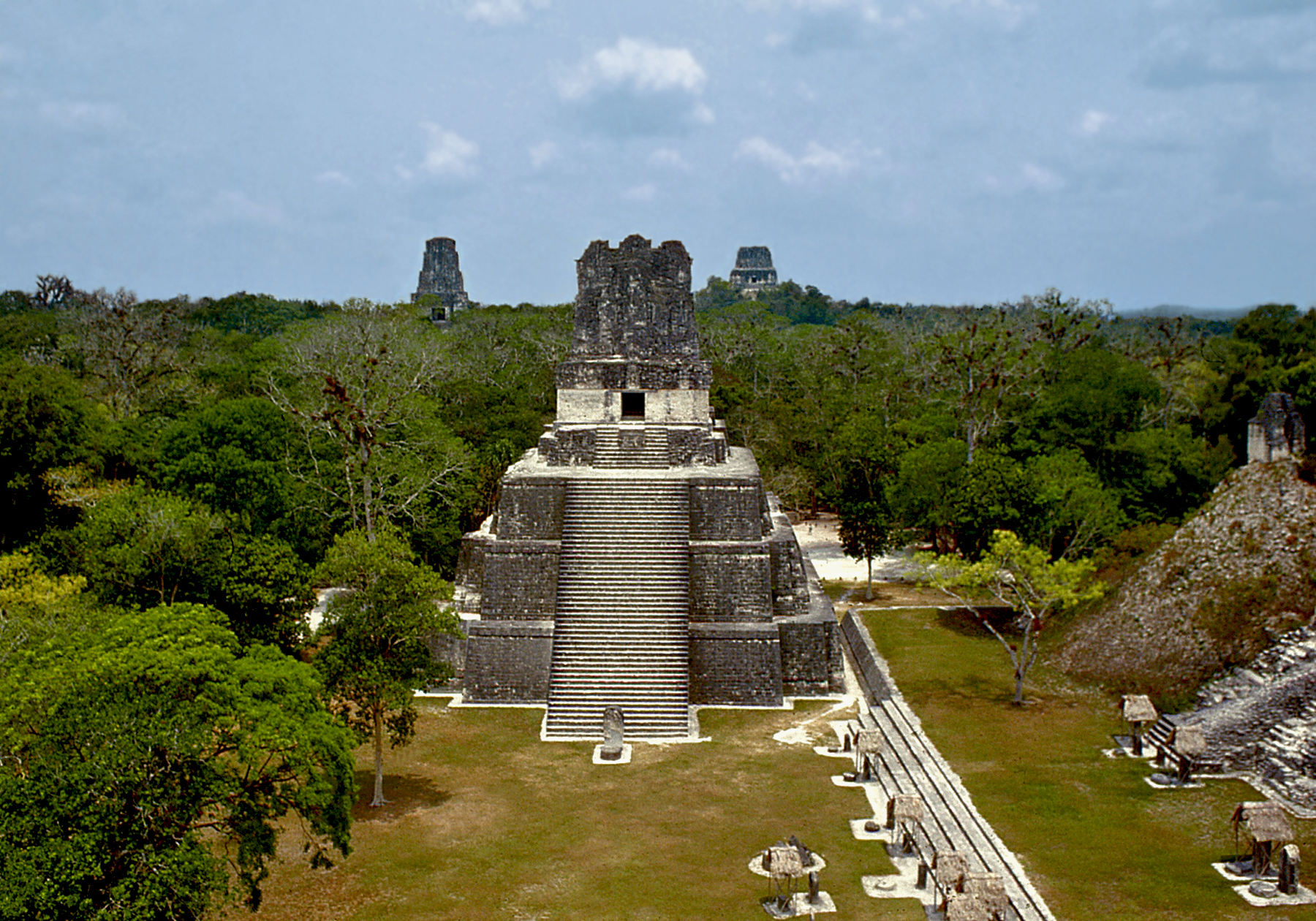
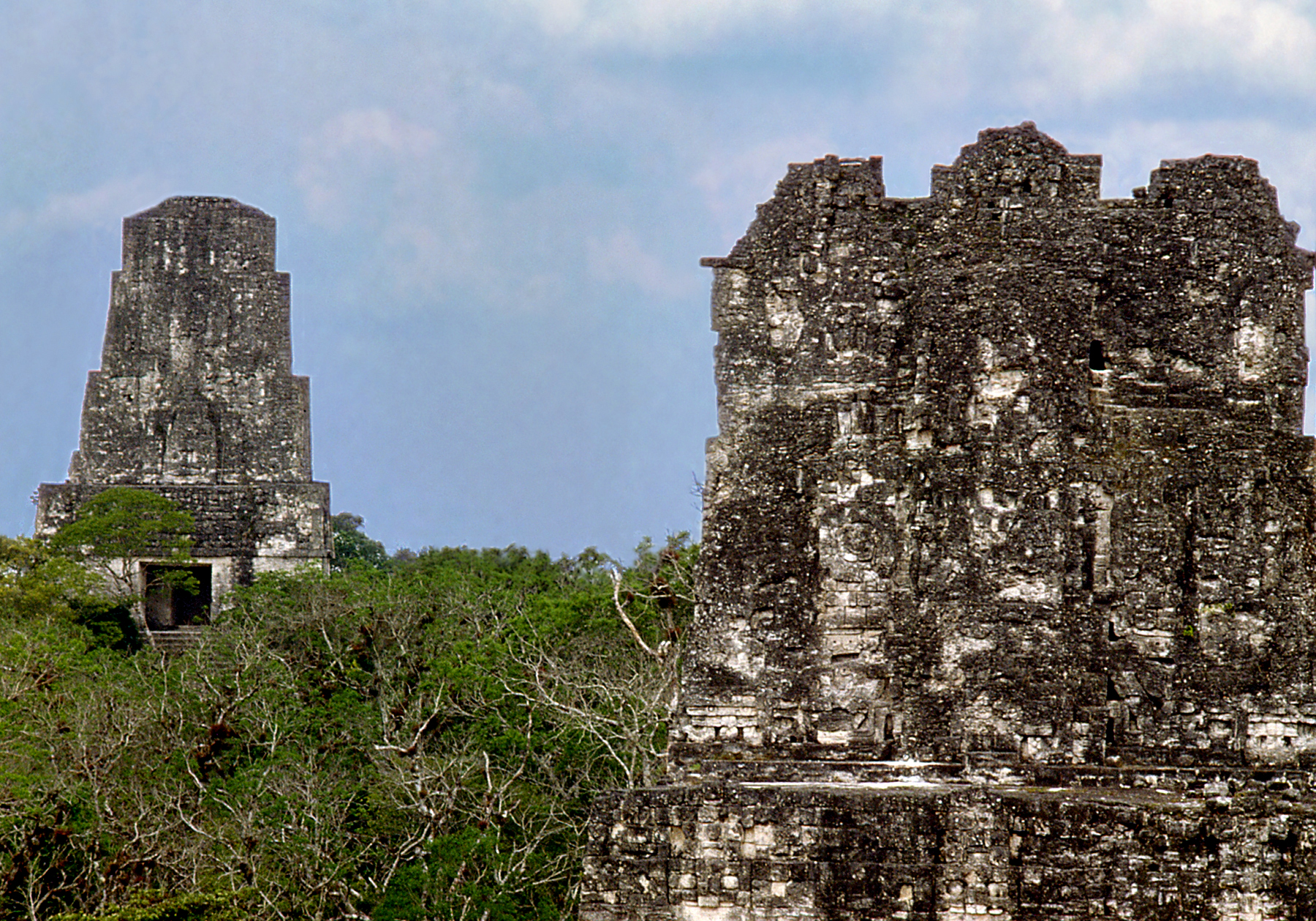
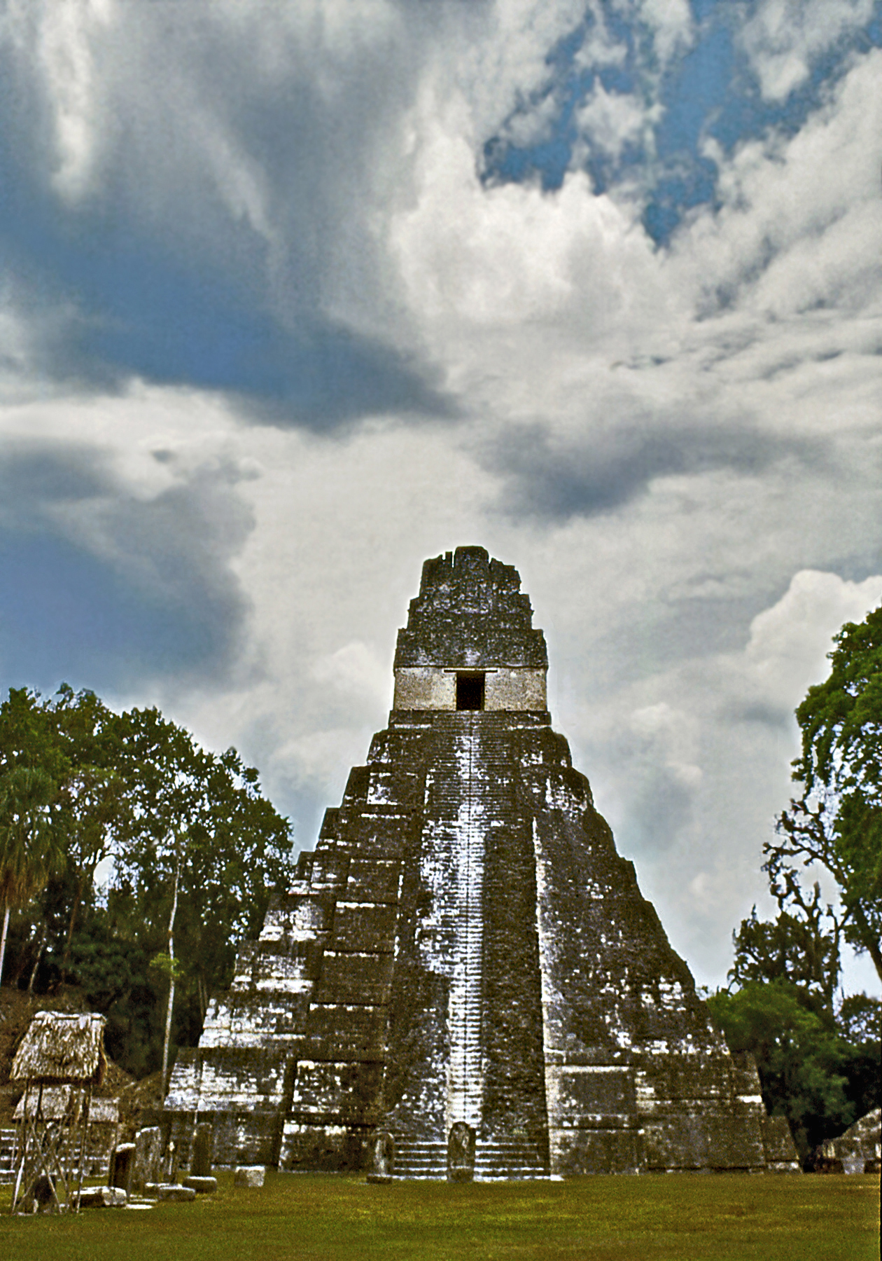
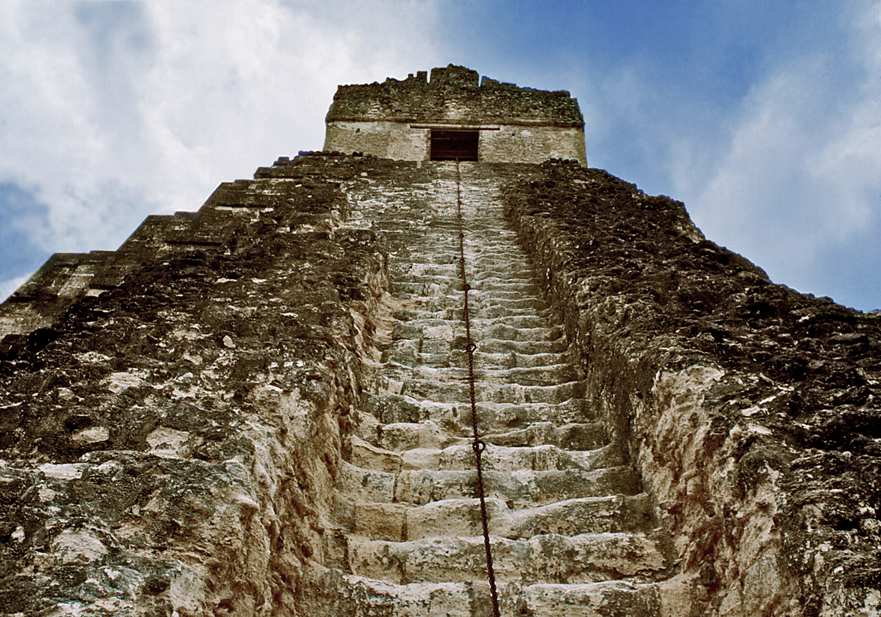
From the highlands of Oaxaca and Chiapas in southern Mexico the terrain gradually descends towards the Guatemalan region of the Peten, traversed by great rivers like the Usumacinta and covered by dense tropical jungle. Yet this region, which today appears so wild and inhospitable, was for over a thousand years the heartland of Maya culture which reached its apogee during the Classic period from 250 to 900 CE. The tops of the temples at Tikal soar high above the treetops seemingly floating over an endless ocean of green. Tikal is the largest known Maya center. This great city, which in its hey-day covered over 16 square kilometers, built the tallest and most impressive monuments of the Maya world.
Roofs Above the Jungle Canopy — (click photos to enlarge)Approaching the Great Plaza
The architects of Tikal developed one of the most characteristic elements of the classic Maya temple, the ornamental projections called roof combs which are used to extend the height of buildings. Another important structural innovation was the corbel-vaulted ceiling. The Mayas combined these two elements to build impres-sively tall structures; but the massive walls needed to support the weight of the roofs resulted in very limited interior spaces.
The Great Plaza of Tikal and Pyramids in the DistanceRoof Combs
Two great pyramids face each other, as if in dialogue, across the great ceremonial plaza. The tallest is the temple of the Great Jaguar built in the early 8th century CE. Its slender silhouette is made up of nine levels, a number sacred to the Maya, crowned by a tall roof comb that extends the building’s height to an impressive 155 ft. The sculptures covering the roof comb represented a king seated on his throne. He has been identified as Jasaw Chan K’awill, one of the most powerful of Tikal’s rulers whose tomb this was. The pyramids of Tikal most clearly embody the concept of the Maya temple; a sacred space poised between heaven and earth, surrounded by clouds of incense atop a magic mountain where only priests and royalty could step.
Temple of the Great JaguarAscending the Pyramid
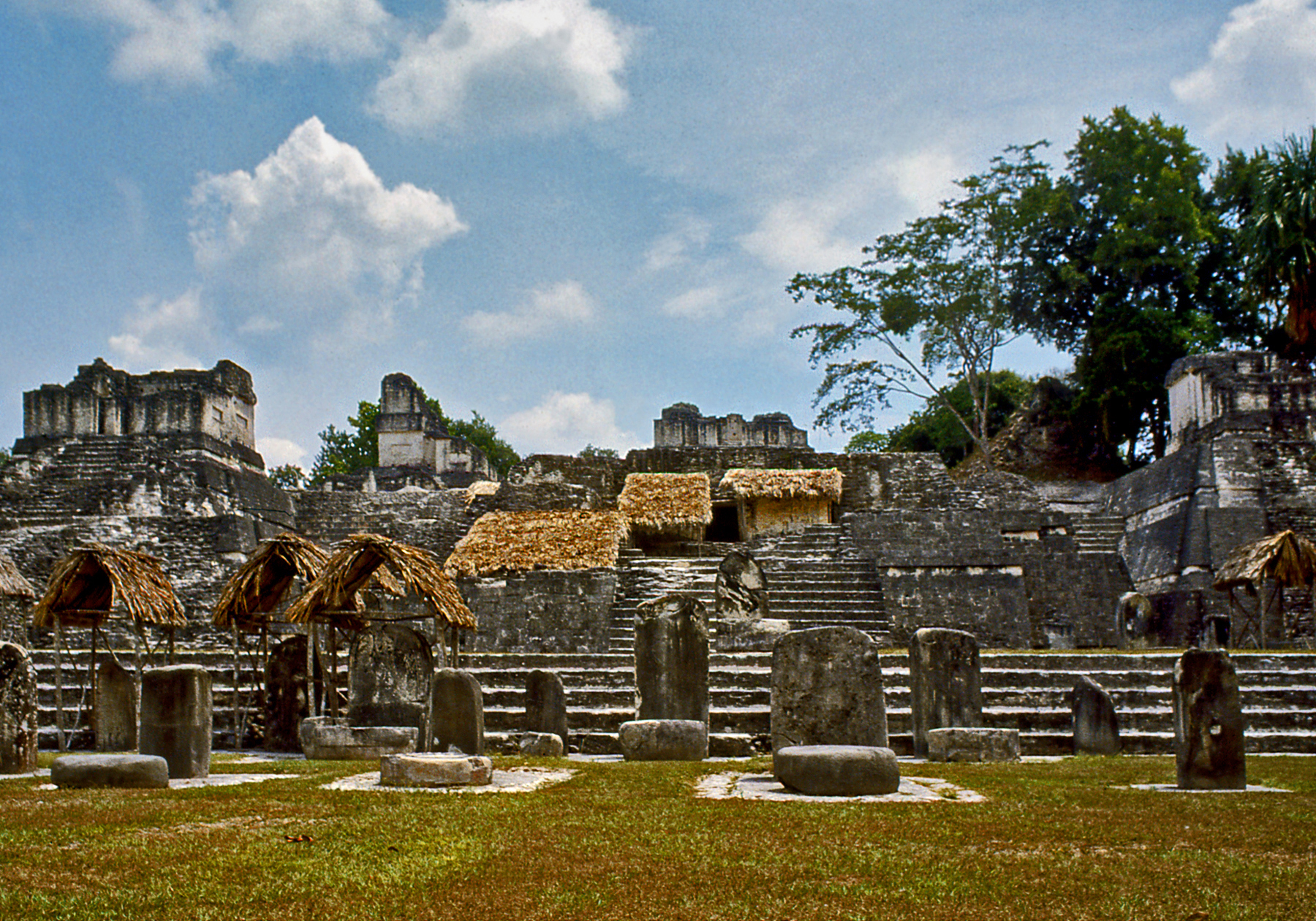
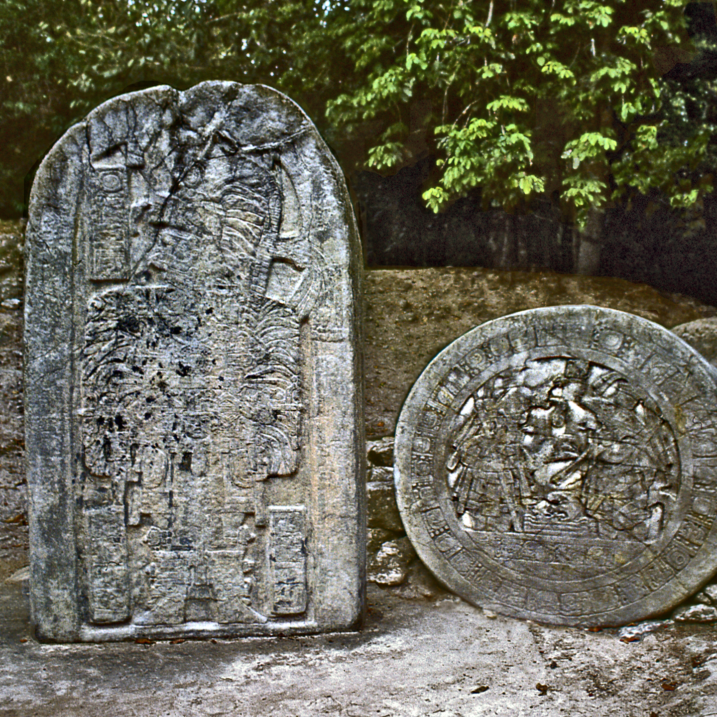
The central plaza is bounded by the buildings of the north acropolis containing the tombs of the ruling families of Tikal. From the begin-ning of the Classic period the Maya erected dated commemorative stone altars and stelae, and a collection of these monuments adorns the plaza. In recent decades, great advances in deciphering Maya hieroglyphic inscriptions and their iconography have revealed that these sculptures represented a cult of the rulers. They memorial-ized their accession to the throne and recorded the alliances, wars and victories of the great dynasties that ruled the Maya city-states.
Monuments of the Great PlazaStelae Depict Tikal’s Rulers
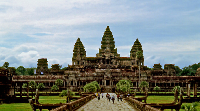
The renowned temple complex of Angkor Wat is only one of many impressive monuments spread across 200 sq. km. in northwestern Cambodia. This region was home to several successive capitals of the Khmer empire over a period of 400 years from the 9th to the 13th centuries CE. Many buildings have collapsed or have been covered up by jungle so that today only forty accessible sites remain, known collectively as Angkor. Although the sites have been cleared of vegetation and carefully restored, the humid exuberance of the tropical jungle is overpowering. Some structures have been left purposely untouched still tangled in vines and tree roots fulfilling every traveler’s romantic notion of a mysterious lost world.
Angkor Moat and Spires — (click photos to enlarge)
According to legend, an Indian nobleman conquered the land and married a local Naga princess (who was half-human and half-serpent). The ancient tale mythologizes the union of these two cultures and attests to the importance of water in Khmer society. In the 9th century Jayavarman II, who had been educated at the indianized Sailendra kingdom of Java, became ruler of the Khmers and introduced the cult of the devaraja (divine king) which identified the person of the king with the Hindu deities Shiva and Vishnu. The Indian concept of a sacred temple-mountain was also adopted so successfully that it would become synonymous with Khmer monumental architecture.
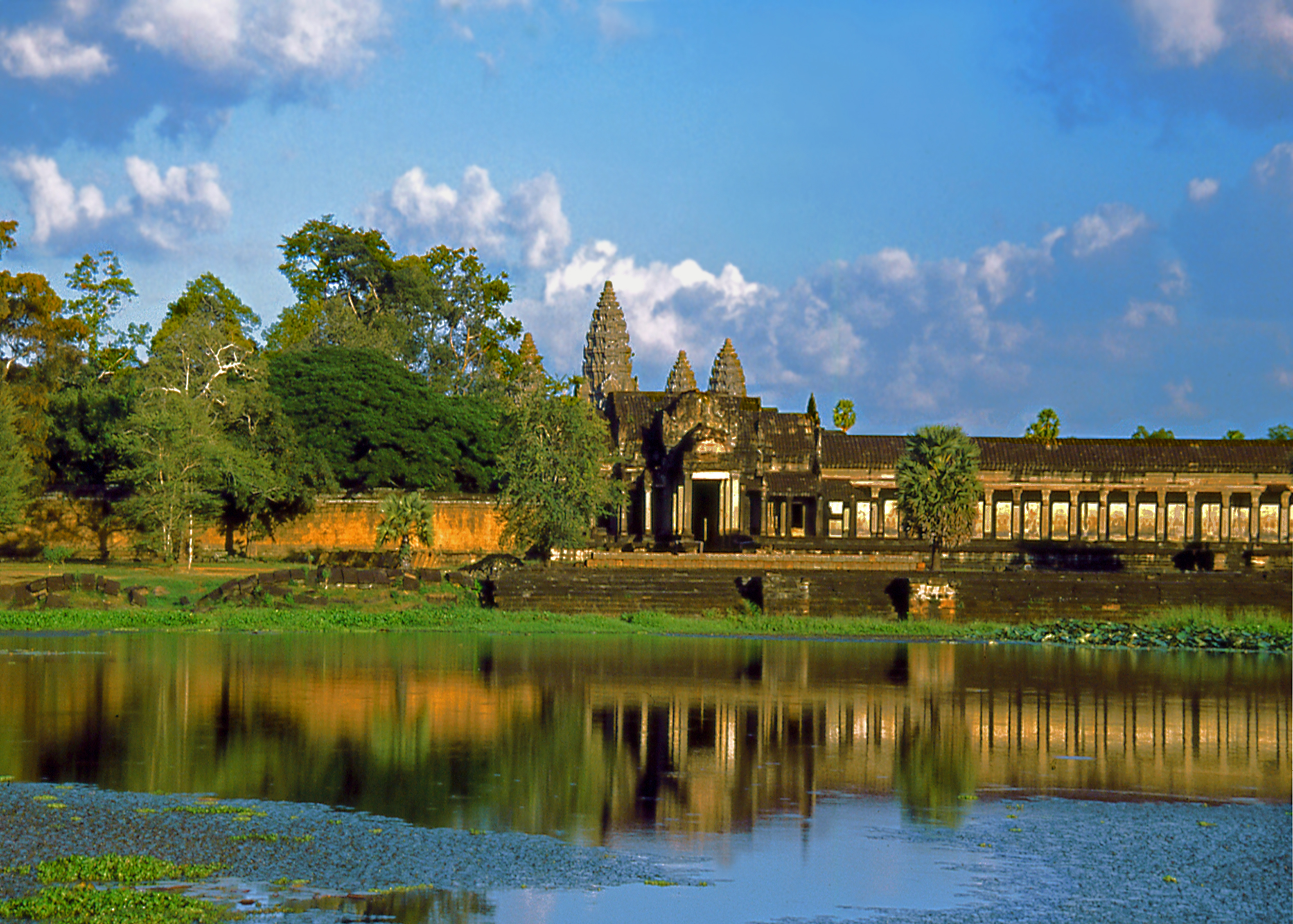
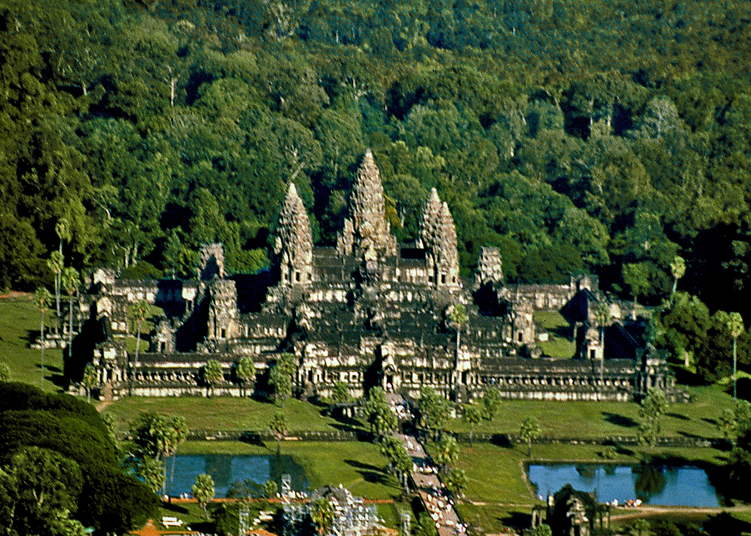
Overview of Angkor Wat
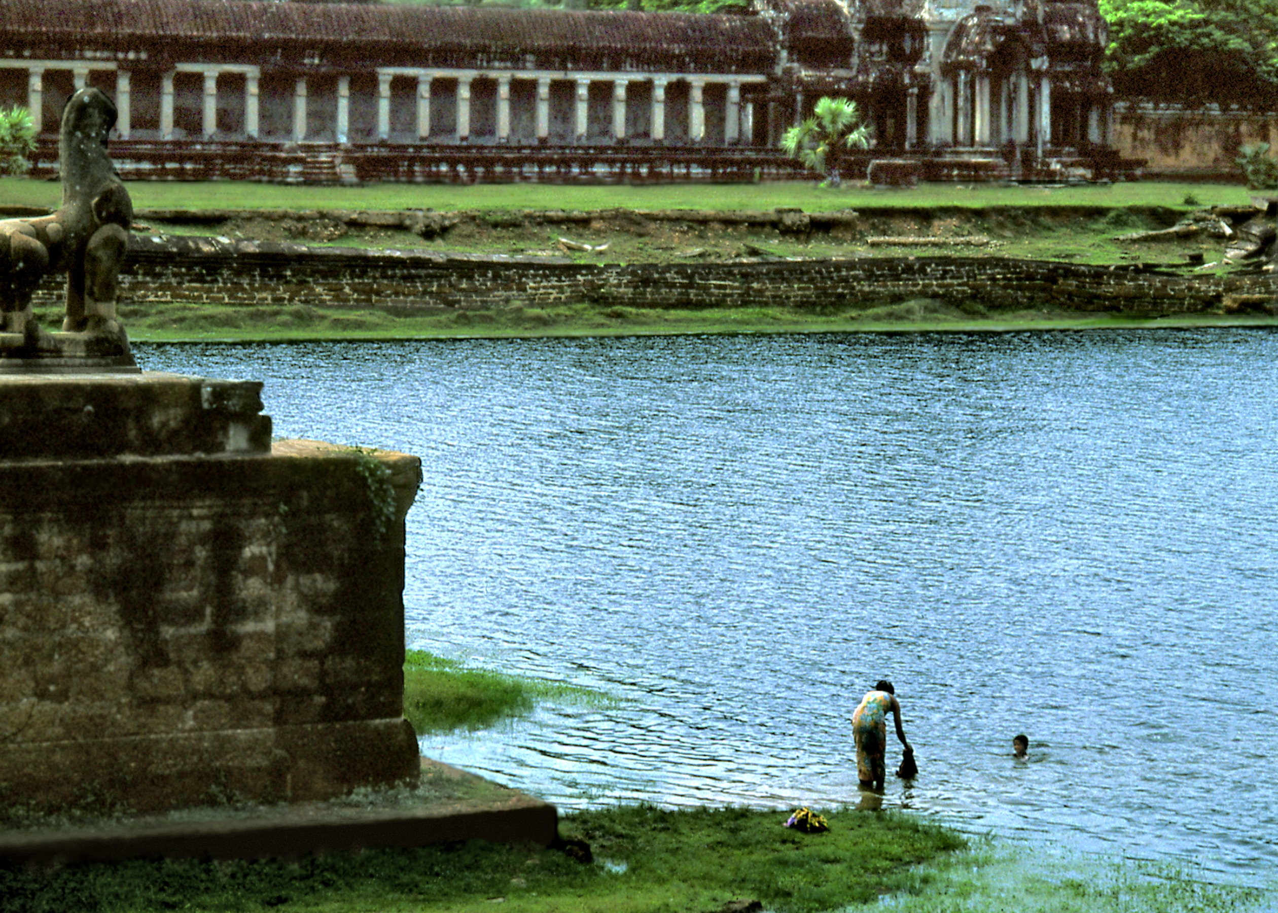
Angkor is located in a large basin bounded by the Tonle Sap lake to the south and mountain ranges to the north. The Mekong River and its tributaries traverse Cambodia, flowing from their source in the Himalayas to the South China Sea. After the rainy season, silted channels cannot accommodate the excess water and the river backs up, flooding the Tonle Sap and doubling its size. The flooded area becomes an ideal habitat for fish and rice cultivation. The rulers of Angkor achieved feats of hydraulic engineering to control and manage this water supply as their source of power and prosperity. Two large reservoirs, the East and West Barays, supplied the city’s water. Like the verdant backdrop of vegetation that surrounds it, the reflective expanses of these vast water features greatly enhance Angkor’s aesthetic appeal.
The Moat Serves as Water Supply
In the flat landscape of the region several isolated hills stand out and their promontories became the site of the first temples. By the 10th century, the basic design of a single tower atop a stepped platform was expanded into a five-tower design, where a large central tower symbolizing Mount Meru is surrounded by four smaller ones at each corner and stairs at the four cardinal directions in a cruciform plan. These basic elements multiplied throughout the monument form the radiating geometric pattern of a cosmic mandala diagram. Unlike other monuments at Angkor and Hindu temples in general, Angkor Wat faces West, the region of the dead, not East and the rising sun. It may have been built as a funerary monument for Suryavarman II (1113 -1150 CE), one of the greatest Khmer rulers.
Plan of Angkor Wat
Angkor Wat (wat means temple) is immense, bounded by three con-centric walled enclosures and surrounded by a wide moat. The moat is crossed by a stone causeway leading to a tall gopura or entry tower (derived from South Indian temples). Towers also rise at the corners of the enclosure walls and over each of the four entrances. The walls are not defensive in nature, but rather function as psychological barriers circumscribing a sacred space. Steep stairs lead to the central summit of five towers whose tapering profiles resemble sprouting lotus buds. Only the king and priests were allowed on the top level. Thus at Angkor Wat as one moves inward into the heart of the temple complex one simultaneously ascends, physically enacting the symbolism of climbing a sacred mountain.
Ascending the Temple Mountain
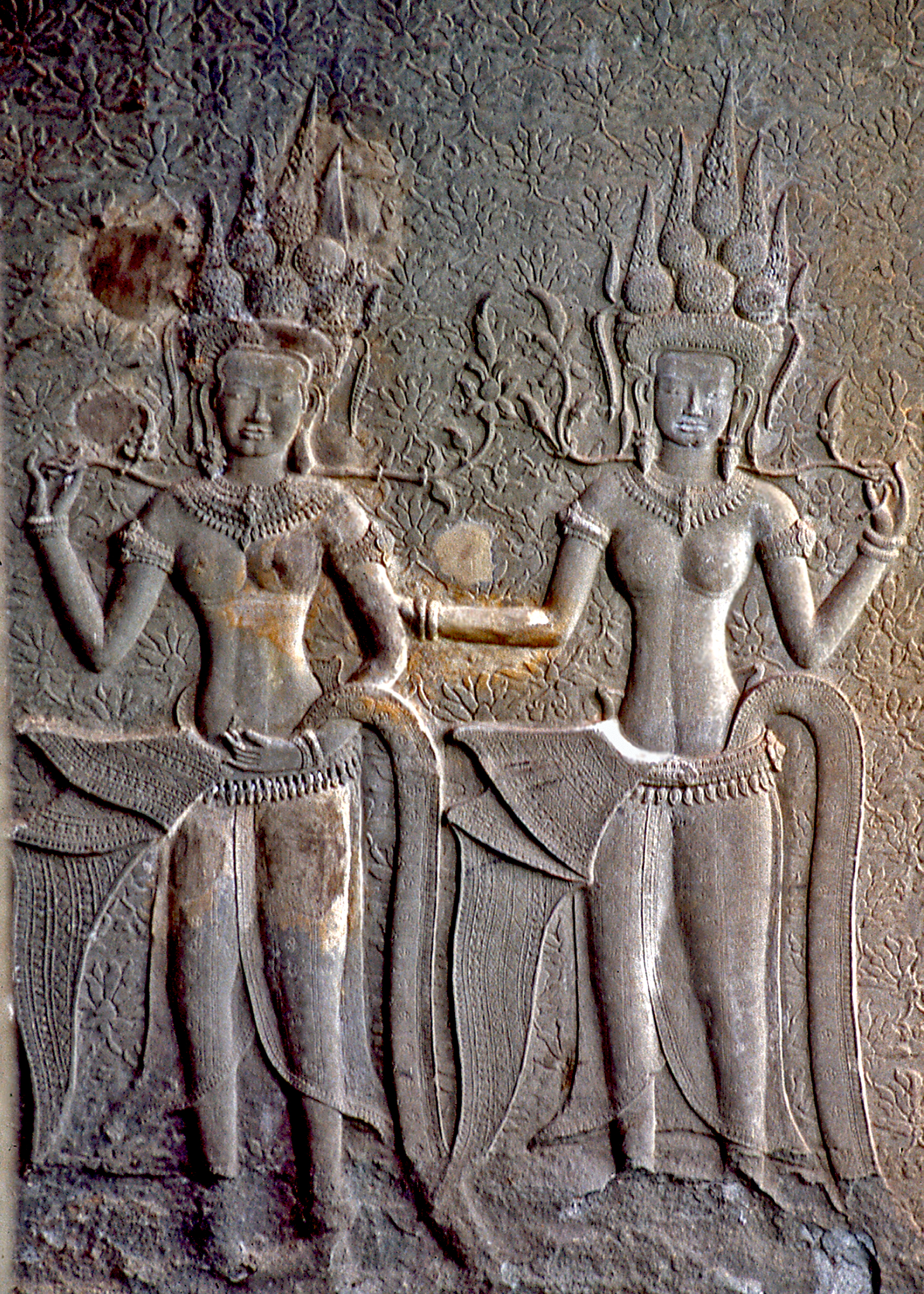
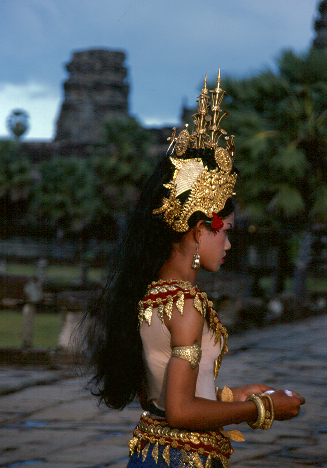
The central summit, home of the god-king, is ringed by long raised galleries with vaulted stone roofs and colonnades open on one side. The inner walls are covered with exquisite bas reliefs depicting the Hindu Ramayana epic, court processions and battle scenes. The galleries also feature over 1,500 reliefs of apsaras (celestial dancers of Hindu mythology) no two alike. They stand in graceful poses, gorgeously attired and bejeweled, enchanting visitors with their timeless allure. Walking down the deserted corridors and empty galleries, through slanting shafts of light and darkness, one can almost hear their long-vanished whispers and lilting laughter emanating from the walls.
Apsara ReliefDancer Resembles Ancient Counterparts
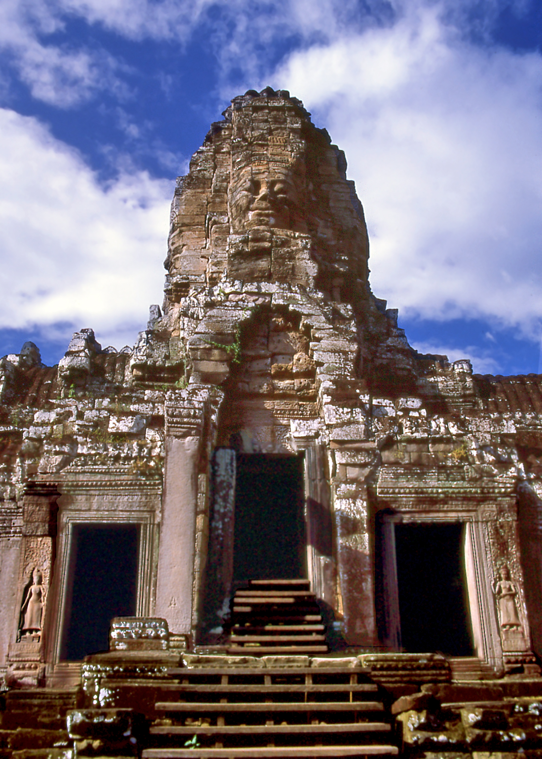
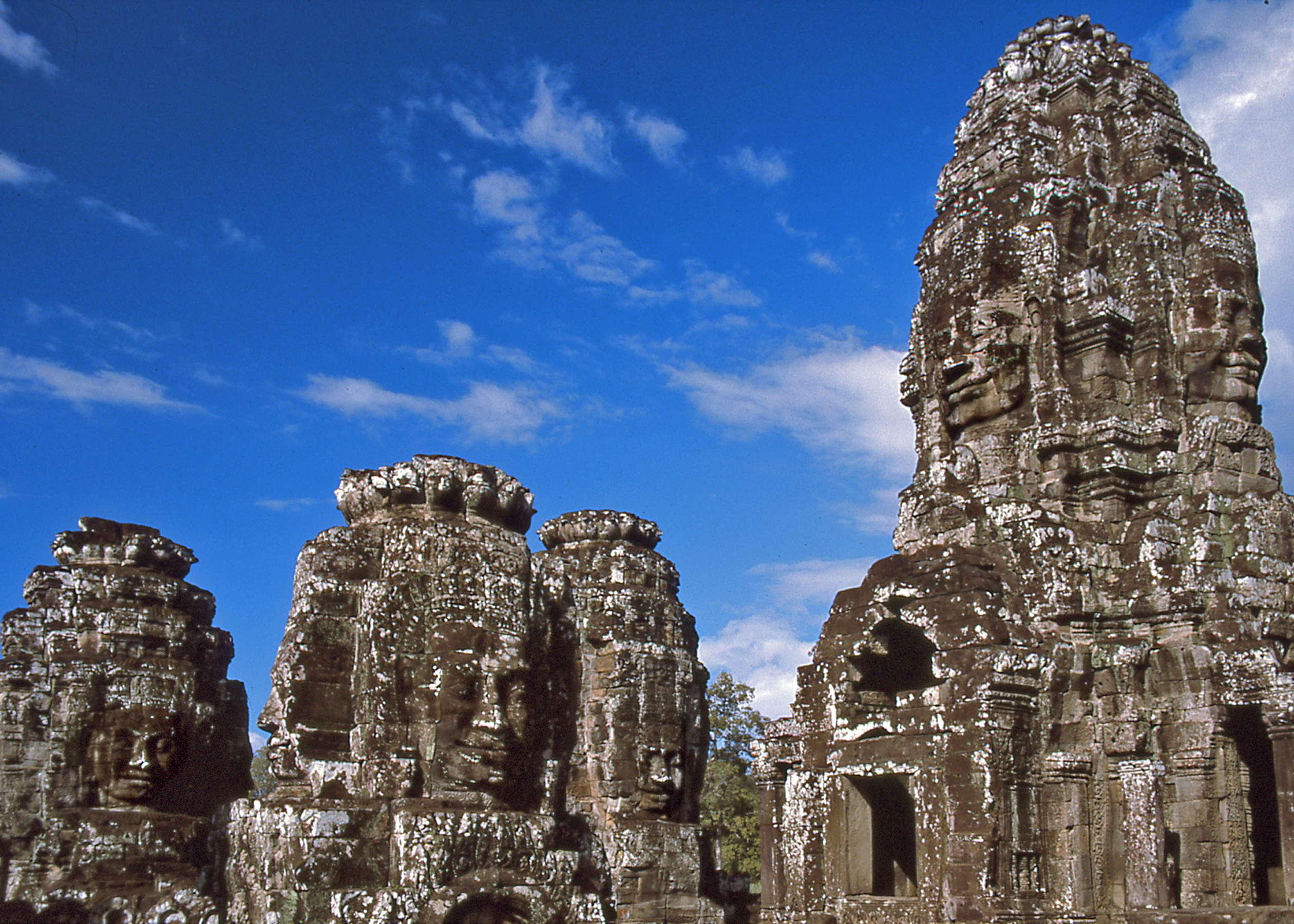
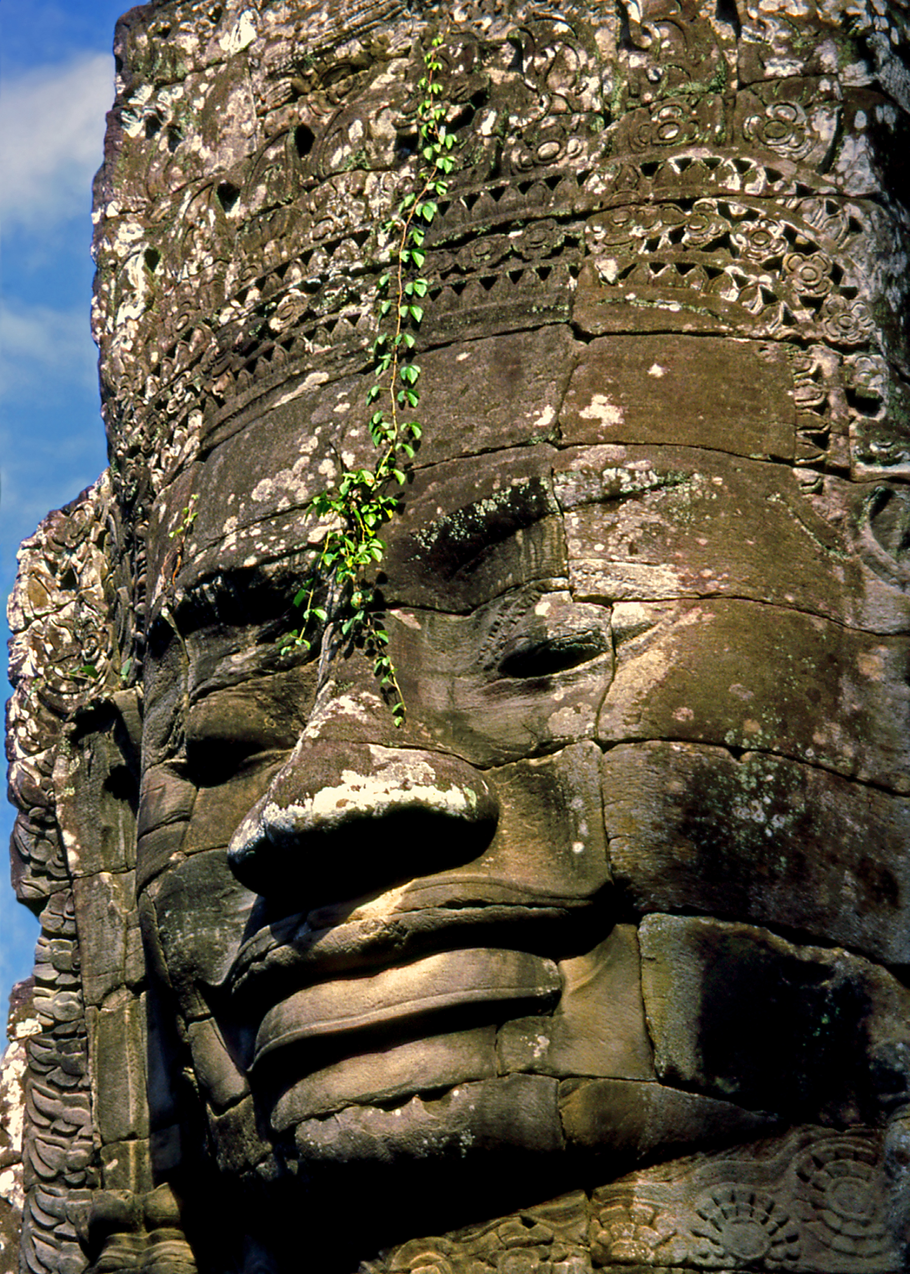
The nearby city of Angkor Thom was built by king Jayavarman VII (1181-1220) in an area slightly to the north of Angkor Wat. The city was laid out in a quadrilateral ground plan and surrounded by an enclosure wall and moat. A bridge leading to the city gates crosses the moat, ornamented on each side with a row of mythological figures holding the body of a giant serpent as the railing. The entryway gopuras feature the distinctive colossal faces looking out toward the four directions. At the very center of the city, Jayavarman VII placed his own temple-mountain, the Bayon, dedicated to the Buddha. His monument evinces the interplay between Hinduism and Buddhism prevalent at that time.
Faces on the Towers of the Bayon
Over 200 faces carved on 54 towers give the temple its surreal and enigmatic character. They feature the famous “Smile of Angkor,” downcast eyes and serene expression considered the epitome of Khmer art. They have been interpreted as representing the omni-presence of the king in the guise of his patron deity the Bodhisattva Lokeshvara. Angkor Thom was designed as a microcosm of the universe, a giant mandala divided into four quarters with concentric monuments radiating outward from the central temple-mountain of the Bayon, seat of the powerful god-king and cosmic link between heaven and earth.
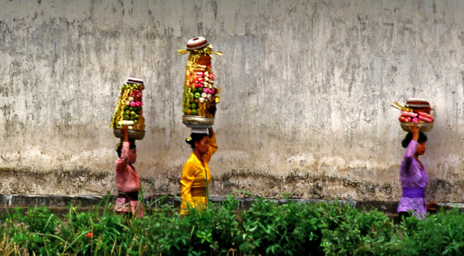
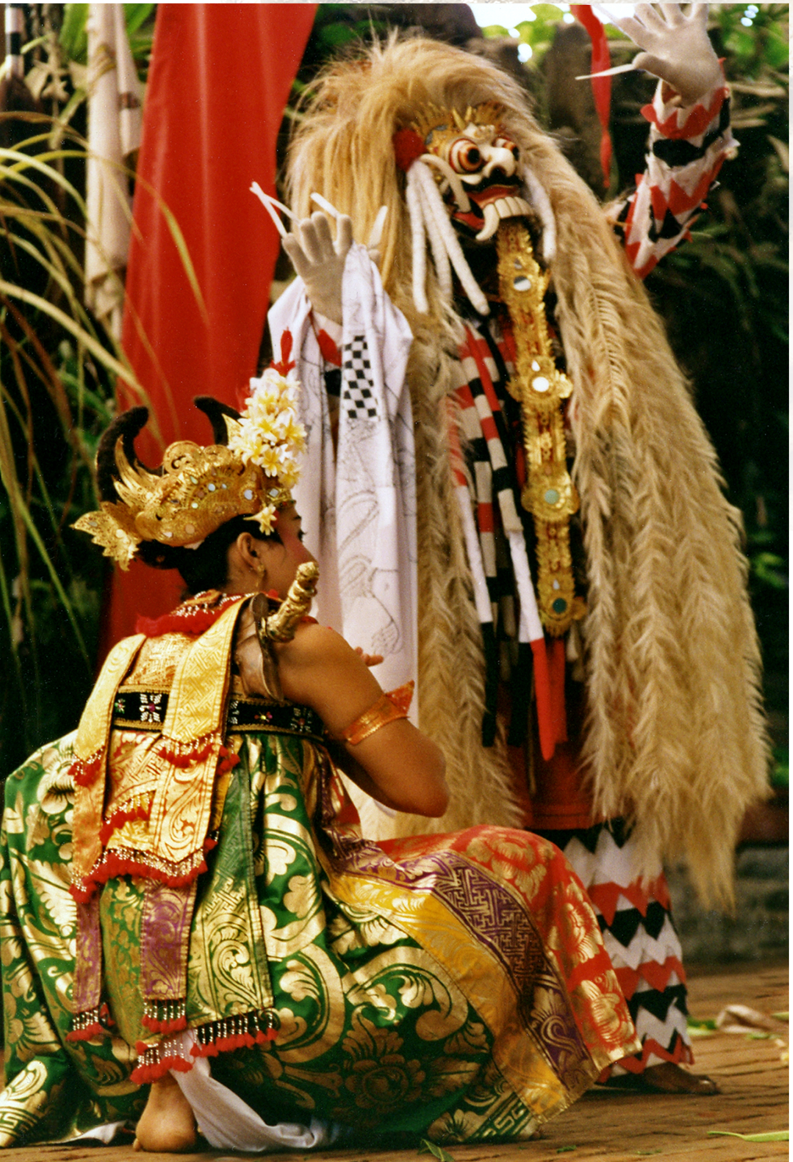
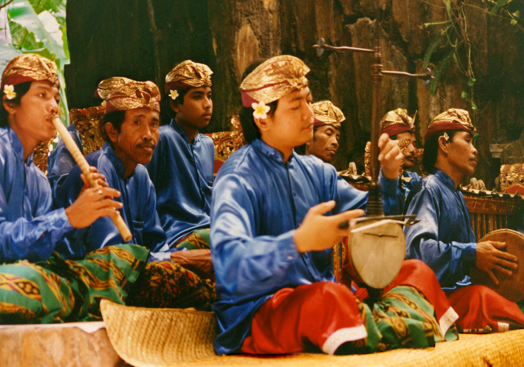
The beautiful tropical island of Bali boasts a rich and complex culture belying its small size. For centuries Bali was culturally and politically linked to neighboring Java, home to a powerful maritime empire influential throughout Southeast Asia. After the spread of Islam to the Indonesian archipelago in the 16th century, the Hindu aristocracy of Java with its priests, scholars, artists, dancers and musicians fled to the secluded sanctuary of Bali, adding to the small island’s cultural heritage. Today Bali is the last stronghold of Hinduism in Indonesia. Balinese Hinduism is a fascinating mixture of adopted Indian philosophy and rituals overlaid upon the island’s indigenous animism with its ancestor worship and magical practices. In Balinese cosmology spirits are everywhere, and their propitiation through daily offerings and rituals maintains the cosmic order and the balance between good and evil forces. The famous Balinese dance dramas depict this mythic world of gods and nature spirits, with their flower bedecked and gorgeously costumed dancers gracefully gesturing to the hypnotic music of the gamelan.
Balinese Dance Drama — (click photos to enlarge)Gamelan Orchestra
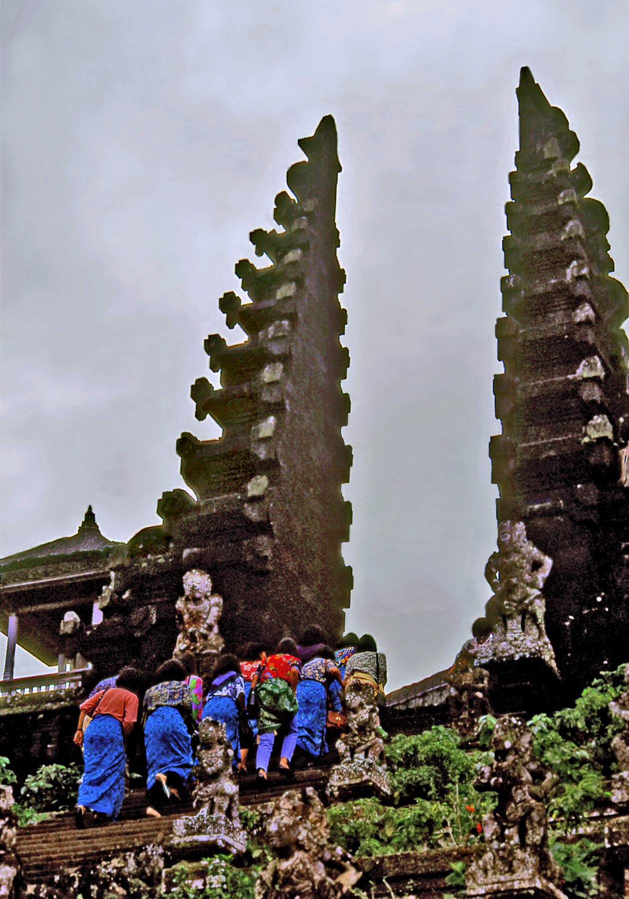
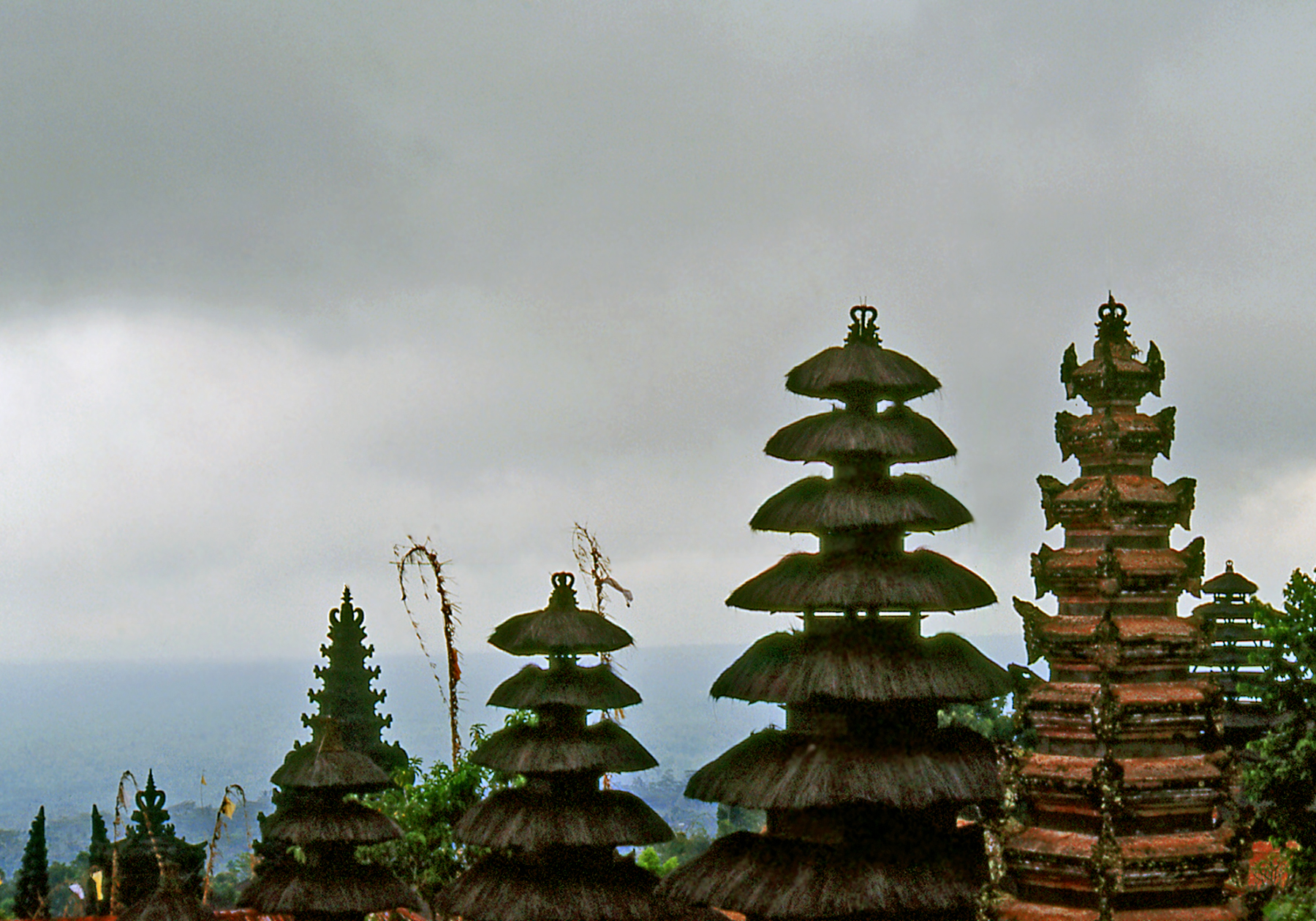
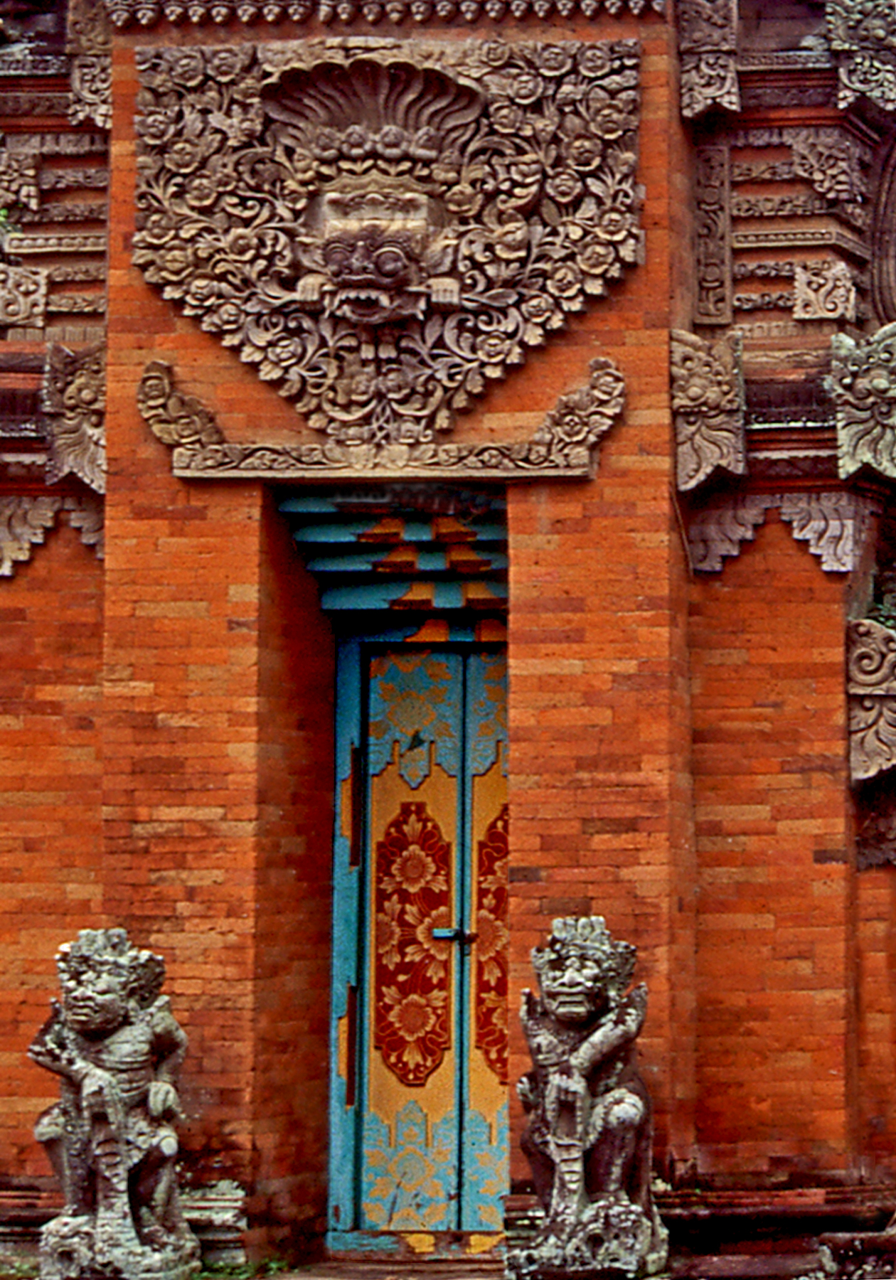
The range of towering volcanoes at the center of the island is con-sidered to be the realm of the gods, with Gunung Agung, the highest mist shrouded peak being the home of Shiva. Perched on its slopes is Pura Besakih, Bali’s most sacred “Mother Temple” originally dating from the 14th century. It consists of a series of courtyards connected by steep stairways, each containing multi-roofed thatched shrines resembling pagodas. They are called “meru” harking to the Hindu mythical mountain at the center of the universe. Temple courtyards also function as performance spaces for sacred music and dance. They are entered through unusual split gateways with no top lintels and each side ending in a pointed wing-like projection. As the place of transition between secular and sacred space, temple doorways are decorated with protector masks and flanked by guardian figures.
Climb to Pura BesakihMerus at Pura Besakih
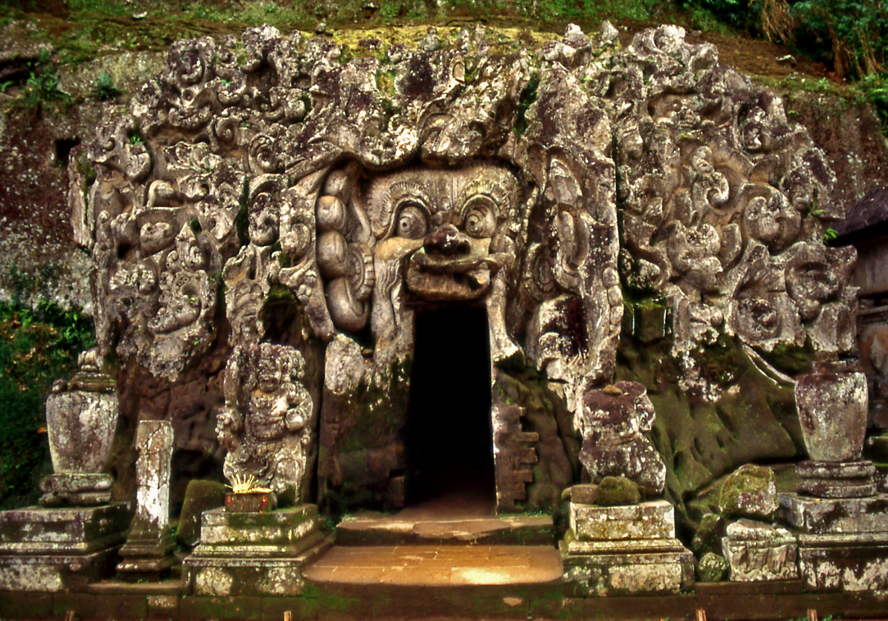
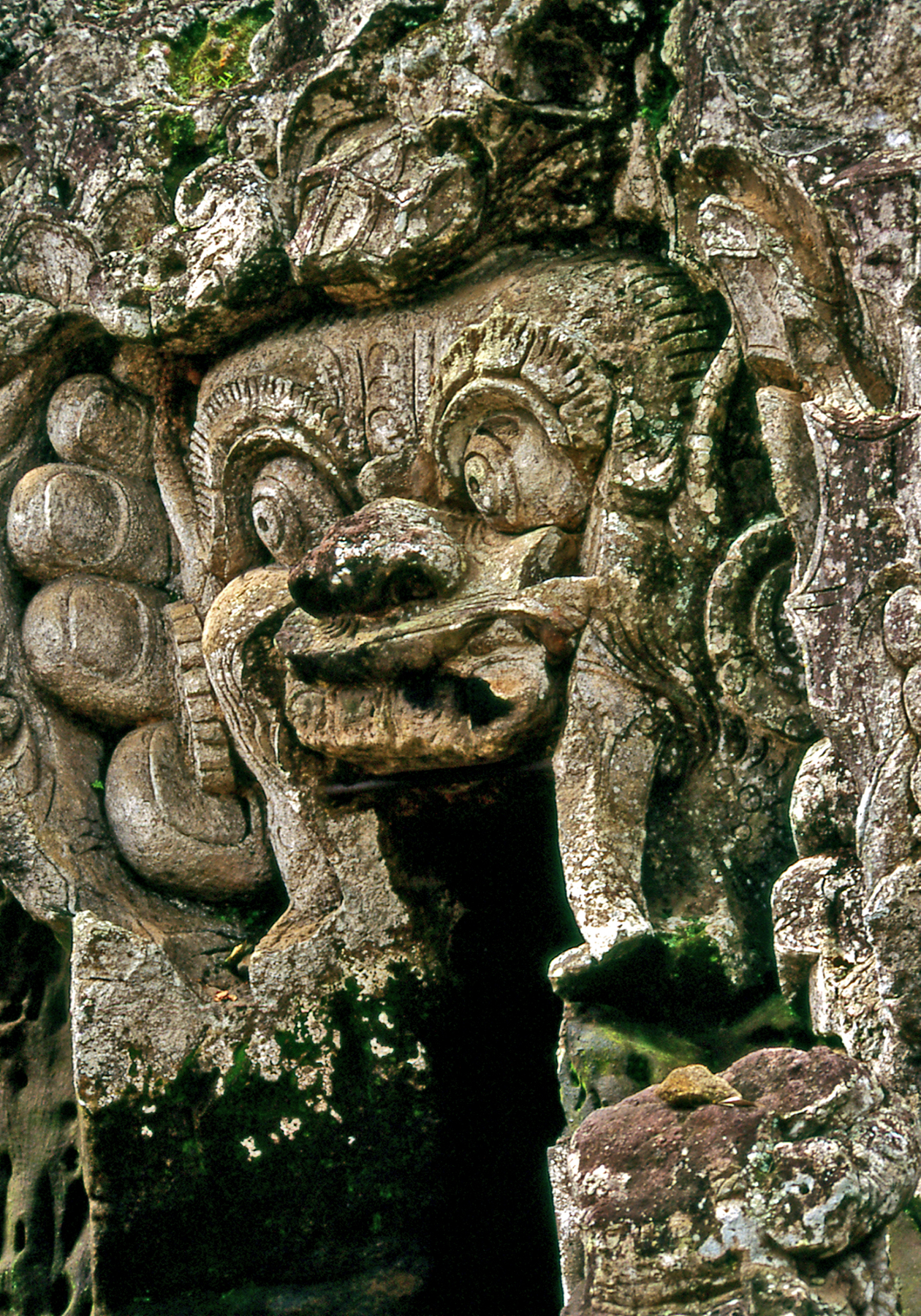
Balinese art is imbued with a baroque sensibility inspired by the exuberant tropical environment. The cave of Goa Gajah dates from ca. 1,000 CE. The side of a low hill has been carved with intertwined plants, animals and decorative scrolls which seem to move and writhe as they emerge from the dark depths of the earth, bursting forth in astonishing profusion. They surround a giant stone face whose mouth forms the entrance to a small natural cave. The face is said to represent Bhoma (born of the earth) the son of Vishnu, ruler of the waters, and the earth goddess whose union ensures the fertility of the soil and brings forth vegetation. Nearby is a ritual bathing pool fed by natural springs and decorated with statues of women holding pots from which the water pours into the pool. Thus cave and pool symbolically represent the importance of water in Balinese life.
Cave of Goa GajahFace Detail
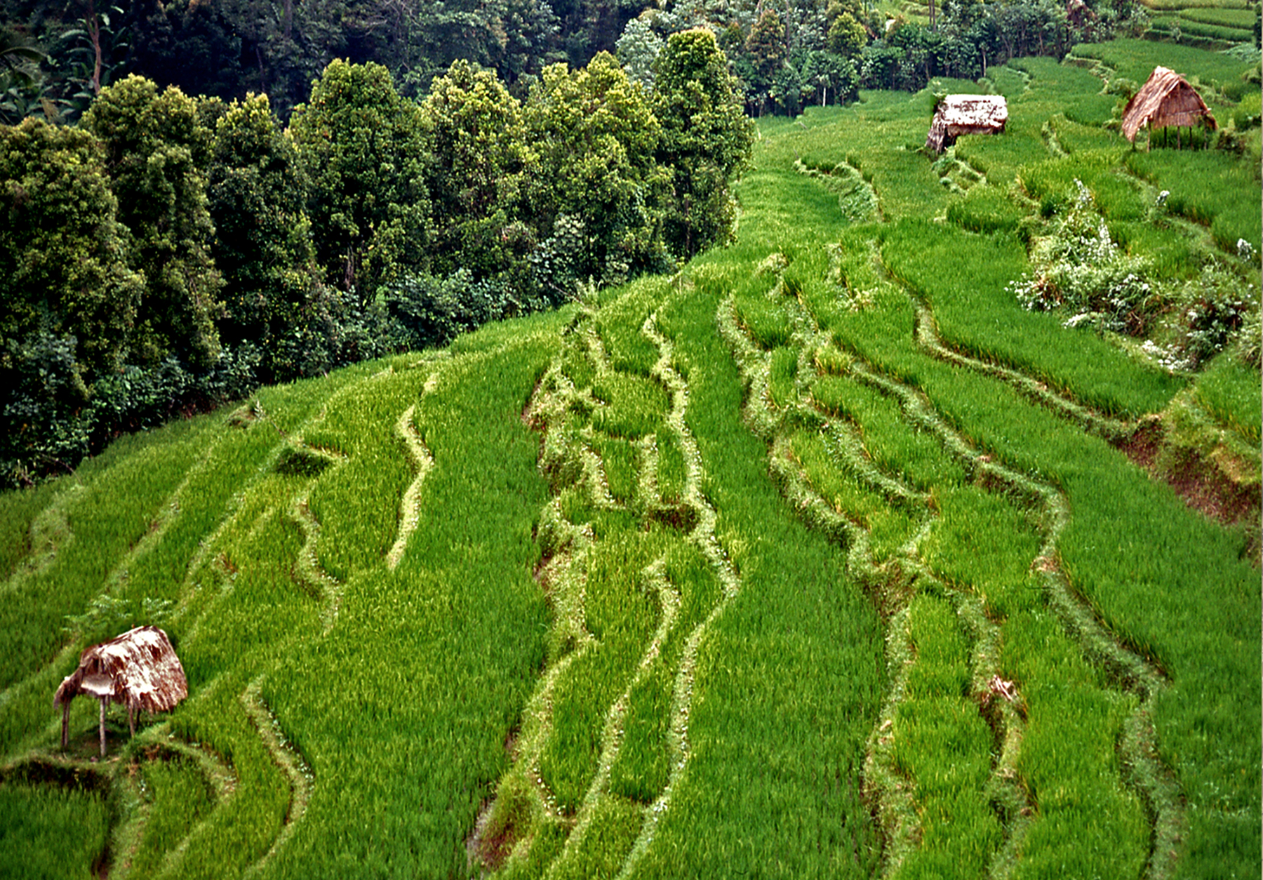
The spectacular contoured rice terraces that blanket the hillsides of the central highlands depend on an elaborate irrigation system, one of the oldest in continuous use in the world. Water from streams and mountain lakes has been diverted into aqueducts and channels that are maintained through communal work and rituals tied to the social and religious organization of the surrounding farming villages.
Highland Terraces
The town of Ubud in the central highlands is the cultural heart of the island. Away from the tourist traffic of the beach resorts, it is still possible to experience the unique integration of nature and culture that is traditional Bali: a verdant landscape animated by the spirits of forests, waters and mountains kept in ecological and spiritual balance by the power of rituals and the beauty of art.
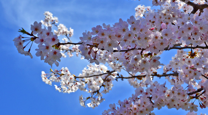
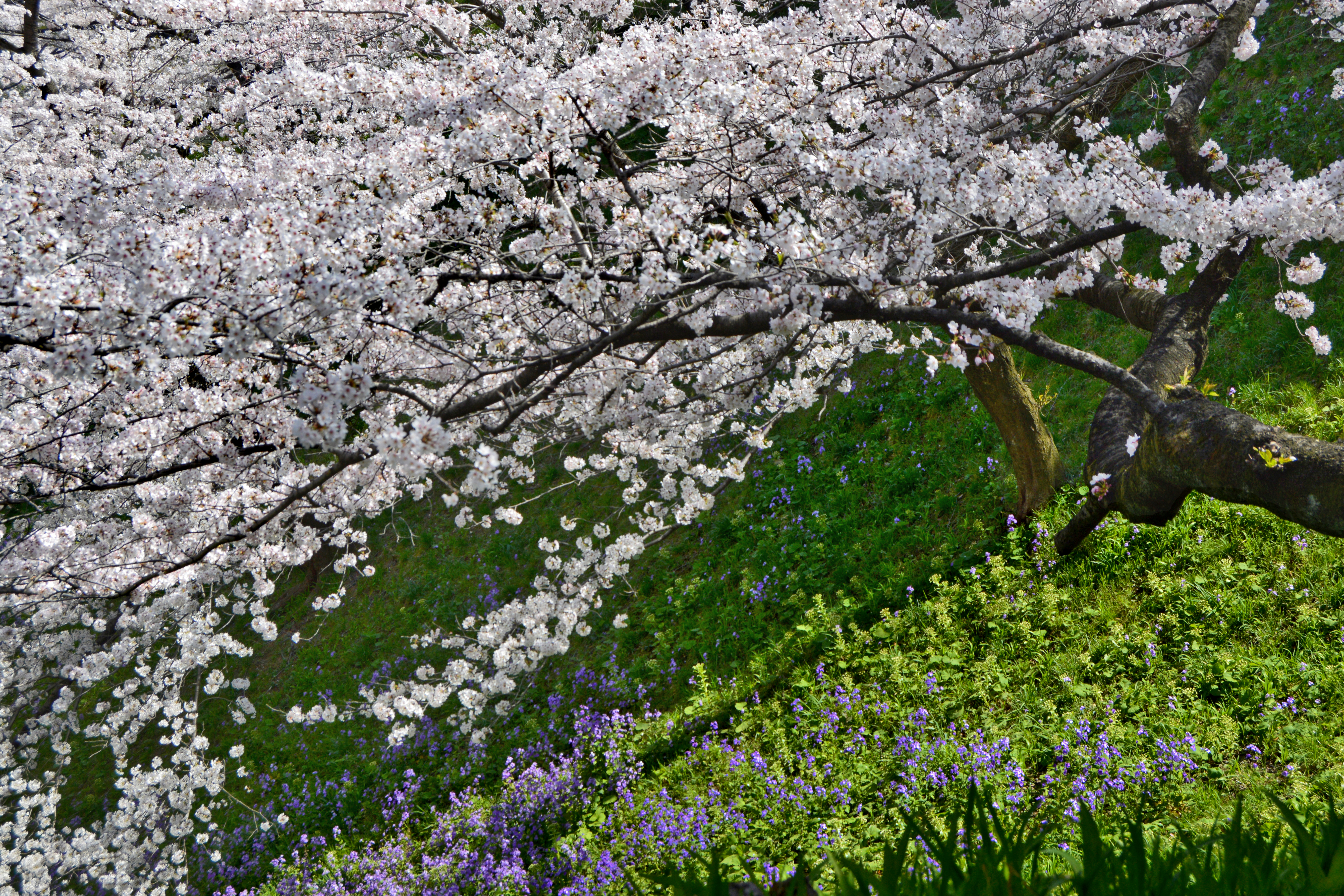
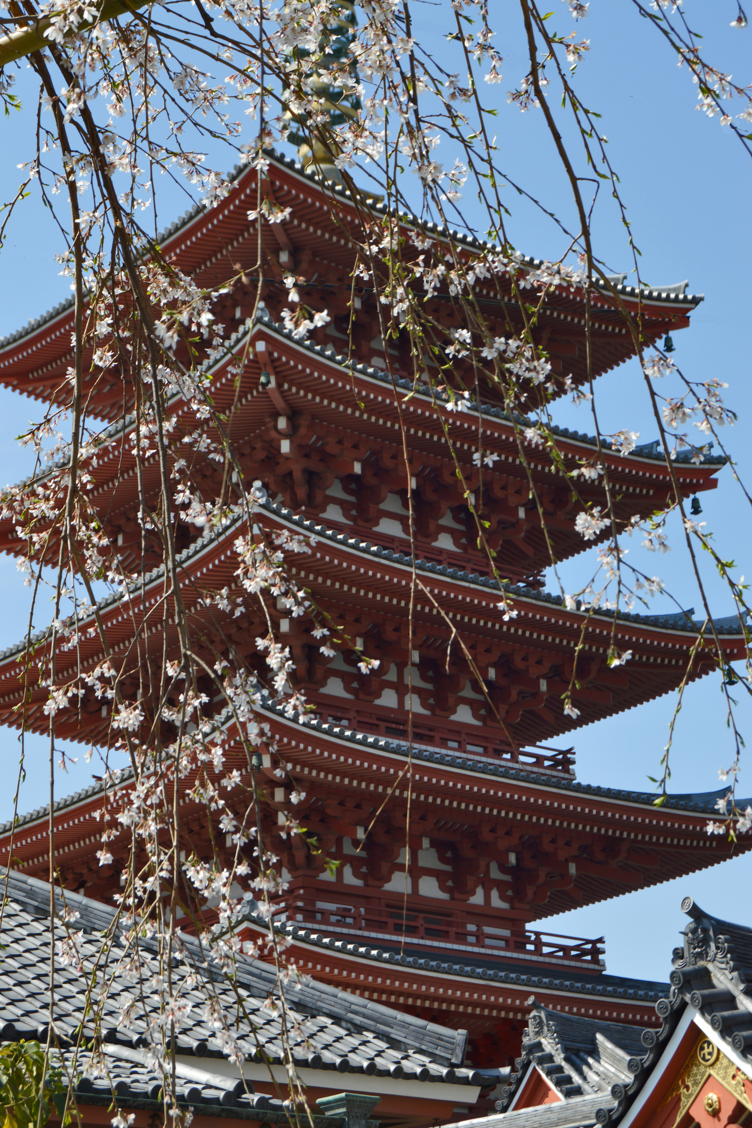
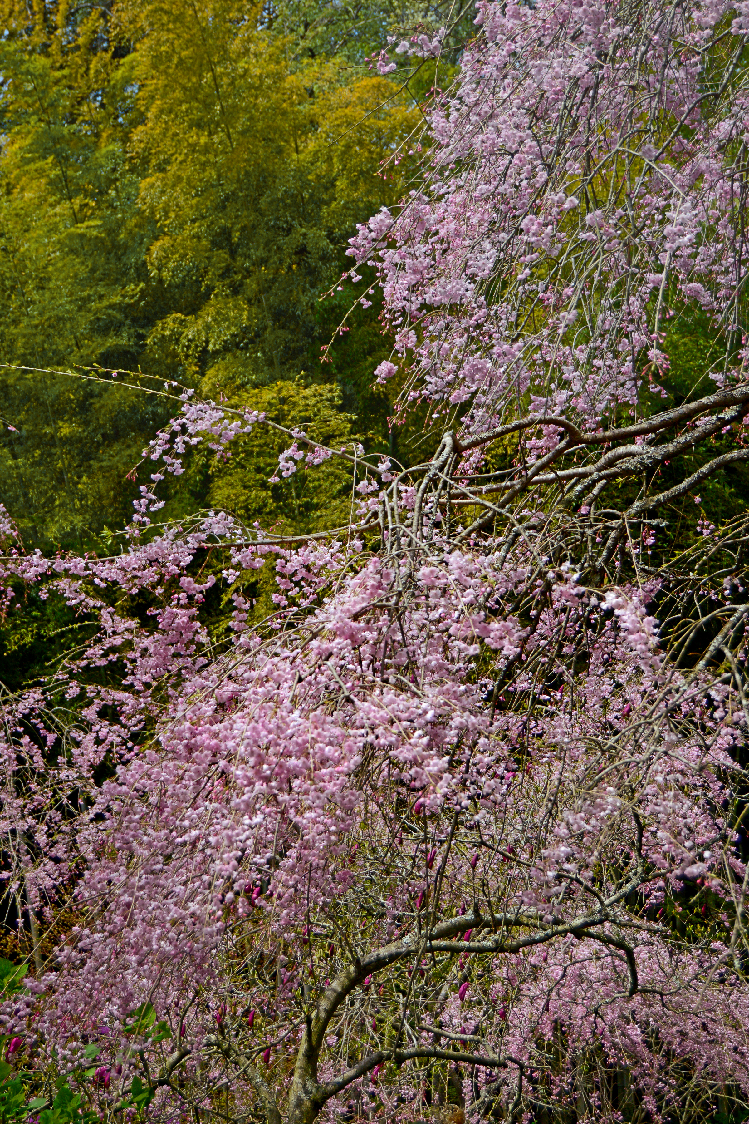
The traditional Japanese appreciation of nature and natural materials is evident in their architectural use of wood, straw, paper and stone; culminating in the aesthetics of the Japanese garden. This love of nature is demonstrated every year during cherry blossom season, as the blooms gradually spread throughout the country from mid March to late April; forecasted and monitored by the Japanese weather service and eagerly followed by the general public.
Signs of Spring — (click photos to enlarge)
The flowering cherry tree (prunus serrulata) called “sakura” is the national flower of Japan. These ornamental trees are grown primarily for their flowers and don’t produce fruit (edible cherries come from a related species of prunus which also comprise plums, peaches, apricots and almonds). Flowering cherries include some spectacular weeping varieties, and their blossoms range in color from pure white to deep pink shades.
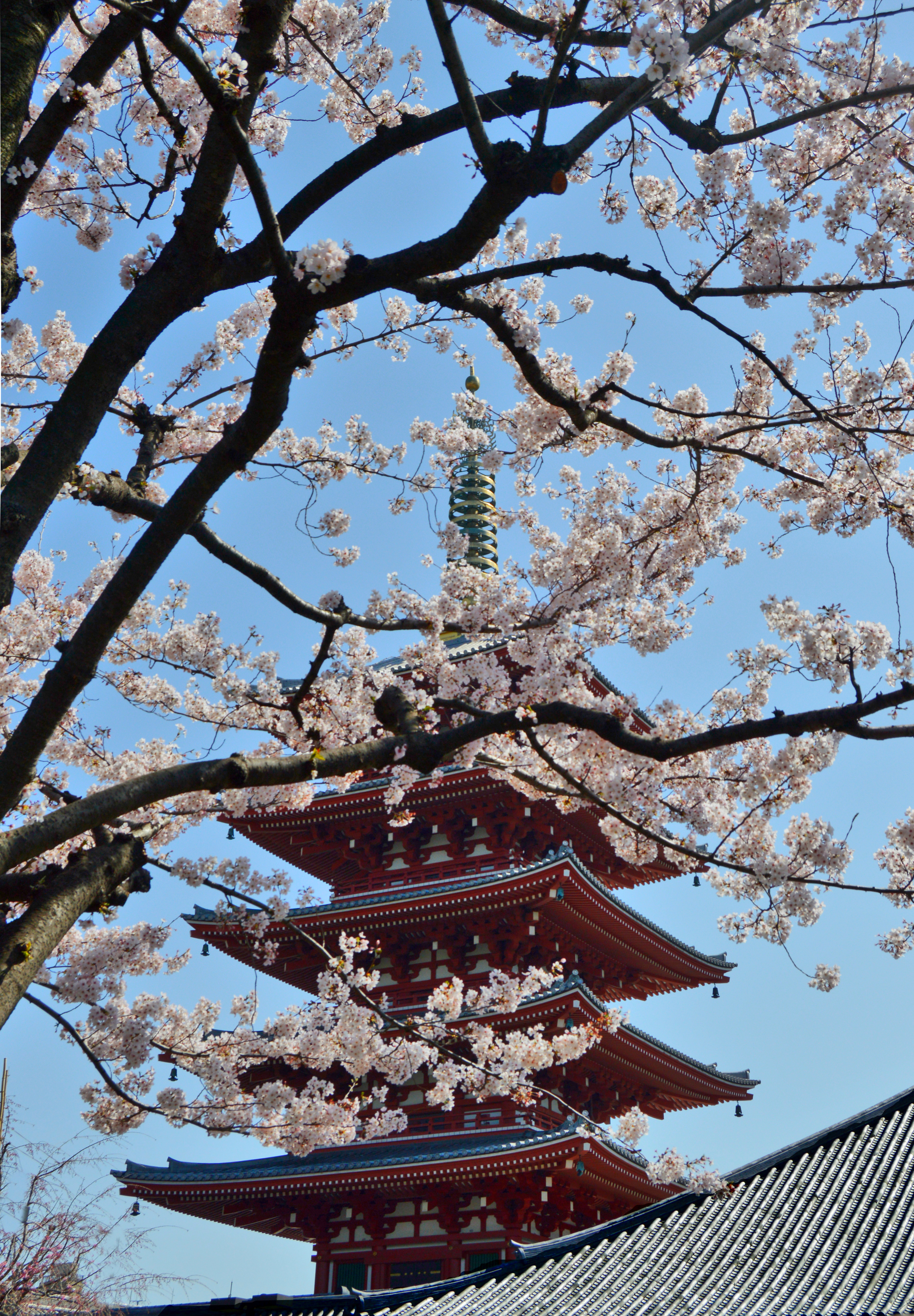
Asakusa Shrine
With the arrival of Spring, in large cities such as Tokyo, a collective obsession seems to take hold of the population as thousands of people gather (ever so politely) to view the cherry blossoms, take countless photographs, picnic and drink sake under the flower-laden trees. Family outings, office parties and school field trips all converge in the joyful exuberance of a shared pleasure. And in the evenings for “yozakura” (night-sakura or flower-viewing at night) paper lanterns and artificial illumination turn parks, tree-lined streets and canals into magical wonderlands.
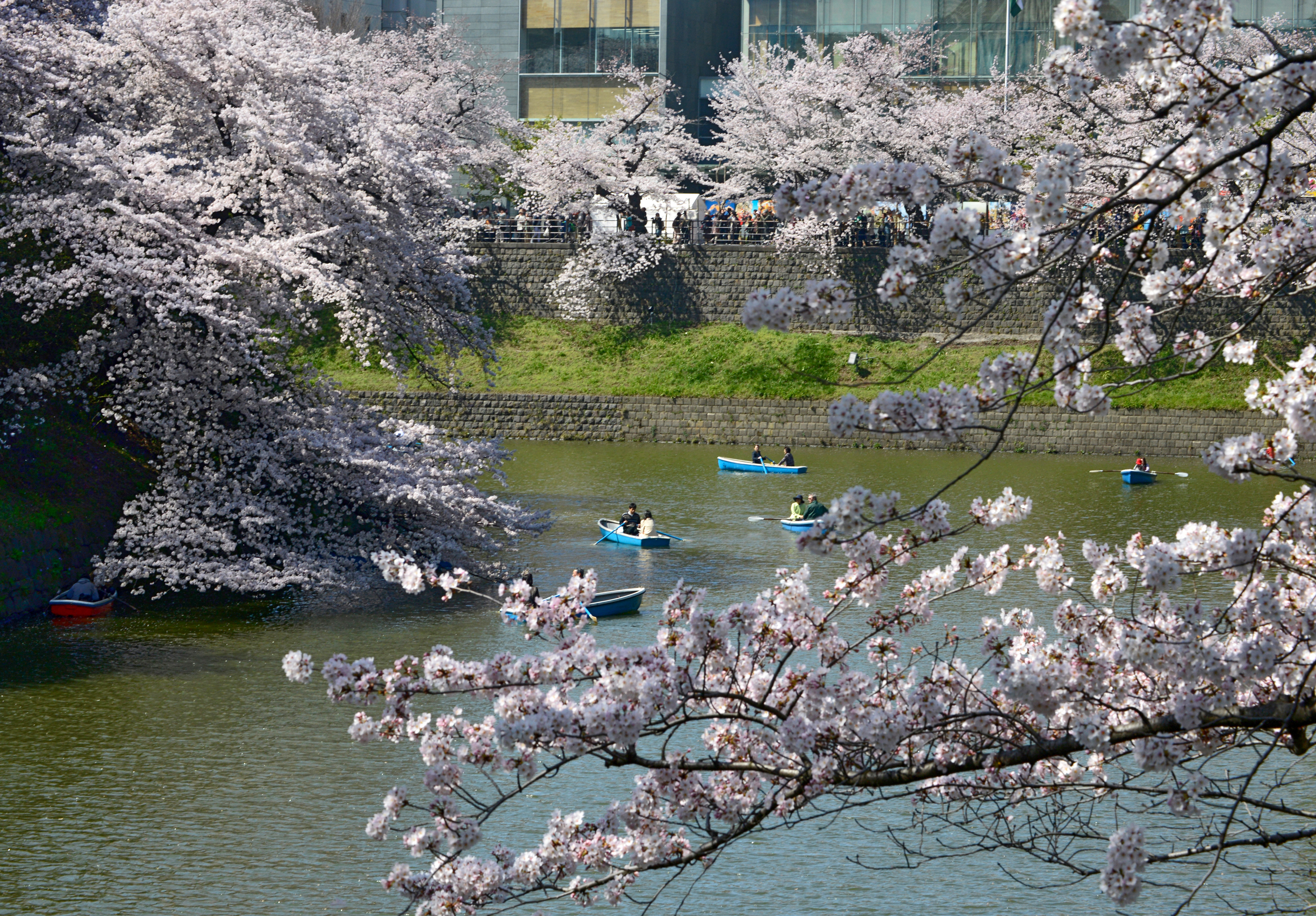
Moat Surrounding the Imperial Palace, Tokyo
“Hanami” (flower-viewing) is a centuries-old Japanese tradition which originated among the aesthete courtiers of the Heian period (794-1185). Members of the Imperial Court would gather to admire the sakura at outdoor parties featuring poetry competitions. The custom later spread to all classes of society, and even fierce samurai warriors cherished the peacefulness of their gardens and paid poetic homage to the frailty of flowers.
Meigetsu-in Temple Garden, Kamakura
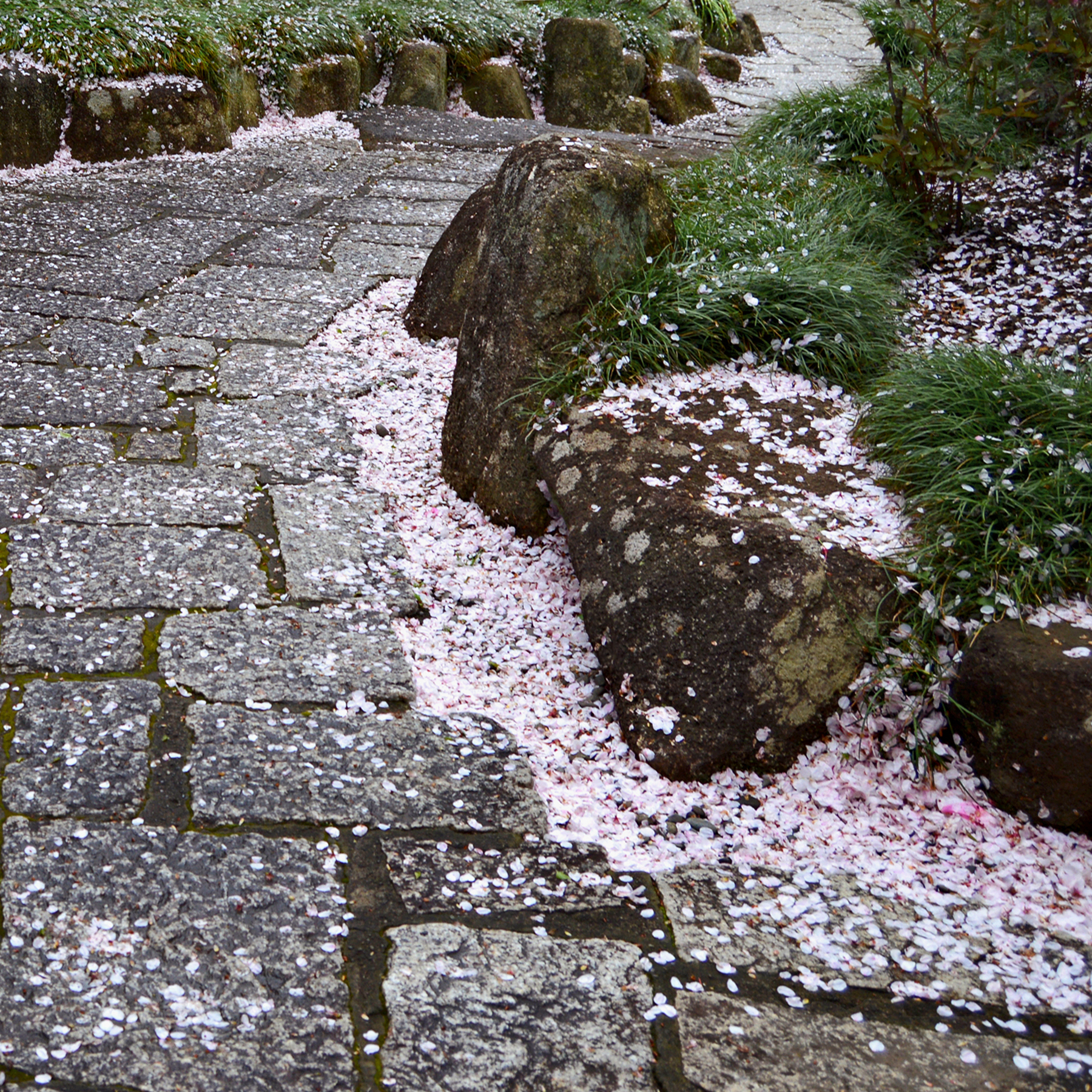
Ever since, cherry blossoms with their short but spectacular blooming season have been favorite subjects for Japanese poetry and painting, symbolizing life and beauty, evanescence and death. This poignant pleasure in the ephemeral transience of things is peculiarly and endearingly Japanese. There is even a term for such feelings “mono no aware” (the pathos of things), a wistful awareness of the impermanence of beauty. Impermanence is one of the essential doctrines of Buddhism which, over the centuries, has permeated many aspects of Japanese culture.
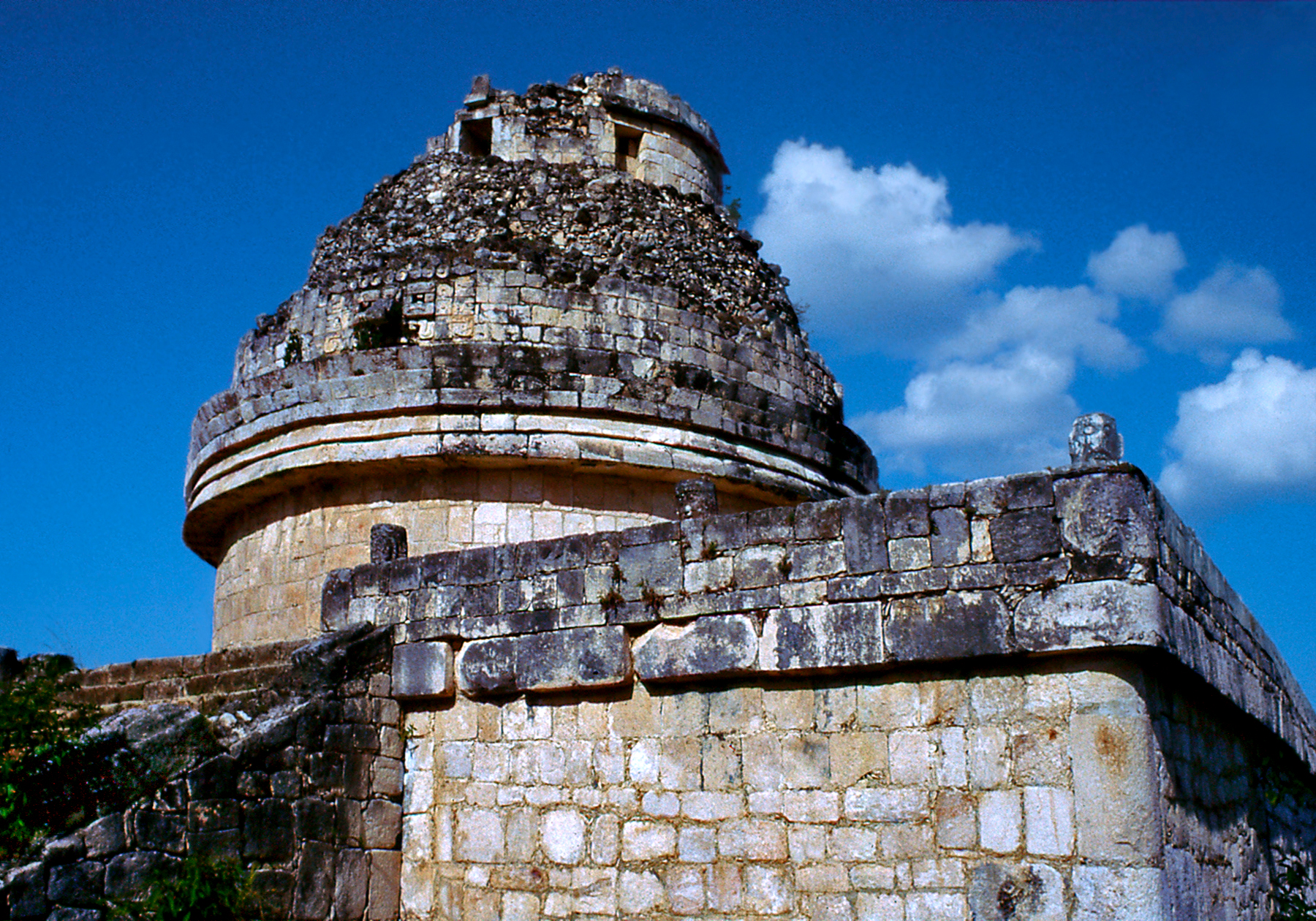
During the Late Classic period Maya society was undergoing significant changes and becoming increasingly militaristic. In 918 CE the Itzas, a Maya-Toltec ethnic group, conquered northern Yucatan. These warriors introduced new elements from central Mexico into Maya culture. The circular shape of the observatory known as El Caracol derives from central Mexican temples dedicated to Ehecatl, god of the winds. This unusual structure consists of two concentric corridors and a spiral staircase which leads to a room with window slits oriented to various astronomical alignments. The Maya were superb astronomers and mathemati-cians who independently developed the concept of zero, performing advanced calculations and devising an accurate calendar spanning millennia. Maya priests observed celestial cycles of the sun, moon, planets and stars to predict future events and determine propitious times for ceremonies and important endeavors.
The Observatory — (click photos to enlarge)
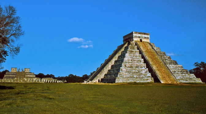
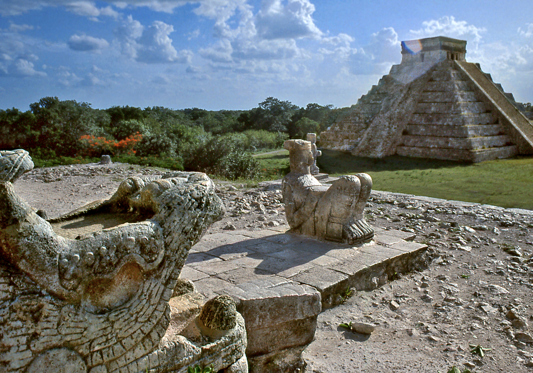
The layout of Chichen-Itza also breaks with old traditions. Buildings are no longer grouped together to form quadrangles or an acropolis, but instead stand isolated in the middle of great plazas. The pyramid of El Castillo commands the central plaza with its stepped profile of alternating “tablero” (flat planes) and “talud” (sloping sides). Its design is a representation in stone of the Maya calendar system.
View of El Castillo
Four stairways ascend to the summit and the 91 steps on each side added to the top platform equal the 365 days of the year. The 9 levels of the pyramid are divided by the stairs into 18 sections, the number of months in the Maya year. The 52 sections of tablero correspond to the number of years in a full cycle of their Calendar Round. The Maya believed in the cyclical nature of time, and this 52 year cycle held special significance for them. The ending of a cycle was an ominous time which could herald the destruction of the world or its renewal, and the dawn of each new cycle was greeted with bonfires and festivities.
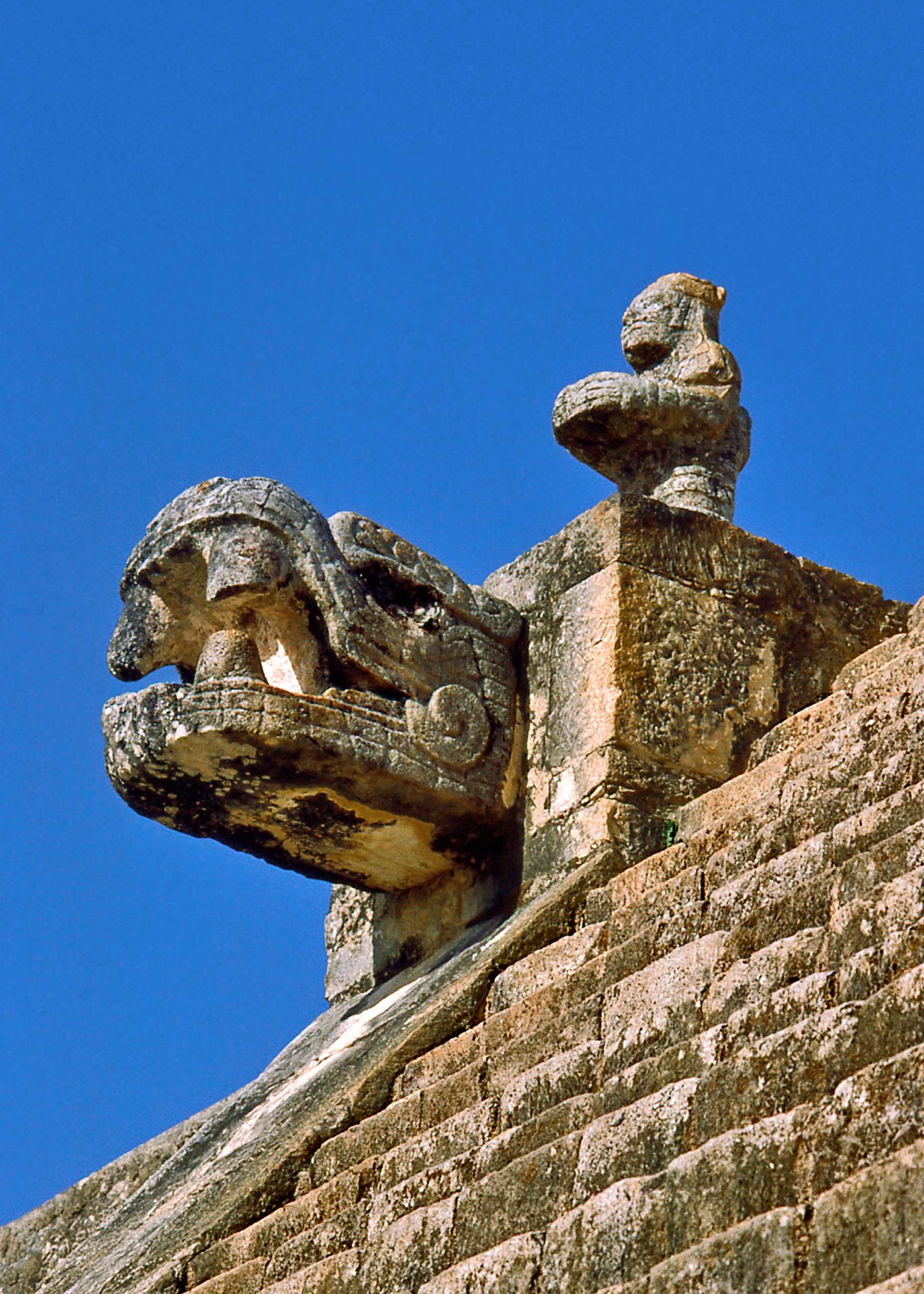
Kukulcan the Feathered Serpent
El Castillo was also designed to produce an astonishing light and shadow display during the spring and autumn equinoxes, as the light of the setting sun slithers down the main stairway, from the temple at the top to the serpent heads at the base, reenacting the descent of Kukulcan from heaven to earth. Kukulcan was the name given by the Maya of Yucatan to Quetzalcoatl the feathered serpent. This bene-volent deity who brought mankind the arts of civilization was widely worshipped throughout Mesoamerica.
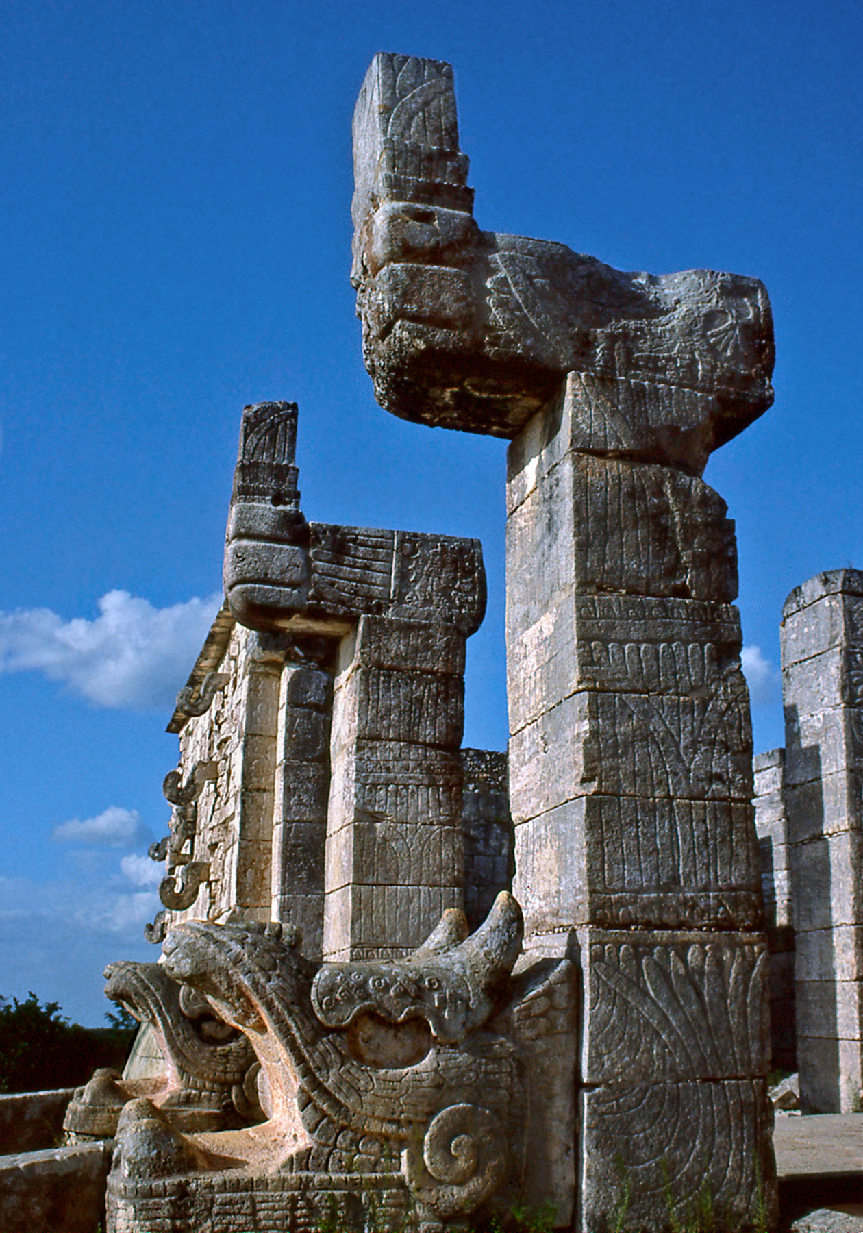
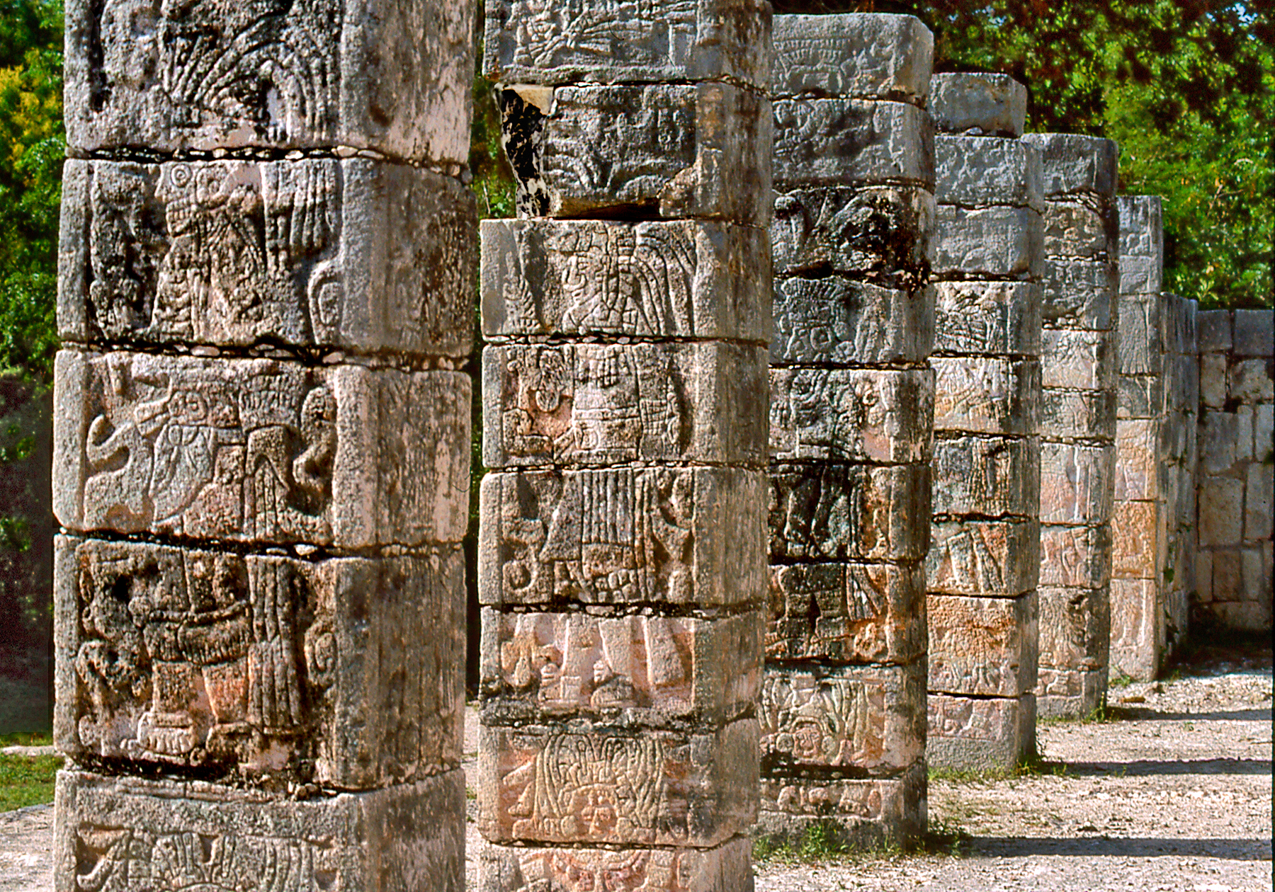
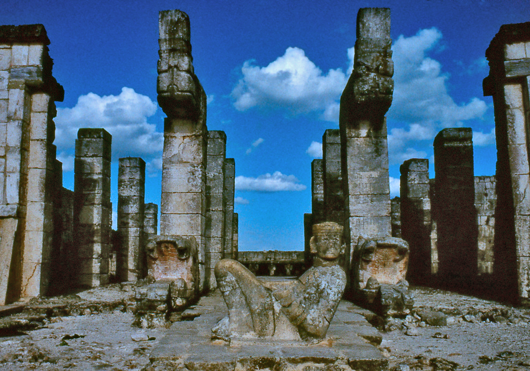
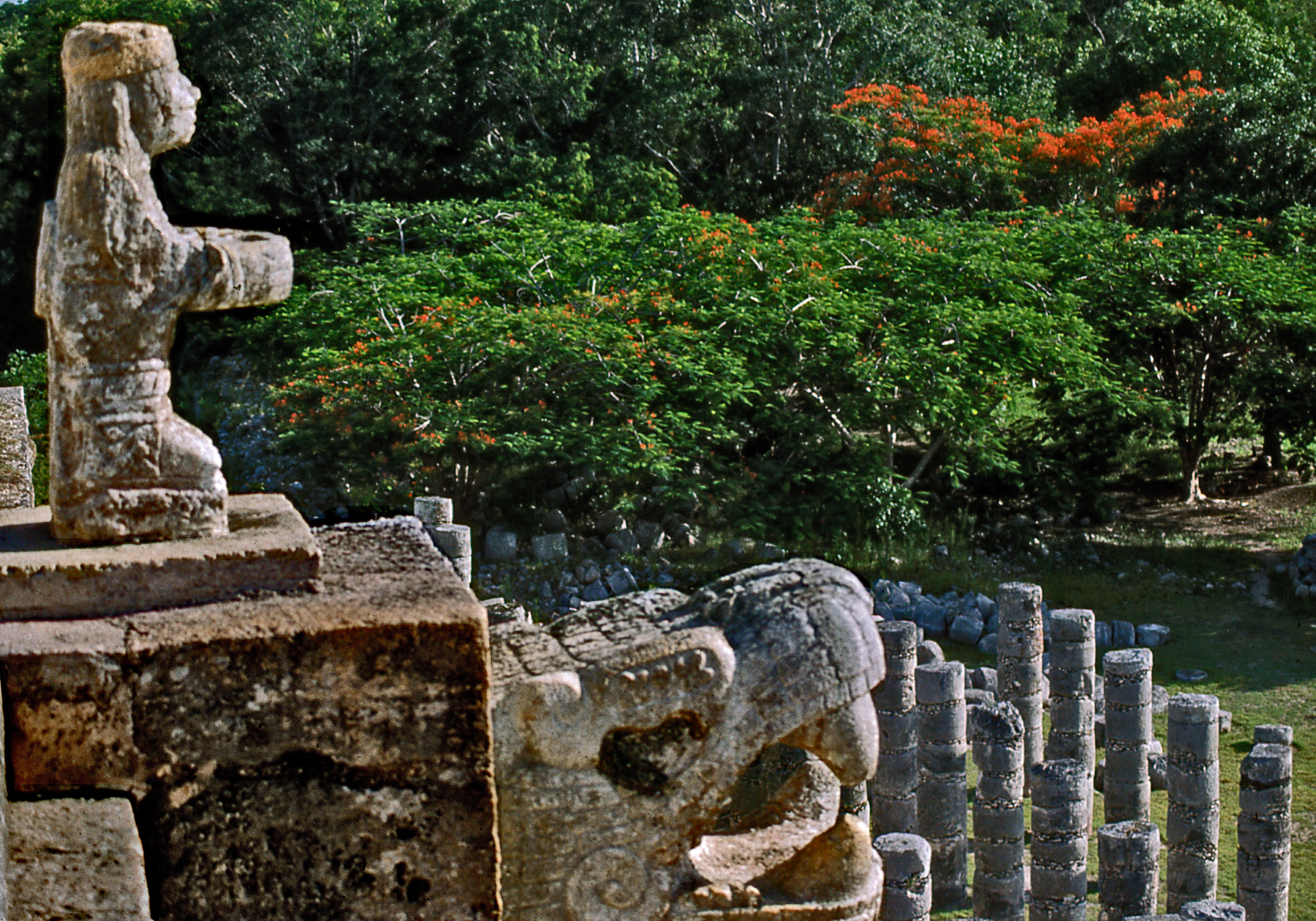
Columns with Images of Warriors
The Temple of the Warriors has open pillared halls decorated with reliefs of warriors in Toltec-Mexican attire. Two massive columns in the shape of feathered serpents flank the entrance and the reclining figure of a Chac-mool lies before the sanctuary. This sculpture of Mexican origin is thought to have figured in the sacrificial rituals as a receptacle for human hearts. Although later carried to gory extremes by the Aztecs as a ruthless tool of conquest, the shedding of human blood, as the most precious gift which could be offered to propitiate the gods, was a deeply ingrained belief in ancient Mesoamerica.
Chac-mool StatueThe Great Ball Court
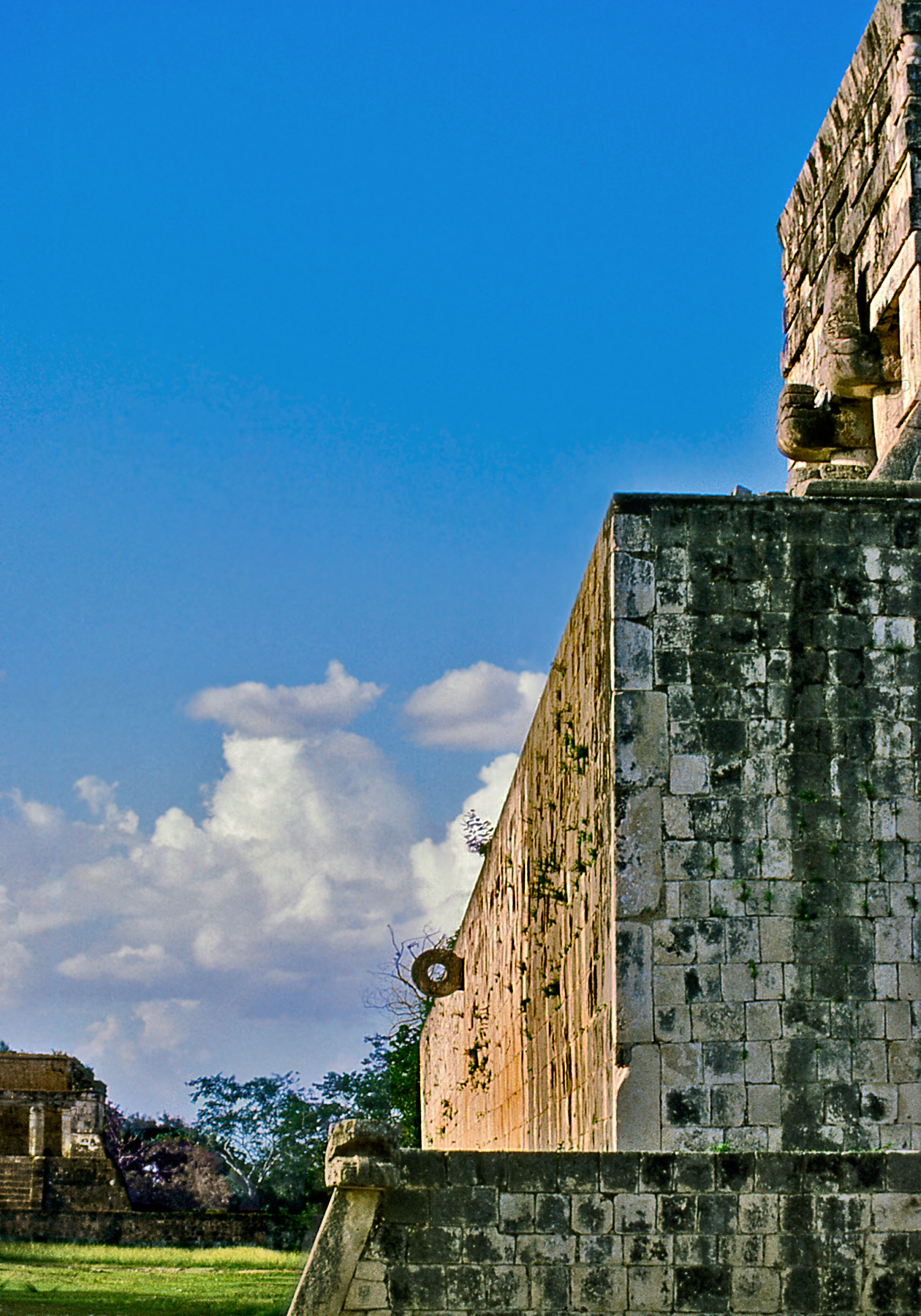
The impressive ball court at Chichen-Itza, measuring 550 ft. in length, is the largest in Mesoamerica. A sculptural relief on its walls depicts the sacrifice by decapitation of a player in the finale of the spectacle which played out there.
Ball Court Relief
Players wearing padded suits could not use their hands or feet to hit the solid rubber ball. More than a mere sporting event, the ritual nature of the ball game can be symbolically interpreted as a match between the cosmic forces of light and darkness. The sun (represented by the ball) made a perilous journey through the dark underworld of night (represented by the court) to be reborn victorious with the dawn. The Maya believed that the blood of sacrificed players contributed to the regeneration of the world.
View of the Market Area
The Maya were a cultured people, but they were also fierce warriors whose bloody rituals seem horrifying to our modern mindset. Yet, the Maya created one of the most vibrant and long lasting cultures of the Americas. Their impressive architectural achievements are the embodiment in stone of a great civilization, offering insights into a vanished world.
The Ganges is the longest river in India, flowing for some 1,600 miles from its source in the Himalayas to its mouth at the Bay of Bengal. All along its length the river is considered holy by Hindus and personified as the goddess Ganga, who descended to earth through the magical intercession of the great god Shiva. The Ganges is a link to the Himalayan abode of the gods, an ever-flowing manifestation of Shiva’s energy or Shakti. Having descended from heaven, the river is likewise a vehicle of celestial ascent where planes of existence intersect; hence its importance in Hindu funeral rites. Flowing water purifies and the Ganges is believed to cleanse the sins of a lifetime granting release from the cycle of reincarnation. Thus, for Hindus, cremation on the banks of the Ganges imparts salvation.
Pilgrims — (click photos to enlarge)
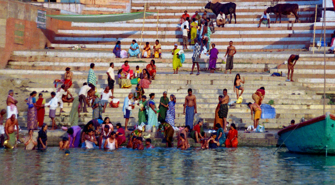
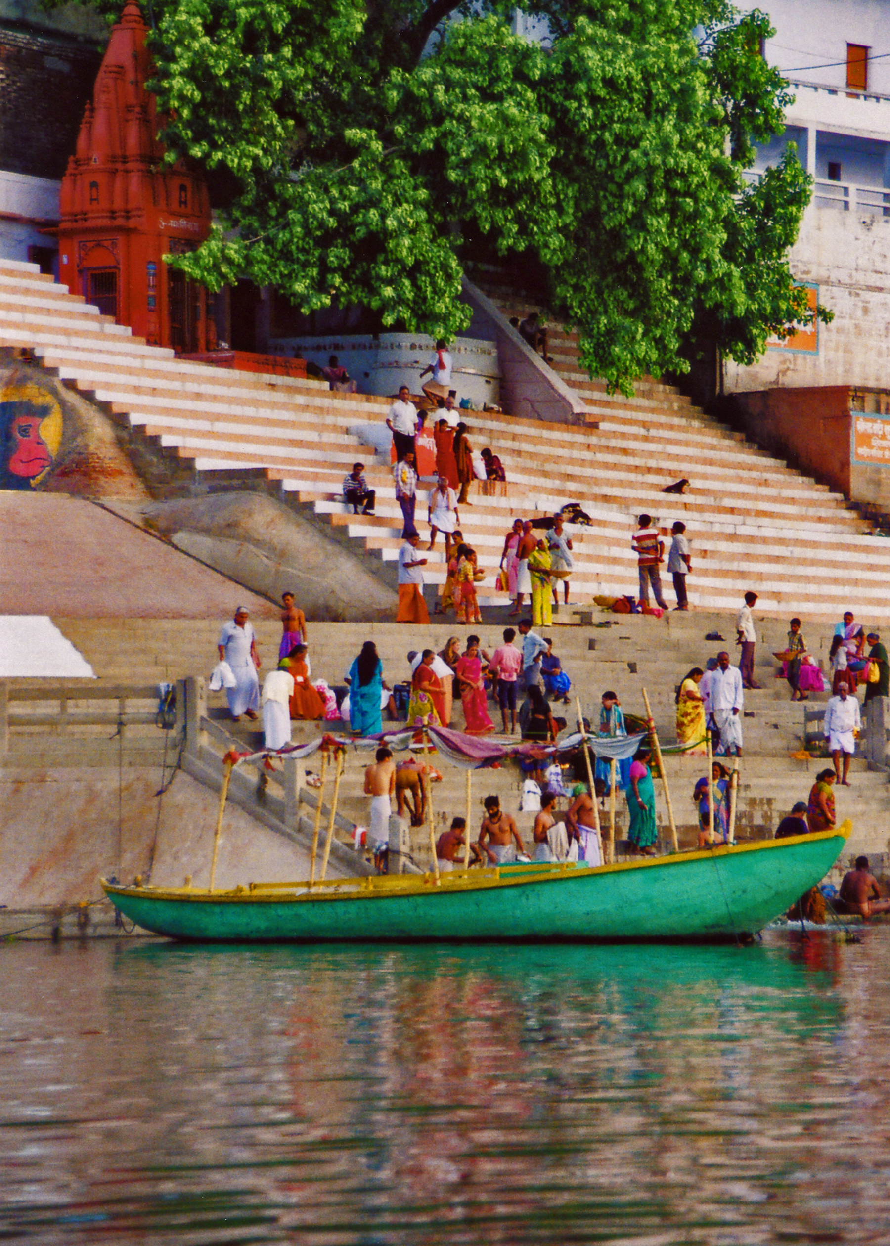
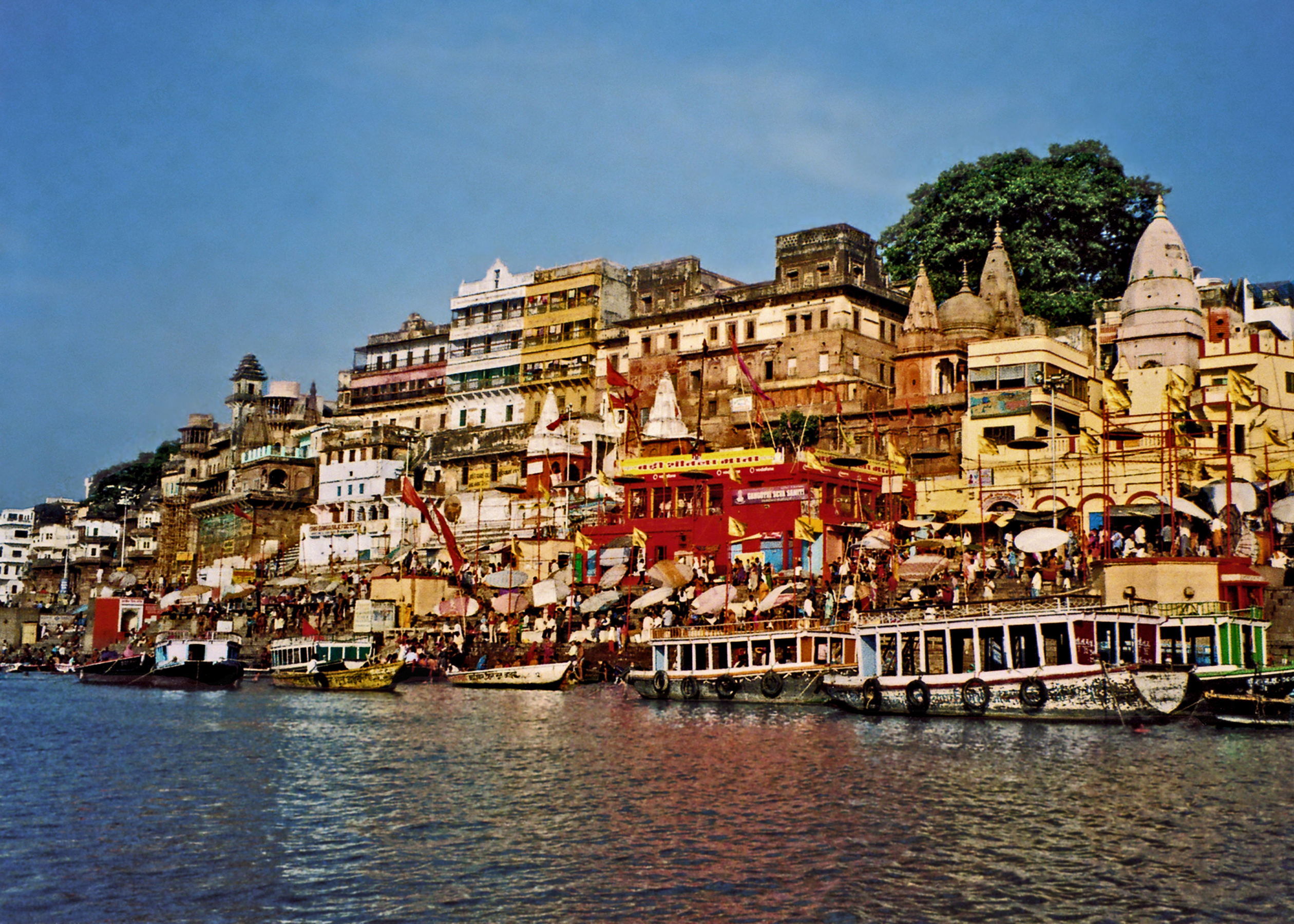
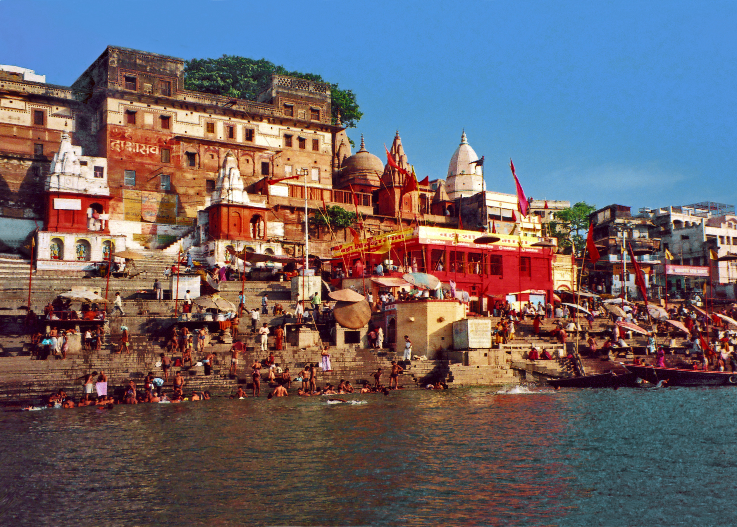
Varanasi (Benares), built along the southern riverbank of the Ganges, is one of the oldest continuously inhabited cities on earth. It is known as Kashi, City of Light, already a great cultural and trading center when the Buddha preached there in the 6th century BCE. The city prospered until falling to the Muslim invaders who conquered northern India in the 12th century. Innumerable Hindu temples were destroyed and mosques often built over the ruins. Yet, despite the devastation, a positive legacy of the Mughals was their promotion of silk weaving and the exquisite brocades for which Varanasi is still famous. Varanasi eventually reverted to the rule of Hindu kings who rebuilt the city in its present form in the 18th century, including the famous ghats, or stone steps leading down to the Ganges.
Dashashwamedth GhatThe Largest and Busiest Ghat
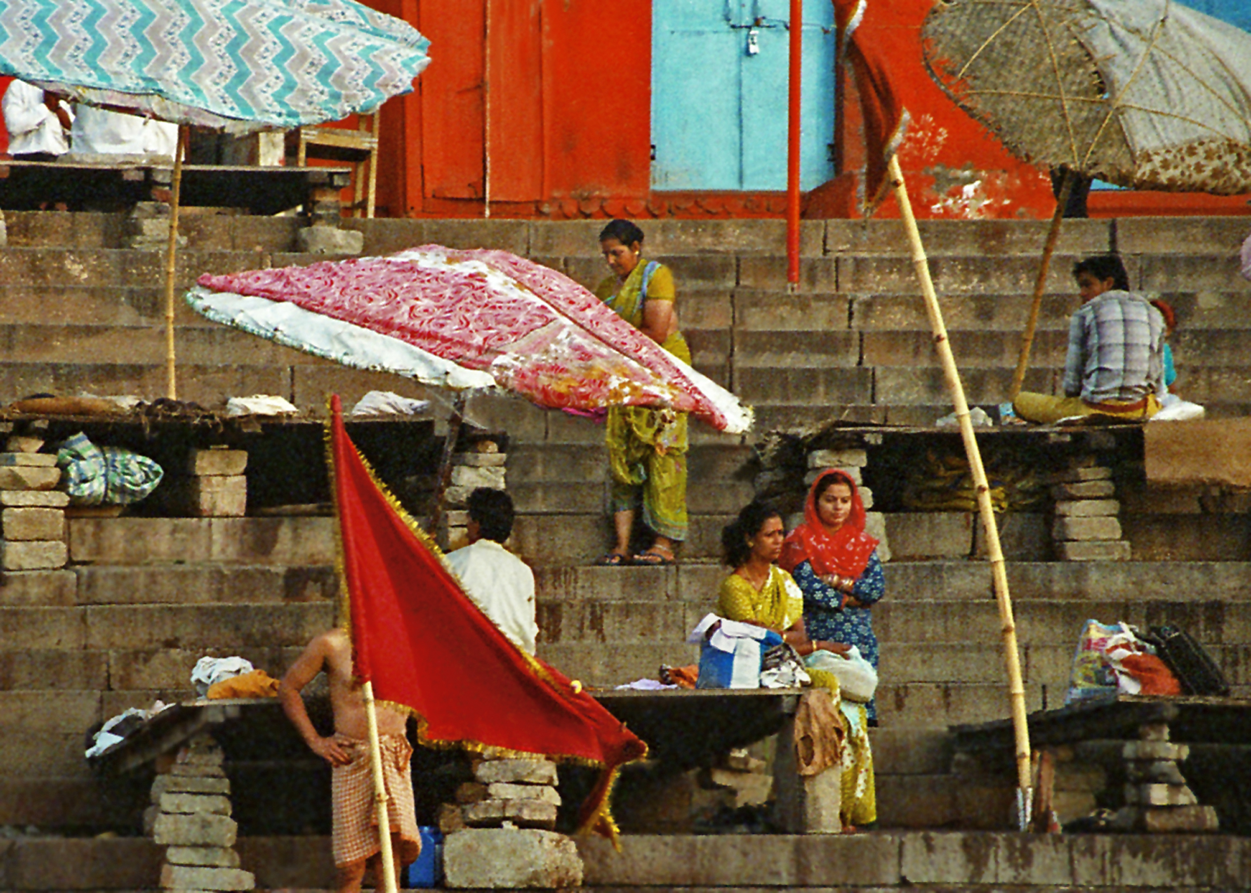
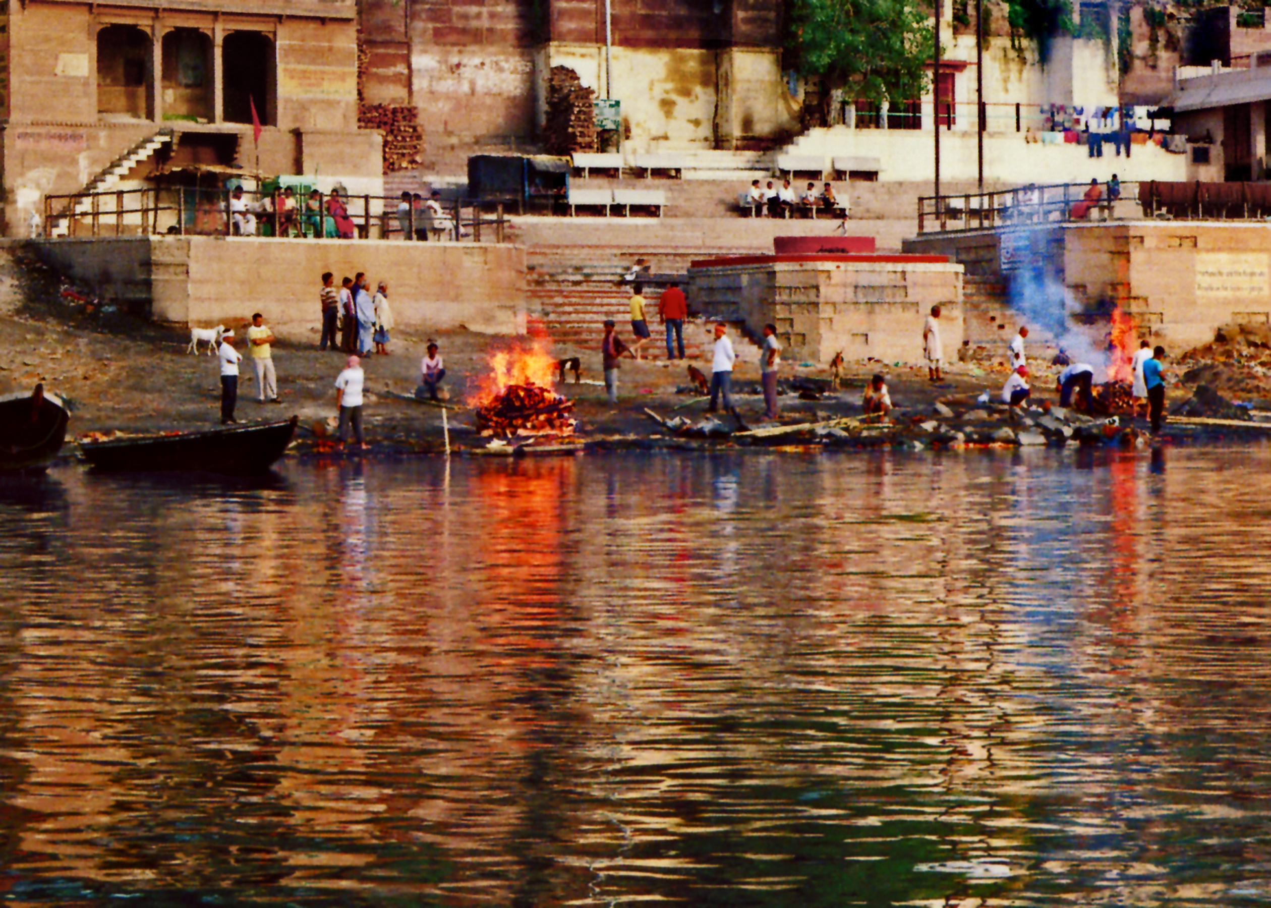
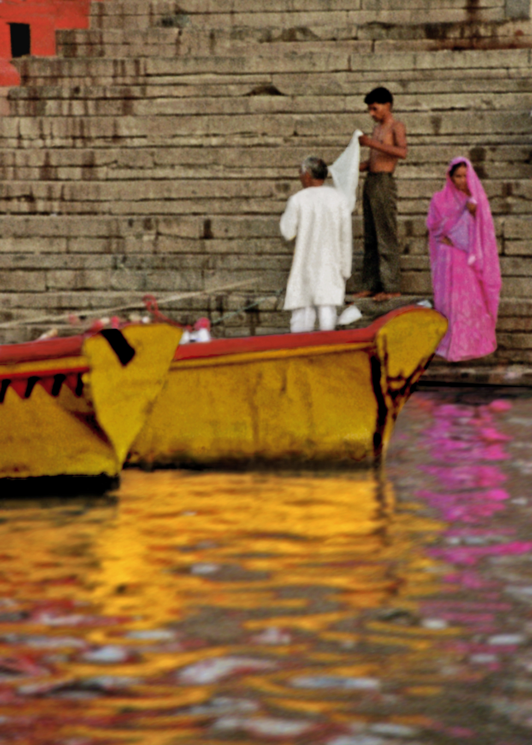
Every dawn an ancient ritual is reenacted as crowds emerge from the dark narrow lanes of the old city to congregate on the ghats for morning prayers and ablutions. It is one of the great spectacles on earth, filled with the colorful cacophony of India. Bathers appear oblivious to the throngs of people talking gregariously or in silent contemplation, making flower offerings or filling small brass pots with the holy water. For despite the increasingly alarming levels of pollution, the river’s sanctity remains undiminished for the devout. As the morning progresses, boats load and unload passengers making the rounds of famous pilgrimage sites. Pandits consult under mushroom shaped umbrellas, ash-smeared sadhus display their yogic prowess, beggars beg, vendors sell, pilgrims pray and tourists gawk, while everyone ignores the cows ambling about. Life and death commingle as cremation pyres are set ablaze while children splash nearby and colorful saris are laid out to dry.
On the StepsCremation Ghat
The ghats challenge our affluent western notions of hygiene, pro-priety and personal space — we gasp, recoil, laugh in disbelief at the shocking incongruities and, in the end, are deeply moved. We leave the ghats with senses heightened and assaulted, having plunged into a far more raw and ancient way of living, exposing the heights and depths of our humanity and all its myriad manifestations in a way that is unforgettable.